
Perhaps the recent launch of Google Street View for Canadian cities has made my trips to the many 1ière avenues of Montreal somewhat unnecessary. A visit to any of these streets is now as simple as pulling up a map of Montreal and dragging the little yellow person onto whatever street you want to wish to see. However, I am undeterred. Despite my tendency to lapse on visiting and posting these 1ière avenues, my trips will continue. Despite the 360° views every few metres and the ability to toggle between street View, aerial view, and map view, the street view photos are somewhat disconnected, having been taken automatically from the roof of a car without discretion from a photographer (as amateur as I may be, in the case of these photos). Street View takes the photo from the centre of the street, moves on and takes the next photo and so on in perpetuity. I (and other humans), however, can stop and inspect something that catches my attention more closely while ignoring what I deem to be more uninteresting and banal. Street View does not possess this luxury. If anything, at least I take my photos when the city is looking good rather than the right-before and right-after winter photos taken by Google, a time of year that most people can agree is when the city looks its worst.
No matter, my journeys continue. This time through the central neighbourhoods of Rosemont and St-Michel. This 1ière avenue is the only one that existed within the pre-merger borders of Montreal so when someone spoke of (or wrote on an envelope) “1ière avenue, Montreal”, this is the street they meant. Although not the longest numbered street in the city, it is the longest 1ière avenue with a length of 14 blocks. It also starts off one of the longer continuous (more-or-less) series of numbered streets in the city which ends 44e avenue, right before boul de l’Assomption.
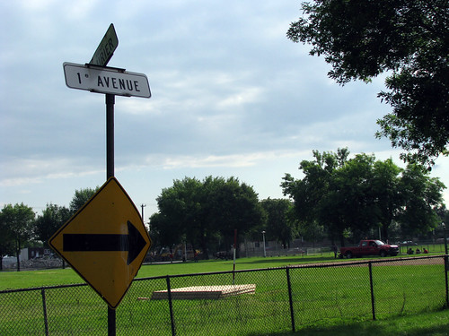
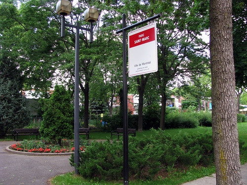
This 1ière avenue starts at the south in a park (pictured above) that connects to a disjointed section of Laurier E.. We will continue northward until the street’s end at Jarry E..
These photos were taken on June 28, 2009.
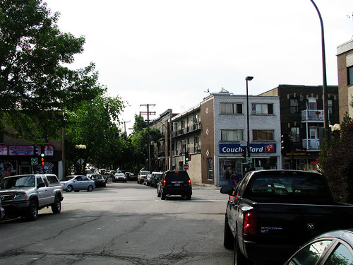
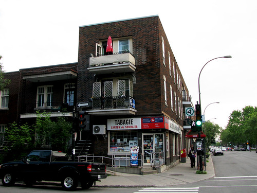
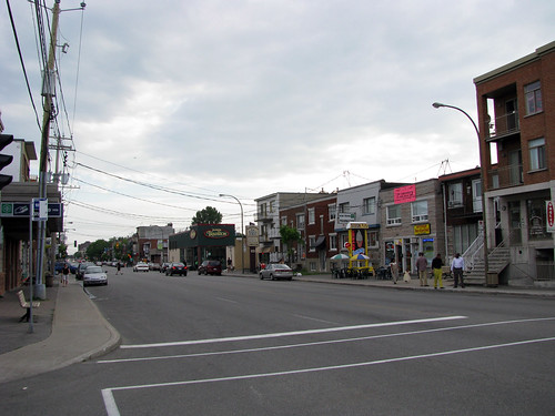
This is the first intersection at the pleasant commercial stretch of rue Masson, or, as they’ll have you call it, Promenade Masson.
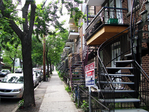
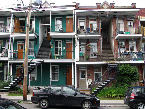
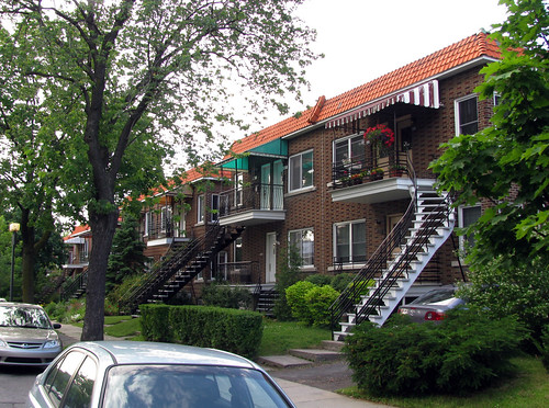
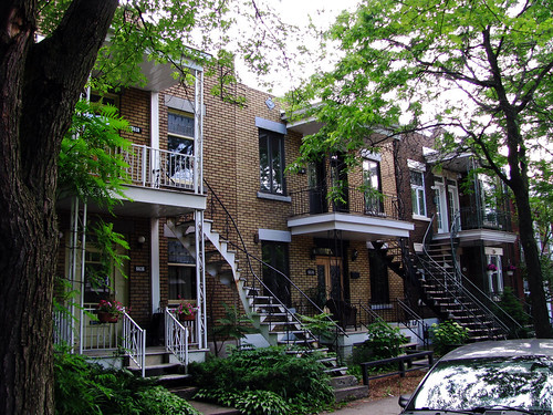
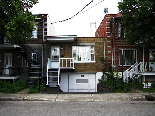
Much of the residential housing in this part of Rosemont is made up of typical Montreal ‘plexes with winding staircases connecting the second and sometimes third storey balconies with the street.
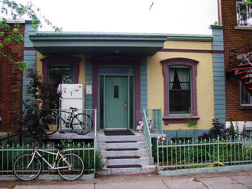
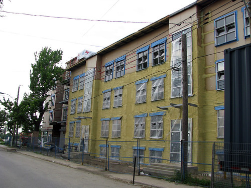
Some interesting infill just north of Masson.
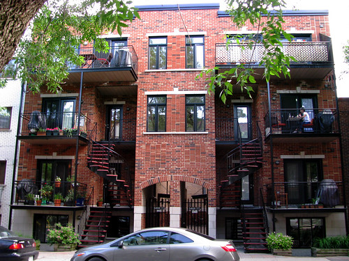
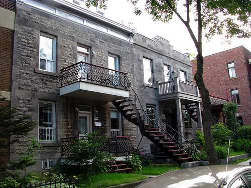
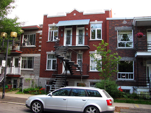
I’ve never seen a plex in Montreal like these before. There were about four in a row, all the same.
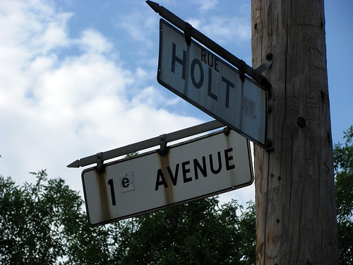
White tape covering the generic “st.” and the “st” after the 1 on these street signs hints at the possibility of an anglo history in this neighbourhood.
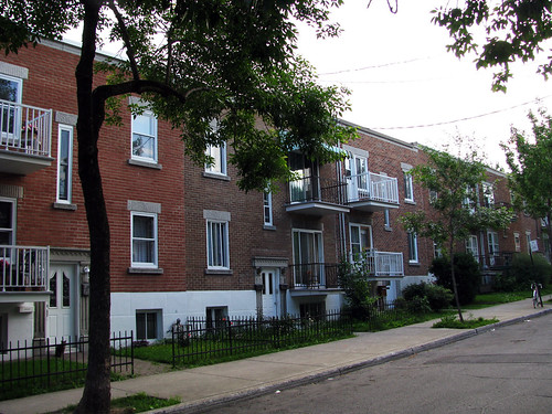
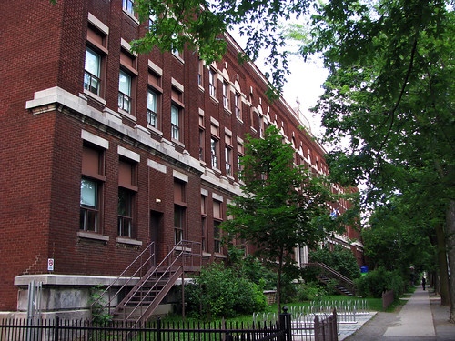
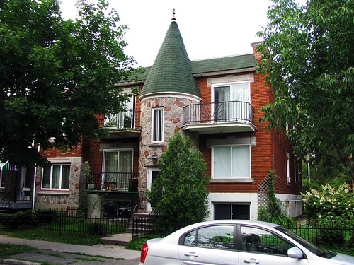
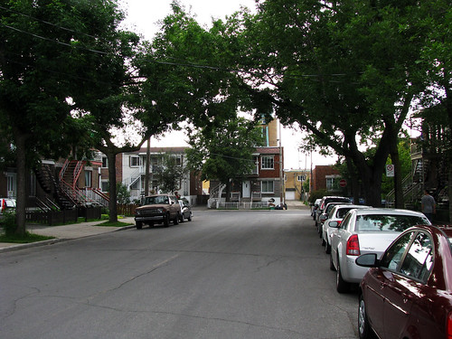
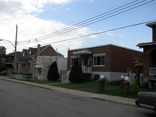
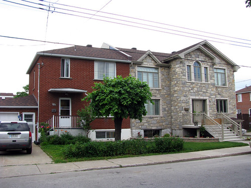
Not unlike most neighbourhoods in Montreal, the housing types and architecture changes every couple blocks.
More infill done relatively well.

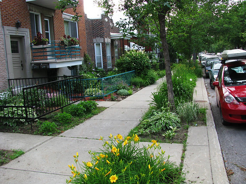
It appears that the city has removed some of the sidewalk which has resulted in the planting of some beautiful flowers and other plants. It also seems to have inspired people to continue planting as the front yards of all these houses all have some very nice landscaping.
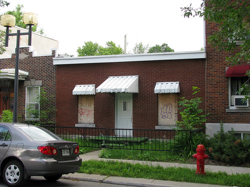
A rare abandoned house, boarded up American-style.
This park (Parc Saint-Marc) also has a small community garden, some of which can be seen in the background.
At rue Beaujeu, the street ends but starts again slightly to the west.
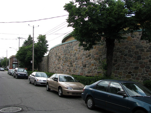
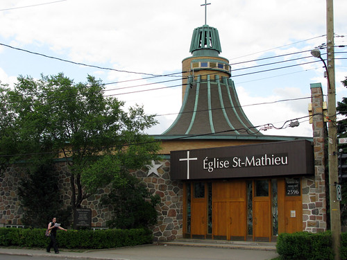
I assume the street is disconnected so as to go around this church.
The intersection of Jean-Talon. We’re now in St-Michel.
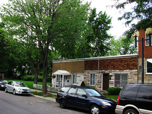
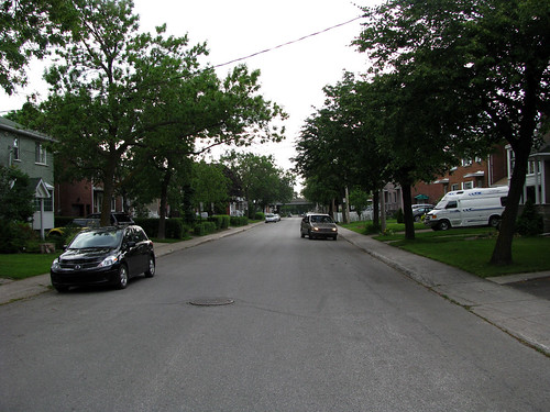
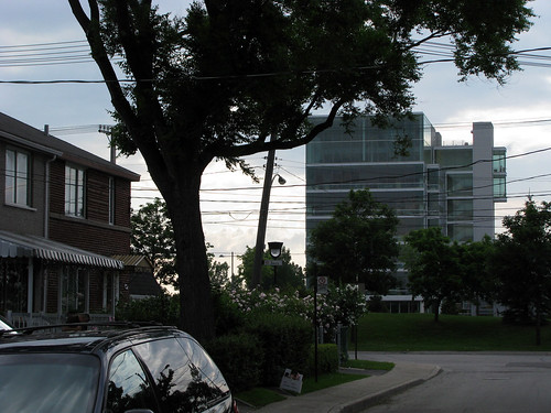
North of Jean-Talon, the density lowers considerably. The housing also gets kind of weird.
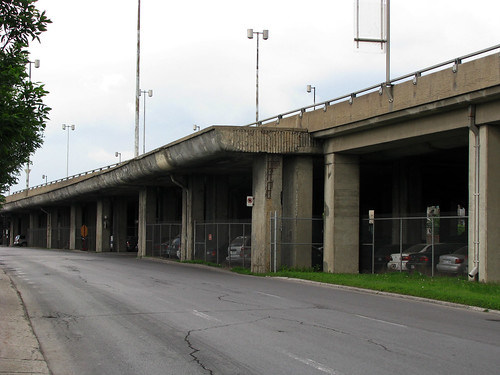
The elevated autoroute 40 (autoroute Métropolitaine) looms in the distance.
I really like these unfinished off-ramps all along the elevated highway, suggesting a more ambitious plan for this highway in the past.
Beyond the highway, new condo construction is popping up everywhere.
Likely spurred by the Cirque de Soleil campus on Jarry at the end of the street.
Also in this series: Verdun, Lasalle, Lachine.


9 comments
Great post!
i like to think of St Michel as starting from St Michel Boulevard and moving east. So the part that you photographed along Jean Talon is actually in Villeray. St Michel has a different look and feeling. But most of these boundaries are personal, of course.
I’ve always thought of St-Michel beginning at either Papineau or de Lormier (the space in between has always been kind of grey for me). But you’re right, although the city might have its own official boundaries, where one neighbourhood begins and ends is completely personal.
Thanks for posting – despite the availability of Google Street View, your posts are much more interesting. :)
The official boundary between Villeray and St-Michel is actually ridiculously far wast – think it has become rue de Lanaudière. Some of us suspect the city is trying to eliminate Villeray (grrrrr!) The latest map I’ve seen of the Villeray-St-Michel-Parc-Extension arrondissement also has the western boundary of Villeray on St-Dominique, putting all of Parc Jarry in St-Michel! This is ludicrous as there is a natural border – the CP tracks.
I’d definitely put the psychological border west of St-Michel – I’d say rue d’Iberville. It is indeed a fuzzy boundary.
Other than condos, there is also a new co-operative housing development going up at the corner of Jarry and 1ière avenue, including a bicycle repair shop and an organic restaurant. That area is rather desolate but changing – and there is the great Asian supermarket already depicted on Spacing in a post by Cédric Sam.
I think the English-speaking people in that area were mostly Ukranian and Polish people. Note the two nearby Ukranian churches at the corner of St-Michel (one Orthodox; one Catholic).
I’ve seen a few shotgun houses boarded up around here (Petite-Italie and Villeray not far from marché Jean-Talon) but usually it is because a taller plex is going up.
Holt was pretty active in big business around the turn of the 20th century, and also had some interests in land development and infrastructure (Montreal Light, Heat, and Power).
From the Centre d’histoire de Montréal:
En fait, l’achat des terrains pour les ateliers Angus se fait entre 1892 et 1902. Dès 1899, U.-H. Dandurand et son associé, Herbert Holt, s’intéressent à une terre située juste au nord des terrains du Canadien Pacifique, la terre Crawford. Holt fait d’ailleurs partie de ces hommes qui ont su se bâtir un véritable empire financier au tournant du XXe siècle, avec des ramifications dans tous les secteurs de l’économie. Dont le secteur ferroviaire, et plus précisément avec le Canadien Pacifique, dont il a été l’ingénieur en chef. En 1918, Holt siège au conseil d’administration de pas moins de 135 entreprises ou organismes!
http://ville.montreal.qc.ca/portal/page?_pageid=2497,3090217&_dad=portal&_schema=PORTAL
Never been to Montreal. Fascinated by the exterior curved staircases.
Here’s an ad from 1913 selling lots in “Rosemount”, a new modern neighbourhood next to the Angus shops.
“Rosemount possesses all the conveniences of the oldest parts of Montreal including SIDEWALKS, WATER, DRAINS, CHURCH, BANKS, FIRE STATIONS, MACADAMIZED STREETS, SCHOOLS, STORES and ELECTRIC LIGHT”
http://bibnum2.banq.qc.ca/bna/massic/detail/c-74-a.jpg
I love the park St. Marc (Bordé par : 1re avenue, entre Bélanger et Saint-Zotique, http://www.arrondissement.com/montreal/parcsaintmarc).
It’s real gem of new Montreal with a beautiful flowerbed.
Thank you very much for your photos. I feel nostalgic for park St. Marc. I hope it will be fine without my regular visits there.