
Special contribution by Anton Dubrau.
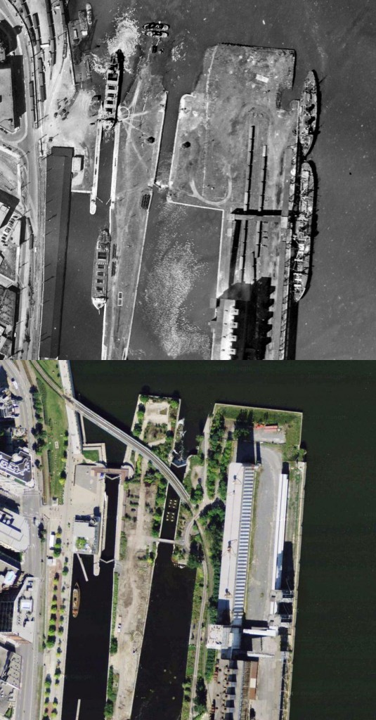
A series of aerial photos taken between 1947 and 1949, which were recently published by the City of Montreal, and made more accessible by this little mashup, has brought to light some interesting discoveries about the evolution of the landscape over the past 65 years.
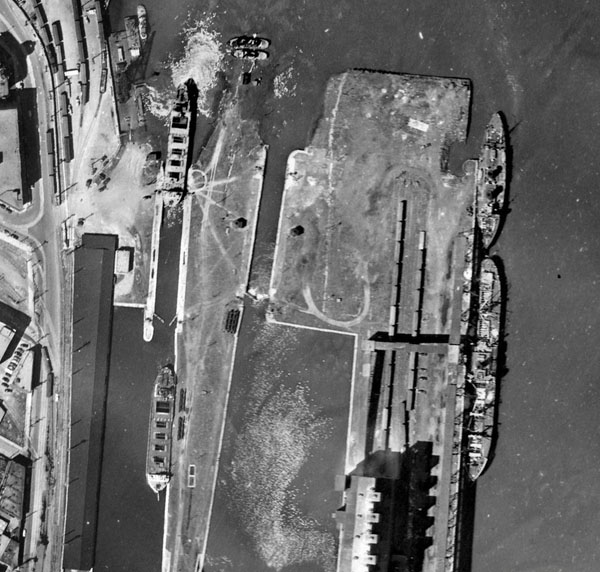
In the 1947 aerial imagery one can see a lot of the industrial heritage of Montreal. Two pieces of industrial infrastructure, which today have become industrial monuments, can be seen in the image below.
The second monument is silo #5 grain elevator, a massive machine for the transfer of grain from trains to ships. The complex was built in several stages starting in 1906. It’s largest addition came in 1959 – so it is not yet visible in the 1947 aerial image.
A decade after the historical photo was taken, both these icons began to decline into obsolescence.
The Lachine canal was expanded several times to try and accomodate larger ships, but eventually couldn’t be expanded anymore because of the adjacent industries. Finally, in 1959, the St Lawrence Seaway was built to replace the Lachine Canal, with the objective of attracting trade, just as the canal once had. The expansion of silo #5 is a testament to that optimism. But just as the Lachine canal helped move economic activity west from the Maritimes, the St Lawrence Seaway moved it west from Montreal. It provided a way for sea-going ships to move further inland, and do the grain transshipment in the great lakes. Today, Thunder Bay is the largest grain port in North America.