
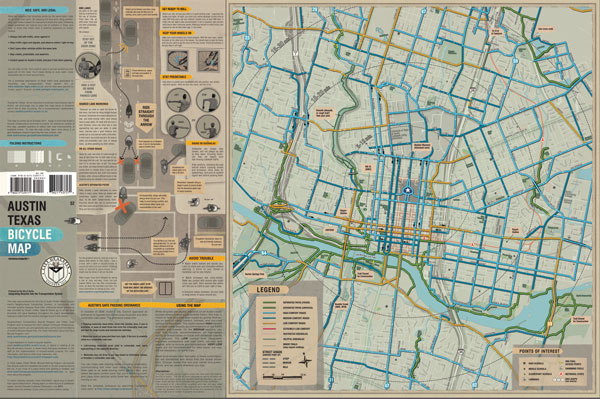

Traditional bike maps only show where lanes begin and end throughout the city, but in Austin they are designing a map that also includes how safe each route is. The idea is to encourage 60% of the population who are interested but concerned about safety. The new map specifically details the safest routes, and includes bike safety tips.
Seasoned fearless riders make up less than 1% of the population and 30% of the population says they want nothing whatsoever to do with it.
Image via City of Austin.
Urban Planet is a roundup of blogs from around the world dealing specifically with urban environments. For more stories from around the planet, check out Spacing on Facebook and Twitter.
One comment
So who determines what’s safe(r)? The City, or riders?
Where Ms. Morrison died was on a signed bike route (now removed), about exactly where the City created a pinch point in mismatched curves between the yellow centre line and the concrete curb.
Their proposed “fix” at c. $180,000 fails to address this road geometry problem, and they refused to consider painting it up as the Urban Repair Squad did briefly over a year ago. That lasted a day maybe before the City blackpainted it.
There are lots and lots of other screwups that endanger.