
Maps
-
Image of the Moment: Remapping Rideau Street
Image: From the Uptown Rideau CDP Workshop – 28 May 2014 Location: Rideau Branch of Ottawa Public Library, 377 Rideau Street, Ottawa, ON Date of...
By Dwight Williams -
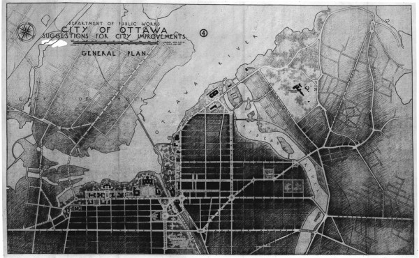
Image of the Past: Ottawa Improvements Maps
Image: City of Ottawa Suggestions for City Improvements, General Plan, Department of Public Works Location: Ottawa, Canada Date of Map: Believed to be...
By Spacing -

‘Planning Canada’s Capital’: A resource for research into the Capital Region’s planning history
Today we at Spacing Ottawa would like to highlight some of the research currently being undertaken in regards to the Capital Region’s planning...
By Kristen Gagnon -
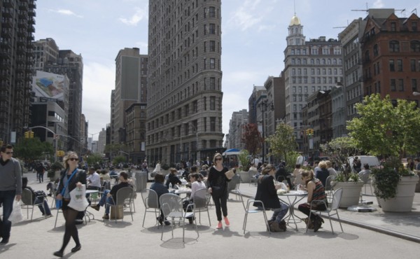
‘The Human Scale’: We’re all human, so why aren’t we building cities for people?
November 14th marked the second event in the 2013-2014 Urban Forum calendar, with a public screening of the documentary, The Human Scale. The Ottawa...
By Kristen Gagnon -
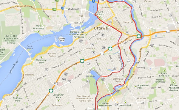
Rideau Island: An island for Ottawa?
Toronto has Ward’s Island, Vancouver’s got Granville, and Montreal has, well, the Island of Montreal. So it is about time that Ottawa took a look at...
By Kristen Gagnon -
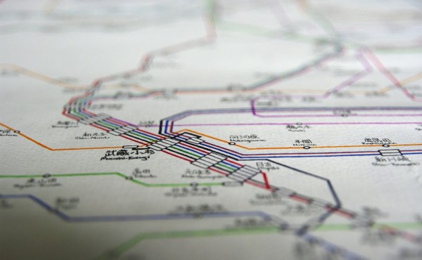
Hand drawn map of Japan’s intricate rail system
Artist Wyton Cho has hand drawn Japan’s rail system. The colourful lines intersect and meet at stations, and present an immediate sense of how vast...
By Jonathan Zettel -
Spacing releases Canada City notebook-sketchbook
The newest item added to Spacing’s e-store is our Canada City notebook/sketchbook. The 5.5-inch by 4-inch book contains 64 blank pages for your...
By Spacing -
Last day to enter Spacing’s Creative Mapping Contest
DEADLINE TODAY! Spacing magazine presents the CREATIVE MAPPING CONTEST Do you love maps? Are you an illustrator, graphic designer, or visual storyteller...
By Matthew Blackett -
Creative Mapping Contest deadline extended to May 31
DEADLINE EXTENDED TO MAY 31st Spacing magazine presents the CREATIVE MAPPING CONTEST Do you love maps? Are you an illustrator, graphic designer, or visual...
By Spacing -
Today is deadline for Creative Mapping Contest!
Spacing magazine presents the CREATIVE MAPPING CONTEST Do you love maps? Are you an illustrator, graphic designer, or visual storyteller? Spacing wants...
By Matthew Blackett -
Creative Mapping Contest deadline on Monday!
Spacing magazine presents the CREATIVE MAPPING CONTEST Do you love maps? Are you an illustrator, graphic designer, or visual storyteller? Spacing wants...
By Matthew Blackett -
Just over 2 weeks left to enter Spacing’s Creative Mapping Contest
Spacing magazine presents the CREATIVE MAPPING CONTEST Do you love maps? Are you an illustrator, graphic designer, or visual storyteller? Spacing wants...
By Spacing