

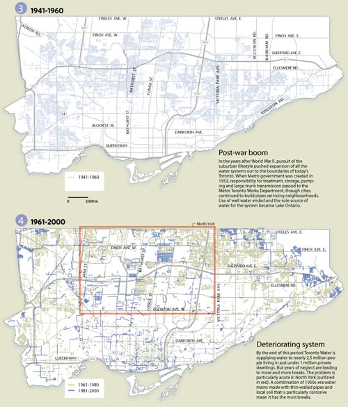
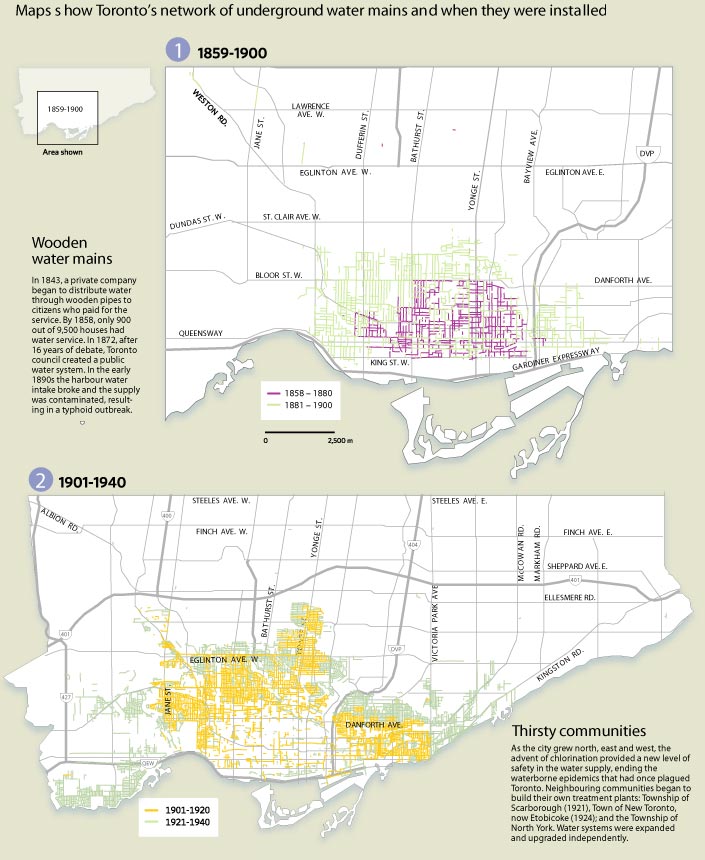
In the Toronto Star last weekend was a special 2-page spread on the sorry state of Toronto’s water mains with emphasis on who’s to pay for upgrades (see story online here). However, the maps included give a fascinating glimpse into the history of Toronto’s development seen through the age of the water mains. Divided into four periods, 1859-1900, 1901-1940, 1941-1960, and 1961-2000, these maps are indispensable for anyone interested in the history of urban infrastructure. To see a little more detail, follow these links (maps 1+2, maps 3+4) – if you prefer, a much more detailed PDF version of the maps is available from the Star’s site here (PDF).
Crossposted to bricoleurbanism.org as part III of a series – to view the two earlier parts follow these links:
2 comments
My comment is not in relation to this post-I just had to send you the word and say that this is the greatest and most interesting blog/site I have found yet on the web.
Hey, I second that. You guys are seriously cool.