

Spacing correspondent Ian Malczewski is spending the summer interning with the Canadian Urban Institute in Iloilo City, the Philippines. During his time there he will share his observations of its public spaces.
Since the Philippines is a country of islands (there are over 7 000 of them), it goes without saying that it has a special relationship with the water. Other than providing an abundance of postcard-perfect beaches and a wealth of seafood, the water here has also served as an important element in the country’s urban development.
Just like in Toronto, the urban waterfronts of most cities in the Philippines developed to accommodate shipping and industrial needs. Iloilo City is no different, with a port that developed to support textile and sugar industries. Though neither of these industries are still of major importance, the legacies of industrial warehouses and an inaccessible waterfront still linger.

Iloilo rests on the Iloilo Strait, affording the city an enviable position on the ocean. Across the Strait sits the neighbouring island-province of Guimaras, which, with its lush green hills and minimal urban development, shimmers like a tropical mirage, a stark contrast to the mountains of concrete across the way. Home to some of the best mangos in the country and several low-key beaches, Guimaras is the ideal escape-from-the-city that most urban dwellers need to enjoy every now and then.

There are two wharfs which serve as ports of transportation between Iloilo and Guimaras, and each day dozens upon dozens of pump boats travel between the two neighbours. This high level of transportation-related activity means the waterfront feels more like a terminal than a place for any kind of relaxing interaction with the water itself, though.

At Ortiz Wharf, the busier of the two, the water’s edge consists of a few metres of concrete sidewalk that is often crowded with people and merchants selling pineapples, mangos, and other treats for commuting passengers.

Not far from where passengers get on and off the boats at Ortiz Wharf there is an informal basketball court, where there are often kids at play at all hours of the day.

A few hundred metres away from Ortiz Wharf lies a promenade that does allow access to the water. This is the site of Fort San Pedro, a now-gone fort that was built in the 1600s to protect the city from invasions. Despite the historic importance of the site, it is often deserted.

Towards the end of this promenade is a disused look-out point. A giant statue of Jesus sits at the top of a somewhat collapses stairwell, though the amount of tagging on the statue suggests this is not a well-visited lookout (although this may just be my experience: accounts of family outings to the area suggest I may be looking with the wrong eyes).

I’ve been encouraged to avoid this part of the city late at night, something that amazes me given that it is one of the few places where the water itself is within reach.

To say that the waterfront has been neglected is certainly accurate, but, after some conversations with friends involved in urban development processes, I have learned that the Iloilo Strait is not the most important body of water in the city. That distinction goes to the Iloilo River, a wide, winding river that cuts through the city, serving as the most important natural element of a largely urban environment.
In Toronto, the priority of waterfront redevelopment is on the central waterfront, where downtown meets the lake. While both the Humber and the Don Rivers are important to the revitalization of the waterfront, they are not the first places we associate with Toronto’s waterfront. The opposite is the case in Iloilo; the Iloilo River is the waterfront in many ways, attracting the most attention via public space-interested blogs and re-development plans.

Of course, the river is polluted – very polluted – and ill-advised waste disposal, regular flooding, and the presence of informal settlers are just a few of the issues the river faces. Still, the potential of the river to become the focal point of some incredible public spaces is hard to ignore. I cross the river twice in my daily commute, and I am always relieved by the open air and natural scenery it affords in contrast to the denser parts of the city.
Although the waterfront here has a long way to go, there is no shortage of ideas or plans for the revitalization. A House Bill was recently introduced before Parliament here to create a body similar to Toronto’s Waterfront Toronto that will oversee redevelopment of the area. Despite the many differences between Toronto and Iloilo, I’ve found the neglect and potential of both cities waterfronts to be one of the most striking similarities.
2 comments
I may get strung up by my ankles for saying this, but I think Toronto needs to embrace urbanity right up to the edges of some of its waterfronts. Its nice to have parks and green space around our waterways, but we’ve channelled enough of them, like the southern part of the Don, that there is no real reason not to build up close to its edge. I recognize the need for flood protection, but there is nothing to say we couldn’t build raised promenades along its edge.
The infatuation with doing things like Sugar Beach Park — a disaster of a idea — will only make the place animated for half the year. I would rather have seen something more commercial and urban than a copy-cat HTO park.
Dale Duncan wrote about Seoul’s re-discovered river. This is an example of what I’d like to see in a place or two:
https://spacing.ca/toronto/2006/09/14/inspiration-for-toronto/
I actually agree with you, Matt. When I was in New York for a workshop with Project for Public Spaces a few months ago I asked the president what he thought of Toronto’s Waterfront redevelopment . . . he wasn’t exactly complimentary. I don’t want to mis-paraphrase him, but he basically said that there’s been too much emphasis on parks and not enough on other destinations that might bring people down to the water.
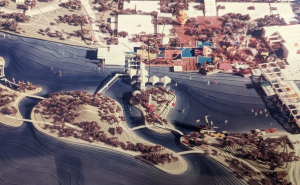
A rare exception to this is what MVVA have planned for the Keating Channel in the lower Donlands – see the last image on this post:
https://spacing.ca/toronto/2007/04/24/lower-donlands-designs-a-closer-look/