


[Editor’s Note: We are happy to present the last of three InDepth Features covering a trio of special Jane’s Walk neighbourhood tours around Marpole, Grandview-Woodland, and the West End. These were organized as a unique partnership between the City of Vancouver, Museum of Vancouver and Spacing Vancouver, in light of the ongoing Community Plan process currently happening in each important district. This will be followed by podcasts of the tour, if you missed the Walks, and a final dialogue event on June 19th. Stay tuned for more information.]
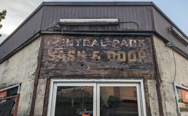
The West End is a neighbourhood that is definitive of the urban changes that have affected Vancouver over its history. The City’s oldest suburb has seen shifts in form and demographics over the past century since the peninsula west of what is now Burrard Street was surveyed in 1882 as New Liverpool. From Victorian homes to walk-up apartment blocks, to mid-century modernist towers, to contemporary tower and podium “Vancouverism”, the neighbourhood has shifted intensity and focus with each new coming flux of residents and development pressures. It has become one of the most dense communities in Canada, yet still sees redevelopment and regeneration pressures as the community continues to mature.
On Sunday May 6, a well-attended Jane’s Walk was held highlighting the public spaces and significant points of development history in the West End. Guided by Christine Ackermann, President of the West End Residents Association (WERA) and urban designer Graham McGarva of VIA Architecture, the discussion tracked paradigm shifts within the neighbourhood and reactions to interventions of connectivity, affordability, density and public space provision. The City of Vancouver’s John Grottenberg—Planning Analyst for the West End Community Planning Team—was also present, lending his insights about the important neighbourhood.
The overarching concept of the Walk was to convey an understanding of design and planning or the area, not only as it exists today, but also with a mindfulness to its history and sharp awareness of how interventions today can—and will—impact directions in the future. With this in mind, a carefully planned route was chosen to usher attendees through the complex issues affect the neighbourhood. The sequence and issues are succinctly described below and are followed by more a in-depth analysis of key insights as they related to the tour:

Stop 1: West End Community Centre – Looking forward to the Community Plan.
Stop 2: Greenway Behind the Centre – Planting the saplings of change.
Stop 3: Behind Sunset Towers – Reimagining Lanes and Housing.
Stop 4: Barclay Heritage Square – New ways of looking at parks and retention.
Stop 5: Pocket Parks and Traffic Calming – experiments and expansion
Stop 6: St. Johns’ redevelopment – STIRing Contention and new relationships with towers.
Stop 7: Comox – Helmcken Greenway – A coming corridor as a public spine.
Stop 8: Erickson’s Sunset and Henriques – Changed theories behind tower density.
Stop 9: Renovictions – Losing affordability in the face of change.
Stop 10: Renewing Nelson Park – Urban gardens and a changing public space.
Stop 11: Mole Hill – A gold standard in design.


Design Impacting the Future:
The power behind placing and responding to ideas that help shape the city is that small, but well thought out, actions can build in momentum and have major future impacts on the rest of the urban environment. Planting and retaining trees as well as buildings can help to define and focus paths and spaces in a neighourhood, giving them character and identity. If done well that can influence further interventions. City building and design do not exist in a vacuum and, as such, ideas grow off of each other. Just as the metaphorical journey starts with a single step, a ‘forest’ of the urban places starts by planting the first saplings, and will mature by tending from many hands.


Streets and Connections:
The grid-iron of the West End has had few apparent changes to its streets and block structure over the last 130 years. The treatment of these streets is where design and planning has had an impact. Traffic calming has been present in the neighbourhood since the 60s, and has increased to a level that there are few unimpeded routes between trafficked arterials.
The neighbourhood has an emphasis towards pedestrian movement, but new initiatives are attempting to improve biking and walking infrastructure. The Comox-Helmcken Greenway [Stop#7] has been on the books for years, yet the $6 million earmarked for the project in the last budget still requires an official neighbourhood plan for the process to continue.
Further connectivity may be achieved by utilizing forgotten and potential passages. At 33 feet (10m), the lanes of the West End are some of the widest in the city, and have room for potential activity and programming. Ackermann felt that the lanes are the West End’s ‘backyard’, but that more needs to be done to make them inviting and responsive to residents’ needs. Some lanes and block cuts have the potential as neighbourhood greenways [Stop#1-4], while others can become that ‘backyard’ by sharing parking and service infrastructure functions with paving, furniture and planting treatments to emphasize their use by people [Stop#11].


Parks and Public Spaces:
There were few park and school sites set aside in the downtown, and the spaces that have developed have done so through assembly and demolition of preexisting housing over the last century. In some cases public space expansion has been connected to social housing provision, such as Sunset Towers [Stop#2&3], while in others there have been creative solutions and redefinitions of ‘public good’. In Barclay Heritage Square [Stop#4] – a defining project for Graham McGarva – a shift in thinking on the nature of ‘parks’ was necessary to retain a number of key heritage buildings on ‘Park Site 19’. A treatment as a connected network of Edwardian gardens and greens allowed 9 heritage houses to be retained as part of the park’s structure and value.
A similar assembly of properties for the expansion of Nelson Park led to the re-imagining of the heritage housing of Mole Hill [Stop#11]. Now a housing cooperative replete with connected and self maintained green spaces, gardens, and a pedestrian oriented lane, it is seen by many as a gold standard for design practice in the West End. Nelson Park [Stop#10], in turn, has dramatically transformed into a people place that attracts casual and intentional users with gardens, play areas, and dog runs, while regularly adapting street space for farmers markets. One of the only concerns— as described by Ackermann—is that the park still does not have a promised public washroom.
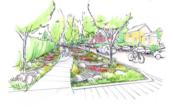
Another creative West End solution to public space provision has been the creation of Pocket Parks [Stop#5]. These spaces fit into the rights-of-way of north-south streets have dual purposes of aiding traffic calming, while providing spaces for residents to no only walk and cycle through, but also linger in. Appropriate programming is especially important in these spaces, as underused shuffleboards and inaccessible planting are all too common. The success of these interventions has led to proposals for expansion, including an extension of the Broughton Pocket Park Nelson through to Comox as part of the St Johns Church redevelopment [Stop#6].

Housing, Density and Affordability:
With a continual influx of resident demographic groups and development pressures guiding the West End’s development, there has been identifiable shifts in building and unit types as well as how residents adapt and respond to them. Dwellings intended for a single family have been transformed into multi-unit apartments while rental units in towers have gradually become more geared towards housing singles and seniors. Yet incoming pressures also include the needs of families trying to make a go-of-it in this dense neighbourhood.
With the changes in density there have also been modifications to how developments address the urban environment. In a poignant example at the 1200 block of Nelson [Stop#8], the 1960s modernist towers of Arthur Erickson—an “antiurban response set back from the street with a vehicular access lane and inaccessible green space”—faces a 1990s post-modern tower of Richard Henriquez, where density bonusing was given for heritage retention of a walk-up next door and landscape amenities addressing the sidewalk.
Due to stable older housing stock and other factors, the West End has been an area of relative affordability for a number of years, despite its proximity to the city’s core. It has also been a neighbourhood of renters. In an effort to up-value rents, the trend of “renovictions” has risen [Stop#9], where building owners drive out existing tenants under the guise of “suite improvements” and bring in new ones at substantially higher rates. Previously, stratifying the units for sale had a similar effect. (That practice has been ended by direct policy protecting existing purpose-built rental stock.)
A number of other efforts to help guide affordability and tenancy have also occurred over the years. In past years, there were incentives to build rental stock and seniors housing. Some of that emphasis has shifted to providing units for low income and hard-to-house, as clearly demonstrated by the shift at Sunset Towers [Stop#3].
There have also been a number of Cooperative Housing strategies to create affordable housing mix—one of the most successful, as mentioned earlier, is the Mole Hill Co-op [Stop#11]. Due to its adaptive reuse of existing heritage buildings, it can be seen as high-density housing model in low-rise form .
Furthermore, there has recently been a city initiative of Short Term Investments for Rental (STIR) in the West End neighbourhood. This has caused outcry as the incentives (such as density) have been enacted through ‘spot zoning’ outside of a cohesive neighbourhood plan, and in many cases has led to the redevelopment of existing heritage or landmark structures [Stop#5].


Community:
In the end, the upcoming Community Planning process is about making places home, as a community. City Plan has been a ground-up initiative – a process wherein the ideas, concerns and hopes of residents are incorporated into a plan that attempts to compile and facilitate that shared direction. As this is the early stage of a renewed process, now is the best time and the most fertile environment to plant the ideas and seedlings that will effect the paths these community takes. It is also the time to tend those elements that need to be carried forward to the next stages of thinking about what the West End, Marople and Grandview-Woodland communities are…and what they could be for the next generation of Vancouverites.
Graham McGarva’s poem about urban childhood and growing up was recited to us at Nelson Park, and seems a provocative and hopeful thought to end on.
—
“Unfortunately, you may not notice.”
young girl walking alone
to school.
blond pigtails
pencil case coloured paper
guileless inside her transparent backpack.
Motherwoman, bending over
(cup of coffee in one hand
cigarette behind her back)
talking childtalk
waiting for the light to change.
girl skips up ahead the sidewalk
brief pause at the next intersection
glancing round with a quick
catch-me-if-you-can
The Mother-woman calling
“fast walker; fast walker”
half out loud falls behind.
girl-skipping across park corner
marking her way to school
I half turn to see where the
Woman
perhaps could be
a block away at the curb
perhaps a total stranger
the only child seen in years self-walking to school.
There once was
A normal world
Where children grew up
On the walk to and from school.
Handling traffic
Handling Strangers
Skipping lightly in the almost spring.
Wednesday, March 8th 2000
Bute Street, Vancouver, Canada
Graham McGarva – The Architecture of Love