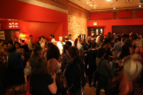
Suburbs
February 5th, 2010
Only a mere two kilometres north of Meadowvale, in Brampton, is another “lost” village, Churchville. Both communities share a lot in common: both were established as mill towns on the Credit River, both were served by the Credit Valley Railway when it arrived in the 1870s and the Toronto Suburban Railway, which ran from 1917 to 1931. Both are removed from major roadways, perhaps helping their survival.
In “Toronto’s Lost Villages” by Ron Brown, published in 1997 and one of the inspirations for this series, the author lamented that Churchville was about to be inundated by suburban development. Luckily, because of strengthened historical interest, and the proximity of floodplains that restrict new development, it remains relatively intact and somewhat interesting.
Churchville was the most northerly settlement in Toronto Township (which in 1968 became the Town of Mississauga) and is somewhat older than Meadowvale, established in 1815. At its peak, Churchville had several stores, a church, a hotel, mills and other local services. An ambitious network of streets was laid out, some of which do not exist today, but still appear on some maps (such as the Google Map linked above). After a a period of growth, the population level stagnated after nearby Brampton grew larger with the 1856 arrival of the Grand Trunk Railway and designated as the county seat. Many of the stores left, the mill was lost to time, and fire destroyed at least one of the churches.
January 31st, 2010
The latest installment in this series brings us to Meadowvale Village, a well-preserved rural settlement that is now all but lost in Mississauga’s sprawl. Indeed, without a map, Meadowvale is difficult to find, as road diversions and detours has removed all through traffic, with a complex detour necessary to follow long-established routes.
Meadowvale was established in the 1830s as a mill town on the Credit River and as a service centre for northern Toronto Township, featuring schools, churches, stores and a tavern. The Gooderham and Worts distillery empire had a significance here, even constructing a mansion built as a summer house for the Gooderham family. Later businesses included a auto service station and additional shops, but until the 1990s, Meadowvale remained a separate, distinct community.
Unlike Thistletown, Meadowvale had direct railway access. In the 1870s, Meadowvale became a stop on the Credit Valley Railway, which went from Toronto to Orangeville via Brampton (with a “branch” to St. Thomas via Milton and Galt from Streetsville), but quickly acquired by the Canadian Pacific. In 1917, the Canadian Pacific was joined by the Toronto Suburban Railway’s short-lived Guelph route, serving mostly small towns and villages between the line’s Keele and St. Clair terminus and Guelph. (The TSR Meadowvale Station survives, but is now on the grounds of the Halton County Radial Railway museum near Rockwood, itself on the old TSR route.) However, Meadowvale never became very prominent; losing out to larger nearby communities like Streetsville, an incorporated town and a major railway junction; and Brampton to the north, which was larger still and the county seat for Peel.
January 8th, 2010
GO Transit is in the throes of major expansion. Examining how the system’s stations influence their surroundings, and how this, in turn, affects the suburbs, can provide a glimpse into the future of the GTA.
As an example of the potential for what GO transit could do for the suburbs, Oakville Midtown is fertile fodder for the imagination. Oakville’s midtown provides several unique and highly desirable characteristics, including a large wooded ravine, natural heritage, and large-scale public land ownership. The exciting redevelopment plan for Oakville’s midtown is an example of how enhancing the areas around GO Transit stations (an initiative central to the Ontario government’s Places to Grow Act) could help fix the suburbs while at the same time solidifying the feasibility of the region’s existing transit infrastructure.
Oakville’s Midtown Core development is centred on the Oakville GO station, in the area bound by the Sixteen Mile Creek, the QEW and the Oakville rail yards. The Midtown plan calls for a redrawn street grid, new civic facilities, an educational campus, and conversion of surface parking into two large garages. The area could host upwards of 5,500 new residences and around two million new square feet of office and commercial space by 2030. Designed to create a focus for the neighbourhood, the civic centre proposal includes a new town hall, marquee arena, and public square.
January 7th, 2010
23 Jason Road, Thistletown’s first house, built around 1802
Thistletown, perhaps Toronto’s best-hidden historic neighbourhood, is located at the intersection of Albion Road and Islington Avenue. The village, which was never incorporated, was established in the 1840s, servicing the important Albion Road. The settlement got its name from a prominent local family.
Albion Road was surveyed as early as 1799, predating the grid-based concession farm plot and road system, as an extension of Weston Road. Albion passed through other lost villages such as Clairville (at Steeles) to Albion Township (later amalgamated into the Town of Caledon). The road’s diagonal path made the route ideal for farmers to bring their produce and livestock to market in the larger town of Weston, or all the way into Toronto, particularly before the railways were built. At its height, Thistletown had a population of several hundred, a community hall, an inn and tavern, and several shops at the corner of Albion and Islington.
December 29th, 2009
The brutalist Chelmsford Apartment towers loom over an old village house.
This is the first in a series I plan to do over the next little while on the hidden villages and hamlets that have been engulfed by urban sprawl in the Greater Toronto Area. This is going back to the beginning for me, as one of my first posts on Spacing Toronto was on the lost village of Ebenezer, now part of Brampton’s sprawl.
I chose Agincourt to launch this occasional series for two reasons: this is one area in which many, if not most, Spacing readers should have some familiarity with; and it is here that Transit City has its humble “groundbreaking” - namely the grade separation of the CN Uxbridge Subdivision and Sheppard Avenue East.
Unlike lesser known villages around like O’Sullivan’s Corners (Sheppard and Victoria Park), or Hough’s Corners (Eglinton and Birchmount), Agincourt as a geographical place name lives on, in the form of a GO Transit train stop; a mall at Kennedy and Sheppard, local schools, amongst other things. Indeed, today, many Torontonians would describe Agincourt’s boundaries as from the 401 to the south, Steeles to the north, Victoria Park to the west and McCowan or Markham Roads to the east (the City of Toronto’s neighbourhood definition for Agincourt isn’t clear either, splitting “Agincourt” into two neighbourhoods).
125 years ago, Agincourt was a bustling, yet unincorporated, rural village at the corner of what is today the intersection of Midland and Sheppard Avenues, assisted by the construction of the pioneering Toronto and Nipissing Railway in 1871 (which became part of the Midland Railway of Canada empire, the origin of the name Midland Avenue) and the Ontario and Quebec Railway, later the CP mainline to Montreal.
Knox United Church and cemetery, Agincourt. An old church and cemetery will often mark the location of a former village.
The suburban creep of Toronto didn’t catch up to Agincourt until the early 1960s, after the construction of Highway 401 and the wholesale bungalowization of Scarborough Township after the Second World War by Reeve Oliver Crockford. The train has stopped continuously in Agincourt, first hosting passenger trains to Coboconk and Lindsay, later CN, then VIA rail diesel coach commuter trains to Markham and Stouffville. GO Transit took over the service in 1982.
Today, Agincourt village still maintains much of its original building stock, though urbanization has blurred the old boundaries. This has had the effect so that Agincourt is a village lost in plain sight. Several churches from the village era remain in use today, though there have been some adaptations to the area’s changing demographics, including Mandarin and Cantonese language services. The local school, built in 1912, still welcomes students, and the old Victorian and Edwardian housing stock, while standing out from the ranch houses, high rises and townhouse complexes that surround the area, are plentiful on several local streets as well as Midland Avenue and even Sheppard.
October 27th, 2009
It’s a busy week for talking about North York: Last week I wrote about the Leona Drive project in Willowdale, tonight is the North York Modernist Forum, and on Wednesday …
October 27th, 2009
In late September, I had the privilege of sitting in on one of the walkability studies that are taking place in conjunction with the City’s Tower Renewal pilot project. The studies enable residents of the tower neighbourhoods that are part of the pilot project to show how they walk in their area and what the barriers are to walking, with a view to discovering potential improvements. They have been developed by Jane Farrow of the Centre for City Ecology and Prof. Paul Hess of the University of Toronto.
The site was a set of four towers organized around Cougar Court in Scarborough Village, just off Eglinton East near Kingston Road. The first thing Jane Farrow showed us when we arrived was a classic piece of suburban unwalkability. Just east of the four towers, which house over a thousand people including many children, there is an elementary school and a park on Gatesview Ave. But a string of houses along Cedar Dr. were built along the east side of the towers complex blocking direct access to these amenities (full satellite map). Residents of the towers would have to take a roundabout route (especially for those in the north towers) through a pedestrian-unfriendly alley to the south to get to them.
October 24th, 2009
A little excitement while driving on the Parkway in the morning.
Street Scene will appear each week showcasing the illustrations of local …
September 14th, 2009
back in March 2009, Spacing launched our first season of Spacing Radio, a bi-weekly podcast hosted by the CBC Radio’s David Michael Lamb. After six episodes — including interviews …
August 18th, 2009
This is part of a series of posts by students in OCAD’s Cities for People summer workshop (click the link to read a bit about what the class was about). This post was researched, photographed and written by Mary-Ellen Simko. More information on the psychogeographic map above at the end of the article.
- - - - - - - - - - - - - - - - - - - - - - - - - - - - - - - - - - - - - - - - - - -
History of the Area
Both Alderwood and Long Branch, adjacent neighbourhoods in the southwest corner of Etobicoke, were a part of Colonel Samuel Smith’s land and many of the streets in Alderwood are named after the farmers in the area. The Alderwood name became official in 1933 and was derived from the First nations word “Etobicoke,” meaning “the place were the alders grow.” Long Branch was named after a resort in New Jersey and ferry boats brought thousands of Toronto vacationers each summer to use the cottages, hotels, the boardwalk and amusement rides including a Coney Island Carousel. It became a more accessible community in 1916 when Lake Shore Boulevard was paved and turned Long Branch into a year-round community.
Stats for Ward 6
Alderwood and Long Branch are home to 56,620 people that comprise 26,240 households located in an area approximately 18 square kilometres in size. In 2006 56% of the occupied private dwellings (31% were single-detached houses) were owned while 44% were rented spaces. 72% of these south Etobicoke residents drive to their jobs while 79% took non-work related trips by car. Most of the new immigration to the area has been from Eastern Europe (primarily Poland) with the highest percentage arriving between 1991 - 2000. Ward 6 has an average household income of 69,500 which is lower than the city of Toronto however 20% report having an income over 100,000. The population demographic has increased between the ages 45-64 but decreased for the age group 5-9 however 60% of households have children. (more info here - pdf)
Transit and how to get there
Both communities are serviced by the Lakeshore east/west Go transit line that stops at Long Branch Go Station while north/south Browns Line has an off-ramp from the QEW and 427 highways. TTC tracks have existed along this southern edge of the city since 1912 and the all-night 501 Streetcar connects the western Long Branch loop to the eastern edge of Toronto at the Neville Park loop. Bus routes on Browns Line and Kipling join the neighbourhoods with the Kipling Subway station.