 |
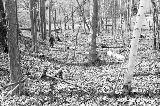
patches of green : : : : : : : Pull out your GTA map book and peruse the thin blue lines and patches of green. The city's oft-ignored waterways and wooded areas are great for finding countless urban-nature pathways and trails. Like oases - with tangles of native plants underfoot, indigenous trees overhead, and tributaries and streams - these under-appreciated wild spots provide a respite from 'managed' public spaces. Whether it's the long-reaching ravines that run like arteries through the city, or just a well-worn dirt pathway through a patch of wildlife connecting a parking lot to a parkette, there are all kinds of alternatives to groomed parks and paved squares within city limits. On some ravine trails, you can actually hike for hours and still hop the TTC home. The most appealing feature of the ravines is being able to walk alongside moving water. Nothing helps you forget concrete like water The Don River Watershed and Wilket Creek for example, have many paths that follow their flow. Many of the larger parks that connect with ravines, such as Sunnybrook, have meandering footpaths in their surrounding wooded boundaries - by-products of walkers carving new trails off of popular routes, or making connectors to other parts of the park and nearby streets. Their twists and turns can lead to all sorts of unexpected natural delights. You can travel the common paths and cruise the tamed parklands, but it's the unmapped trails and the neighbourhood nooks of nature tucked just out of view that are the most rewarding. They may be hidden along an out-of-use section of rail, in-behind a strip of houses, or you may notice an opening in the bushes at the edge of a park And like any explorer worth their salt, you have to be willing to come up bust or find yourself frustrated and lost. With a little groundwork - or blind luck - you can find places in Toronto's under-investigated greeneries that make you feel worlds away from mini-malls and exhaust fumes. My favourite chunk of ravine is near my parent's house. It cuts along Wilket Creek, and has a main path leading from the tip of a dead-end street to a mid-size park, with a handful of sub-trails along the way. Native flora of all kinds tug at your ankles. There's an amazing tree that has four trunks that reach outward diagonally at 45-degree angles but still share one huge foundation of roots. Another tree, along the waterside trail, has a lumpy-based branch coming out of it that, I swear, looks just like an elephant head with its trunk outstretched. Crossing on an unofficial bridge in the form of a large clump of branches felled by storms, you can sit on a sandy creek bank and watch the water go by. I've never actually timed how long it takes to get from one end of the ravine path to the other. I figure it can be done in around five to ten minutes - but it's taken me close to an hour on many occasions. : : : : : : : Ravine Resources Toronto's Ravines: Walking the Hidden
Country http://www.city.toronto.on.ca/trees/ravines.htm http://www.trca.on.ca/water_protection/strategies/ http://www.globeandmail.com/series/outsiders/ : : : : : : : Sean Waisglass is a Toronto based writer and photographer |
spacing.ca || contact || subscribe || in this issue || stores (c) 2004 Spacing Publishing |