
EDITOR’S NOTE: Based on feedback from an earlier post on urban density, Spacing Atlantic will feature one of the top five dense residential neighbourhoods in Atlantic Canada each week. Previous neighbourhoods: Quinpool Road Halifax, Nova Scotia; North End Halifax, Nova Scotia; Uptown Saint John, New Brunswick; Downtown St. John’s, Newfoundland & Labrador.
![]()
So, why density? Residential density, the number of people living in a given area, is one of the most important characteristics of urban areas. High densities create vibrant streets, support main street commercial areas, and encourage walking, biking and transit use. But how dense should our neighbourhoods be? What types of buildings create high densities? What do high density neighbourhoods look like?
Hopefully this series encourages people to look around their neighbourhood and ask: how does density affect the quality of my neighbourhood?
Without further ado…on to number one!
1 – Spring Garden/ Queen Street, Halifax, Nova Scotia
Atlantic Canada’s densest neighbourhood is probably also Atlantic Canada’s liveliest neighbourhood. Spring Garden Road is the busiest retail street in Atlantic Canada, with lots of activity all day and into the evening. Located near Halifax’s central business district, hospitals and universities, this neighbourhood has many shops, restaurants and offices. The many housing options include high rise condominiums, many low rise apartment buildings, 19th Century townhouses and single family homes on small lots. Most buildings have small setbacks and cover most of their lot, resulting in a high population density, especially since so many buildings are multi-unit. Very few lots in the neighbourhood are undeveloped, and several new buildings are under construction or proposed.
Population Density: 7160 people/ km2
Dwelling Density: 54 units/ hectare


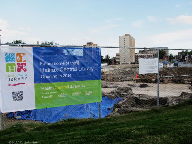

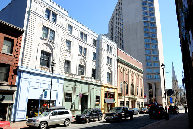


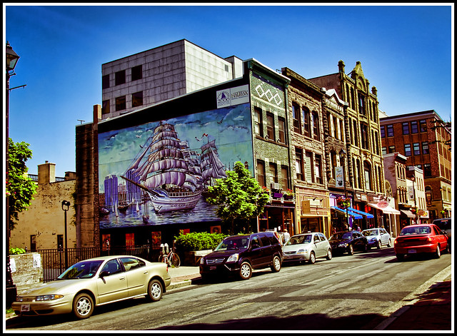

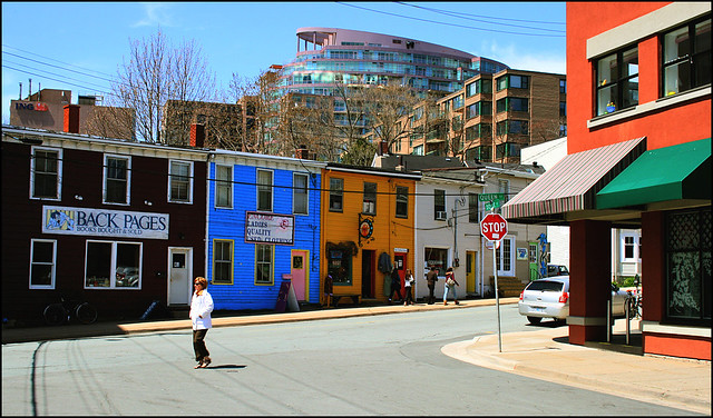


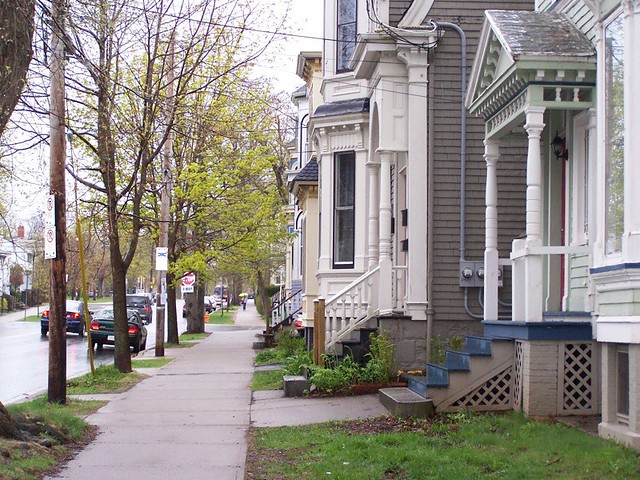


Photos by lumierefl, Ben, tvordj, jkcrawley, nsca, KenRR, 3rdLife, Matt Lazzarini, december seventeen, TomFlemming, Holsz, derivative, BGrantPaul, baekken, J.Elliott, midexies and Wilson Hum @ Hfx.


6 comments
It would be interesting to know how the boundaries of this neighbourhood was chosen. Especially, since 3 of the picture in the post are close (but not in) the boundaries of the neighbourhood map shown at the beginning of the post. Spring Garden Rd is generally 1-2 block north and south of Spring Garden Rd. But I would not associate Inglis with Spring Garden Rd, that’s the South End). Nor would I associate Lower Water St, (that’s Downtown). Otherwise, interesting post and pictures.
A couple pictures aren’t in sync with the map…true, but with a dearth of good pictures available…we put up a couple pictures that represented the area and it’s density well.
Regarding the author’s methodology…from the ‘North End Halifax’ post (https://spacing.ca/atlantic/2011/09/26/atlantic-canadas-densest-neighbourhoods-halifax/)
“As far as choosing the neighbourhoods, I’m limited by the data available from Statistics Canada. For the Census, the city is divided into small census tracts and even smaller dissemination areas. I can combine census tracts and dissemination areas to create the “neighbourhoods” but I can’t break apart those components to create absolutely any neighbourhood I choose. So North Street is a boundary created by Stats Canada, which I chose to use because to me it is a good boundary for this neighbourhood.
A good example of the limitations of the Census data, for this project at least, is the area to the south west of this neighbourhood, just outside the boundary (Maitland, Portland, Brunswick. Cornwallis). It really should be in this neigbhourhood, but I can’t get any information on that area that doesn’t include a huge swath of the central business district, which clearly isn’t in the Old North End. But that’s the way Stats Can chops up the data – c’est la vie.”
One other reason the neighbourhoods in Halifax are so large is because if I had chopped them up into smaller bits, I would have had a series called “Halifax’s Densest Neighbourhoods”. Ken you are right that Inglis and Spring Garden aren’t usually thought of together … but since it’s a single stretch of high density residential, which isn’t broken up by major roads or parks, I lumped them together. I think for the purposes of this blog series this “neighbourhood” illustrates an area of high density.
The downtown core of Halifax didn’t make it onto the countdown for a very simple reason – it isn’t very dense. Very few people live downtown, and most that do live in or around Scotia Square. There are a few other apartments scattered throughout the downtown, but not enough to create any sort of critical mass of people. To me this is downtown’s single biggest problem and the reason why Barrington Street struggles – many, many more people need to live downtown to support that type of street. High residential density is one of the cornerstones of vibrant urban places – just ask Jane Jacobs.
How come the Halifax Commons/Citadel aren’t included in any of the Halifax peninsula neighbourhoods profiled in this piece? Surely this open space/cultural space is important for the residents of these neighbourhoods. It might lessen the density totals, but should be included in order to demonstrate the true density of these neighbourhoods, which are in many ways part of a single greater neighbourhood.
Also, I would wager that Dalhousie’s Studley Campus would fall somewhere in the middle of these rankings if you were to investigate the student population as it relates to the institutional environment surrounding it.
The Commons/ Citadel are so large they would lower the numbers pretty dramatically. The purpose of the series was to look at the connection between urban form and density, so I felt it was more important to show built-up areas (density net green space, if you will). If the Commons were included it wouldn’t be clear how much of the resulting density number was due to the urban form and how much was due to the huge chunk of open space.
I totally agree though, at the neighbourhood and peninsular scale the Commons are key to how these neighbourhoods function. Not including them in my calculations isn’t any indication of their importance. Including them in a density number, however, would be more appropriate at the peninsular scale, at least for what I was hoping to show. Your point about these areas being part of a larger district is very true – there is a solid band of moderate density to moderately high density neighbourhoods extending out from downtown in all directions until the Robie/ Young Street area (and beyond in some cases).
I never thought of Dal’s main campus (or SMU for that matter). Clearly they add a lot of people to the peninsula when school’s in, people that don’t all get counted by the census. I have no idea how many students live on campus, and what the densities might work out to, but I’d be intrigued if people had the numbers.
In Dalhousie’s case, the population of each residence is posted on the University’s student housing website.
http://www.ancillaries.dal.ca/default.asp?mn=1.8.591