Edmonton is currently undergoing a massive transformation that includes a redesigned downtown core, the annexation of land to the south of the city, and a new look for Stony Plain Road. Coupled with the ongoing debate on bike infrastructure, we have a lot going on. In light of these development projects, some people are asking questions about the effectiveness of the City of Edmonton’s public consultation process.
Here, I detail a recent engagement process conducted by the City of Edmonton that demonstrates how theories about the importance of place can enrich both the public engagement process and create meaningful projects for citizens.
Patrick Devine-Wright, a geographer and researcher, defines ‘place identity’ as the “…ways in which physical and symbolic attributes of certain locations contribute to an individual’s sense of self or identity”. A place is comprised of its physical characteristics, the activities that occur there and the meanings derived thereof. Place is important to how we see ourselves, our community, and our city.
The notion of place identity has profound implications for how urban planners consult on growth and development within our city. It points to the need for both a broad (i.e. a wide cross-section of people) and deep (i.e. seeking the depth of knowledge of individuals) consultation. With the Communities on Foot program the City of Edmonton completed a broad and deep consultation to construct unique community walking maps.
To understand how they built their consultation process, I contacted Ian Hosler with the City of Edmonton Community Services. He said “…in different formats we ask the citizens who live in the neighbourhood, who are the content experts, two main questions: (1) If someone moved in next door, where would you tell them are the interesting places to walk to? (2) Or where are the pleasant routes if you want to go for a walk?”
Hosler goes on to say that “We make it clear we aren’t looking for the obvious … playgrounds and parks, as we have that information, but what are the things you wouldn’t see on a typical “City” map”.
Acknowledging citizens as place-based content experts seems to be a departure from current development thinking, but is deeply rooted in place-based geographic theory (see Kevin Lynch’s The Image of the City published in 1960). In this instance, the City used a range of consultation formats, from approaching schools with the goal of engaging children in the conversation, to traditional planning charrettes, in order to gather place-based content.
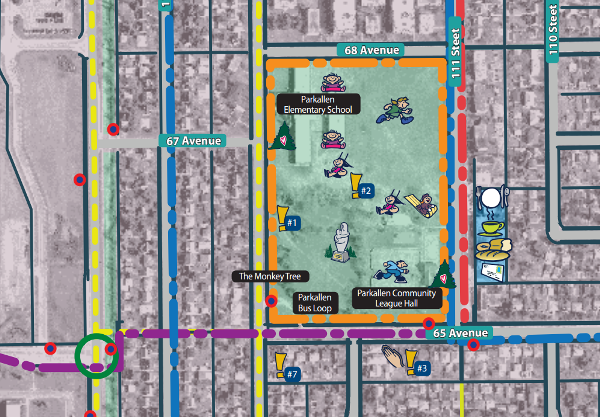
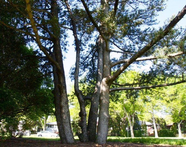
The end product, the Community Walking Maps, demonstrate the depth of place based understanding that can be gleaned from citizens. For instance, the Parkallen walking map shows a ‘Monkey Tree’ on the south end of the Elementary School yard. Hostler said that the knowledge of this tree emerged in talking with school aged children. The Monkey Tree is a special place for kids who attend the Parkallen school.

It is clear that the Community Walking Maps are built by seeking a wide range of input, from a variety of citizens who express a deep understanding of place. As Hosler says “…we hear amazing stories and facts that may or may not be able to be incorporated in the map...” These stories are reflected in the detail and range of meaning expressed on the walking maps. I suggest that you look them up.
Consultation that is meaningful – that represents a shift from looking for buy-in for a specific project, to defining the scope of place-based attributes that are meaningful – can be a powerful approach to achieve citizen engagement.
Recognizing that citizens have expert knowledge of their community can help improve the success of a project, not least by reducing conflict between project members and citizens. This type of citizen engagement might also act as a starting point to preserve or improve important places.
Building understanding with citizens requires that urban planners acknowledge the deep and expert level of knowledge that citizens bring to a consultation. It also requires a range of tools and methods, from traditional charrettes to utilizing the suite of emerging location-based web tools. As shown with the City of Edmonton Community Walking Maps, the results are well worth the extra engagement effort.

