

Top photo by Bitpicture.
My recent Psychogeography column in Eye Weekly had me walking down Jarvis Street from Bloor to the St. Lawrence Market. I cross over Jarvis usually twice everyday, but rarely travel up or down it. I was inspired to do so by a Tweet from Councillor Denzil Minnan-Wong that seemed designed to get car drivers riled up and think there is a war against them being planned.
On February 20, at 8:02am, city councillor Denzil Minnan-Wong tweeted “Used the middle lane on Jarvis St to get to work. Fast and efficient!†When questioned he said, “It was a great way to get to work. Imagine driving to work and not having to wait in gridlock! It was fantastic!â€
The exclamation-mark-mad muckraking councillor was intentionally wading into the contentious debate about the future of Jarvis. At the same time, he betrayed the strange panic that causes car drivers to think anything taming the dominance of the automobile on urban design is somehow a declaration of war on the car.
Jarvis, once the most beautiful street in Toronto, has been reverse-gentrified and turned into a fat arterial traffic pipe between North Toronto and downtown. The City’s Jarvis Street Improvement Plan, championed by local councillor Kyle Rae, aims to return the street to some of its pedestrian-friendly glory.
Read the rest over at Eye. The two things I found most interesting about Jarvis were the sheer amount of people that live on or near the street, and how many of those old, wonderful details (and new ones) remain. This means there are both historic and present day reasons why Jarvis should be made more pedestrian friendly and tame the planning crimes that were committed in the 1960s when the car was king. As I suggest at the end of the column, Jarvis isn’t the superhighway the Minnan-Wong’s think it is (it goes down to two lanes at non-rushhour times), and the plan isn’t a declaration of war against the car at all. What follows are iPhone photos I took during my walk of some of those Jarvis details as visual companion to the column.
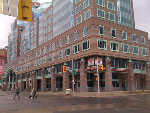
Jarvis begins at the Rogers postmodern Death Star.
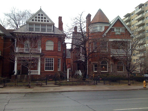
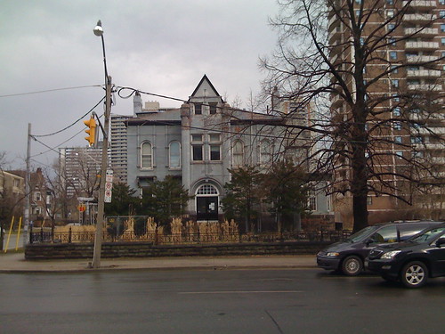
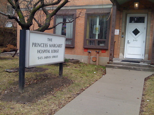
Fine old buildings and institutions remain.
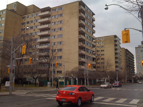
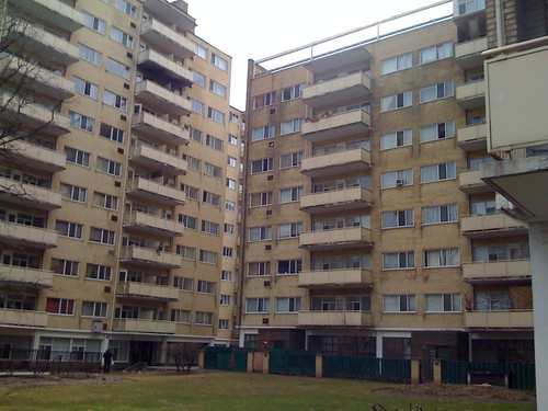
This apartment complex — one building is called Massey House — is some of the finest mid-century apartment living in the city.
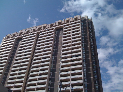
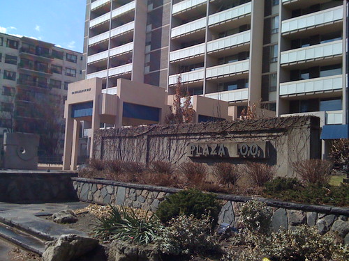
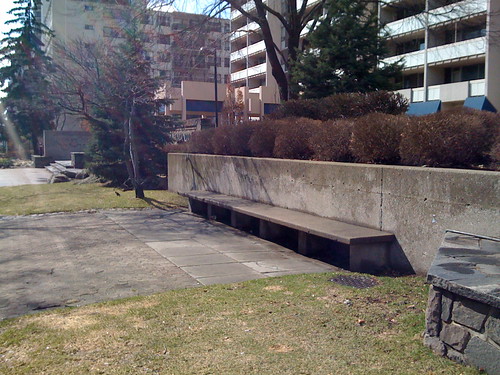
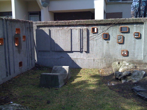
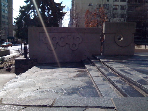
Plaza 100, at Wellesley, comes complete with rooftop swimming pool and avant garde 1960s shapes. It is always astonishing to think such far-out-ness was an integral part of so many developments in Canada. As I was born in the 1970s, this kind of architecture does trigger some nostalgic feelings, but also an appreciation for the bold thinking Canadian developers and architects had during the decades after World War II. I think of this kind of stuff as the architectural equivalent of a York Wilson mural. Plaza 100 is also a fine example of the kind of wonderful places that concrete can create. When Jarvis is improved, these spaces will likely become cherished urban pocket parks.
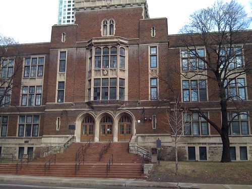
Diagonal from Plaza 100 is Jarvis Collegiate. With Minna-Wong’s rhetorical meddling in my head, I thought this school presents an opportunity to crank up the language on the other side: when kids hear the bell and run out of the school they’re met with a meter or so of sidewalk and then a busy 5-lane arterial road. Perhaps the good councillor’s Twitter feed will one day have an answer to the question “What about the children”? Do Jarvis students, along with area residents, not deserve better?
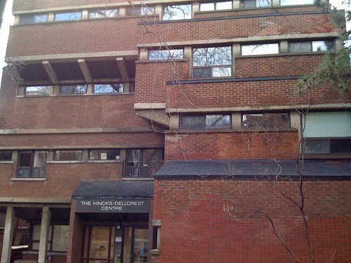
Across the street and just south of Wellesley the Hincks-Dellcrest Centre is another modern gem. After the column was first published in Eye, we recieved a note from Toronto heritage consultant William Greer (and winner of Heritage Toronto’s Lifetime Achievement Award in 2007) with more information on this building and on the ones in the following pictures:
The Hincks building was by Shore & Moffat and Partners in the 1960’s and designed to fit in scale and materials of the earlier Jarvis St buildings. The Toronto Historical Board in the 1970’s-80’s encouraged the developer to conserve the four houses south of Jarvis Collegiate and build highrise housing behind so as to help preserve the original built-form character of Jarvis St.

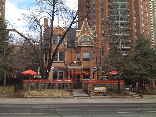
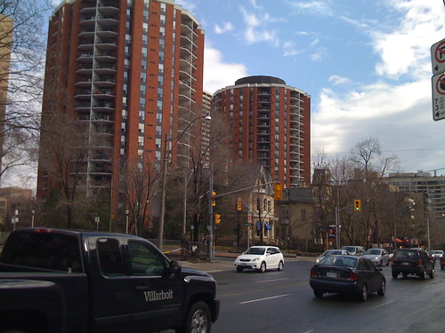
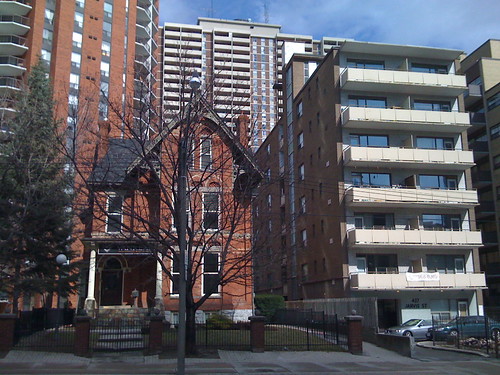
A particularly Torontonian blend of old and new, something we do very well. In the last photo above, the amount of space a single family home takes up vs. a low-rise apartment building is somewhat surprising.
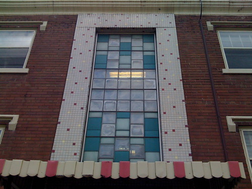
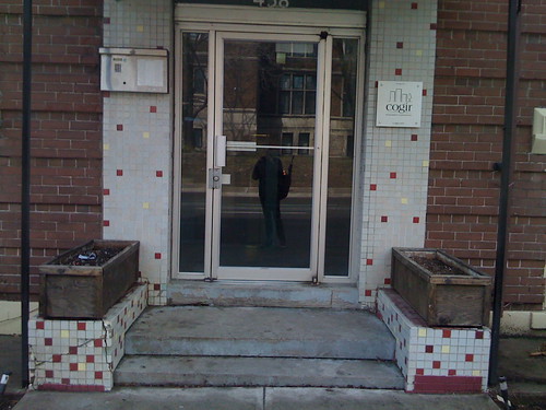

You don’t put details like these on an unloved street.
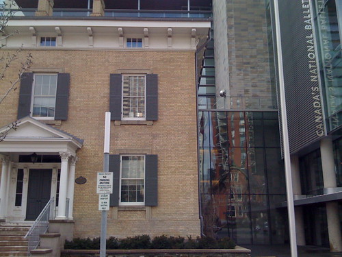
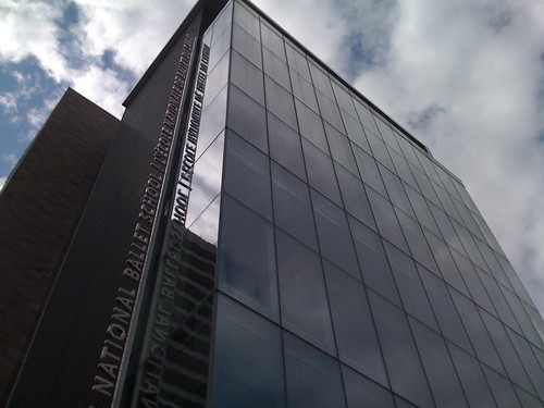
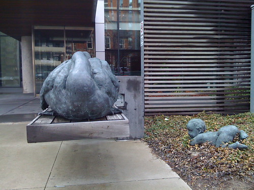
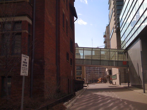
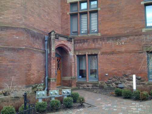
National Ballet School/Radio City/former CBC Headquarters (itself formerly the Havergal school for girls) complex.
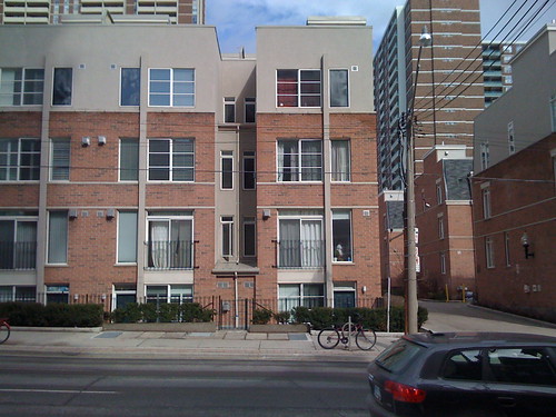
A nondescript but perfectly urban residential building in the shadow of the more flashy Radio City. People living along Jarvis, everywhere you look.
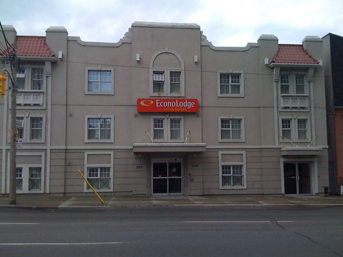
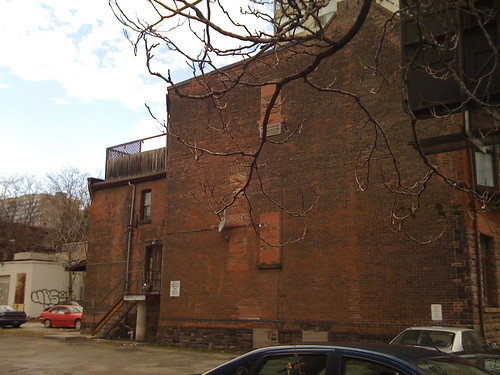
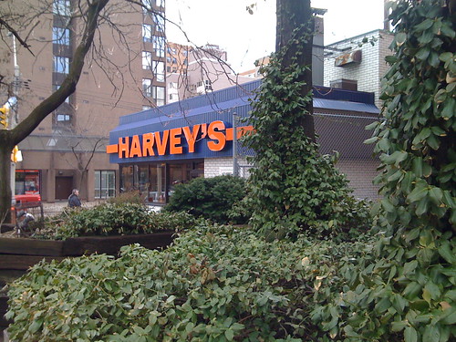

South of Gerrard Jarvis hasn’t always been maintained the way it should, and sometimes has a beat-down or fortified look, but that isn’t contiguous and the urban bones are all still there.

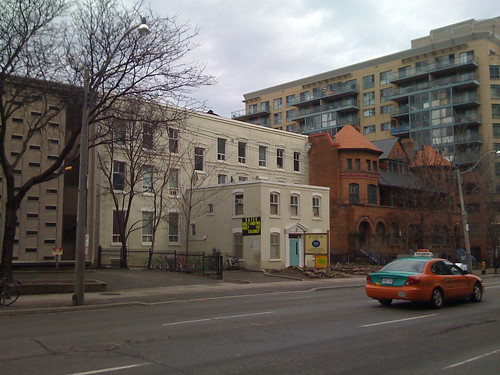
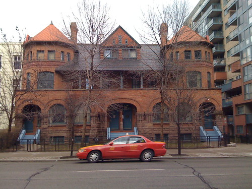
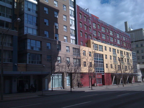
The Jarvis mix.
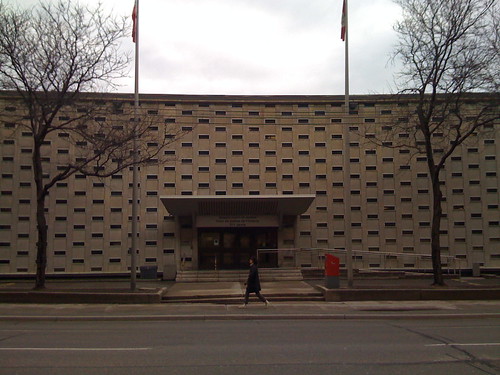
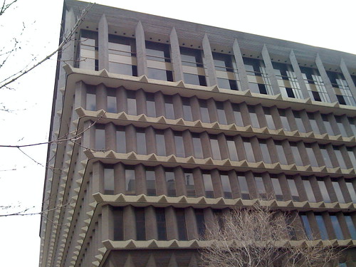

Two modern favorites of mine are the Ontario Court of Justice building (by Peter Dickinson) and the Sears Canada headquarters. The latter is likely controversial and not universally loved –perhaps viewed by some as “Robarts East” — but if the ugly fenced in parking lot just south of it were turned into something less parking lot-like, I think opinions of the audacious Sears building would improve. So many tiny bricks make up something so huge, at once heavy and light.
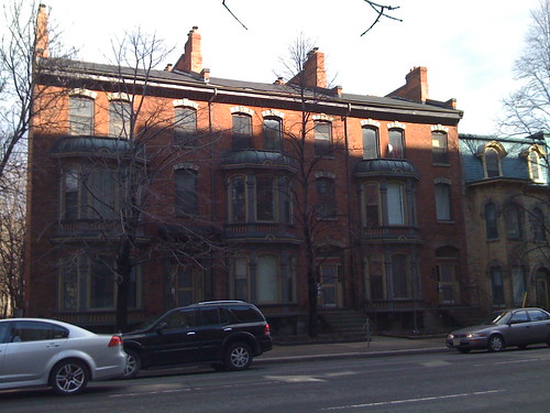

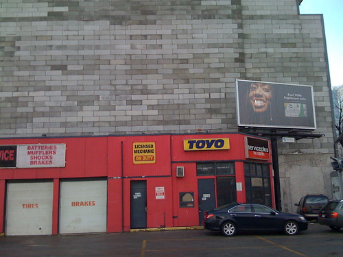

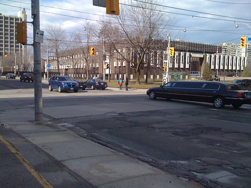
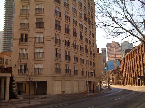
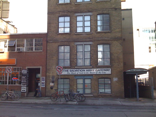
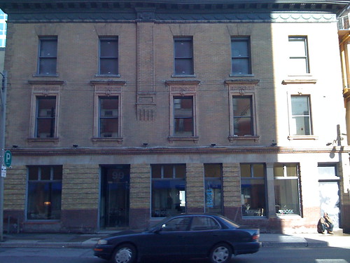
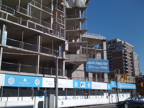
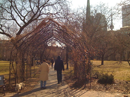
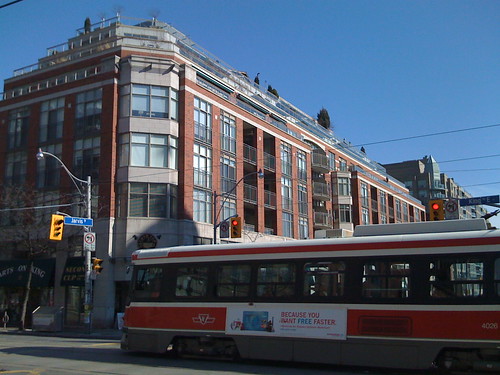
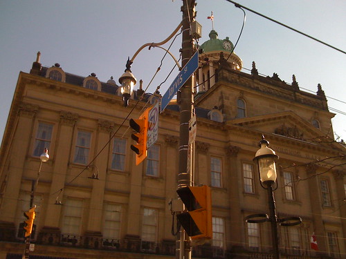

While there are some holes in its urban fabric (like the Moss Park Armory and soon-to-be developed lots around Queen) Jarvis becomes an urbane street in St. Lawrence Market, the reason why I’ve never understood Jarvis’s reputation as a quick arterial. If Jarvis is such an important arterial street, it can’t end just like this because, as I’ve noticed many times, it becomes a bottleneck — so Jarvis-as-freeway is a Minna-Wong fiction. It’s about time Jarvis’s design reflects everything it is today (and yesterday), including cars. Take a walk down or up Jarvis and see for yourself.


18 comments
your iPhone takes much better photos than mine. maybe i should clean the lens. =P
but i totally agree that Jarvis can greatly benefit from some love and making it more pedestrian-friendly would make it safer and more enjoyable for all.
it’s sad that the Regent Park area was so horribly neglected. if it could be revived the way the St. Lawrence Market area or Yorkville (though not so posh and uppity( was revived that would be awesome.
I only mention it was iPhone to apologize for the quality — which as you say isn’t so bad. I’ve stopped carrying around a camera since I got the phone.
“Jarvis becomes an urbane street in St. Lawrence Market, the reason why I’ve never understood Jarvis’s reputation as a quick arterial. Such streets can’t just like this because, as I’ve noticed many times, it becomes a bottleneck  so Jarvis as freeway is a Minna-Wong fiction.”
The bottleneck at the lower 5% of the road doesn’t change that the upper 95% is like a freeway. I don’t dirve on Jarvis, but it is the route for my express bus to and from work. I imagine that he, like the bus, switches to our east/west freeways downtown, Richmond and Adelaide, and never sees south of King in the St. Lawrence market neighbourhood. I used to live at Jarvis and Wellesley and the traffic always moved at a highway-like clip. There is a long distance between traffic lights and they have some sycing in place to create waves of cars. It reminds me exactly of Main and King Streets in Hamilton where you have 30 seconds of dead time and 10 seconds of cars whizzing by at 60-80.
great post. I’ve had some recent walks up and down Jarvis, and likewise been surprised at the sheer residential density, not only on Jarvis itself, but along some of the side streets.
Richmond and Adelaide certainly take some traffic — but the supporters of the status quo often point to the quick route Javis provides to the Gardiner.
I drive on occasion, and rush hour or not, I avoid Jarvis, top or bottom, for more sure-and-steady one-lane Sherbourn. The middle lane ends north of Queen, so even those Richmond/Adelaide drivers still get bottlenecked.
All this to say (and I make this point better in the column itself) that Jarvis functions as a crummy “fast route” so trying to keep it as is and not vastly improve it for so many other people, is silly.
What a great piece Shawn; I love your Flaneur walks.
The bottleneck at the bottom is mostly filled with cars coming from Adelaide and Front heading for the Gardiner. The problem is that Jarvis is a key access point to getting onto the Gardiner – the next road east of Bay or York, which are also clogged up at rush hour, so it takes the overflow of traffic that is avoiding those bottlenecks. So really what you have are two flows, the traffic heading north from downtown up to Mt. Pleasant, and the flow from downtown heading south.
I must say though that the St. Lawrence North market is a hideous brown pile that makes one want to walk next to it to look at the other side of the street.
Bay Street in the ’50s through to the ’70s was much
like Jarvis today.
Then, it was a quick route out of downtown back up to Forest Hill and beyond mainly because there were no major building north of Queen St. Jarvis southbound now was like Bay northbound back then.
It also helps to remember that Mt. Pleasant Rd.,which begins near the end of Jarvis, was built as a condition of North Toronto joining Toronto. The residents of North Toronto wanted an
alternate route into the city and Mt. Pleasant was the result of that–even though it had to cut through
Mt. Pleasant Cemetery.
Yes, another great post! I walk on Jarvis from Front to Wellesley several times a week and agree it has great potential and many hidden gems. The new Salvation Army building opposite the ghastly Moss Park Armory is ‘interesting’ (I have not decided yet if this is positive or negative)and the North St Lawrence Market will be rebuilt in next 4 years. An architectural competition is being planned and the new building will have the markets on the main floor and traffic courts on the 3(?) upper floors).
Kyle Rae has been working on getting the street improved for many years and I hope that finally we will actually see action. Final plans will come to City Council in May. see http://www.toronto.ca/involved/projects/jarvis/
Interestingly, most cabbies avoid Jarvis in favour of Sherbourne … they claim that the Gardiner dumps more traffic onto Jarvis which slows it down. It’d be interesting to see how true this is.
What about the great Allen Gardens?
Joe> I mention it in the column.
I don’t want to sound whiny and say “read my column, please!” cuz it sounds….whiny and uncouth….but I do these posts on Spacing as “extra’s” to my column, with photos and comments I may not have been able to fit into the piece itself. The column is the core, though. Etc.
That said, I did not have room enough to get deep into the fact that along Jarvis, the great Allan Gardens has such poor street presence. Nothing along it except a godawful info pillar. It could be so much more — a grand gate leading to the hothouse; a wonderful wrough iron something; etc. Contract to the picture above of St. James Park, with that neat arch made of branches. It says “Welcome, come on in”.
I trust the Jarvis Street Revitalization will improve the Jarvis length of Allen Gardens.
There are many ways to add to the charm of Jarvis, and dedicated bicycle paths should be one of them. Dedicated bicycle paths- not sharrows- are no less important than the Light Rail Transit initiatives for the City of Toronto, and should not be given second place.
You said in your Eye article that there ‘may be bike paths’- there ‘should be bike paths’. If you want to revitalize a neighbourhood, add bike paths.
There are many ways to add to the charm of Jarvis, and dedicated bicycle paths should be one of them. Dedicated bicycle paths are no less important than the Light Rail Transit initiatives for the City of Toronto, and should not be given second place.
You said in your Eye article that there ‘may be bike paths’- there ‘should be bike paths’. If you want to revitalize a neighbourhood, add bike paths.
I too believe “should” but said “may” because right now the plan seems in flux, and there was some disagreement about who – Peds, Cars, Bikes – would give up space. Somebody involved in that could comment perhaps.
I guess we all must wait until early May to see which voices the City heard! The Project site, URL above, says:
“The project team will consider all comments received by February 6, 2009 to complete the project’s Environmental Study Report (ESR).
Upon completion of the ESR, City staff will write a report to the Public Works and Infrastructure Committee for their endorsement (May 5, 2009) and for City Council’s approval (May 25 & 26, 2009). If the project is approved by City Council, the ESR will be placed on the public record. The public and review agencies will be notified of the study completion. The public and review agencies will then have 30 days to review the ESR.
Should any individual, group or agency have significant environmental concerns, they can request the Minister of the Environment to issue a Part II Order against the City within this 30-day period. If no Part II Orders are received, the project is considered approved and the City will proceed with this project as outlined in this ESR.”
“In the last photo above, the amount of space a single family home takes up vs. a low-rise apartment building is somewhat surprising.”
This always surprises me when I see it, too. 1 (large) single family dwelling vs. perhaps 24 (small, but probably livable) low-rise units. Then again, most of these single family homes have been turned into apartments, too, even though it’s hard to tell from the outside unless there are obvious buzzers or multiple mailboxes by the front door.
I spent three years working at Jarvis and Queen in the 90s, which has to rival Hooker Harvey’s up the street as one of the most depressing stretches. The street can definitely be grand again with a proper streetscaping and removal of that middle lane. Traffic is elastic and life will go on. Get it done.