Skip to content

Canadian Urbanism Uncovered

On the edge: Photographs of Toronto’s downtown waterfront

Photographer Steven Evans captures the varied aspects of Toronto's harbour

By

Read more articles by

A view of the Toronto harbour at dawn, seen from York Quay

A view of the Toronto harbour at dawn, seen from York Quay

Like Toronto’s winding ravine system, the Toronto waterfront is a significant and defining geographical feature. Before the arrival of Europeans, Indigenous peoples flourished on the land that would much later become the City of Toronto. For Indigenous people, the waterfront served as a direct route to the St. Lawrence River and the Upper Great Lakes, thereby enhancing trade and communication within the traditional territory of its various nations, including the Mississauga of the Credit, the Anishnabeg, the Chippewa, the Haudenosaunee, and the Wendat Peoples.

As described in the Waterfront Toronto history page and other sources, the arrival of European colonists marked a significant change for the Lake Ontario shoreline. After the American Revolution in 1776, Toronto emerged as a logical site for the British to establish a naval base to protect Upper Canada from the threats posed by the new American government. By 1793, with the building of Fort York, the town of York established itself as a protected, active and reliable port.

(Click on the images below to view the photographs full size.)
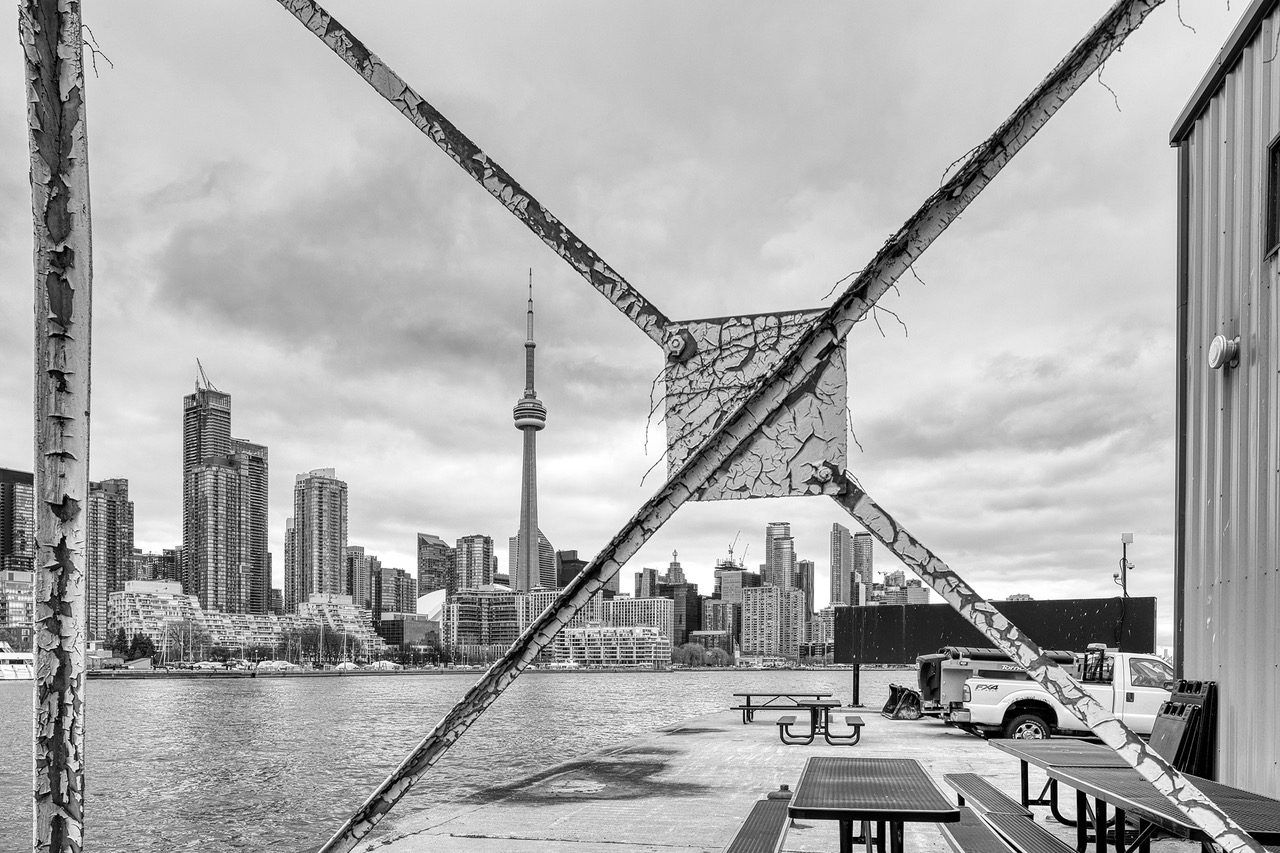
Toronto's Central Waterfront seen from Billy Bishop Airport
Toronto’s Central Waterfront seen from Billy Bishop Airport

York’s success as a port fueled rapid growth, resulting in a need for enhanced shipping facilities to accommodate increasing demands. Starting in the 1830s, a 120-year process of infilling the original Toronto waterfront extended the shoreline to its current location. During this time, the extent of Toronto’s harbour grew alongside its industrial use, leading nearby residents to move further from the city core. This shift, driven by the rise of the automobile and the construction of highways, enabled workers to commute from the suburbs. One notable route to the city, the elevated Gardiner Expressway, was constructed in 1950, effectively creating a physical boundary between the city and the waterfront.
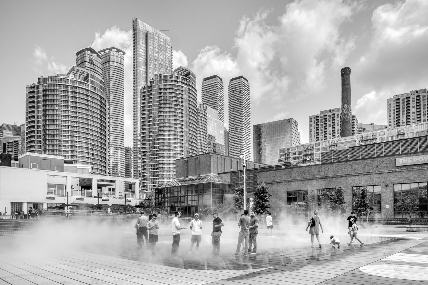
A "misting feature" in the new plaza that replaces the popular pond and skating rink at the Harbourfront Centre
A “misting feature” in the new plaza that replaced the popular pond and skating rink at the Harbourfront Centre.

For the next twenty years, the harbour began to lose its significance for shipping and manufacturing. In response, Toronto residents started to envision that the waterfront could be reclaimed for new, attractive public uses, including parks and cultural facilities, as well as for business and residential development. Today, assessing the overall success of this ongoing endeavour to regenerate the waterfront is challenging. Individual achievements are numerous, as are some serious mistakes.
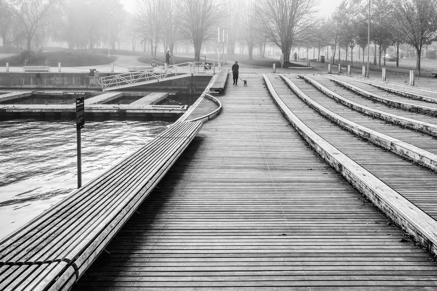
The Rees WaveDeck, one of a trio of undulating boardwalks on the south side of Queen’s Quay between Simcoe and Bathurst Street

In 1984, as a graduate student, I created some of my earliest photographs of industrial architecture at Toronto Harbour for my thesis project. In the years that followed, I periodically returned to the waterfront to document the ongoing transformation driven by efforts from government and private interests to improve public accessibility to these areas.

Considering the significant developments over the years, now seems an appropriate time to explore the waterfront’s current state more closely.
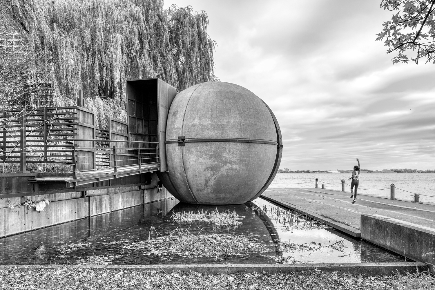
The Sundial Folly, a steel and concrete sculpture located on the southwest corner of Harbour Square Park. The giant steel globe by John Fung and Paul Figueiredoreposes in a pool of water that feeds an adjacent waterfall spilling into Lake Ontario. Visitors can enter the globe from a ramp on one side for a unique view of Lake Ontario.
The Sundial Folly, a steel and concrete sculpture located on the southwest corner of Harbour Square Park. The giant steel globe by John Fung and Paul Figueiredo, reposes in a pool of water that feeds an adjacent waterfall spilling into Lake Ontario. Visitors can enter the globe from a ramp on one side for a unique view of Lake Ontario.

These photographs are samples from my latest photographic excursions to document the Toronto waterfront—a project I will continue over the coming months. Geographically, the area I will cover stretches from the shore of Lake Ontario in the south to the Gardiner Expressway in the north and from Cherry Street in the east to Dufferin Street in the west. Assuming all goes well, I plan to exhibit the work in the fall of 2025.
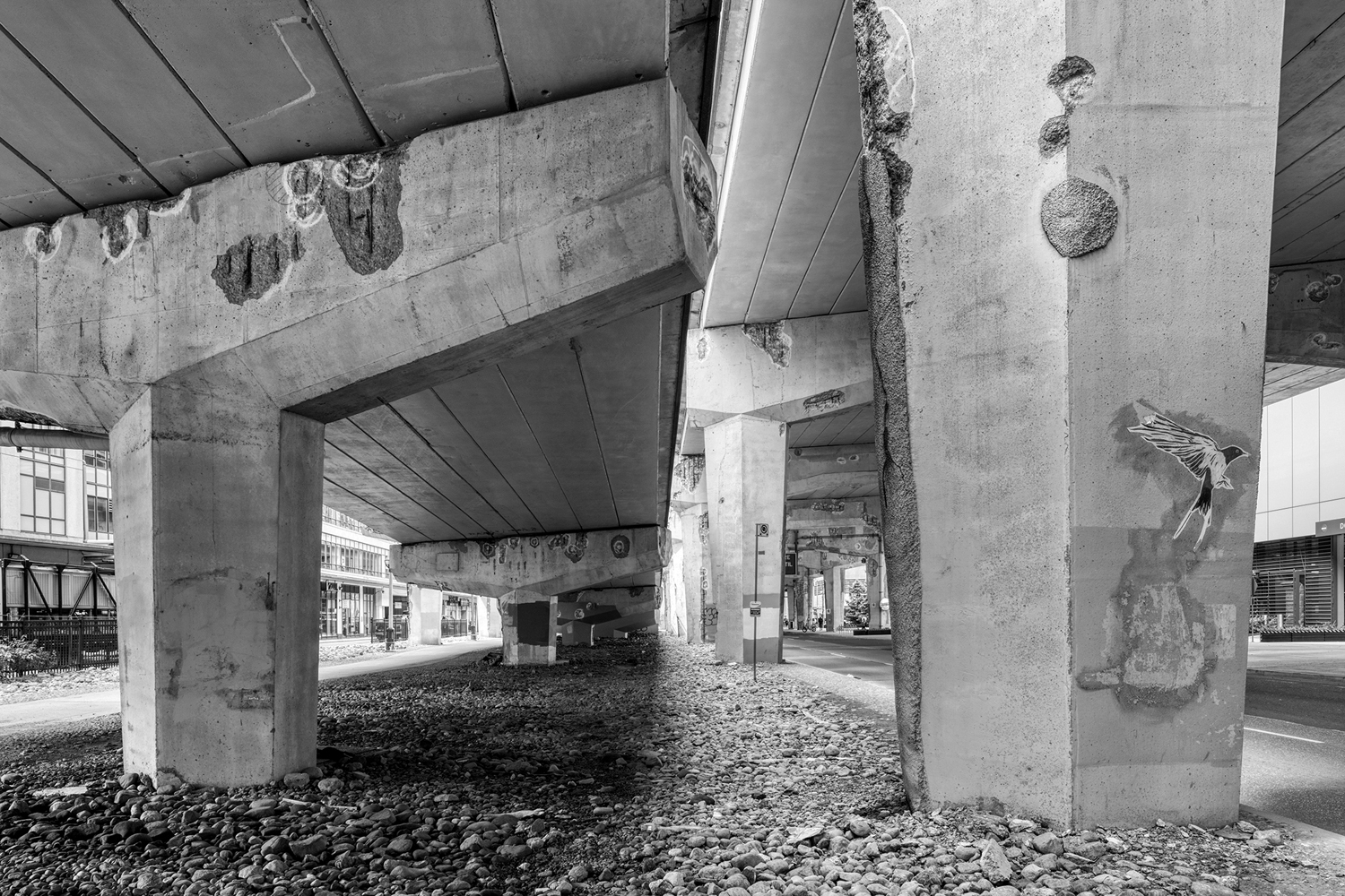
Aging concrete columns supporting the Gardiner Expressway show corrosion caused by years of leaking expansion joints and de-icing salt contamination.
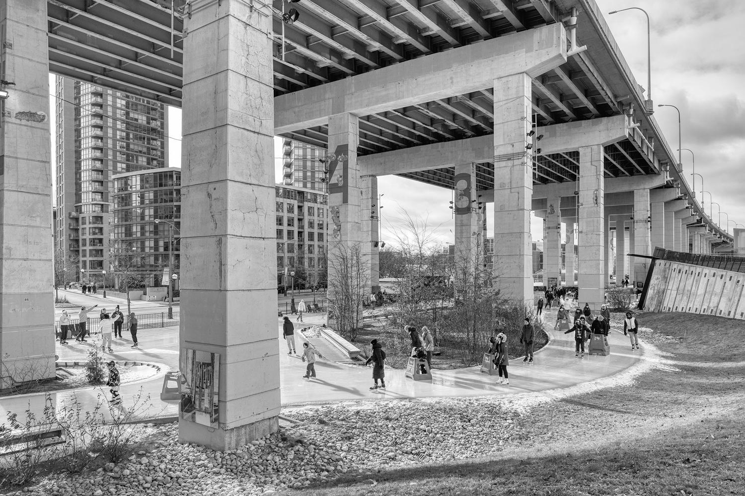
The Bentway Skate Trail, located below the Gardiner Expressway, is part of an ongoing innovative project that utilizes formally abandoned industrial land for public use.
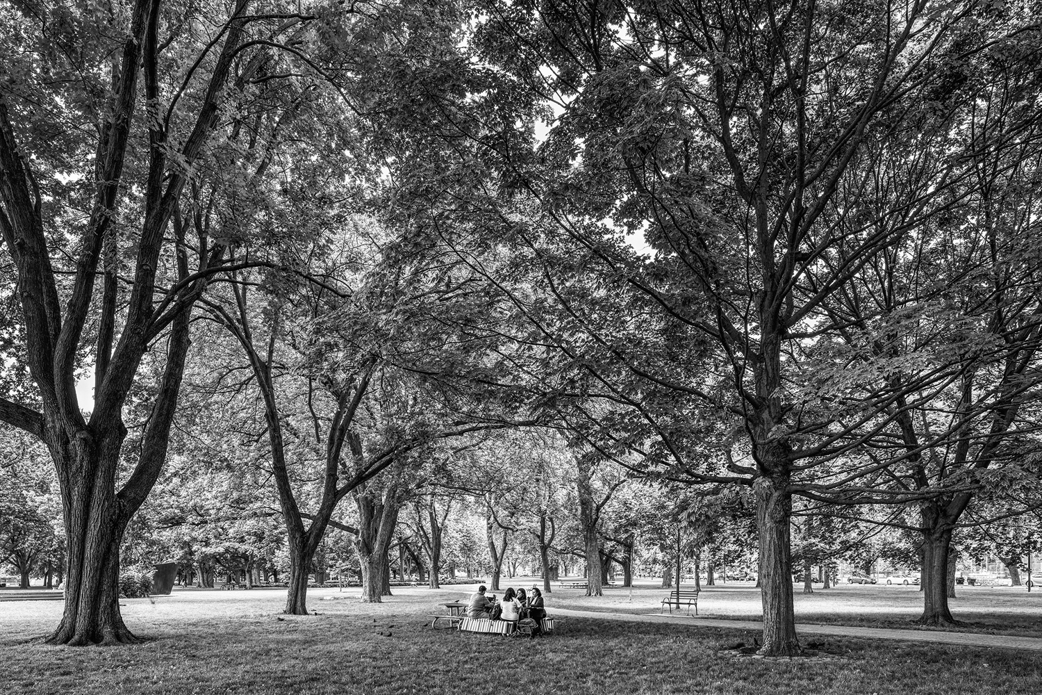
A family picnic in the shade of the old memorial trees at Coronation Park.
Summertime concerts draw appreciative audiences to the Giant Grass Steps Amphitheatre at the Music Gardens on Queen's Quay near Spadina Avenue.
Summertime concerts draw appreciative audiences to the Giant Grass Steps Amphitheatre at the Music Gardens on Queen’s Quay near Spadina Avenue.
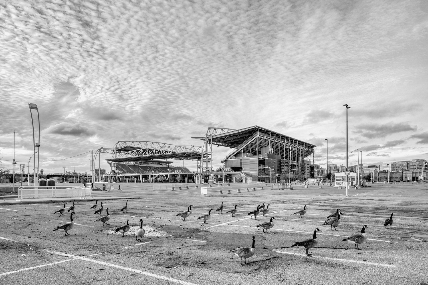
The expansive exhibition ground parking lots surrounding BMO Field.
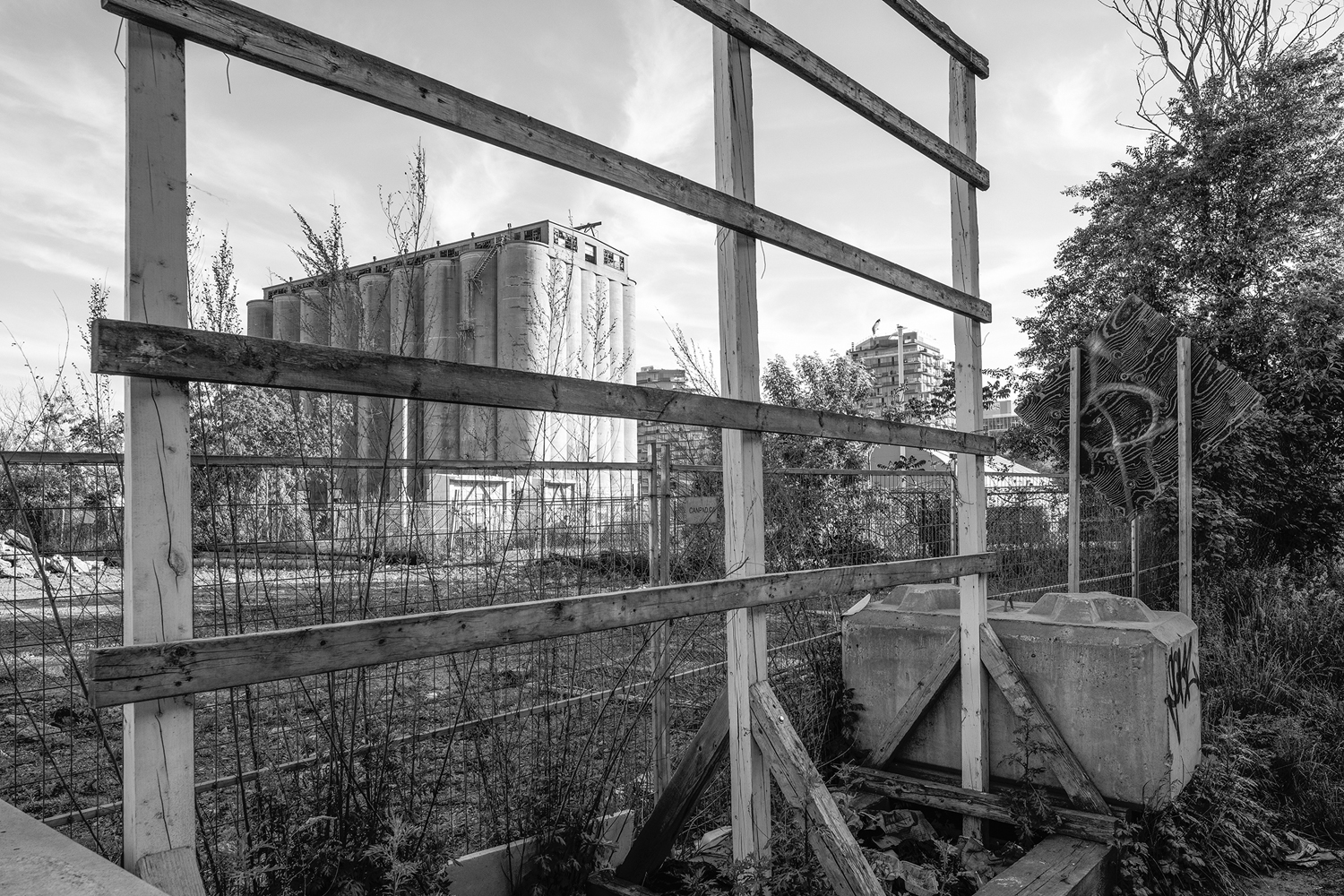
This concrete remainder of industrial heritage on the waterfront, located at the foot of Parliament Street at the mouth of Keating Channel, is the only surviving storage silo left on the former site of the Victory Soya Mills.
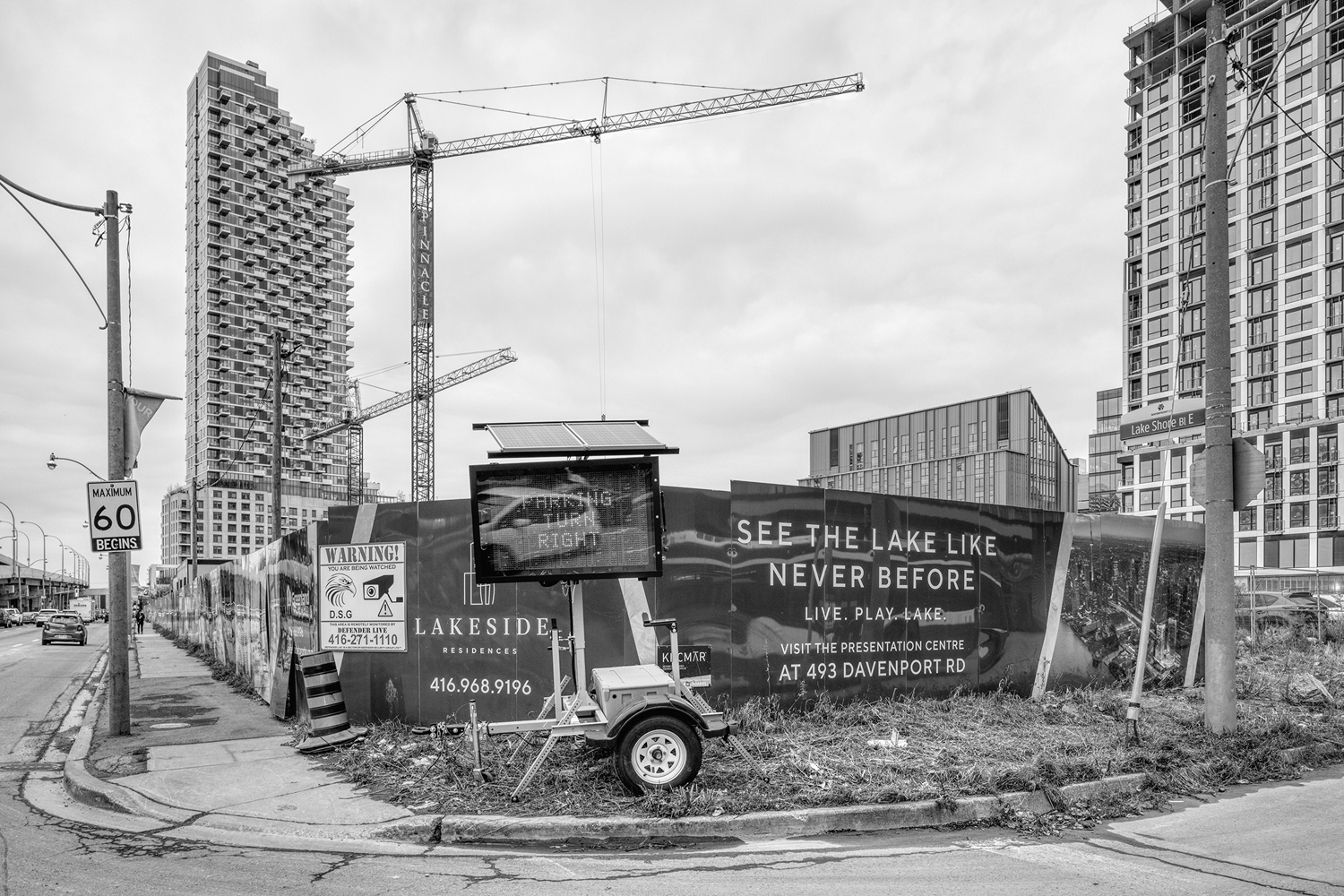
Hoardings for a new condo development in the East Bayfront district portray the virtues of life beside the lake.
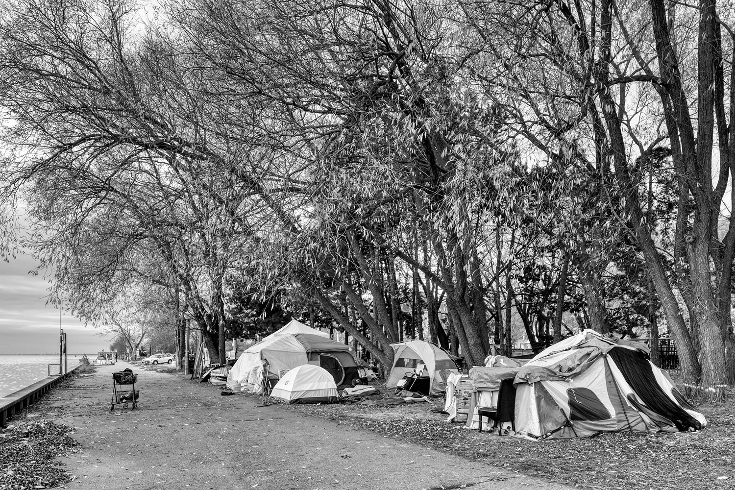
One of the homeless encampments located across the waterfront.
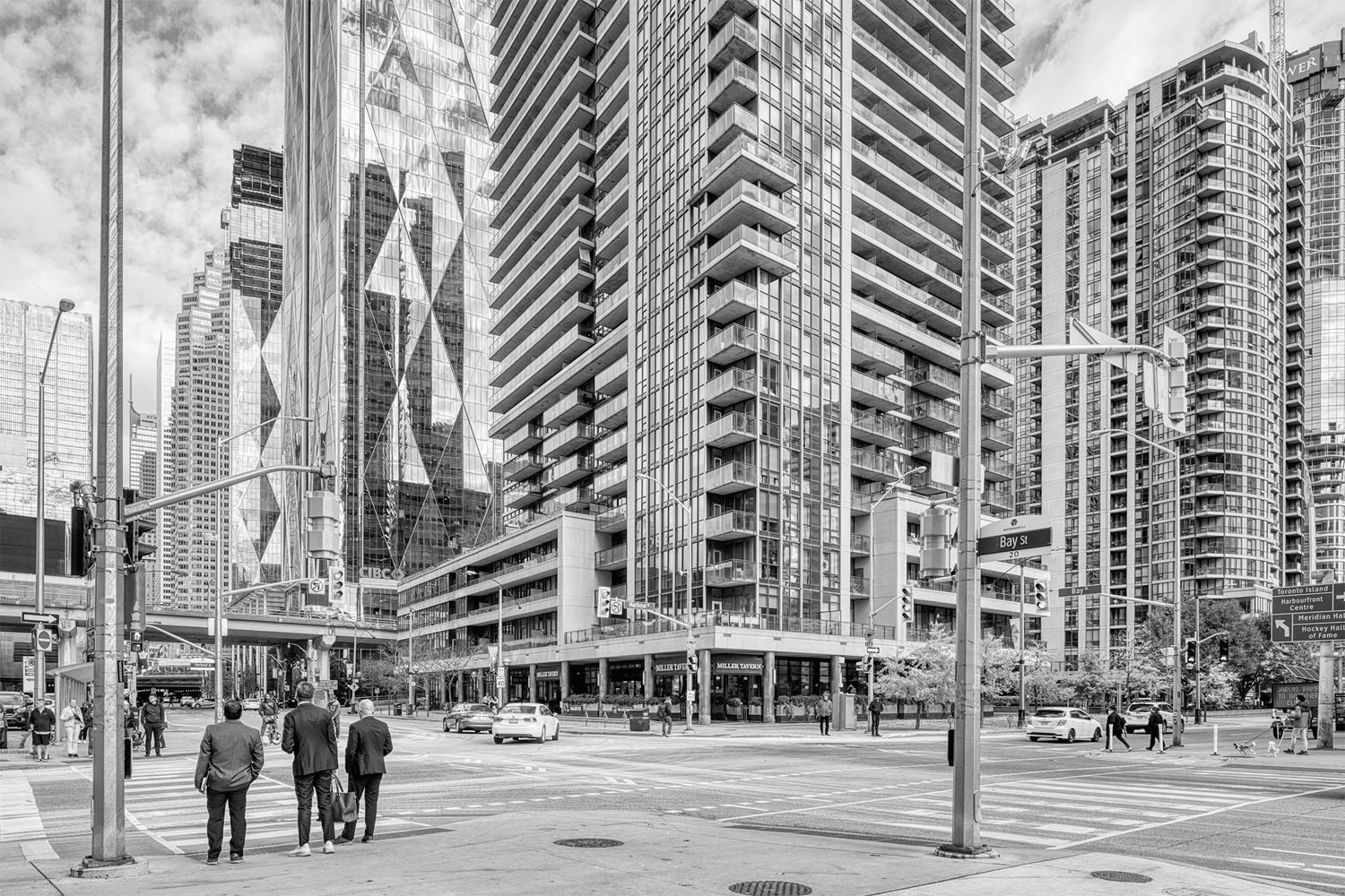
The conspicuous wall of office buildings and condos that have sprung up along Harbour Road and Lake Shore Boulevard East between Bay Street and Parliament Street.


Recommended

Leave a Reply

Your email address will not be published. Required fields are marked *

This site uses Akismet to reduce spam. Learn how your comment data is processed.