


This is part of a series of posts by students in OCAD’s Cities for People workshop. This post was researched and written by Laura Headley, Margarita Massioukova, Hannah Smith, Angelina Stoilkova, and Jiani Xie. Their psychogeographic map of the neighbourhood above is a mix of the maps found below based on their on-the-street research of the Simcoe Street Corridor.
![]()
S I M C O E S T .
WHERE IS THAT AGAIN?
Oh right.
Roy Thompson Hall; St. Andrew’s Presbyterian Church; Elephant and Castle; the growing bones of the Shangri-La’s hotel and condo; the falling glass and the street’s many condo liners. One of these architectural or media-frenzied events have in one way or another managed to slide Simcoe st. into the city’s memory.
Our study attempts to gain an understanding of the essence of the Simcoe St. For the purpose of this study we have selected a corridor starting with McCaul street (at Dundas), going east along Queen street and south along Simcoe street until Queens Quay. It is an amazing way to get to Toronto’s lovely waterfront and we see Simcoe street as a strong potential to smoothly connect the creative institutions along Queen, McCaul and Dundas streets with those on the waterfront like Harbourfront Centre and the Power Plant galery. To get a better understanding as to what we are dealing with we started to explore the area.
The name of the street honours John Graves Simcoe, the first Lieutenant Governor of Upper Canada, and the one who ordered the abolition of slavery, notably long before Britain decided. Geographically, this pathway is in close proximity to two of Toronto’s oldest residences: the Grange House and the Campbell House. The Rex is one of Toronto’s most visited, and historical Jazz clubs. The site of Roy Thompson Hall, at King Street, is one of Toronto’s major music centers, and the accompanied Canadian walk of Fame, used to host the Government House the Lieutenant Governor’s house, even built twice over (torn down and rebuilt in 1870).
This meeting of streets also used to boast the slogan of ‘Legislation, Education, Damnation, and Salvation”, for its four institutions on its four corners: Government House, Upper Canada College, a popular tavern, and St. Andrew’s Presbyterian Church. Simcoe is between Toronto’s major sports centers, the Air Canada Centre and the ‘Skydome’ (Roger’s Centre), and gives a dramatic viewing angle to our CN Tower. Queen Street and the city’s waterfront have also seen much change and shift in purpose over the years, with increasing focus towards pedestrians in the growth of the city’s density
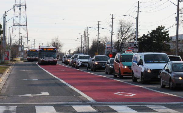
We found the beginning of Simcoe St. to be oddly quiet, especially as it contrasted with its high traffic cross-streets. As we moved down the street past king the sidewalks and streets expanded and the number of people on the street has increased dramatically (perhaps because it was one of the first places that seemed to accommodate seating and provide vegetation and water). This inspired us to look further into the density of people on the selected streets. Below is a map created to illustarte the various densities. The simpler/larger shapes on the map illustrate low density and the smaller complex shaped represent higher density. As seen on the map, we have discovered that our corridor consists of nodes of high density and zones of oddly serene and empty spaces.

Along our walk we have noticed an apparent efforts to improve the space with planters and new trees. The further south we went the more vegetation we encountered. This led us to a second study. On this map we have located spaces that seemed to attract people and encourage lingering around. The images on the map illustrate areas where we have found some decent amount vegetation, water and an unobstructed view of the sky.

The sidewalks were fairly wide but are met with flat, impenetrable walls. These large concrete walls are a reoccurring sight and this led us to look at the various textures found along the corridor. The map below shows the images we have taken of the textures we have encountered on the selected streets.

Finally we wanted to tap into the thoughts of the people who spend parts of their lives on Simcoe Street, and their motivations for being there, aspects that draw them towards or in conflict with the area, and any vision for improving their experience of the space. We interviewed a number of people. Generally, they enjoyed the people around, the proximity to services, restaurants, and even the quiet spaces to break from people. Some of the complaints we have received were regarding the amount of traffic and noise, and lack of spaces to sit and rest. To get a better understanding of the people we are catering to, we have decided to illustrate the type of people we encountered on our walk. Below is the map that captures our perception.

We also wanted to look into a more abstract topic that would interact with a person’s psyche. For this purpose we have gathered and organized (geographically) the words that we have encountered along our path. The map below shows those words and also allows one to see the nodes of bustling activity.

As it is currently set, Simcoe street is a quiet trench through office and condo buildings leading from cultural bustle of the AGO and Queen St. to the City’s waterfront. It cuts through high traffic streets of the Entertainment District, widening below King. Through our walks and research we found that the pathway from the AGO along McCaul and Queen Streets leading to the long stretch along Simcoe to the city’s waterfront has a lot of potential for a pedestrian and bike-friendly route to one of the city’s great assets. We look forward to proposing a means of moving towards this goal, but also a incorporating the depth and quietness of the corridor.

2 comments
I’m still wondering how a stretch of McCaul has anything to do with Simcoe. Why not St Patrick? You could have said something about what works about Simcoe and what doesn’t by looking at its northern end at Elm, in the hospital district, the pedestrianized section behind the US consulate, the change in one-way direction at Queen, the lack of controlled intersections/pedestrian crossings – these things hamper the street’s revival.
The choice of including McCaul seems somewhat arbitrary to me as well. It appears as though it is included to draw a cultural corridor from the AGO to the Harbourfront centre which you address, but sometimes it seems more about the utilitarian perspective of Simcoe itself. It would have been nice to draw some more attention to this choice from the different perspectives.