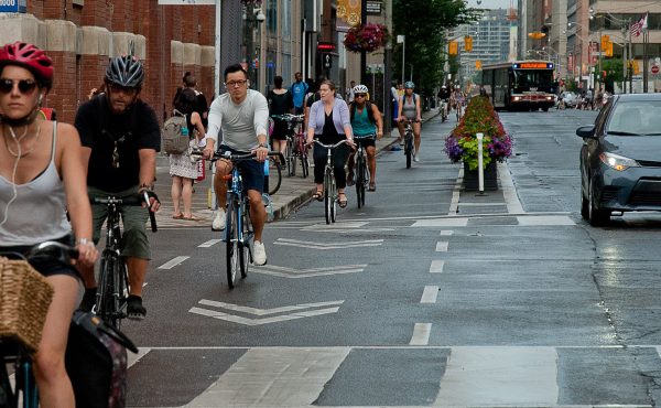
During Toronto’s last three elections, cycling campaigns focused primarily on on-street infrastructure including protected bike lanes and Vision Zero road safety improvements. Think of Cycle Toronto’s 2014 “Minimum Grid” campaign or their #BuildTheVisionTO (2018) and “Safe and Active Streets for All” (2022) coalition campaigns. While Toronto still has a lot to do to catch up to other cities – especially in the inner suburbs – the Ford government has made building bike lanes even more difficult while the bike lane removal provision of Bill 212 is still awaiting a decision from the Ontario Court of Appeal. Maybe it’s time for something different?
Let’s shift the focus towards completing the gaps within our trail network.
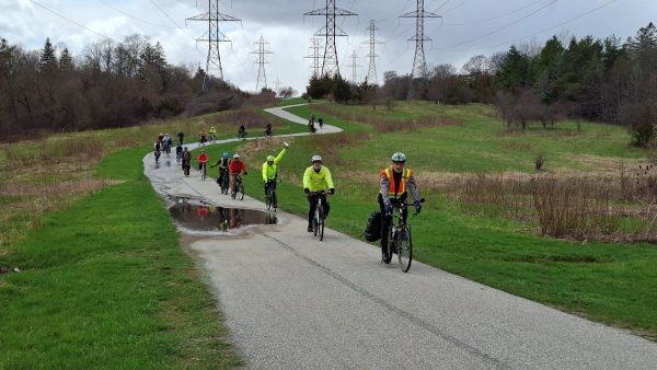
One trail system Community Bikeways is focused on is the 72 km Loop Trail consisting of the Martin Goodman, Humber River, Finch Hydro Corridor, and Don River trails. On Sunday, April 19, about fifty people biked the loop to enjoy the natural scenery, explore the trail gaps, and advocate for the completion of the circuit. The below map shows the Loop Trail marked in blue, the gaps marked in red, and temporarily closed trails marked in orange.
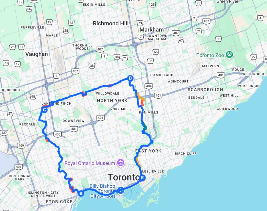
The Mid Humber Gap is arguably the most contentious gap which would require expropriating golf course lands; a process expected to take years. The short Weston Road gap was approved by City Council in December and is tied to road resurfacing expected this year or next, while the multi-use path on Finch Avenue West from Weston to Arrow Roads could start construction in Spring 2027. The Finch Hydro Corridor gap near Yonge Street was subject to Transform Yonge which itself is paused due to provincial legislation. Meanwhile, G Ross Lord Park – the second most dangerous gap after the Mid Humber Gap – is not expected to be addressed anytime soon.
In Scarborough, The Meadoway has seen significant progress over the past few years with the Midland Avenue to Marcos Boulevard stretch being done last fall, while the almost completed East Don Trail Phase 1 will make accessing The Meadoway from downtown (and vice versa) a lot easier. The Bermondsey Road to Eglinton Avenue stretch is now expected to start construction in Spring 2027 while design and planning work is underway for the Neilson Road to Military Trail and Pan Am Drive to Conlins Road stretches. The only major gap remaining is from Kennedy Road to Arsandco Park which could take a while given the need to co-ordinate with Metrolinx to install a new bridge across the Stouffville GO line.
The West Scarborough Rail Trail (WSRT) from Warden to Kennedy Stations has been the subject to community advocacy for at least fifty years with Misha Perozak and the Scarborough Junction Community spearheading the latest efforts. They expressed concern that the TTC’s proposal to use the GECO rail bridge for a pocket track could ultimately kill the project. The Gus Harris Trail goes through Warden Woods from Warden station to Pharmacy Avenue, but the Dentonia Golf Course is blocking the possibility of establishing a connection between the Taylor Creek and Gus Harris Trails (and ultimately the WSRT and The Meadoway).
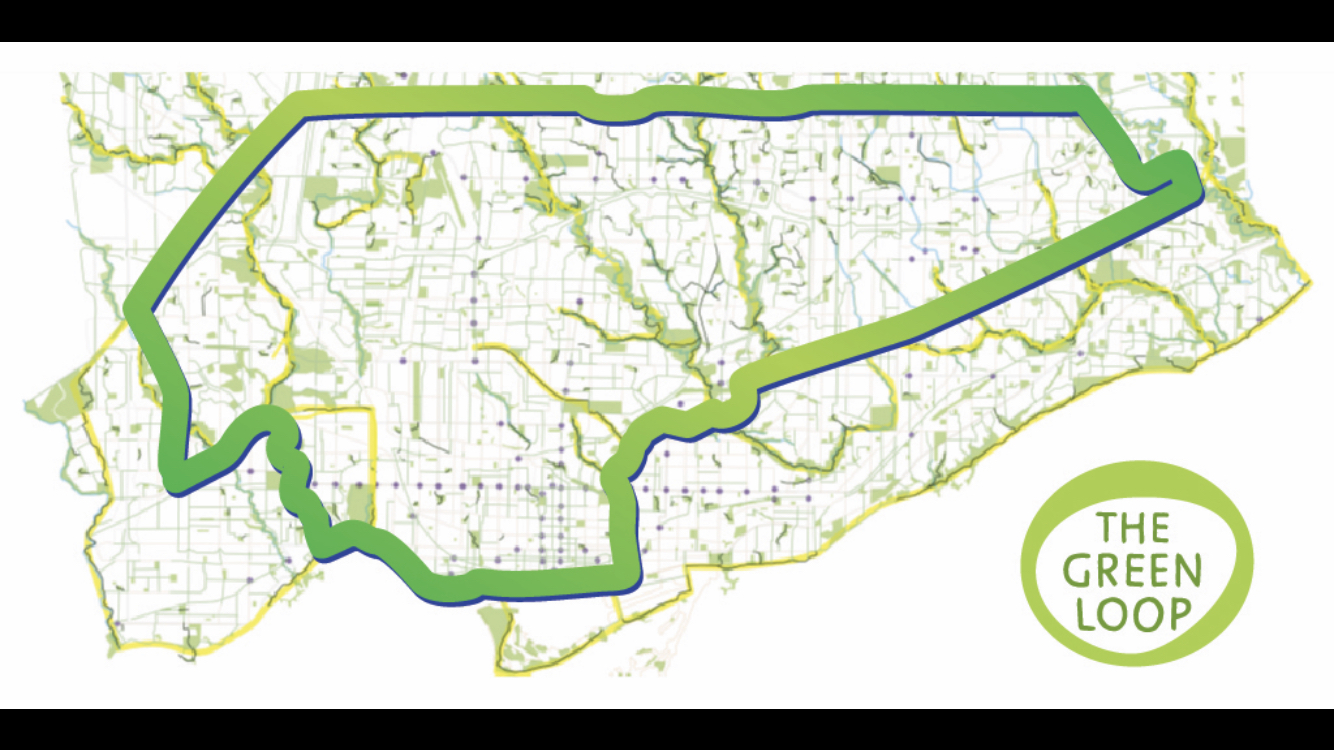
During the 2022 election campaign, then mayoral candidate Gil Penalosa proposed a larger 100 km Green Loop to include Scarborough and Etobicoke in the ravine network. Completing the Scarborough portion – which I would call the Scarborough Loop – would involve completing the Meadoway, as well as extending the Finch Hydro Corridor east from Middlefield Road to Morningside Avenue and west from Pharmacy to Pineway Boulevard. A feasibility study was supposed to be in the works for the western extension, while the 2025-27 bike plan called for a study along Finch Avenue East to complete the gap (which itself could be at risk). The Don River Trails would form the western portion of the Scarborough Loop.
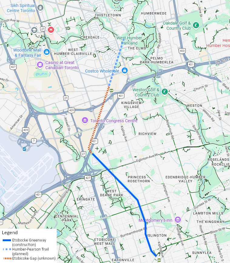
The Etobicoke Greenway from Kipling Station to the 427-401 interchange is already under construction and the Humber Pearson Hydro Corridor from the Humber River Trail southwest to Kipling Avenue is called for in the 2025-27 bike plan. However, it could be challenging to connect these two trails given the need to cross the Kitchener GO line and two 400-series highways.
With less than six months until the election and nominations recently opened, let’s ask candidates for public office to complete the gaps within the existing trail network. Not just by filling gaps in the Loop Trail, but also completing The Meadoway, the West Scarborough Rail Trail, the Finch Hydro Corridor, and eventually the Humber Pearson Hydro Corridor.
Robert Zaichkowski is an accountant, long-time road safety advocate, and author of the Two Wheeled Politics blog.
Photo by Robert Zaichkowski