
The Nova Scotia Archives is pleased to share photos showcasing the changing faces of urban centers in Nova Scotia. You can learn more about the archives and explore thousands of photos, textual records, maps, art, and more on their website.
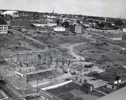
Duke Street Tower, Scotia Square, Under Construction ca. 1967
HALIFAX – From the Nova Scotia Historical Quarterly:
Those familiar with the busy shops and high office towers of the Scotia Square complex in downtown Halifax will not find it easy to picture the area as it was a century or more ago. Near the original townsite the streets were early laid out, and soon became lined with homes, stores, warehouses and public buildings. Argyle, Grafton, and Albemarle (later Market) streets all extended north to Jacob Street, which ran east down the hill to Lockman (now Barrington) and was not far from the present extension of Cogswell.
Then north from Jacob ran Starr to Hurd’s Lane, and Poplar Grove, a no-exit street. From the corner of Barrington and Duke to Hurd’s Lane may be found the sites of nine places of worship…
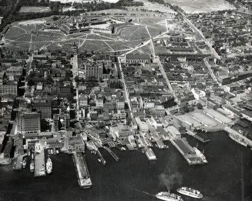
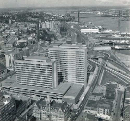
Aerial View Showing Central Business District from the Harbour
to Citadel Hill ca. 1935
The right half of the photo shows the neighbourhood which was razed for the subsequent construction of Scotia Square and the Cogswell Street Interchange.
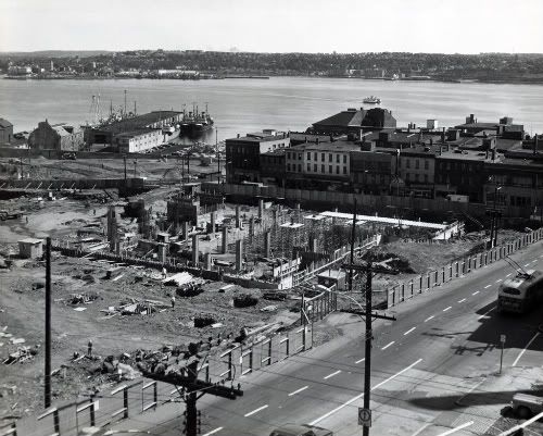
Duke Street Tower, Scotia Square, Under Construction, ca. 1967
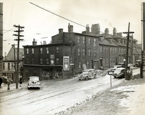
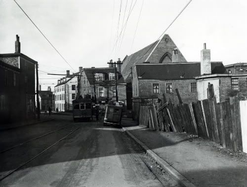
Corner of Jacob Street and Brunswick Street
The neighbourhood razed to construct Scotia Square and Cogswell Street Interchange included the buildings at the corner of Jacob and Brunswick streets.
Intersection of Jacob Street and Grafton Street ca. 1947
The neighbourhood razed to construct Scotia Square and Cogswell Street Interchange included People’s Drug Store, 25 Jacob Street.
Scotia Square ca. 1973
Scotia Square once contained popular shops and services such as a Woolco department store, a Famous Players theatre, a well-known tavern, a food court called the Port of Call, and an area on the second level where the store fronts were designed to resemble a village.
Woolco closed in 1994. The Woolco space was vacant until 2000 when Aliant converted the space into a call centre. Over time, nearly all of the second level shops closed or relocated to other malls in the area.
Reference: Nova Scotia Information Service NSARM no. NSIS 27744, NSARM Photo Collection: Places: Halifax: Air View, Edward J. Kelly NSARM accession no. 1985-417, no. 3, Robert Norwood NSARM accession no. 1987-481, nos. 359-377, NSARM Photo Collection: Places: Halifax: Scotia Square: Duke Street Tower: Excavation Site
2 comments
I love these archived photos! Re-imagining, and reconfiguring my visual socialization with the landscape… reconsidering what is. What’s also important to mention, when considering Scotia Square is the loss of social infrastructure for people who lived where Scotia Square now sits. The tenement housing and the consequential housing shortage and homelessness which occurred due to the building of the mall. The poor economic planning of a mall and office buildings which were difficult to populate/rent. These socailly problematic planning models also remind me of all of the social infrastructure which has been lost on Gottingen street… where is the bank? the grocery store? etc…. the lack of these essential services to communities around Gottingen street isolate residents in the area. Just some thoughts.
I’d love to see some pics of the former theatre at Scotia Square. In all my photo-Googling, I’ve never seen much about it.