
Over the last month, Spacing Atlantic has engaged in an in-depth analysis of HRMbyDesign, the ambitious plan set fourth by the municipal government to transform the region over the next 25 years. This is the final segment in a series of weekly installments that has explored the plan’s various nooks and crannies, carving out a unique and fresh perspective on the HRMbyDesign process.
________________________________________________________________________
HALIFAX – Aside from making our downtown more sustainable, economically vibrant and heritage-friendly, HRMbyDesign also intends to change the way we move. The Downtown Halifax Secondary Municipal Planning Strategy (Downtown Plan) section on transportation addresses issues such as the reorganization of downtown streets, active transportation, public transit, freight movement and parking.
One of the main parts of this section is the Street Network Plan. The Street Network Plan designates primary uses for downtown streets with the goal of streamlining traffic . Under the plan, Lower Water, Hollis, Prince, Sackville, Duke and Brunswick streets are designated as higher traffic flow streets. Barrington and Spring Garden are going to be taking on a greater role for public transit, while Bedford Row, Granville, Argyle, and Market — amoung others — will take on greater roles for pedestrian and bike traffic. Motor vehicle traffic on streets that are to be primarily used for biking and walking will be discouraged by allowing only one direction of motor traffic. I like this element of the Downtown Plan. It provides a good foundation on which other improvements to downtown transportation can be made.
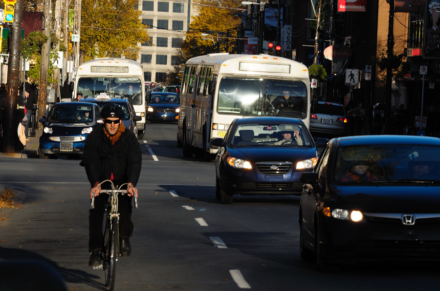
When HRM talks about active transportation, they mean walking and biking. We took a brief look at pedestrian related improvements in the piece on HRMbyDesign and sustainability, so let’s take some time to look at cycling.
The Downtown Plan says that all cycling-related improvements to downtown will happen through HRM’s Active Transportation Plan. The Active Transportation Plan is another incredibly large document that really deserves more comprehensive treatment in a separate article. All that’s really relevant here is that the city intends to set up a comprehensive network of bike lanes throughout HRM, with a high concentration of bike lanes in the downtown area.
“This is a good plan if anybody actually acted on it,” says Steve Bedard of the Halifax Cycling Coalition. Steve says that the Active Transporation Plan has been around for five years, but that many of the planned bike lanes are still not in place. “I don’t really know why that is because there’s really clear maps of where there are supposed to be bike lanes,” says Bedard. “One of [HRM’s] road engineers gave us a huge list of [road construction] projects [that are currently] on the go. We’ve identified about twenty that were part of the Active Transportation Plan but they didn’t put in the bike lanes.” Bedard thinks that one of the big problems here might be communication: “As far as we know all the bike stuff in the city is handled by four people. We don’t know how often they’re meeting or communicating [on bike issues].” Bedard says that the Halifax Cycling Coalition will meet with HRM staff to talk about the Active Transportation Plan this coming Thursday, so hopefully we can get some concrete answers on when we’ll get to see more bike lanes downtown in the near future.
The Downtown Plan also aims to improve access to the downtown through public transportation. Other than the obvious environmental benefits, the City also thinks that public transit can go a long way towards improving traffic congestion in the downtown core. To accomplish this goal the Downtown Plan says that there will be some significant infrastructure improvements. These include the creation of a frequently running downtown shuttle, a downtown transit terminal, and ferry service linking downtown to locations around the Bedford Basin.
Jen Powley of the Ecology Action Center thinks that the City is largely on the right track with its transit plan. She says that Metro Transit is seriously committed to improving the transit system: “Metro Transit reinvests 65 percent of what they get through the fare box, which is a lot. Some big American cities only reinvest like 10 percent.” But, Powley says that if all of the City’s transit ambitions are to be realized, there needs to be more funding from the provincial and federal government. From her perspective this is only fair: “the province… subsidies [private] road users. There’s not a lot of toll highways or toll roads… so essentially people who drive on the roads do it for free. Transit should get the same subsidies.”
Powley also has some advice for the City on parking. She says that if you want to see more people using transit to get downtown, there needs to be greater restrictions on parking availability. “Right now it’s just too easy,” says Powley. The City’s stance on parking is kind of contradictory. The Downtown Plan says that limiting parking is a good idea for exactly the reason that Powley suggests. However, the plan also states that “for a downtown to be vibrant and continue to thrive, parking is required and should be developed to encourage short trips.” The consequences of these conflicting policy objectives are as follows: HRM will use the Land Use By-law to exempt developments from requiring parking. HRM will use the same By-law to “encourage appropriately designated parking structures.” I personally think that the Downtown plan should be a little more clear on this issue. If HRM staff believes that encouraging use of public transit is important, then they really need to consider what will be best for the city in the long run and take a stand.
As far as freight movement is concerned, the Downtown Plan acknowledges that the endless flow of semi-trucks on Barrington, Hollis and Lower Water Streets is a significant problem. The plan is a little bit short on solutions however; it says that all of the theoretical fixes to this problem are quite expensive and further study is needed. The public will get more detailed information about this and other transportation issues in the upcoming Transportation Functional Plan. Andy Fillmore, urban design project manager with Capital District, says that we should expect to see the functional plan within the next eighteen months.
photo by Lawrence Plug