
The Nova Scotia Archives is pleased to share photos showcasing the changing faces of urban centers in Nova Scotia. You can learn more about the archives and explore thousands of photos, textual records, maps, art, and more on their website.
The Halifax Common was granted in 1763 by King George III “for the use of the inhabitants of the Town of Halifax forever.” (Text from HRM)
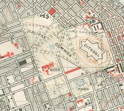
Map. ca. 1918
The 235-acre grant is in the tradition of English Commons which were used to convey rights of use for land by the population before the concept of Public Lands were fully developed. The original Common grant was on undeveloped, largely swampy, land behind the city and its boundaries were originally loosely delineated.
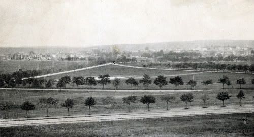
View from the Citadel ca. 1899
As the town grew across the peninsula, the Common’s boundaries became defined as what is today Cunard Street in the north, South Street in the south, Robie Street to the west and North Park/Ahern/Bell Road/South Park Streets to the east. Today the Common is still approximately 235 acres in area with approximately 200 acres still being publicly owned.
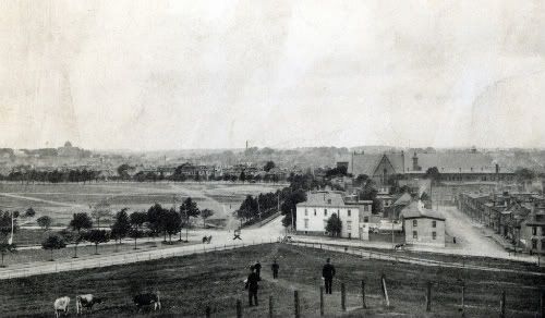
View from the Citadel ca. 1899
The original intended uses of the Common seem to be intentionally vague. Over its history it has been seen as a public resource that’s use reflected the public needs of the day. Early on, these uses included common pasture, access to fresh water, use as a military parade and campground, and as a dump. At times, the stewards of the Common have also seen fit to divest of portions of the Common (35 acres) to encourage growth of the city, swap for other lands and exchange for the development of roads.
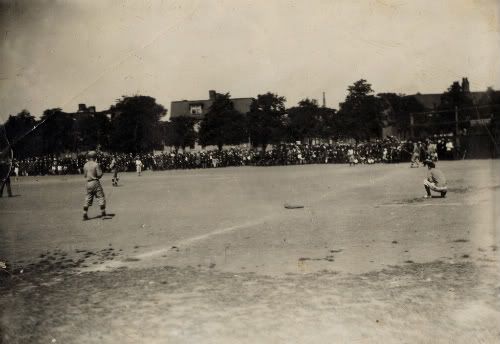
Baseball on the Commons ca. 1900
Up until the 1860’s the majority of the Common was open land. After that time the city council and the Province began placing public institutions on the Common. These included a university, schools, hospitals, museum, public gardens, parks, sportfields, city operations yards, a fire station, cemeteries and churches. In the north section, the area from Jubilee Road north were not permitted to be built upon as the British Military reserved clear firing sight lines from the back side of the citadel to guard against a land-based attack. A good deal of the north Common was used by the military for drill grounds and military camps. The Armouries was built just off the Common in 1899 for this reason.
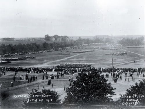
Military Review in Honour of Coronation of King George V and Queen Mary, Commons, Halifax, Nova Scotia, ca. 1911
In 1942 these restrictive lines were lifted, which allowed the construction of Queen Elizabeth High School, the Vocational School in 1949 and CBC Studios in 1952. The remaining open lands in the north (43 acres) are what most people understand as the Common. These lands found wide use as a recreation open space.
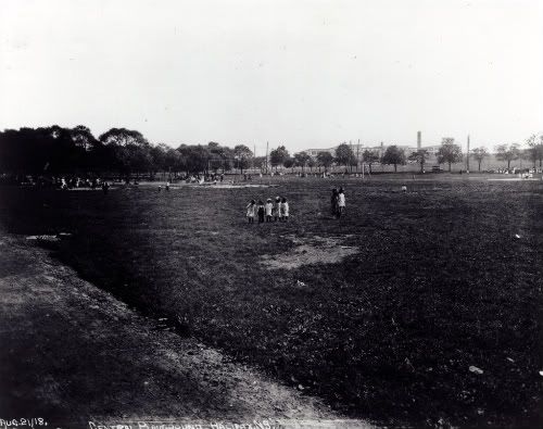
Commons Playground, ca. 1918
Such a large piece of open space has since found ready use as a horse racetrack (1940’s), car racetrack (1990’s), special events venue (1860 to today), sportfields (1920’s to today). Today over half of the Common remains as public open space including the north and central Common, Wanderers Grounds, Public Gardens, Victoria Park, Camp Hill Cemetery and public streets.
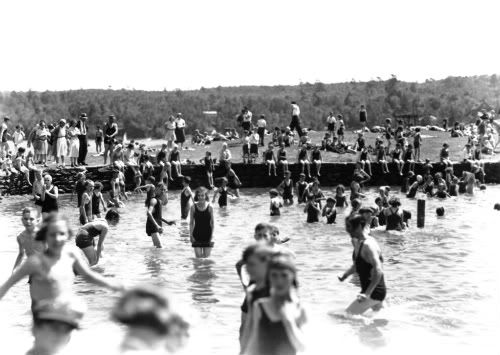
Swimming at the Egg Pond ca. 1920s
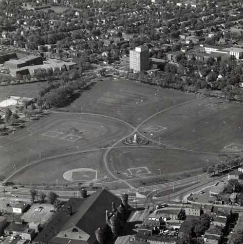
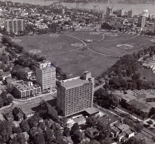
Aerial view ca. 1969
Aerial view ca. 1974
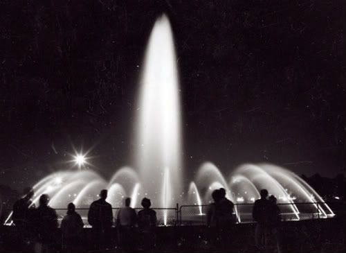
Fountain ca. 1970s
2 comments
Interesting to see the development in uses over time depicted in the photos. I didn’t realize that the Commons land actually included the Public Gardens and Wanderers grounds, let alone the CBC building, NSCC, QE, etc. Nor did I know that they used to hold horse races on it!
the photograph you have of the children swimming in the eggpond on the commons is actually tHorseshoe Island on the Northwest Arm