
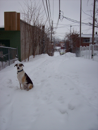
Elliot the the dog out for a romp in the alleyways of a not-yet-definitively-named neighbourhood.
Every once in a while I overhear a heated debate about where exactly the boundary between Mile End and the Plateau is to be drawn. More than once, I have shocked Mile Enders by suggesting that there is no absolute answer to this question because, geopolitically, Mile End is of course part of the Plateau borough. Except for the bits that are in Outremont.
Because Montreal’s boroughs are relatively small, (by comparison, New York’s 5 boroughs are each home to between 1 and 2.5 million people) I think we tend to refer to them as neighbourhoods, especially in parts of town that we do not know very intimately. This blog is guilty of listing the likes of “Hochelaga-Maisonneuve”, Centre-Sud, and of course The Plateau as neighbourhoods, even though they are really collections of places.
So what is a neighbourhood? And why have some, like the Mile End, retained or renewed a strong identity, while others seem to lack a sense of place, or even a place name?
I’ve been thinking about these questions a lot since I started reading a blog called “Le Coeur de Sainte-Marie.” The author, Eric, writes in his first post:
“I live in the part of town the city calls “Ville-Marie”, locals call this area “Centre-Sud” (which is more of a general area rather than a neighborhood), we’re on the other side of the tracks of “Hochelaga Maisoneuve” … and what’s confusing is that when there was a fire on my street, CTV News said it happened in the “Hochelega-Maisonneuve” district. We have other names for our federal and provincial ridings, when online I found the mention of “Sainte-Marie” and on the map I found “St-Eusèbe” listed right around where we live…”
As the blog unfolds, Eric and his dog Elliot set out to discover the heart of the area South of Sherbrooke and East of the Jacques Cartier bridge. (“By “Heart”, I mean that “thing” that makes a neighbourhood have soul: its stores, its bars, its parks and its community,” he writes). He begins by checking out local cafés and chatting with neighbours but before long he finds himself hitting the local library up for info about the origin of Montreal’s boroughs. The blog’s title even changes once or twice as he tries out new names for the neighbourhood.
As a place that has suffered a number of scars (including the Jacques Cartier bridge, Expo-67 circulation planning, the demolition of the Faubourg m’lasse, and a number of local fires during the ’74 Fire Department strike), this neighbourhood does not wear its heart on its sleeve.
But I admire the author’s faith that the place is worth getting to know, even if it is not a spot likely to be written up in the glossy pages of Nightlife Magazine or gushed over in a guide book.
Its an interesting experience to follow, especially when so many Montrealers simply seek out the ‘hood that best resembles themselves (or their desired identity) and rarely venture beyond.
28 comments
Really great post. I would definitely say that the Mile End is bounded by Van Horne (North), Parc (West), St-Laurent (East), and as for the south… not too sure, but I guess I would say St-Joseph. I feel that the East, West, North boundaries are indisputable… the south boundary could be argued. But anything north of Van Horne is not Mile Endy and anything West of Parc is not Mile Endy and anything East of St-Laurent is not Mile Endy. I, of course, use the term “Mile Endy” loosely.
Interesting topic! Another related question that could inspire a debate – does a neighbourhood need geographical boundaries?
Might interest you to know that Boston has always had what are essentially boroughs, but they are officially known as “neighborhoods”. When I lived there I thought that was weird, given that the larges has nearly 100,000 people in it, but in the context of your post it makes perfect sense. Boston’s central neighborhoods are historic communities – like Mile End – and the other ones are formerly separate towns that were annexed by the city over the years. Sound familiar?
Thanks again for the link to the blog! I for one, definitely like the idea of boundaries as I think it helps identify one’s community. A name is at the very heart of this… my wife said to me “our neighbourhood is anything within walking distance” and although I agree (kind of), if I wasn’t so obssessed with boundaries and definitions, I wouldn’t have bothered writing a blog. What I realise though is that Montreal has changed the boundaries of wards and boroughs so many times over the years that it’s no wonder certain areas are arguing over names to this day. In one of my upcoming blogs I am going to discuss my specific “zone” (between Iberville on the west and the CP rail lines on the east) as it exists in one of these grey zones since it was once called Hochelaga Ward or St-Eusèbe Ward and which is now part of the Ville-Marie borough… and that’s simplifying things.
With all this talk of Mile-End and the Centre-Sud, it’s amusing to think that they were part of the same arrondisement into the 90’s.
http://www.google.ca/url?sa=t&source=web&ct=res&cd=3&url=http%3A%2F%2Fwww2.ville.montreal.qc.ca%2Focpm%2Fpdf%2Freferences%2Fplans92%2Fplateau9.pdf&ei=CQHNSd7aLJeEnAfVs_DMCQ&usg=AFQjCNER1Pf9wbeaSms3zd1_5D1kymdDww&sig2=O_UTosFnWQCYNLc5izvvCQ
(PDF of the Plateau Mont-Royal/Centre-Sud density plan from 1992, presumably colored in with magic markers)
Tben, Ville-Marie ended at Amherst. It’s interesting, because the morphology of the area between St-Hubert and Amherst reflects this, with numerous residential high-rises.
Anyway, the name I’ve heard most often from actual residents is– ironically– Ville-Marie. Centre-Sud sounds too impersonal, and Ste-Marie doesn’t have enough currency to use in actual conversation. I think being a rump territory of the trendier, more glamorous Plateau left it with uninterested governance, uncertain borders, and ambiguous labels.
That’s not to say the area doesn’t have an identity–it’s (I guess) the closest one could come to quintessential working-class Montreal. I think we’re having difficulty grappling with the identity issue because it’s the last anglo frontier, a neighborhood that doesn’t have a definitive persona hammed out in real-estate adds. The Latin Quarter and the Gay Village might be good nightlife, Park Lafontaine might be the spot to be on a beautiful day, and even Hochelaga-Maisonneuve has it’s “HoMa” gentrification thing going on–but for anglophones like me (and I’d wager a fair proportion of this site’s writers and readers), the area in between is like some inkblot on our mental maps of the city.
I’m pretty sure the residents of the area could define their neighborhood pretty damn well anyway, with or without a name.
As for the classic Montreal parlor game, “Where’s Mile-End start?”, I’ll go for Villeneuve.
I live in Centre-Sud and that’s what I call it, since Village gai seems too exclusive (not to mention increasingly centred around the consumerist SDC rather than a social and political grouping) and Ville-Marie – no way, no-one I know, franco or anglo, calls it that, that’s the borough name and it includes the entire downtown!
The census tracts (secteurs de recensement) can be an interesting guide to neighbourhoods, since they represent an effort to group together socially similar populations as well as taking account of physical barriers.
Officially, as people at the Institut national de la recherche scientifique – Urbanisation Culture Société (www.ucs.inrs.ca) would tell you, Mile End extends right down to avenue Mont-Royal.
…and that it extends past Park to Hutchison, which is the official boundary between the Plateau and Outremont.
I don’t live there, but I’m sticking to my guns on the Ville-Marie thing. It definitely has some currency, separate from the borough name. “Ville-Marie” comes up much, much more often in the context of the Centre-Sud than it does for anywhere else in the borough. Granted, it doesn’t make much sense, given that the area wasn’t part of Ville-Marie (the borough) until the 90’s. Likely it’s just a confusion of Sainte-Marie and Ville-Marie.
http://lecoeurduquartier.wordpress.com/2009/01/03/what%E2%80%99s-in-a-name-am-i-getting-warmer/
The lady mentioned in the above post isn’t alone in calling the Centre-Sud Ville-Marie, anyway. I think.
Speaking of neighborhoods with ambiguous names, what is the accepted name for the area bounded by Atwater, Sherbrooke, Guy, and René-Lévesque? Shaughnessy Village? Lincoln-Tupper? The west end? Are those even the right boundaries?
I was going to point out that Mile End extends one block west to Hutchison as well not just because it is the official boundary between the former city of Outremont and Montreal (now boroughs of Outremont and Le Plateau Mont-Royal) but because the housing stock changes considerably after that street is crossed. Hutchison is made up mostly of 2 and 3 storey plexes with exterior staircases where Durocher, the next street over, is mostly 2 storey duplexes without exterior staircases. The housing stock of Outremont is much different than that of next door Montreal in order to distinguish it as a separate place for different people (of a different, higher class). Exterior staircases were thought of as being for the working classes which is why you don’t see them in NDG or lower Westmount where the housing stock is very similar to that of Outremont. Changes in architecture, setback, housing-type, etc. are much more important to distinguishing one neighbourhood from another than official boundaries which is why it is important to consider Hutchison as a part of Mile End.
Also, I would argue that Mile End begins at Mont-Royal, above the park. I’ve never thought of it beginning (at the south) anywhere else than there.
Okay, being cognizant of the fact that debating neighborhood boundaries is the urban equivalent of arguing how many Star Trek episodes there are, I think there’s no way the north side of Mount-Royal can possibly be considered Mile End. Historical boundaries or not (and if we go by them, Mile End should stretch up to Jarry Park), Mount-Royal is like the heart of the Plateau. Mile End is more an amorphous blob around St-Viateur and Parc, in my mind.
We “gays du Village” simply call the area on the other side of the bridge “Frontenac” and consider it a less desirable annex of the neighbourhood (there are *plenty* of us that live on that side though.)
I take issue with the claim that the “Gay Village” is exclusive (unless I’ve misinterpreted the statement). For one thing, if you’ve been there any time in the last couple of years, you’ll notice it’s called LE Village. That’s what we call it too. Because it’s not just for gays, it’s for gays, lesbians, bis, trans, curious and open-minded straights.
I’m still not convinced that having neighbourhood boundaries is a necessary concept (aside from for administrative purposes), especially when those boundaries are used dividing up communities. It’s a question which greatly interests me, as I dedicated a large part of my post-grad research to the effects of administrative organisation on cultural identity and perceptions of community in Central Europe.
If you can’t tell the boundaries easily, it’s probably a very good thing. Jane Jacob’s wrote a lot about “dead zones” that often occur between single use areas or on one side of a park. Train tracks are usually absolute barriers in many parts of a city. I live in Verdun which is pretty much a grid between the river and the aqueduct. Yet it’s hard to think of Verdun as one whole neighborhood. When I was a teenager we had technical names like “The French End” and “The Other End” which generally described the eastern and western portions of the city, but nothing for the “middle” where most of the action was. Merchants on Wellington in the past have tried things like “Downtown Verdun” which don’t do much for anyone, aside from inspiring a little local satire and sarcasm.
One of the great things about Point Saint Charles is that there is very little doubt about where the Point begins and ends. Local divisions, like on either side of the tracks, however, can lead to much debate among local historians.
This is a fascinating topic.
…and I live in the Latin Quarter, which must be the smallest “neighbourhood” in Montreal, since in my mind, it covers not much more than a few blocks east and west of St-Denis Street, below Sherbrooke and if UQAM didn’t go all the way to René-Lévesque, even that would be pushing the definition a bit.
Well, if we want to be very technical about la Petite Italie, that is tiny as well. The signage starts it at St-Zotique up to Jean-Talon, and Drolet or so to ??? the western boundary is less clear, does it include the Alexandria-Marconi area west of St-Laurent? And in decades past, there were always a lot of Italian businesses down on Beaubien, and on rue de Castelnau and houses with Italian gardens in southwestern Villeray (near St-Cécile church) – eastern Villeray/St-Michel was a later development. And the whole area is very multiethnic now.
Montréal’s Chinatown is also very small, though it was also truncated by building Guy-Favreau and Complexe-Desjardins.
I can’t say anywhere I can easily walk too feels like my neighbourhood, as I have only a fairly short walk to northwestern Plateau/eastern Mile-End, and to Parc-Extension, crossing through the viaduct under the railway tracks.
There is much less of a feeling of disjunct crossing Jean-Talon to southwestern Villeray, where I also lived for years. Nicer trees up there though.
That’s something I noticed when I moved up here. As soon as you cross Jean-Talon into Villeray, the trees are much nicer. I wonder why that is.
I really enjoyed seeing everyone’s comments on this thread and can say that it will surely influence me moving forward with the blog. My obsession with boundaries is the geographical-nerd in me that appreciates urban zoning and planning and the roots of it all is the amateur historian in me that wants to uncover how the area got from A to Z.
Things that I would like to explore:
– A in-walking distance neighbourhood series that includes Hochelaga, West of Papineau, Plateau and Rosemont. As long as I can walk there within 20 minutes.
– Study boundaries from a historical/municipal perspective and find out more info to the roots of these various names
– Finally… continue, to search for the heart and soul of my neighbourhood.
All in all, I am happy that I made the decision early on to name the web-adress of the blog “Le Coeur du Quartier” otherwise I would be trying to convince everyone that St-Eusèbe is the official name of this neighbourhood… mind you, it’s still on the map and I have found NO data on this other than the fact it’s a church on Fullum St… I might just change the title name once and for all to “Le Coeur du Quartier”. Maybe.
Thanks again to Alanah and Spacing Montreal!
Just for info, from a person who’s doing research into it – the Revitalisation urbaine intégrée (RUI) programme for Ste-Marie – which is definitely the kind of thing where ‘administrative’ boundaries and everyday activities intersect – considers the limits of Ste-Marie to be Sherbrooke to the north, the railway to the east, the river to the south and Dorion or de Lorimier to the west. Apparently a few people stretch it as far west as Papineau, but the bridge is quite a barrier. West of de Lorimier is the neighbourhood of St-Jacques (which is what my Éco-Quartier and local market are called).
Good luck with finding St-Eusèbe.
One would hope that all the people for whom “the Village” is “for” are open-minded, not just the straights. On reflection, though, I think I dislike the widespread name “le Village” as much as I dislike “le Village gai”, on the basis that if I wanted to live in a village, I’d leave the city (the so-called ‘Monkland Village’ of NDG seems just as daft). I know it’s a metaphor, it’s just one that doesn’t appeal to me much, personally. I suppose I’d still rather have the anonymity of an abstract orientation (Centre-Sud), but that’s just me.
…on the other hand, I’ve seen just how “village”-like it really is one day as I was to meet a couple of friends at the Second Cup. When I arrived, they had already left, but they told a friend that I would be showing up, so he tapped me on the shoulder and said “You’re looking for Jacques and Séb, right? They’ve gone down to L’Aigle…”
Both Jacques and Séb grew up in small villages where everyone knows of everyone and where people are, and they feel very comfortable in the Village because it provides much the same experience. That it’s full of other pretty gay men instead of prying gossipy little old ladies is icing on the cake, except that often, the two are similar :)
Eric, love your blog (and Elliot). When the CSN moved to the very west of the area (on de Lorimier), people just called it eastern Centre-Sud, and there was the pretentious attempt to name it “la Cité des Ondes” as not only Radio-Canada but also Télé-Métropole and Radio-Québec were located there; Radio-Quéec on Ste-Catherine east of de Lorimier near the big sporting goods store.
Gay people moving into the area after the police raids on the area around Stanley in the west called the area the Gay Village – I think it was with the same spirit racialised groups might speak of their “hood” nowadays – a place where people feel safer and have more of a right to be themselves. There were bars and clubs, but the area wasn’t as commercial and plastic as it has become nowadays. The Gay Village is a specific part of Centre-Sud, certainly not north of Ontario (though obviously there are many lgbt people living there too). It didn’t start out as a trendifying name like “Monkland Village” or “HoMa”.
The actual street playing the fictional “rue des Pignons” of the Radio-Canada TV series about life in an old working-class neighbourhood was located in southwestern Ste-Marie, a tiny street with the gabled houses of the name; a friend of mine used to live there back then as she was working at the nearby CSN. If I recall, the street was located between de Lorimer and Fullum, and probably south of de Maisonneuve, certainly south of Logan. Can’t find it googling “rue des pignons”.
It is sad that there is not much of a unifying shopping area or street where people congregate – those stretches of Ste-Catherine and Ontario are very sad between western Centre-Sud and Hochelaga, despite Café Touski, a good Mexican restaurant, some Vietnamese shops and small restaurants near Frontenac, and the remnants of the old Polish community (Wawel bakery, and I believe there is a Polish church).
The story of how the small Polish community came into existence there would also be worth a look.
O drat, I made a long post, which seems to have disappeared into cyberspace.
One element was about the Radio-Canada series “Rue des Pignons” – the street standing in for the fictional rue des Pignons is actually la rue Champagne in a southwestern corner of Ste-Marie: http://imtl.org/image.php?id=3646
A lucky street that has preserved some of its original harmony!
Somehow your long post got caught up in the spam filter.
Well, it is there, and in the meantime I located la rue des Pignons! (rue Champagne in reality).
Still wondering how the Poles wound up there – were they dock workers, or specialised tradespersons in a nearby factory?
Great post and great comments.
About the Polish community in the Village… I lived for a while in Point St Charles and there were also remnants there of a Polish community: a Polish charcuterie, a church, etc, though they didn’t seem to really live in the area. I always wondered about the Polish history in the Point. Anybody know?
By the way, I lived for 12 years on Jeanne Mance between Mt-Royal and Villeneuve, and now I’m on the East side of Hutchison. And I DEFINITELY live in the Mile End!
Thanks again everyone. To the person (urbanmkr) researching the Ste-Marie urban revitilization project, please contact me through my site as I would really love to hear your feedback on these initiatives. I actually just posted my first blog about the project (but haven’t really researched it enough yet).
Having lived in Outremont near St-Viateur i would not use the official Hutchison boundary even for the architectural argument as i always felt Parc was really the big divide between the two worlds.
So, if you want my vote for the mile-end limits, hehe, i’d give the limit as something like:
Parc-ish/Van Horne(or train tracks)/St-Laurent-ish/Villeneuve-ish…
Mile End and Outremont are a bit like twin cities: separate political entities that are socially and economically intertwined. People from Durocher and de l’Épée buy their fish from Falero and coffee from Olimpico the same as people from Waverly or Esplanade. What’s really interesting is that two neighbourhoods that look and feel so different can be so closely linked.
The Hasidic community is another story altogether. For them, I doubt there’s any distinction between Outremont and Mile End. It’s all “the neighbourhood.”
Yes, Christopher, however the neighbourhood for Chassidim is very physically defined by the Erouv (or Eruv), the fine wires that make a neighbourhood into a “home” in which people can push and carry on the Sabbath (pushing wheelchairs, prams etc, carrying baby and other supplies – no money of course) . I do think there are probably class distinctions, though, as I’ve seen Chassidic families in some rather grand Outremont houses and cramped Mile End flats.
Though of course the Chassidim have their own businesses, and in most non-Chassidim aren’t made to feel exactly at home, even if they are Jewish. (I have two secular Jewish friends living on heavily Chassidic streets). The exception, of course, is Cheskie’s bakery, welcoming to everyone.
What about the boundry between Petite-Patrie and Rosemont?? are they separated by Papineau or D’Iberville?