
Spacing has always used our merchandise as an important fundraising tool for the magazine — it helps to keep our ad content low, and editorial content high. Now we are teaming up with a number of independent Canadia designers to showcase and sell their work through our e-store. Over the next week we’ll be highlighting these new products as they become available to purchase online. If you or someone you know creates interesting urbanism- or Canadian city–themed products and would like to sell them through Spacing, email us at merchandise@spacing.ca
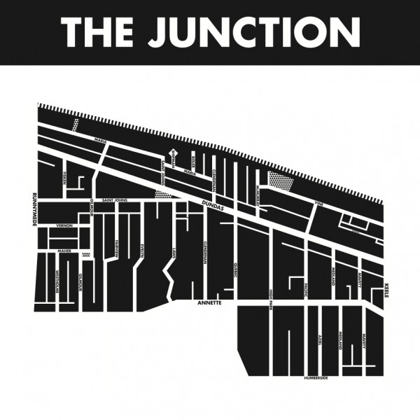
Alexander Arvelo McQuaig is a Toronto-based graphic designer. His neighbourhood maps are a bold, attractive representation of the area’s streets, laneways, and parks.
“In my love of Toronto I’ve occasionally yearned for maps that depict our unique neighbourhoods — both to celebrate them and note their boundaries — but have been unable to find such a thing. Now that I’m in graphic design school, I decided to try crafting such maps myself. The result is austere designs meant to celebrate our neighbourhoods as distinct from their surroundings, like tiny cities unto themselves. Oriented to our streets’ grid rather than what is technically north, these maps are meant to represent our neighbourhoods simply, as we instinctively think of them in quotidian navigation.”
Currently we have six maps of Alexander’s available: The Annex, The Junction, Kensington Market, Leslieville, Parkdale, and Roncesvalles, and he is hard at work creating more that will be released over the following weeks.
2 comments
As a resident of the west side of Roncy, I am feeling pretty left out right now! … just sayin’. Otherwise, great looking maps. I’ve always been a fan of our inner city laneways.
It’s a great idea to make these neighbourhood maps. I think it should be supported. But that’s just a part of the Junction on the map. It doesn’t even include the parts closest to the railway junction from which the neighbourhood developed in Victorian times and got its name. The present boundaries are probably Runnymede to the west, the CN/GO transit railway tracks to the east, Annette Street to the south and St. Clair and Glen Scarlett Road to the north. That incorporates a variety of urban spaces from streets lined with large Edwardian homes to Bay and Gable Victorian streets to industrial streets–all of which are significant to the Junction as a place.
This map only captures the hipster Junction particularly well–there aren’t many hipster joints north of the CP tracks or east of Keele, for instance. Yet beyond that there are streets and places that are part of the neighbourhood nevertheless. That’s where musicians rehearse in the cheaper studio spaces like 500 Keele Street, where more lower income people live and where cars are fixed, for instance. This map evades the whole story of a great and fascinating neighbourhood–including its important history of developing around the railway junction that doesn’t even appear on the map.