
I just got a copy of the new 2006 Toronto Cycling Map. It’s new and improved – it looks crisper and glossier, and the routes stand out better. Presumably to keep Scarborough from feeling left out (it used to be alone on the back), it shows half the city on either side, so it’s a bit challenging if you’re going from the west side to the east, or vice-versa.
The City of Toronto web site’s cycling portal has not yet been updated with the new map, but it should be soon. The map itself should be available shortly in libraries and other locations.
3 comments
What’s the logistical reason behind splitting/truncating the city in such maps?
Reminds me of how, just about into the 70s (and definitely in pre-MapArt days), Toronto street maps were still prone to cutting off at Markham Rd in the E…
Dylan… where did you get yours? Do all the bikeshops have them now?
Adam… Toronto is pretty big. If you put it all on one page with an appropriate level of detail, it would be the size of a big area rug! 🙂
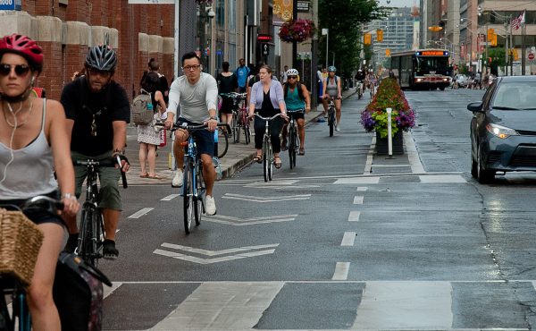
4 boxes of maps were brought down to CBN – 761 Queen Street West. I picked up a few there. Now I just have to give them to people. I just can’t get the Cycling Ambassador out of me! By the way, I took the photo on the front on our last day of work last year. I guess they want to emphasize the whole bike and transit thing.
I’m pretty sure the layout is the same as last year, making a cut through downtown. I think it’s because of real estate, it’s more efficient this way.