


Any visitor to Toronto, or first time subway user will know just how difficult it is to navigate the city’s underground. Although there may only be four lines to ride and 69 stations to choose from, the system presents itself as a much more complex challenge than it actually is. The reason behind the confusion is simple: signage. Despite the iconic and clear mid-fifties subway font that Torontonians have grown to love, known unofficially as “Toronto Subway” font, years of renovations and new station additions have eroded the effectiveness of the overall signage strategy into an antiquated mess.
Throughout the system, there is a lack of large route maps that identify not only where you are in the system, but also where you are in the city and what amenities are accessible. The few poster-size route maps that do exist at each station are often mounted in inconvenient locations, such as the bottom busy staircases, where it is difficult to stop and get oriented. In some cases, where people have clearly complained about a lack of signage, there are handwritten signs by TTC employees or temporary makeshift signs.
Additional confusion exists on the TTC platforms, where there are directional signs that tell you the next station stop, direction of travel, and the final station stop, providing little information for those not familiar with the city. LCD arrival screens, launched by the TTC in 2008, show train arrival time in the bottom right-hand corner of the screen. Although the LCD arrival screens are much better than the 8 ½ x 11 time schedules that are still present in some stations, the arrival time is displayed in a font size too small to be read from some parts of the platform or by anyone with vision impairment.

The arrival screens also don’t provide you with a route map to decipher where you’re headed, and the screen is shared with a ton of other information including: advertisements, news headlines, five-day weather forecast, and wind speed. All of which take away from the purpose of the arrival screens. The old fashioned flip signs, a throwback to the days when the TTC was running two lines on each route, are perpetually stuck in their final position and can add to the confusion.


Sometimes, simple is better. A few photos shown below display the type of arrival signs and signage used other cities. Directional subway signage in Stockholm not only shows which station you’re at, the direction you’re heading, but also what amenities are available at each stop. If you look closely in the lower part of the frame, you’ll see that only the direction of travel is coloured and the other segments of the line are grayed-out so there is no confusion which way you’re headed. A similar technique of graying-out the non-travel segments of the line is used in Vienna. A TTC route map displaying a single subway line and surface connections, created by Spacing’s Matt Blackett, provides an example of simplified signage that could be implemented in Toronto.


The TTC recognized the signage problem in the early 90s, and brought on British-born graphic designer Paul Arthur to tackle the issue. Arthur came with up with a fresh new signage scheme, which included: simplified and easily readable route maps, pictographs for station identification, numbering the subway lines as opposed to the traditional Yonge-University-Spadina and Bloor-Danforth naming, and including straplines on the upper portion of the station walls which were either green or yellow depending on which line you were traveling.


St. George station was used as the prototype station for the new signage in 1994. Despite spending $400,000 on the prototype project, the TTC decided against put up the $8 million required to retrofit the entire system. Sixteen years later, the prototype signage has yet to be removed from St. George station and is worthy of a visit for anyone interested seeing the difference clear signage can make.
Have you ever had difficulties navigating the TTC due to improper signage? Do you think the TTC should invest in retrofitting the system’s signage or is the money better spent elsewhere?
Photos by: Homo Documentus, Matt Blackett and Adrian Lightstone

37 comments
My favourite signs right now are the handwritten ones in Union telling people to turn round at the bottom of the one staircase that leads to the upper area that’s the wrong side of the turnstiles to get access to the streetcar station. I never thought of it before, but how frustrating must it be to fall foul of those stairs.
I love the fact that the TTC is littered with hand written signs pasting the gaps that appear from poor planning. Or at least I would, if I wasn’t deeply embarrassed by it.
Also, I’ve only been in Toronto for 8 years, so never saw the “Subway Online” signs in action that are still on some platforms. What were they for?
The sign that throws me every time is at Yonge Bloor station. When you approach the southbound Yonge platform after emerging from the Bloor level, there is a sign right in front of the southbound platform reading “Southbound” with an arrow pointing right. That sign has sent me on a goose chase so many times.
Haven’t we been down this road before? http://joeclark.org/design/signage/TTC/
Paul Arthur to whom credit is given for his contributions to TTC signage was indeed British-born, but was brought to Canada at the age of 9 months when his parents, Eric and Doris Arthur emigrated from Liverpool in 1923. Paul’s father is remembered, of course, for his contributions to the selection of Viljo Revell’s design for Toronto City Hall, and for his magisterial book on the City’s heritage buildings, Toronto: No Mean City.
Dinah Arthur, Paul’s widow, corrects me. Paul came to Canada in 1925 after his parents had emigrated and decided to settle here. Meanwhile, he was looked after by his grandmother.
It’s often hard to orient yourself when leaving the subway at busy intersections. What would make things a whole lot easier would be simple signs showing at which corner you’ll emerge. And since Toronto has a NSEW grid system of streets by and large, each exit at an intersection should be labelled with a small map and an indication of whether you’re going to emerge at the NW corner, for instance.
Paul Arthur’s system only supposed to cost $8 million and the TTC decided against it? That’s just sad.
My trips on the subway are generally short – Queen to Union – but have been confused a couple of times when the only information is the end station and trying to remember if it’s Finch or Downsview that I want.
It’s a shame they didn’t continue with the signage at St. George. It would probably help alot of tourists also. I think the money would be well spent, and a better investment then the three projects they ran for the 501 streetcar problem.
the ttc really needs to reconsider signage at dupont station for casa loma. currently, the station signage tells people to head up to the northwest corner of spadina and dupont. casa loma cannot be seen from the northwest corner, and there are no street-level signs telling people to go north on spadina. countless confused tourists end up walking along dupont street with the castle receding into the distance behind them.
one solution would be to direct people in the station to head up the south-east staircase instead of the northwest one. the castle is visible from the southeast corner.
alternatively, there could be a sign at street level on the northwest corner telling people to go north on spadina.
of course, both of these things could be done too…
I would love to see the bus stop “InfoPosts” reworked into something that is professional and easy to read with information-display-standard stem-leaf displays. So instead of this: http://home.snafu.de/provart/TTC/image001.jpg, something like this: http://home.snafu.de/provart/TTC/image002.jpg. It would be great too if bus and steetcar routes (and stops) were on maps of Toronto published by Perly’s, Rand McNally etc., like this: http://www.berlin.de/stadtplan/map.asp. The TTC’s own route maps embarrassingly don’t even show bus and streetcar stops!
I was never that impressed by Arthur’s St. George project. It’s okay, but it hardly seems to be the mystical revelation that some people seem to hold it to be. I didn’t notice that the “strap lines” were colour-coded, but really, there are very few stations where there’s an issue of which line you’re on, and there are probably better ways of indicating this than playing with colours.
Also, the following paragraph in Adrian’s article is confusingly written:
“Although the LCD arrival screens are much better than the 8 ½ x 11 time schedules that are still present in some stations, the arrival time is displayed in a font size too small to be read from some parts of the platform or by anyone with vision impairment.”
My first reaction is that the the schedules serve an entirely different purpose than the arrival times on the screens. But I guess what’s really being said is that it’s easier to read the arrival times than the printed schedules.
Those “arrival screens” are really advertising screens, with a bit of useful info thrown in. Blame our public-private partnerships for that. (On the other hand, the TTC’s announcement system has no outside advertising, but has annoying repetitive announcements on it anyway.)
Looking at Nick’s suggestions, the Berlin example strikes me as unreadably busy.
There are definite issues with the TTC’s stop-mounted schedules. The suggested alternative has some nice design elements, but I wonder how it would work with busier and multi-branch routes. For example, what would you do eastbound Finch at Bayview, given:
http://www3.ttc.ca/Schedule/schedule.jsp?Route=39E&Stop=e.b._on_FINCH_at_BAYVIEW
The running times would be better left off, unfortunately. First of all, the big font had me thinking “connecting routes” until I started wondering what route “4” was. (Take a bow, Annette!) And running times vary. It’s not really information that’s terribly useful once you’re at the stop.
I use the King Station Melinda St entrance quite frequently.
During the afternoon rush hour, the turnstiles are opened and the booth is manned. Outside of this period, glass panels are placed behind the turnstiles, and people have to use the fully-automated turnstiles farther back.
Every now and then I witness someone unfamiliar with the station place a token in the turnstiles, expecting the glass panels in front of them to open up. It’s not an unreasonable expectation for someone unfamiliar with this entrance, as the other entrances are not easily visible from this spot and the glass panels look like they *could* in fact open after you pay.
The signage that TTC put up to solve this problem is a few hand-drawn and hand-cut red circles (drawn with a red marker) with a line crossed through them. The narrow symbols don’t stand out on the glass (the holes within the circle have been cut out so there’s no background), and what they’re communicating is not clear.
It saddens me to think of how many tourists and local residents who don’t use this entrance have dropped tokens here only to waste them.
@Andy:
The Subway Online was simply a clock and a scrolling info bar, providing useful information such as where you can find “cute adorable puppies” and how you can “let your dog have a vacation while you are away”. That’s all they did for the last five years of their existence. Scroll an ad for that kennel in Mississauga over and over again.
One recent innovation I happen to like about the TTC was the fact that they have put up “line maps” on the St Clair line showing the connections and stops on a subway-style map. It’s perhaps not practical for all surface routes but I think it would really help people find their way.
I’m not sure why subways mark the station at the end of the line. Do I want to know the train eventually goes to Kipling? Nope. I want to know I am on the line heading West.
Taking transit around Montreal this summer – a much larger system – I was surprised at the common problems with Toronto. The signage was bad. The stations were even dingier. The transfer system was confusing. Various “special case” connections were confusing and left us at a random location (good thing we had a map with us).
Yes, Chris K, we’ve been down this road before. Here some more recent two cents from Joe Clark:
http://blog.fawny.org/2010/07/15/ttc-design-architect/
Although I’ve lived in Toronto for 16 years, I still occasionally end up on the wrong platform on the Yonge line at Bloor because, coming off the Bloor train, I get caught in the herd and the signs telling me which staircase leads to Northbound trains and which one leads to Southbound trains are too small. That’s a complaint I have for all the wayfinding signs – too small and too few of them, so once you get caught up in the herd it’s difficult to spot one. I also agree with the poster complaining about lack of information about the area surrounding the station. If you emerge a little ways away from the main street, it can be difficult to figure out whether you should turn left or right to find it….
Uh, there are often too many stops to show each one on a small route map, so normally you show the major intersections, that’s all. And I have a great fondness for the hand-written TTC signs — they look like crap, but they show the power of the pen when faced with stifling organizational incompetence.
I find the direction signs in general take getting used to — words jumbled together sometimes, not very clearly connected to the arrows, different sizes. And just in black and white, too.
No need to go to Stockholm — just do what Paul Arthur said, or if you really want to spend more money, send the entire TTC signage department on a trip to Montréal to see how the STM has done almost everything right.Good use of colours, good exit signs, good missing-station-name signs showing where you are starting (some with the time in minutes to get to the next stops), good full transit maps in convenient locations, good neighbourhood station maps, good subway maps in the cars (that even show a discreet outline of the river and, below, the AMT commuter trains on a smaller scale map showing the whole region so you know what it all means geographically), good popular destination signs, good “the emergency phone is here” blue light in the stations.
I can stand at the end of the Berri-UQAM station, for example, and see at a glance where each exit for the different lines is — all nicely colour coded. Not so at Yonge and Bloor, where even the exit signs are blocked by those new TVs hanging in my face.
I could go on, but you’re tired of me saying how great the STM is — but really, they are.
Take a look at their new “mouvement collectif” (society in motion) campaign which is brilliant and beautiful very very design. http://www.youtube.com/watch?v=JPU5V4W8fgg … they use those little > cleverly for all sorts of things everywhere.
At the St. Clair Centre entrance at St. Clair Station, there’s a hilariously out-of-date large sign just to the left of the turnstiles.
It’s advising about schedule changes from June 2008 to early 2009. I first noticed it many months ago and saw again tonight – it’s still there!
I am sure that the TTC Customer Service Panel (are you listening Matt?) will have something to say about the atrocious state of TTC signage, and management will nod their heads and stick a placeholder for it in the 2019 capital budget.
The project will be delivered late, incomplete and won’t do it’s job properly.
But it will cost well into eight figures and we won’t be able to afford to fix it.
In other news, the TTC just got an award for their website. This is not a joke.
See: http://www3.ttc.ca/About_the_TTC/Commission_reports_and_information/Commission_meetings/2010/Aug_23_2010/Reports/Presentation_2010_Co.pdf
The “award of distinction” is the second rank behind “award of excellence”, and when one drills down into the website for the organization granting these awards, you will find that there are zillions of sub-categories. Each entry is scored, and there can be multiple “winners” in each category depending on how many entries score highly enough.
Considering how much criticism the TTC has received for its website, I cannot help thinking that this is to some extent an exercise in self-congratulation for an award that appears far too easy to “win”. The TTC used to be hooked on awards, and I hope this is not a return to the bad old days.
The award will be “presented to the TTC” by a representative of the firm that is the TTC’s consultant building their website. Can you say “arm’s length dealing”?
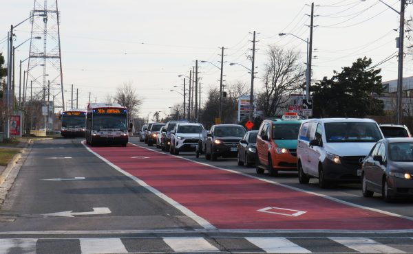
Oh yes – the terrible sign at the top of this post is one of the “temporary” signs for the Bloor station passenger redirection. They are set up and taken down every day, and the cumulative effect of application and removal of all that tape is visible in the disappearing letters.
There are supposed to be permanent signs, but that’s just one more thing falling through the cracks.
@Bryan:
Guessing you’re referring to the Commerce Court entrance @ King station.
If you’re using the Melinda Street “entrance” frequently, you would be, uh, saving a lot of money given that it is the only unprotected dedicated exit in the system. Have always thought it weird that a) it exists at all & b) it has no high-exit turnstile. Presumably TTC brass find walking down the up-escalator difficult enough to believe that does the trick?
You want improvement? WE CAN’T AFFORD IT!
That’s pretty much what any discussion about improving the experience of using the TTC leads to. What a lousy cliche. The most respectable are those who persevere in the face of pennypinching idiocy instead of just moving somewhere else.
I say, screw that! Find a way. Make this the city that works again.
As someone who moved to the city recently (3 1/2 months ago), I have to say that I did find the subway rather confusing at first. I never knew where I was coming out of (there seem to be a thousand exits at some stations) or which staircase to take out of the platform to get a connection (in the case of Spadina Station or Bloor/Yonge).
Signs like the ones found at St. George would have been great throughout the whole system. Westbound/Eastbound mean nothing when you’re new to the city and don’t know which way is up.
@Ed
Well, I can read the Berlin map and I do find the information useful, but perhaps you are right that such maps would be too busy for the average human being 😉 Still, it would be nice to have the two pieces of information (stop locations and busroutes) available at some level to overlay on a map of the city. Ditto for travel time info, but I guess if you can get your smart phone to work with the TTC’s online route planner while waiting for the bus then you’d be ok.
Re. the issue of branched routes and the stem-leaf display, the two are actually separate issues (it exists with the current display too) and I’m not sure why you’re conflating the two. I have seen this problem solved with small superscripts beside the arrival time minutes that denote that a certain bus only goes so far, or short turns at wherever (that is what the TTC currently does).
James asks: “I’m not sure why subways mark the station at the end of the line. Do I want to know the train eventually goes to Kipling? Nope. I want to know I am on the line heading West.” Subways don’t always go exactly east-west or north-south. The Bloor-Danforth is pretty close, true. That’s probably why platforms have both terminal and next station information. I think they may even give a direction, but honestly I don’t remember–haven’t looked at them that closely.
@Mike W. I’m referring to the Commerce Court entrance, which is also referred to as Commerce Court/Melinda St. Here you go: http://en.wikipedia.org/wiki/King_(TTC)#Entrances
I LIKE how our subway signage ‘hand-scrawled clues’ scheme is right out of a post-apocalytpic zombie novel. Please admit that it’s AWESOME.
Nick;
What I mean to say is that the stop-info scheme shown at http://home.snafu.de/provart/TTC/image002.jpg should be tested against routes with more runs and more branches. The example looks clean, but I wonder if it would stand up if there was a lot more info to display; Leslie is not a challenging route.
Try putting in something like 123 Shorncliffe south from Kipling station, or 501 Queen west from Yonge, as kind of typical routes. The worst-case routes would be ones like 39 Finch East and 32 Eglinton West for run fequency. And will the route map concept survive a long route like 54 Lawrence East?
@ Mike W.
Ah yes, that exit. A few years ago I realized that I forgot to get a transfer at my original station, and that I needed it for taking a streetcar later. So I decided to get out of the train at some station, go up from the platform level, grab a transfer and come back down. As luck would have it, I had to pick THAT exit and THAT escalator, and was quite surprised at being spit out of the system without any warning. Didn’t attempt to come back down (probably should have, but didn’t want to have ‘splaining to do, in case the running down the up-escalator trick got caught on some camera).
The other thing that gets me on the TTC is that one station (is it Dundas? I don’t use it often enough to know) that has no inside connection between northbound and southbound platforms. If you built a station with such a ridiculous defect in the first place, the least you can do is have signage in HUGE letters, telling people about it, since most people I know usually get into the subway system first, and then start navigating to the correct platform later.
@Chephy: The reason that Dundas was created as such was due to the space and geography constraints when it was built (1954). Heck, there wasn’t even a tunnel under the tracks when it first opened – if you got in the wrong entrance, you had to travel to College or Queen to change trains!
The problem is that the TTC makes the assumption that all potential users are intimately familiar with the system and it’s quirks. If your new to Toronto, it’s almost impossible to figure out the system.
Wayfinding should much easier, a policy manual should be developed to determine a common look and feel, they should then go through each existing station and update the signage to follow the new policy. The policy would be determined by sending a small group of people (I’ll go 🙂 to visit other subway and metro systems to see how they do it, and adopt the best policies.
One policy would be NO hand written signs, all signs should be requested from the sign department. So that all signs have a common look and feel, otherwise use computers, the computer has a sign application, so that staff fill in a form, and it produces the sign. Signs that are needed on a semi-regular basis, would be printed and laminated, so that the proper one can be kept and reused.
Temporary signs/notices would have a common location, something like a cork board behind glass, all of them go there, a station would have up to 3 of these, one at subway platform level, one at bus platform level and one outside the paid fare zone. All notices would have a remove after date, so for example all the notices for the Bloor subway closure from last week, would have a remove after date of 15 Aug 10. Staff looking after the notice board would have noticed this, and removed them on Monday.
The only signs/notices permitted at a collectors booth would be Metropass/Weekly pass sold out, and booth closed.
A couple of years ago my now ex got confused by the signage at a downtown station and got on a streetcar going the wrong way. She was only a few blocks east of Yonge, but when she got on the correct tram the driver made her pay another fare. Shame no one had their cellphones recording, otherwise the TTC may make fixing their broken transfer rules a priority like their customer service…
Also, I CANNOT stand the mirrored map at St.George for eastbound trains…
A networked printer (surely TTC has at least one Ethernet port in every station?) could have signs sent to it by HQ for temporary/emergency use. The printer could report its state to HQ so that any jams or toner conditions could be dealt with proactively. Permanent laminated or metal signs could be sent through the system with the token collectors.
That said – sign REMOVAL is one of the most egregious fails in TTC and no amount of signwriters and technology will fix this. Every TTC sign should have a legible serial number with either an annual check date or an expiry date at the bottom. The same should be true of ALL advertisements, so I’m not seeing Taste of the Danforth or Nuit Blanche ads on the system long after they are over, or that advertisers aren’t getting weeks or months of exposure for free.
@Ed – you might think that the subways don’t conform to cardinal point directions, but the reality is that TTC use that nomenclature. The fact that the BD line is heading SW and NE at its termini is immaterial. Visual identifiers like colours are more important in the long run, as well as integrating all ROW LRTs into the subway map as SRT is at present.
I’m currently visiting Toronto from London. I’ve been here 3 weeks and managed to navigate the Subway on my own but I have to say the signage problems do make things waaay more difficult than they need to be! London Underground are brilliant with their colour coded lines, tube maps everywhere, platform level signage, just everything makes for a much easier experience on a much more complicated system than you guys have in Toronto.
One thing you definitely DO have right though is a/c on the trains! God do we need that in London! ohh but also, don’t even get me started on the signs for bus routes in Toronto! Terrible. Most the bus stops don’t give you any information whatsoever!!
I must be the only one that likes all the mess. It’s sort of like being in a house that is always a bit of a mess – it looks lived in vs a staged photo shoot. I especially like the handwritten signs in the collector booths – someone actually made an effort to write the sign – maybe was even trying to be helpful.
If you want confusing, just take a stroll through the PATH system, pick a meeting spot and explain to someone how to get there.