After a lengthy hiatus, I bring you the latest installment in my occasional series on the “lost villages” of the Greater Toronto Area.
Mississauga, like many cities and towns in the GTA, contains several smaller communities that were consumed by Toronto’s urban growth. Indeed, several larger towns that became part of the City of Mississauga maintain a strong local identity, especially the former towns of Streetsville and Port Credit. Both communities continued as separate municipalities right up to 1974, when the City of Mississauga was formed, joining these small historic centres with the recently established Town of Mississauga (previously the Township of Toronto).
Despite urban sprawl, several smaller settlements that were part of Toronto Township (and later the Town of Mississauga), continue to survive in the local consciousness. Malton, Erindale, Cooksville, Clarkson and Meadowvale stand out (and not quite coincidentally are also the names of GO train stations) , while others, like Mount Charles (at Dixie and Derry) and Derry West (at Derry and Hurontario), have disappeared entirely in the last few decades.
A few former unincorporated settlements were able to maintain their heritage, such as Meadowvale (profiled earlier this year). But little-known Barbertown has considerable historical interest. Barbertown was a small company-owned settlement on the west bank of the Credit River, just south of Streetsville. For over 150 years, it has been the site of a milling operation.
[cetsEmbedGmap src=http://maps.google.ca/maps?f=q&source=s_q&hl=en&geocode=&q=Barbertown+Road,+Mississauga,+Ontario&sll=49.891235,-97.15369&sspn=25.098398,51.855469&ie=UTF8&hq=&hnear=Barbertown+Rd,+Mississauga,+Peel+Regional+Municipality,+Ontario&z=16 width=600 height=400 marginwidth=0 marginheight=0 frameborder=0 scrolling=no]
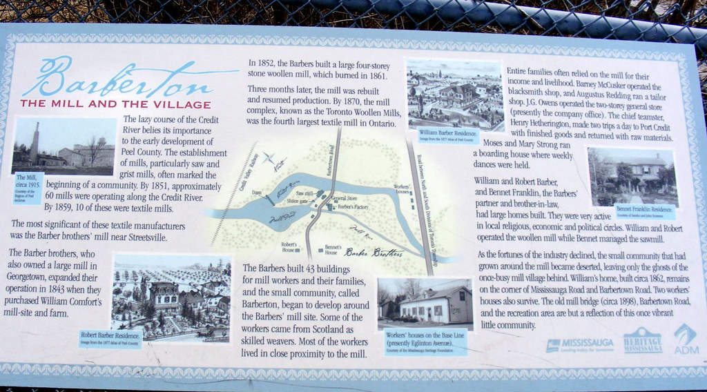
Historical displays, visible only to cyclists and walkers on the Credit River trail, and the presence of a mill, continuously operating since 1870, have helped to preserve a bit of the local heritage.
The mill itself has been on site for nearly 150 years, but has been upgraded considerably, and is now operated by the giant agricultural products firm Archer Daniels Midland. However, some of the old mill races survive in the forested area between the modern mill and the river.
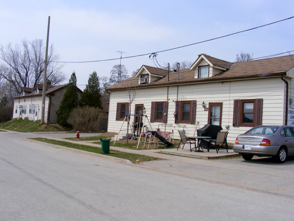
The mill itself is not the only heritage structure of note, the old Barbertown iron bridge survives (now closed to all but pedestrians and cyclists), and near Eglinton Avenue, former workers’ cottages remain standing and occupied.
Another interesting relic is the old wooden crossbuck railway crossing sign as the public road melds into the ADM private driveways. These old style signage for railway crossings were replaced in the mid 1980s at most public crossings to a European-style red and white X-sign without lettering.


One comment
Just a quick random point on the location – every spring for the past 50 years, that’s the put-in for a canoe / kayak race down the Credit to Erindale Park, where there’s a weir. There’s some more info here: http://www.mississauga.com/print/18187 and pictures: http://www.myccr.com/SectionForums/viewtopic.php?f=46&t=32484&view=next and http://outdoors.webshots.com/album/570724427LnxlSN