

The City of Toronto has an opportunity to transform Leslie Street into a welcoming gateway to the Leslie Street Spit and the eastern waterfront, but is currently on course to ignore this opportunity.
Creating attractive new routes to the waterfront is a core element of Waterfront Toronto’s plans. In its maps (above), Leslie St. is presented as one of the key routes targeted for such transformation — the easternmost entrance to the waterfront, and the direct route to one of its jewels, the Leslie Street Spit.
Leslie Street becomes all the more significant because the Leslie Street Spit/Tommy Thompson Park is expected to stop being a dumping ground for construction debris, possibly as soon as 2013. While it is currently only open to the public on weekends because of the dumping during the week, once it is no longer a dumping ground it is likely to become a permanent full-time park, used by the public every day. Leslie Street will be a primary route to the park for those on bikes, and those travelling by transit on the Queen streetcar and then walking.

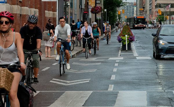
Currently, the strip of Leslie Street between Queen St. East and Lake Shore Blvd. is an unattractive stretch, with narrow sidewalks and awkward intersections for those on foot, and narrow, poorly maintained traffic lanes for those on bikes. The attractive two-way Martin Goodman Trail bike route up from the Spit on the east side of Leslie ends abruptly at Lake Shore for anyone wanting to continue north.
But there’s a golden opportunity to change all that. The TTC is building yards for the new streetcars in the empty lot south-east of Lake Shore and Leslie, and it will have to tear up Leslie all the way to Queen to install tracks. As compensation to the local community for the disruption and noise that will result from the presence of the new streetcars, it is supposed to engage in some streetscaping of Leslie while it’s at it.
It seems like the right time to install bike lanes and improve the walking infrastructure to create the gateway envisioned by Waterfront Toronto, but the TTC and the City of Toronto have so far insisted that they will rebuild Leslie St. exactly like it was before, with just a few cosmetic touches.
The key question is, could Leslie Street lose a lane of traffic in order to create bike lanes and more pedestrian space? Currently, Leslie from Queen to Lake Shore is four lanes. Outside of rush hour, two lanes are used for parking and only two lanes are used for traffic, but during rush hour parking is prohibited to allow two lanes of traffic in the rush hour direction.
Leslie Street is classified as a “minor arterial” road by the City — but minor arterial roads are a primary candidate for bike lanes, and for example another minor arterial road in the area (PDF), Dundas St. East, consists of bike lanes and only two lanes of traffic. So the classification is not an obstacle.
A street also has to be able to cope with the vehicle traffic on it effectively. A single lane of traffic is normally considered to be able to handle up to 900 vehicles an hour. The City’s traffic counts show that even peak traffic counts are below that number, with the exception of one side of the southernmost block, from Eastern Ave. to Lake Shore (1000 vehicles southbound in the morning). So two lanes are needed during rush hour only on the west side of one block — the rest of the street only needs one lane even during rush hour.
What about the streetcars? According to the TTC (PDF), “The majority of the streetcars travelling on Leslie street will operate during off-peak hours, between 5 am and 7 am. The bulk of them will return to the facility at 7 pm, after servicing rush-hour demand.” So they will be travelling at off-peak times when there is already only one lane available each way .
In terms of parking, some residents who face onto Leslie use the parking there — but they cannot use it during rush hour, and have to move their cars elsewhere during that time. While the on-street parking is used, there is no full parking study to show whether there is other nearby parking that could be used instead. The primary destinations on the street, the big-box stores near Lake Shore, already have large parking lots.
As long as there can be two lanes of traffic during rush hour on the southernmost block on the west side, and there is some parking provision for residents, there is reason to suppose that Leslie St. could lose a lane of traffic to create better space for cycling and walking.
A simple solution presents itself: use the easternmost lane of Leslie to continue the two-way, separated bike path on Leslie up from the Spit, which currently stops at Lake Shore, all the way to Queen East. Make parking on the west side from Queen to Eastern permanent. Keep the parking off-hours only from Eastern to Lake Shore to accommodate the heavier traffic in that stretch.
The separated two-way bike lane to Queen East would create connections to the bike lanes on Jones and, through it, the bike lane on Dundas East — helping to build a real cycling network connecting to the Waterfront. (A contraflow lane right up Leslie where it is one-way north of Queen would be even more effective in linking to the Dundas East bike lane).
No major reconfiguration is required to implement this – just blocking off one lane of mostly-parking that is not needed by traffic. The rest is simply changing parking regulations, although that would also provide an opportunity to expand the sidewalk at some intersections to create a more attractive walking route.
Add in a few sidewalk enhancements, and the result is an appealing gateway to the walking and cycling destination of the Leslie Street spit. It’s a solution that is within the City’s grasp, if it would only seize it. If not, Leslie Street will remain an obstacle discouraging access to the waterfront rather than a route encouraging it.

12 comments
That’s a great plan for extending the two-way bike trail up to Queen St., Leslie. Leslie is a tiny bit harrowing for cyclists.
I must say that I’m sad to hear the plan to stop dumping on the spit. I think that as long as the land fill is being renaturalized, they should keep doing it. The more park land, the better.
Not to complicate your relatively neutral proposal too much, Dylan, but I think the case can be made to consider just one lane for each direction, plus a parking lane, for the entire section between Queen and Lakeshore. The one period where volume is about 100 cars over the one-lane capacity is not the strongest argument to maintain the existing capacity in that one block.
Granted, in the inherent give-and-take required for Complete Streets design, one (or let’s say cyclists and pedestrians) needs to be willing to give a little. But who’s to say this 1,000-vehicle volume will not drop following a nice streetscaping job, making that extra lane unnecessary? Of course, it could also increase with simply more residents living and commuting in the city’s east end.
The point I make is that in a holistic approach to city and transportation planning, vehicle volumes and capacities shouldn’t be given as much weight as they currently hold. And, therefore, a bit of extra delay to motorists need not be ‘no-go’ territory.
Does anyone know how Paula Fletcher feels about this? It’s her ward and she’s an avid cyclist.
For these purposes, the “rule of thumb” lane capacity estimate is not necessarily relevant. The capacity of Leslie is going to be dictated by the capacity, and queues, at intersections. That could be freeing in some ways (maybe one of the lanes ends up being underutilized, or maybe there is a way that traffic lights can be set up to make better use of a lane) or it could end up being a constraint, especially when considering factors such as the length of the streetcars, vehicles blocking left turns, and short blocks. (Especially northbound north of Lake Shore.) On the other hand, there could be benefits in reducing to a three-lane cross-section if it means left turns aren’t blocking streetcars (at Eastern, or at the plaza entrances).
Keep in mind that a traffic constraint on Leslie also means greater potential for delay in getting a streetcar into service at the start of the afternoon rush hour (crappier service), or a delay in getting a streetcar back into the yard at the end of an operator’s shift (more overtime… even if marginal, adds up).
The other constraint I would point out is at the north end, where a four-lane cross-section (with streetcars on the inside) appears to be required to provide enough room for the tracks to curve to/from Queen.
Fletcher and bike lanes — hard to say. She pushed hard for the Eastern bike lanes, but I don’t think those had much to do with bikes — it was a fairly blatant move to try to block the SmartCentres development.
I’m not certain, but I believe the figure shown is from the Central Waterfront Secondary Plan, a formal City of Toronto document approved by Council that predates the formation of Waterfront Toronto. Could you clarify?
Toronto prioritizing pedestrians and cyclists over cars? Not going to happen…
At Water Front Toronto under the tab Portlands Greening this:
“In April 2005, Waterfront Toronto along with the three orders of government announced a $10.5 million investment and plans for greening the Port Lands and improving public access to the area’s lakefront. This project includes work to improve the key gateways in the area such as Unwin Avenue, Leslie, Cherry and Commissioners streets, all of which are the major corridors that connect the city with the Port Lands and the primary routes that lead to a future Lake Ontario Park.”
(http://www.waterfrontoronto.ca/explore_projects2/port_lands/port_lands_greening)
So South of Lake Shore Boulevard we’re spending money to make Leslie Street a welcoming Gateway to the Portlands and Tommy Thompson Park – while North of Lake Shore Boulevard the City, the TTC and Traffic Services are ignoring the vision by redeveloping Leslie Street as is.
One hand doesn’t seem to know what the other is doing.
Hi Baray,
The map is from Waterfront Toronto’s “Public Space Framework” document – but it’s possible they took it from the City of Toronto’s document. In any case, WT has adopted these goals (and it’s all the more ironic if this was a City of Toronto plan originally, since the City is now ignoring it).
There’s a link to the document on this page:
http://www.waterfrontoronto.ca/explore_projects2/port_lands/lake_ontario_park
Dylan
What this discussion seems to ignore, is the stoplights into parking lots & fast food/coffee stops, midway between Queen & Eastern, and the lack of both appropriate cycling/signalling at the Leslie /Lakeshore intersection, and a dedicated right turn lane southbound on Leslie to Lakeshore westbound. These obstructions to traffic flows of all types will only be exarcerbated if there isn’t consideration given to mutually agreeable solutions to all parties.
can we not seperate cars bikes and pedestrians
these are special places where symbolic choices are made to express the hopes for the future
at some point the two dimensional grid evolves tearing down then
building up. deciding on corporate efficiencies frees us to go
beyond blame toward gravitational economies of scale
Ian,
On “..obstructions to traffic flow[s]…”.
Good points
The intersection that is essentially two exits from Malls – Price Choppers and Loblaws – adds a set of stop lights to this short stretch. But there is so much volume in and out of these Malls by car and truck traffic that it is necessary.
I think these Box Stores are anathema to the Gateway idea. Perhaps these two Malls need exits onto Lake Shore and onto Eastern Avenue – and NOT on Leslie Street?
This re-visioning of Leslie would free up space for other forms of transportation including separated bike lanes, wider sidewalks and wider green areas – which would be a great beginning to making Leslie Street much more of a “Gateway” to the new Park Lands.