This article was first published in November in the Park People “10 Years Together in City Parks” series, and is republished here with permission. Read the complete 10 Years Together in City Parks series here.
“I think my favourite part is the original Scarborough Centre Butterfly Trail,” says Katie Turnbull, referring to the initial pilot project that launched The Meadoway in Toronto.
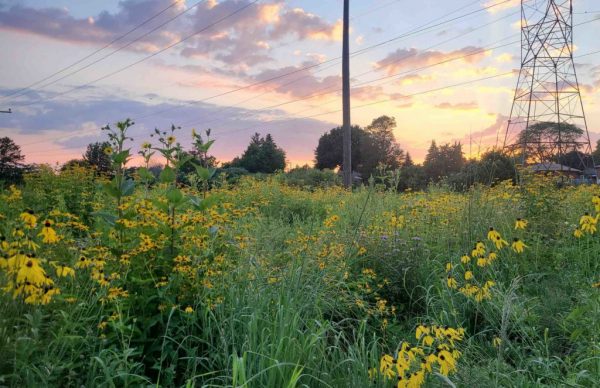
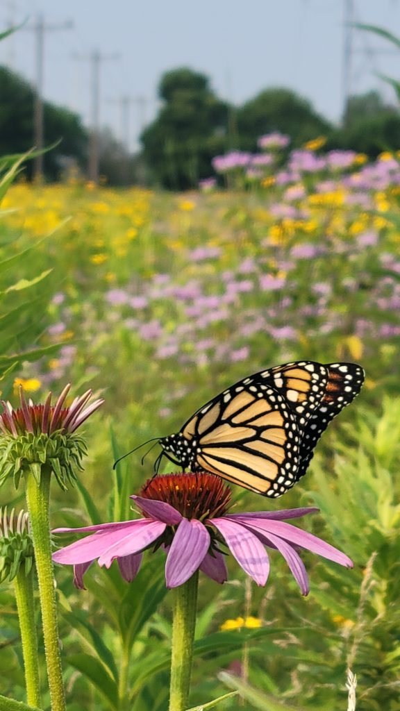
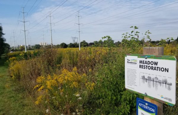
“That portion has been established since 2013. There’s wildflowers and grasses, a couple of allotment gardens, as well as shrub nodes, and the grass buffers are all nicely mowed. To me, that’s the spot that I just love to walk with family and friends. But I also love taking them through the sections that we haven’t restored yet and showing the difference between the mown grass and what could be there.”
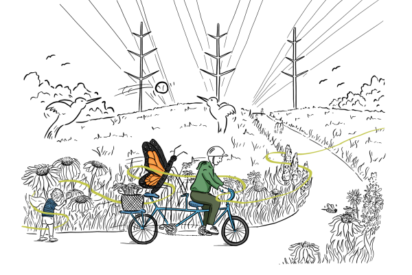
Turnbull has been working on The Meadoway since the beginning, as a Toronto and Region Conservation Authority (TRCA) Senior Project Manager. She’s witnessed it grow from that butterfly trail into a plan to turn 16 kilometres of the Gatineau Hydro Corridor into a linear park of continuous greenspace and meadowlands, along with a walking and cycling trail, that cuts across Toronto’s eastern suburb of Scarborough to connect downtown Toronto to the Rouge National Urban Park on the eastern edge of the city.
Hydro corridors are ubiquitous in cities, and The Meadoway is a new way of thinking about them as sites of recreation, connectivity, wildlife habitat, animal migration and a unique melding of human and natural landscape. “It’s an industrial reuse project,” says Corey Wells, also a Senior Project Manager at TRCA.
“We’ve taken what has been typically viewed as not a place that someone would want to ride their bike or hang out, and flipped it on its side.” Wells points out there are more than 500 kilometres of hydro corridors in Toronto, and the Scarborough project is something that can serve as a blueprint for how they can create new space for parks and wildlife.
The geography
The Meadoway is big sky country. At some of the higher points, there are vistas many kilometres long piercing all the way to the downtown, unencumbered by trees or buildings. Toronto is known for its ravines, wild fissures that weave their way from north of the city down to the lake, generally running from north to south but not connecting laterally. The hydro corridors that cross Toronto are like human-made ravines, portage routes over the tablelands between one ravine system and another. As Wells says, “It’s the backbone of Scarborough.”
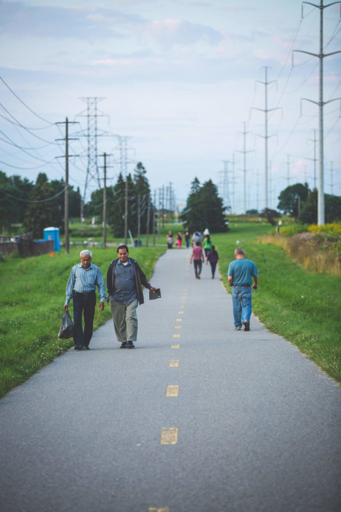
The Gatineau corridor climbs out of the Don Valley at what will be the Bermondsey Road “Western Gateway” to The Meadoway, connecting from the East Don Trail that will lead right to downtown Toronto. From here the corridor runs east, linking seven rivers, 15 parks, 13 neighbourhoods and what will be more than 200 hectares of cultivated meadows on its way to Rouge National Urban Park. Though not yet completed, much of The Meadoway can now be followed on foot or by bike to experience the various stages of this seven-year project. It takes the traveller along a series of long and gentle grades rising from and lowering to, the watersheds. Cycling the trail is a meditative experience as it meanders through the hydro towers, passing dozens of “no mow” signs along the way that protect what Turnbull calls this “central habitat.” There’s much more to The Meadoway than simply letting the grass grow, though.
From lawn to meadow
Before The Meadoway, the Gatineau corridor would typically be mowed six times a year.
“It’s pretty in-depth, what needs to be done,” says Turnbull. “We look at it as a three-to-five-year process. In year one we start off doing farming practices and actually use farm equipment to remove the turf.”
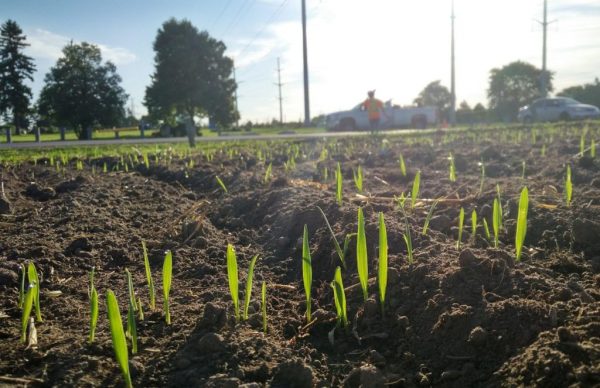
After the existing turf is taken care of by mowing and tilling, a cover crop of oats is planted. Its role is to reveal what other seeds are in the soil and might grow in place of the turf. The oats allow invasive species like dog-strangling vine and Canada thistle to grow, but also keep them in check, making them easier to remove. That crop will be mowed, and the process repeated four times throughout the summer until they are satisfied they have suppressed all the non-desired and invasive species.
Then it will be seeded in the fall to allow natural stratification – a process by which a period of cold and moist weather breaks seed dormancy through freezing and thawing, cracking the seed shell to allow it to absorb moisture – and then subsequent germination in the spring.
“We use a variety of seed mixes depending on the moisture regime in the soils and where we are within the 16 kilometres,” says Turnbull. “All seeds used are from local nurseries that provide native species sourced within Southern Ontario. We try and pick species that will help to increase species diversity, improve ecosystem health, provide a variety of bloom times throughout spring to fall, provide plant host species for pollinators and birds, have long root depths to help stabilize soils, be resilient to drought and provide food sources in the winter for birds.”
There are dozens of different species planted, and the choice depends on the particular landscape, such as butterfly meadow, wet meadow, dry grass mix, upland slopes, and so on. The most seeded species are: big bluestem, New England aster, oxeye, wild bergamot, evening primrose, switchgrass, black-eyed Susan, cup plant, blue vervain, common milkweed – and there are many more.
At this point, TRCA moves to an adaptive management and monitoring phase, watching for more invasive species, monitoring how the meadow is coming up and doing infill seeding where necessary. While this is happening, the City of Toronto mows a three-and-a-quarter metre grass buffer along the trail, as well as a five-metre buffer edge along homes that back onto The Meadoway. Ongoing maintenance is needed because, as Turnbull explains, every meadow will want to turn into a shrub thicket and then a forest.
Rewilding – a new habitat with a lot of benefits
“A big thing I always find in talking to residents along the path is that they are hearing pollinators,” says Turnbull. “A lot of residents hadn’t seen a lot of these insects or heard birds calling before, and all of a sudden the meadow brings a whole new habitat.”
This effect is part of what Turnbull calls enhanced ecological services: increasing the biodiversity and ecosystem resilience along the corridor. With taller meadow plants, birds, along with butterflies and other pollinators, now find a home there. For those staying through the winter, the meadow can now help them through the cold season; for migratory birds and butterflies, it provides a feeding and resting ground as they pass through. Deer and other larger wildlife can travel between ravine systems.
There’s also the mitigation of pollution, as having a more robust flora cover provides air filtration. The larger root systems of the native meadow plants, some more than two metres long, mean the landscape can now hold more water, which also helps with flood attenuation by slowing down water runoff. Less mowing means reduced maintenance costs and lower emissions. And the addition of more meadows could also have a cooling effect.
“We’re looking to see what the temperature differences between turf and meadow is right now,” says Turnbull. “It’s just preliminary but results are showing almost a nine-degree difference in temperature.”
“For me, its power lies in its connectivity,” says Nina-Marie Lister, a professor at Ryerson’s School of Urban and Regional Planning and Director of the Ecological Design Lab, which ran a design workshop for The Meadoway.
“It’s a space of connection across communities but it’s also a space across landscapes and topography.” Because a meadow has so much open sky, Lister says there’s opportunity to see birds in ways we can’t in the forest, and the open quality allows for sunlight that is good for growing things both for human consumption, through urban agriculture, and for enjoyment. “I would describe it as a very different landscape experience,” she says. “On the one hand it’s physical, about connectivity, but visually it’s about openness. The Meadoway is a kind of counterpoint to the ravines, which are folds in the landscape, whereas this provides a view across the tablelands.”
Active industrial corridor and partnerships
“A lot of the classic industrial reuse projects globally are ones where there was a historical industrial usage which has now stopped and it’s been converted into a public space, like the High Line in New York,” says Wells. “The Meadoway is unique in that it’s still functioning for its primary purpose.”
Wells points to Hydro One’s “Provincial Secondary Land Use Program,” which provides opportunities for other uses in the corridors as long as the primary one – transmitting electricity – can still function. These could include, for example, an adjacent developer building a parking lot, or the city maintaining playing fields under the wires. A spokesperson for Hydro One says that while the primary use of corridors is to deliver safe and reliable power, they welcome the opportunity to work with local municipalities and organizations as a community partner to create additional safe uses of hydro corridors.
“I think Hydro One is learning a lot, just as much as we are, about becoming a little bit more comfortable about what has typically been seen as a place where no people really spend any time,” says Wells.
Apart from not planting trees that could interfere with the wires, Wells says the locations of plantings and trails are designed to be in harmony with maintenance needs, and that a meadow is a perfect in-between landscape that is compatible with all these uses.
That learning curve has been shared by a number of agencies and groups including TRCA, Hydro One and the City of Toronto’s various departments, as each group, with their own mandates and core interests, have found a way to work together on this common project.
The Meadoway is also an example of a public-private partnership – a concept more common in US parks than in Canada. This public-private partnership was first created through the Weston Family Parks Challenge, a city parks initiative that funded the Scarborough Centre Butterfly Trail pilot. The success of that first revitalization led to a pledge of up to $25 million from the Foundation to revitalize the entire 200 hectares.
“As soon as we saw the enthusiastic community response to the Scarborough Centre Butterfly Trail, we knew this pilot project had the potential to expand,” says Emma Adamo, Chair, Weston Family Foundation. “The Meadoway really has it all – from environmental benefits, to research and education, to promoting active transportation. It has the potential to have a significant impact on the mental and physical well-being of the surrounding community members.”
The project is even more complex when considering how much ongoing public consultation goes into it.
Community outreach
“We developed something called the community liaison committee, reaching out to a number of local organizations, residents, NGOs, groups like WalkTO and BikeTO, and Scarborough bike repair groups,” says Wells. “Like-minded individuals with different perspectives on how they might be able to utilize the space. We used them sort of as an initial sounding board.”
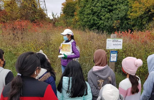
This kind of feedback was critical to how trails and connections were planned, as locals know the space and know-how they use it, and plans were adapted in response before introducing them to the broader public in open houses and public information centres. TRCA developed a “visualization toolkit” with lively and engaging renderings, virtual-reality experiences and even a twenty-four-foot-long scale map of the entire corridor, which was brought out to public meetings so people could put stickers and notes on it. TRCA also reached out specifically to new Canadians among Scarborough’s diverse population to engage them with The Meadoway initiative, and students at local schools were given seeds so they could learn about what was being planted. All of this outreach produced buy-in and a sense of ownership from residents.
After The Meadoway’s designers digested the input they had received, details were sorted out: benches, bike lock-ups, litter bins, and the design of trail intersections, where The Meadoway crosses north-south trails, to include ample seating, play areas and more manicured garden sections. A wayfinding system is still in the planning stages. It will include educational signage telling people where they are and where they can go, but also informing them of the natural and Indigenous heritage of the area, as well as the geomorphology of the waterways The Meadoway traverses.
Design challenges
There are some big obstacles in the way of creating a seamless natural corridor through a crowded city. Lister notes there are more than 30 road crossings along The Meadoway that pose challenges, not just for humans but for wildlife. “If we prioritize pedestrians, and we prioritize the creatures who are most vulnerable to traffic, it’s done by slowing the traffic,” says Lister.
“If The Meadoway is a priority, we need to think really big about what it means to have a healthy, accessible green space for the safe movement of people and wildlife and that it’s worthy of capital investment, as important as sewers and railways.”
While tunnels under roads are not a preferred solution, bridges are expensive. A smaller but useful example of the traffic slowing Lister mentions can be seen where The Meadoway crosses Crockford Boulevard in the Golden Mile neighbourhood. Rather than a signalized crossing, the road is “pinched,” or narrowed, and the usual asphalt replaced with bricks, all of which push drivers to slow down.
Highway 401, with its expanse of express and collector lanes, is perhaps the biggest barrier to a continuous Meadoway. It crosses the hydro corridor just north of the University of Toronto’s Scarborough campus, as the corridor nears its terminus at Rouge National Urban Park. TRCA may route active transportation users through the campus, in harmony with the that are part of the school’s masterplan, including the completed switchback path that leads from the ravine floor up to the campus, and onto Conlins Road, where protected bike lanes were recently installed to provide a route over the highway.
Taking on a life of its own
TRCA has been contacted by a number of municipalities and organizations who are looking at their inventory of these kinds of corridors in their jurisdiction and thinking about what other purposes and uses could be envisioned.
However, TRCA is also hoping The Meadoway takes on a life of its own and becomes a catalyst for other changes along its path. “In 10 or 15 years, I’d like to see a fully connected and seamless trail system from east to west,” says Wells. “When new developments are being planned and parks are being enhanced, I hope they’re all thinking of ways to connect to The Meadoway. I’m really hoping it becomes the veins of a leaf right across Scarborough.”
Lister calls it the “ultimate teaching garden,” one that will influence not just other cities, but individuals and their private property. “If the City and TRCA can do this, we can all do it.” She sees it as a literal, and metaphorical, seedbed for natural gardens. As for Turnbull, she hopes it will inspire people. “I’m hopeful it will be a place where the community and the public can come and enjoy nature and biodiversity,” she says. “I hope it will help them visualize that a different type of habitat in cities is possible.
illustration by Jake Tobin Garrett; photos courtesy of The Meadoway

