In May 2026, as part of the Contact Photography Festival, the City of Toronto Archives opened a new didactic exhibition entitled “Subseries 58: Department of Public Works Roadway photographs.”
For this exhibition, which runs until April 31, 2027, curator Paul Sharkey has taken a conceptual approach to a photo series created between 1910 and 1957 by City Photographer Arthur Goss and his successor Howard MacDonald. Instead of using a conventional layout, he has arranged large numbers of images into “repetitive grids based on visual similarities”.
The stated aim of the exhibition is to “reveal the creativity of the photographers by removing the photos from their original documentary context and arranging them by visual themes, associations, repetitions and typologies”. This approach produces a strong graphic effect, but I find that it conveys little information on the character of Subseries 58.
Many archival photos that were only intended to record facts can be appreciated for their aesthetic qualities after their original use has been forgotten. The photos in Subseries 58 that I find most interesting were those taken between 1910 and 1939 by the City’s first official photographer, Arthur Goss.
Goss was already an accomplished artist before he was commissioned by the City to head his own department, providing photography services to all the other City divisions. His successor Howard MacDonald was an uninspired journeyman who laboured from 1940 until the position of City Photographer was eliminated in 1957. The artistic and the technical quality of the photos in the Roadway series deteriorated markedly during his tenure .
The photos Goss took for the Roadways series demonstrate his ability to animate an image from edge to edge, often by choreographing random street traffic to balance the composition. Roadway No. 109 from April, 1914, looking north on Spadina at Queen Street, features fifteen moving figures, five vehicles and a wheelbarrow, but nothing seems out of place. The dismal weather is visceral, creating a powerful mood that transcends the banal scene.
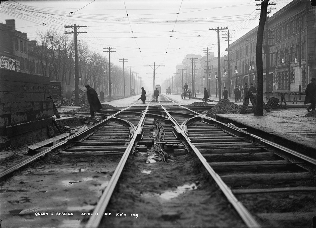
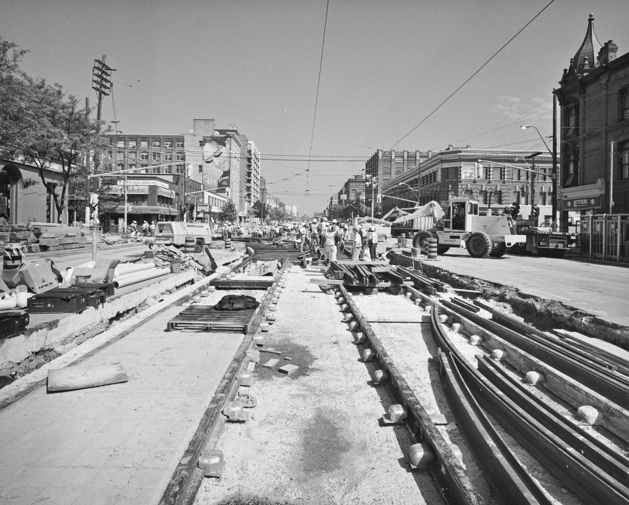
By comparison, my own photograph of this intersection take during construction of the Spadina LRT in July, 1915 is a strictly factual record of a construction site. I might have done better, but security guards prevented me from getting closer to the work.
Goss was also skilled at placing a single figure on a large stage. Roadway No. 339 from October, 1914 depicts a workman in the foreground of a deep perspective of steel rails. The shallow depth of field emphasizes the man’s posture and clothing, revealing a hole in the elbow of his cardigan.
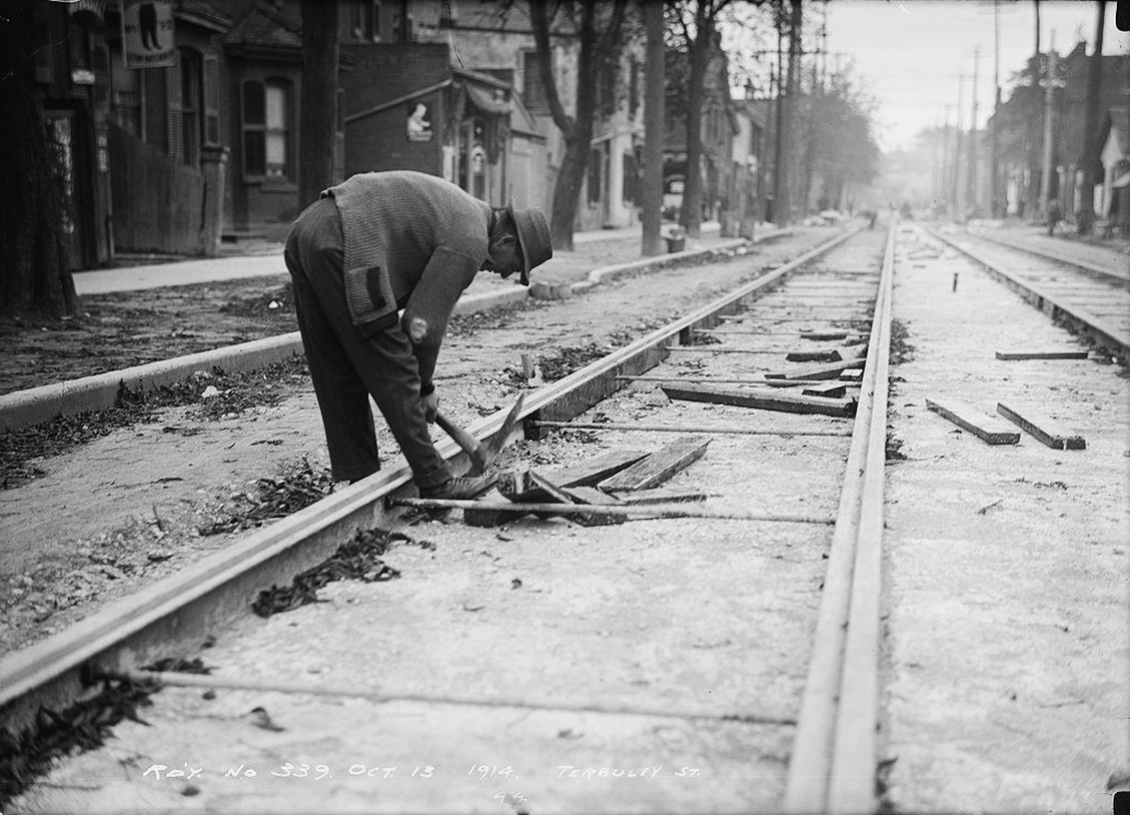
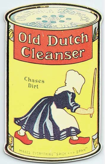
This mildly comical element is reinforced by advertising signs in the background. One directly above the figures is recognizable as the logo for Old Dutch Cleanser. Another sign close to the upper left corner depicts a pair of pants.
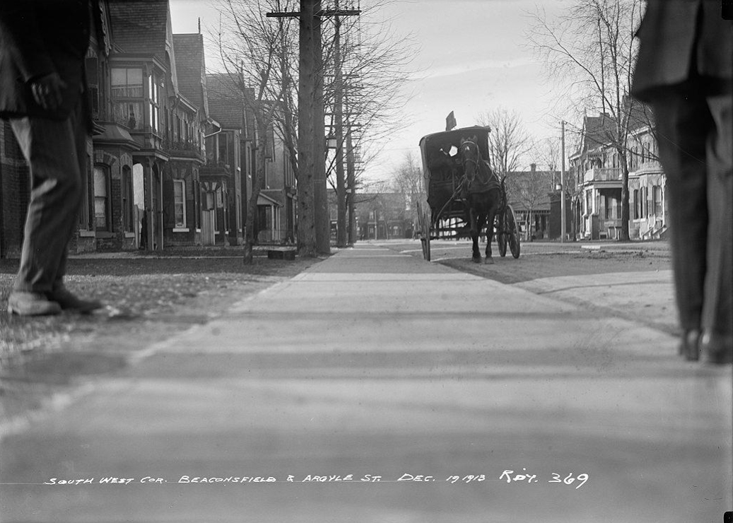
Roadway No. 369 is an example of how a photo taken for administrative purposes can slip into the uncanny. The camera eye looks straight ahead from a position only a few inches above a perfectly smooth and level sidewalk. The identities of the two truncated figures standing to either edge of the frame might be guessed from their clothing. The one on the right could be a City official while the one opposite could be a foreman. But who is that barely visible figure sitting in the mysterious vehicle in the near distance?
When photographing sidewalk scenes on commercial streets, Goss usually oriented his view at an acute angle to the building facades. The nominal subject of Roadway No. 1293 from November, 1931 is “sidewalk encroachment” by merchants on Queen Street West. But the riot of shapes in this image, including that of the warmly dressed window shopper, results from his choice to shoot against the light.

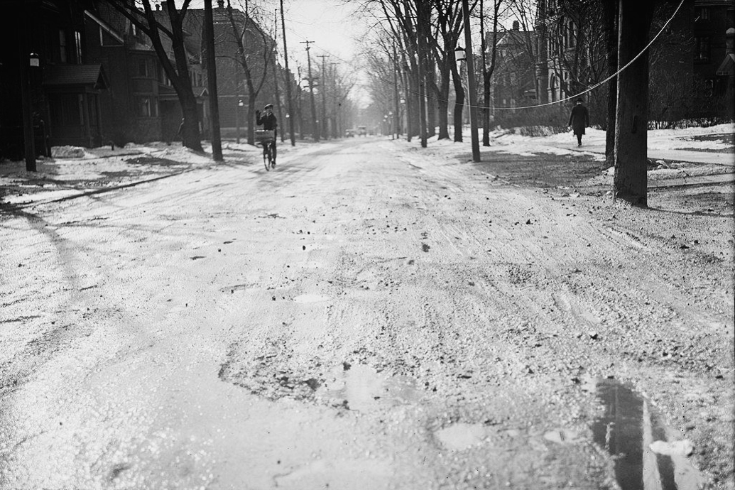
In Roadway No. 1275 from March 1931, Goss again works against the light, which transforms winter-ravaged pavement on Spadina Road into a glistening plane. The saluting cyclist on the left is perfectly balanced against the pedestrian on the right. What can be mistaken for a sagging hydro wire on the upper right is actually a crack in the glass negative.
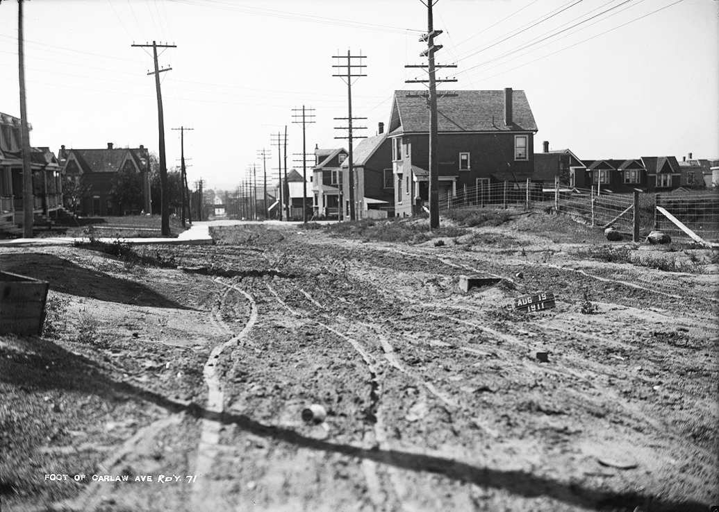
Although it appears as a main thoroughfare on the Goads Insurance map of 1910, Roadway No. 71 from August, 1911 shows Carlaw Avenue as a muddy field veined with squirming tire tracks. The photographer’s shoes are not shown, but their condition can be imagined.
Roadway No. 1303 from February, 1932 offers a comparable scene of suburban development, while illustrating the City’s preoccupation with public safety.

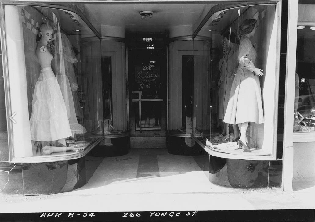
On April 1, 1954, two days after the opening of Toronto’s first subway line, City photographer Howard MacDonald began a project to document storefronts and sidewalks on lower Yonge Street. The timing was not a coincidence. The cut and cover method used to construct the subway on this part of Yonge Street may have resulted in damage to some facades. The City must have wanted MacDonald’s photos to serve as potential evidence in property damage lawsuits.
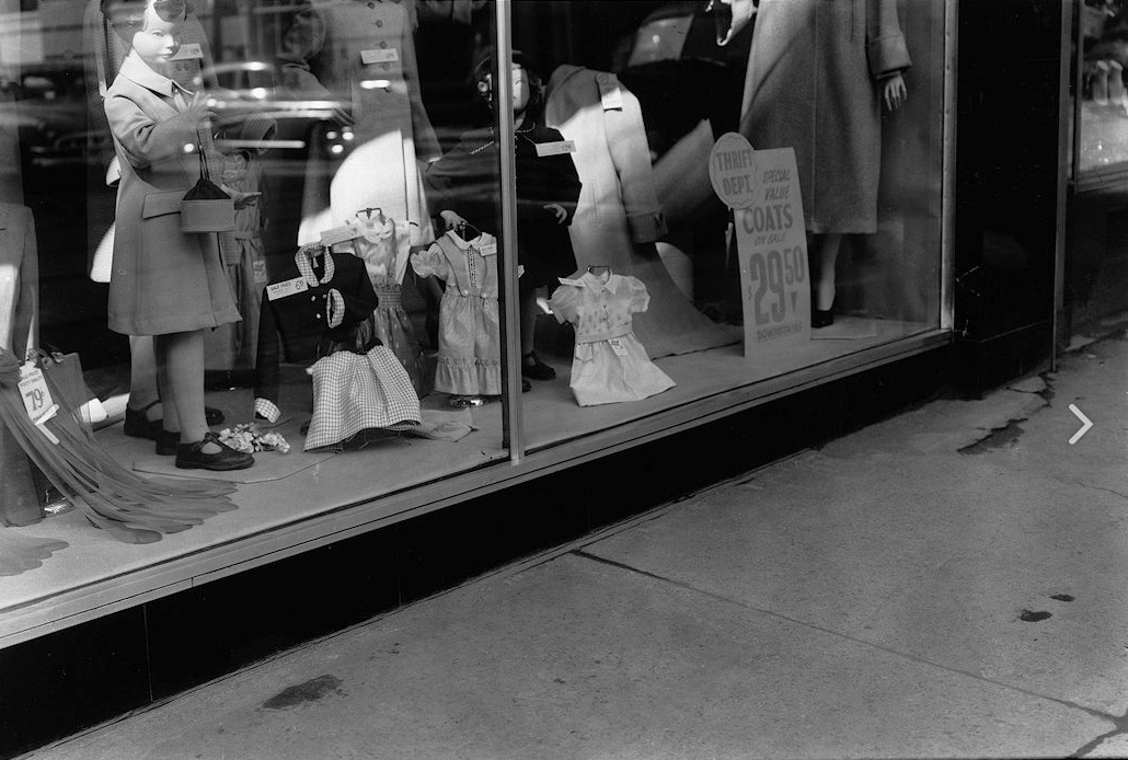
The need to work fast seems to have trumped all other considerations for the photographer. He produced approximately 190 photos over an eight day period, most of which are details, awkwardly composed and badly lit. They give the viewer no sense of what the streetscape really looked like, only truncated views of the store windows and pavement. Roadway No 2532 is typical.
MacDonald was tasked with documenting selected downtown streets by taking a series of axial views of each. His documentation of Terauley Street (originally Alice Street) in June 1950 comprises four views, Roadway Nos. 2069-2072, progressing west from Yonge Street to Bay.*
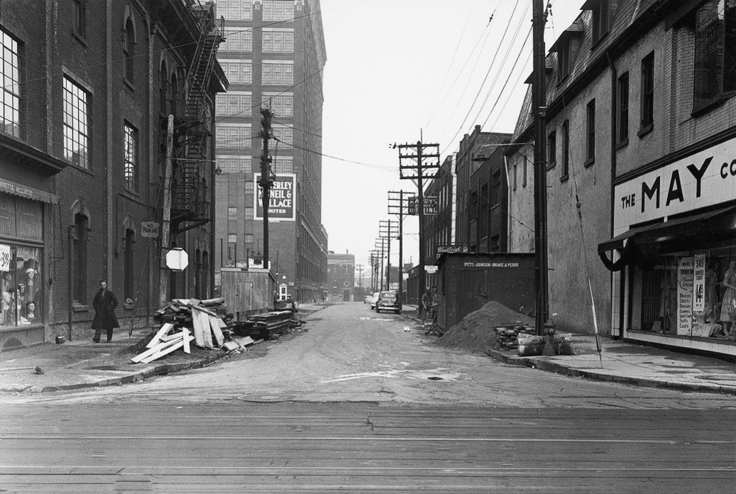
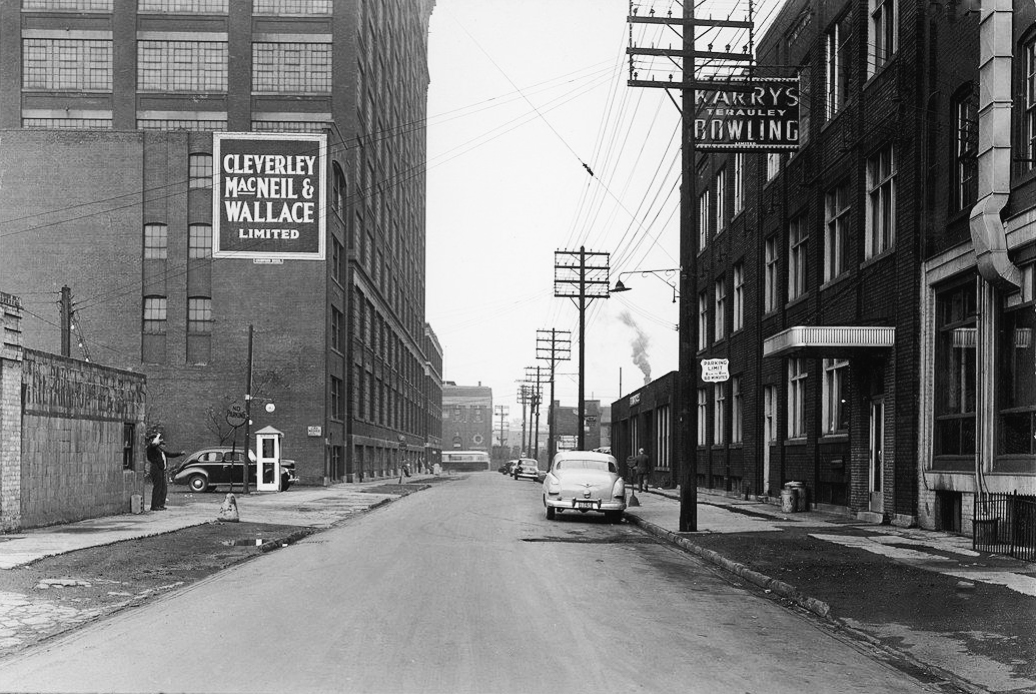
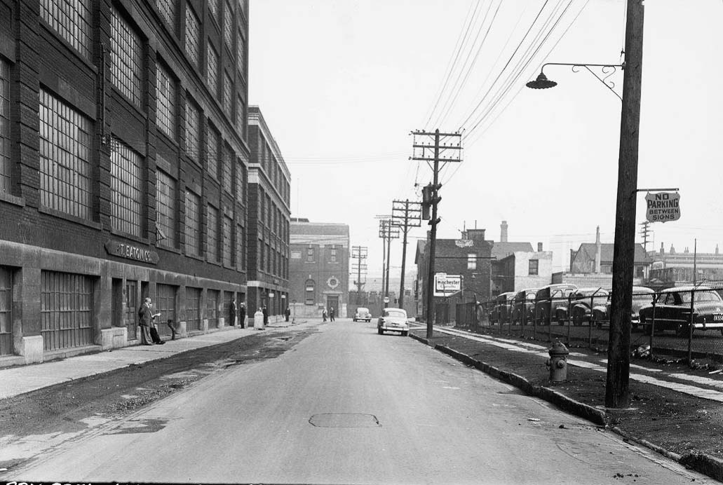
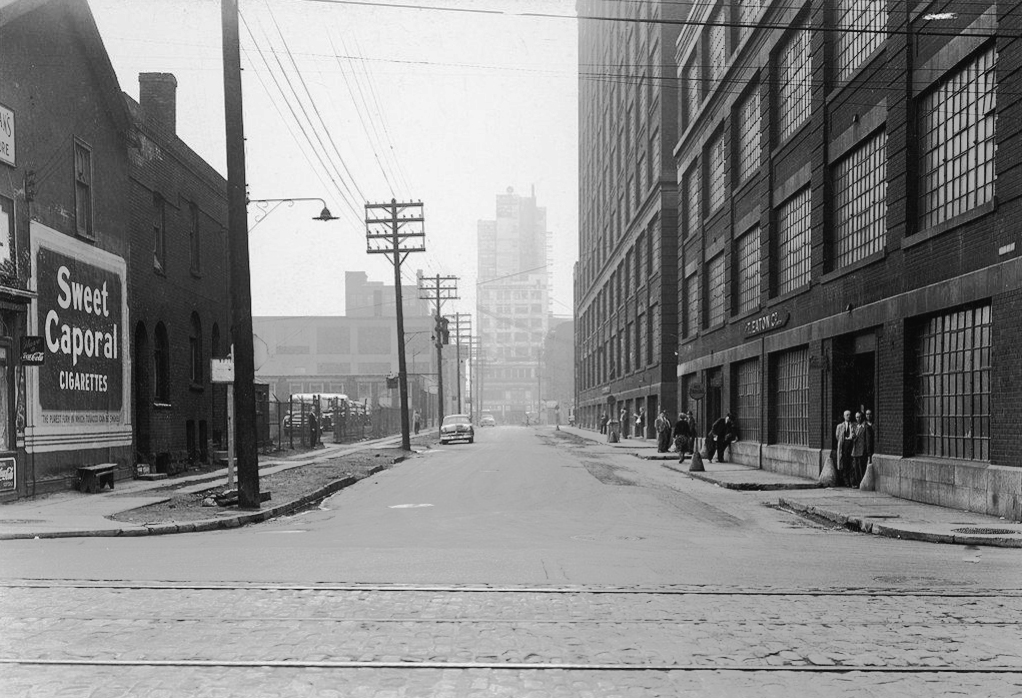
This series provides a glimpse of what Toronto’s downtown looked before its modernist transformation. Terauley is one of the two streets that were erased entirely from the street grid to make way for the Eaton Centre development of the 1970s. The Eaton’s factory that dominated the street was demolished in 1973.
* Until 1922, Bay Street between Queen and College was called Terauley Street. Alice Street was renamed Terauley before 1924.