The second video in our three-part series outlining new visions for Ontario Place was created by Marisa Maggs of the John H. Daniels Faculty of Architecture, Landscape, and Design.
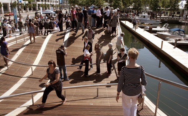
Created for the Fall 2012 Urban Design Studio “Design of the Public Sphere — The Case for Ontario Place,” Magg’s proposal envisions using landfill to build out the shoreline between Ontario Place and Bathurst Quay, thereby doubling the land area of the site. This new land would make it possible to extend Queen’s Quay and connect it to Dufferin Street, which would improve access to Ontario Place by linking all modes of transportation, most importantly the streetcar line. Maggs has estimated that by selling and leasing the new land that is created, enough revenue could be generated to finance the landfill and subsidize public park space. The addition of low-rise housing within a mixed-use development would help bridge the gap between Ontario Place and the waterfront neighbourhoods to the east.
The area south of Lakeshore Boulevard would be connected to Exhibition Place through a land bridge. Open park space flanked by commercial and retail uses would connect to existing programs at Exhibition Place. The existing Ontario Place pods would be surrounded by natural park landscape that connects to the existing parks along the waterfront. Fifty percent of the area would be devoted to public park space with year round programming and activities.
Click here to view The Case for Ontario Place: Part 1 by Christina Pascoa.


3 comments
Would the Federal Government have a problem with the landfill proposal, given that the island Airport (under the Toronto Port Authority which is a Federal agency) is on one side of the Western Gap and the HMCS York naval reserve is on the other?
This proposal to reintegrate Ontario Place & Exhibition Place into the city is an interesting one. My one change would be to re-imagine lakeshore Blvd. as an urban street, particularly if QQ is extended.
Currently Lakeshore Blvd. in Exhibition Place is a hostile fenced off mini-highway where pedestrians are expected to cross the street by mounting pedestrian bridges. Ex Place has been allowed to barricade off a city boulevard all year for a 3-day car race only because no one has been willing to challenge its appointed board.
The city has plans (opposed by the board) to return Lakeshore Blvd. to an urban street as there is little logic in having a second highway barrier along the lake just one block south of the Gardiner.
By following Exhibition Place’s lead in building bridges (land bridges) to cross Lakeshore Blvd. one is selecting an option that is over-engeneered and costly to maintain. Most importantly this high speed section would attract more traffic and cement Lakeshore Boulevard’s position as a high speed arterial barrier for neighbourhoods up and down the waterfront.
I wonder how much it would cost to divert the Gardiner Expressway into a tunnel running from Jameson/Lakeshore, under the Ex-grounds and Lakeshore…to replace the elevated section over to Jarvis. By this time (ideally) the elevated section east of Jarvis would have been shifted on to the Railway Berm.
The land under the elevated section from Bay to Dufferin can then be used for the Waterfront West LRT line…or at least a streetcar along Bremner, Fort York, Fleet and the Ex grounds over to Dufferin…and that portion of Lakeshore Boulevard can become “Lakeshore Road” in the “Fort York District” (or something like that).
From Bay to Jarvis the area under the elevated section can become a linear park