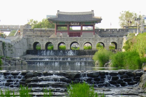

Hwahongmun Gate sits where the Suwoncheon stream passes through the northern wall of Hwaseong Fortress, with seven arches spanning the water. Built of stone and brick in the 1790s, it is one of the most photographed spots in Suwon, about 30 kilometres south of Seoul. I photographed it myself once, walking the fortress wall, without knowing I’d return to this stream years later on a screen. This stream has been part of the city for centuries. It has a name, a gate, a history. Suwoncheon: cheon (천) means stream, a suffix you’ll meet again in the names ahead.
Korean Stream Recoveries
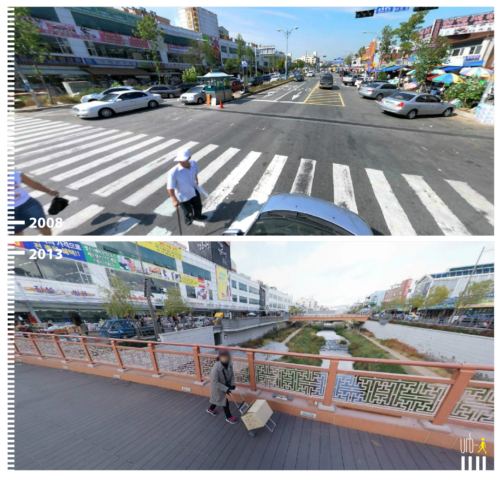
In Suwon, just over a kilometre downstream from Hwahongmun Gate, the same stream was hidden as recently as 2008. A long parking lot, a concrete slab with extremely long zebra crossing marks, bordering a busy market area. Cars parked diagonally along both edges, a pedestrian hauling a cart across the open asphalt. Nothing in the frame suggests a stream was ever there. By 2013, the image tells a different story. From a bridge with decorative Korean lattice railings, the view looks down into a lowered stream corridor, with paths along both banks and people walking below and under the bridge. A woman crosses above it with her cart, the same errand. Same commercial strip, same buildings, but between them, the stream keeps flowing. The parking is no longer visible. Losing it was part of the price.
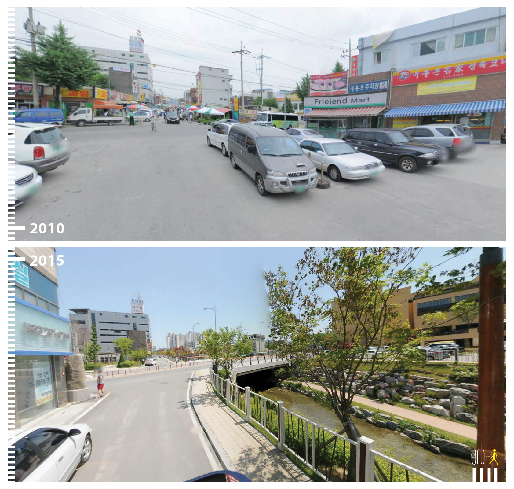
Chuncheon sits about 75 kilometres northeast of Seoul. In the 2010 image, a street, cars everywhere, ordinary commercial frontages. By 2015, a lowered stream corridor has appeared, with a path alongside the water, a bridge ahead, rocks and planting along the banks. Some buildings have disappeared, part of the 78 buildings removed to clear the route. The path along the Yaksacheon runs at water level under the bridges and connects to a newly built park.
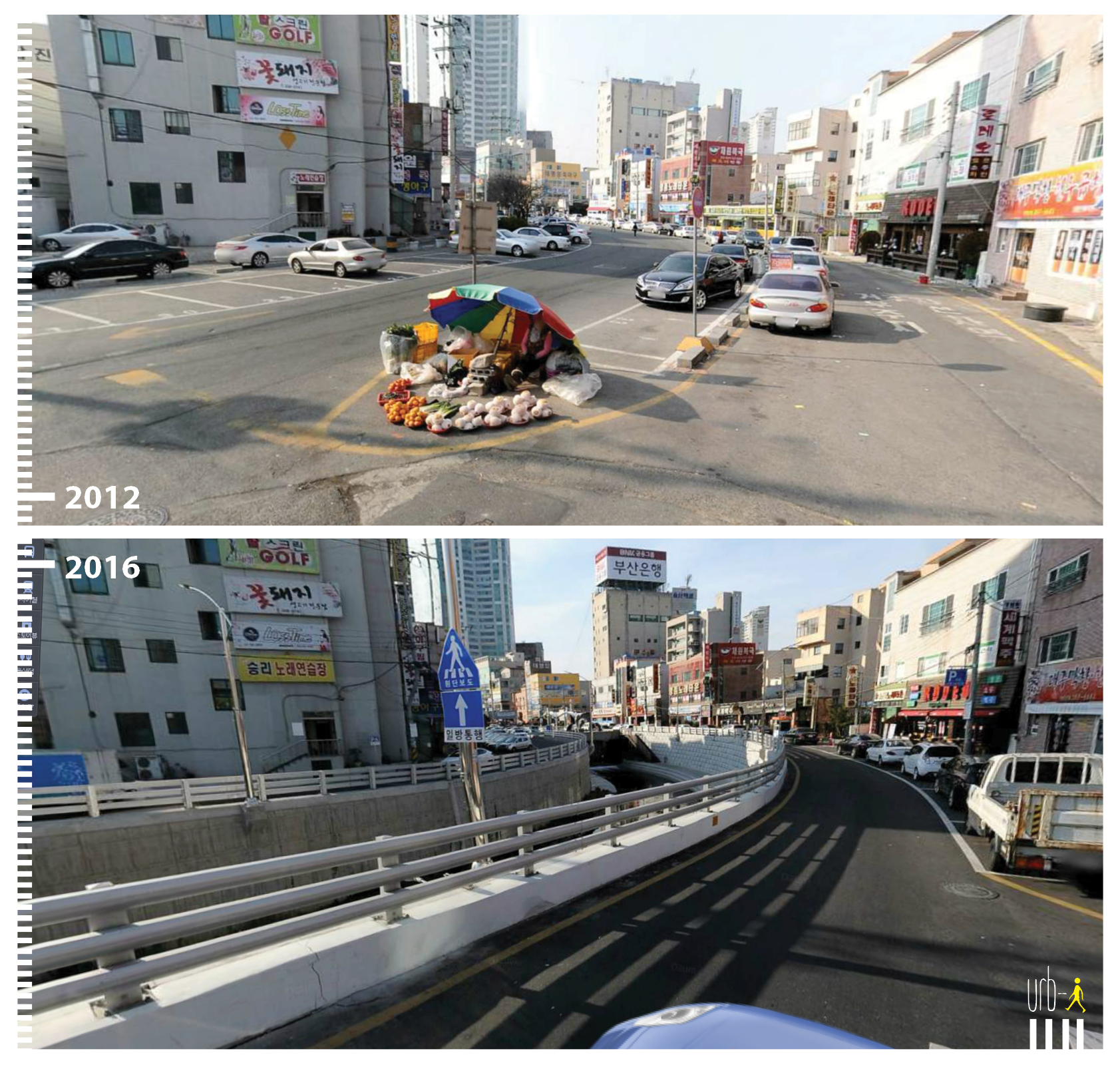
In Ulsan, a port city 40 kilometres north of Busan, a stretch of surface car park gave way to the uncovered Yeocheon Stream. A narrow path runs along the stream, inside a sunken walled channel without much room for planting, but still a path to walk beside the water.
Different cities, different scales, different conditions, but the same spatial logic running through all of them: water back in the open, people alongside it.
What Seoul Showed
To read what happened in these three cities, it helps to go back to Seoul, 2005. The Cheonggyecheon stream runs through the heart of the capital.
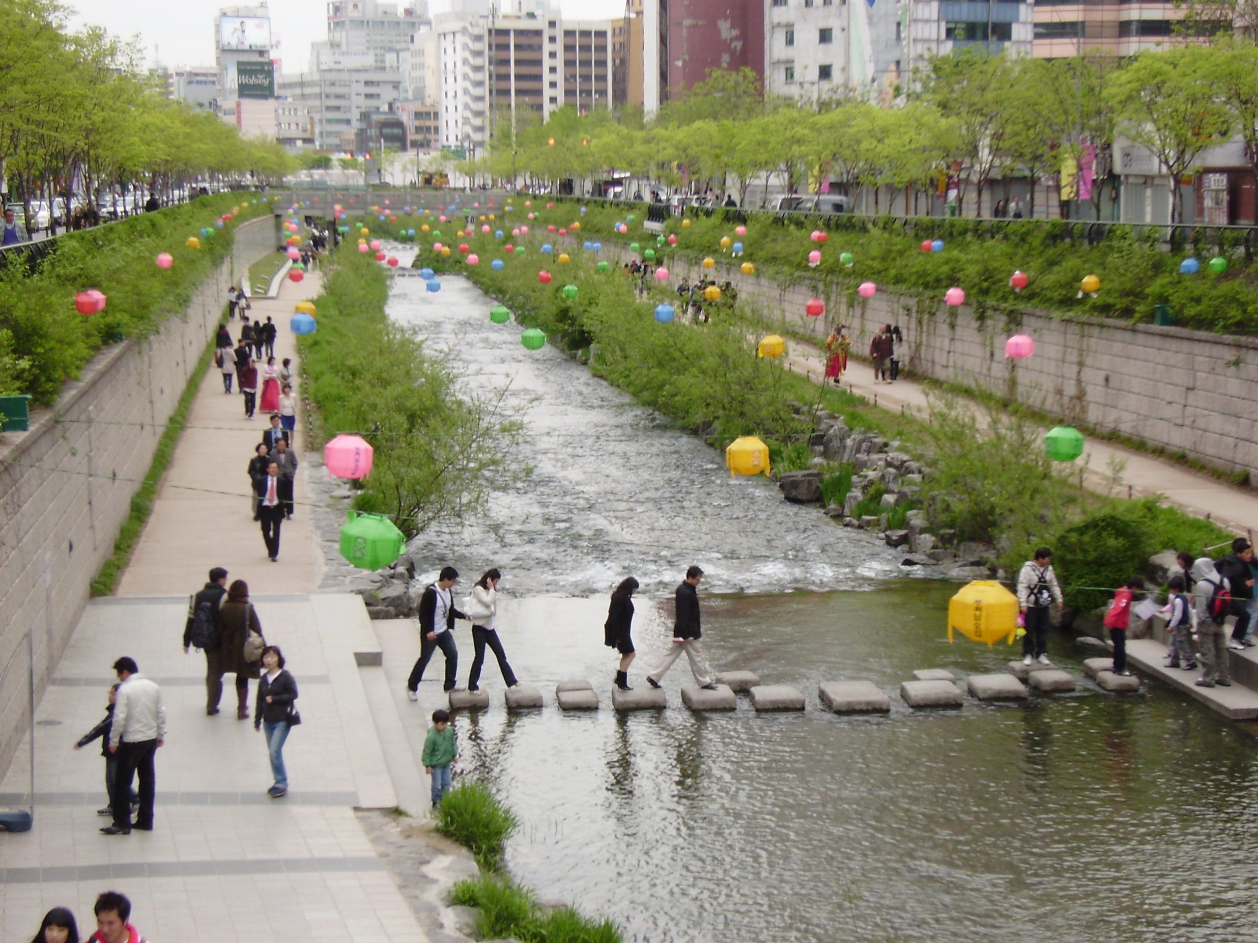
After the Korean War, a shantytown of refugees grew along the Cheonggyecheon banks. From the late 1950s rapid development covered the stream in concrete, and an elevated highway on top was completed in the 1970s. The shanties were cleared along the way. By 2003, the highway was deteriorating, and Mayor Lee Myung-bak initiated its removal. Two years later, the highway was gone, the stream uncovered, and a continuous pedestrian corridor ran through the centre of one of the world’s largest cities. The project became one of the most studied urban interventions of the 21st century. The mayor later became president.
Beyond the stream itself, its recovered tributaries and connected corridors grew into an extensive green-blue network, an ecosystem reaching across the city that can be walked uninterrupted. Seoul showed the willingness to take on large, uncertain transformations and generate a network, where the change compounds.
One honest detail is worth naming. Seoul’s stream is partly engineered, with water pumped in daily from the Han River, its tributaries and groundwater from subway stations. The restoration is real, but sustained by infrastructure. The Cheonggyecheon Museum lays out the transformation process plainly, explaining the water circulation, and recreating a segment of shanty houses on stilts over the bank. None of this diminishes what Seoul achieved, and it shows what it cost.
In my reading, what the Cheonggyecheon did beyond Seoul was shift what felt possible. Before 2005, removing infrastructure to uncover a buried stream was a radical, politically uncertain move. After the Cheonggyecheon became renowned, it was something any city could point to. Not a template to copy exactly, but a proof of concept: that the public would come, that the investment could be justified, that the politics could survive it.
I read this as one wave, and I will call it the Cheonggyecheon Effect. In Suwon and Chuncheon, the Korean press made the link itself. The Hankook Ilbo headlined Suwon’s plan in 2008, in translation, ‘Suwoncheon, too, to be restored like the Cheonggyecheon.’ Chuncheon’s project, the Seoul Shinmun reported in 2013, was being called the ‘second Cheonggyecheon project.’
The Cheonggyecheon Effect is quieter, and it is about permission. That sets it apart from the Bilbao Effect, much as a precedent differs from a landmark.
Bilbao
The Bilbao Effect, one iconic building credited with putting a declining city on the global map, is one of the most cited ideas in urban regeneration. The Guggenheim opened in 1997, and cities began commissioning signature buildings in the hope of repeating what Frank Gehry had done there. Juan Ignacio Vidarte, the museum’s former director general, has been clear about what actually happened: “If Bilbao hadn’t cleaned the river, built the subway, and moved the port, the museum would not have succeeded. The museum was not the most important investment.” Cities copied the building and often overlooked the conditions around it.
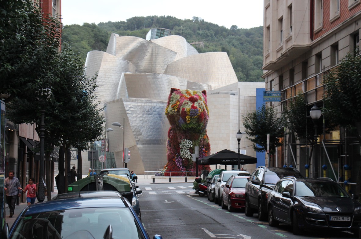
The Cheonggyecheon Effect and the Bilbao Effect share a mechanism. Both produced a postcard-worthy success that other cities wanted for themselves, while the conditions that made it work stayed out of sight, like an iceberg.
Vancouver has a version of this story. Vancouverism achieved residential density with towers on townhouse podiums, and paired that form with a planning process that asked developers for amenities in return. It was taken up in other cities, Toronto and Dubai among them, often more as a look than as the planning system behind it.
Epilogue: Vancouver’s Lost Streams
What seems to have travelled between the Korean cities wasn’t a building or a brand. It was the knowledge that what a city buries, it can also uncover. Vancouver also has quieter versions of the Korean stream recoveries, often referred to as daylighting.
In Tatlow and Volunteer parks, where people whizz by on the bike route from Kitsilano to Jericho Beach, a section of Tatlow Creek came back into the open, on its way to English Bay. Even this short section meant building a new bridge, with a detour for people walking and cycling while it was built.
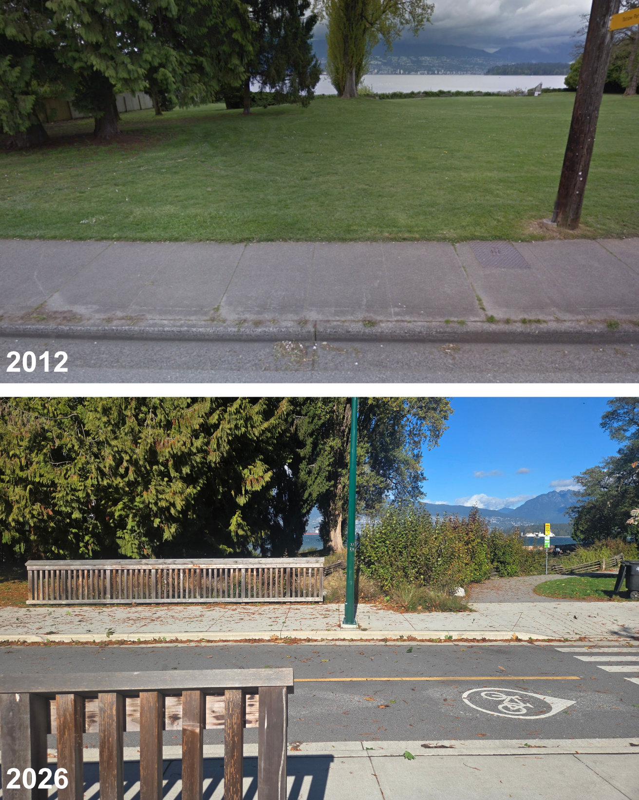
Elsewhere in the city, near Vancouver Film Studios, hidden between industrial buildings, sections of Still Creek have been recovered. In Mount Pleasant, the St. George Rainway carries rainwater through a green corridor, rather than daylighting the creek buried beneath it, an option that sewers and gas lines ruled out.
A historical map of the city’s lost streams, laid over the current street grid, suggests how many more may still lie buried, though recovering a stream need not be an end in itself. So far, the city’s recoveries remove no highway and run nowhere near Seoul’s kilometres. Perhaps this is what permission looks like when it spreads slowly, a short stretch at a time, until the segments begin to connect as a network. Vancouver, what would it take to go a little further?
***
Yuval Fogelson is an urban designer, educator, and artist who loves to explore and understand cities. Based in Vancouver, his work spans the built environment, from public space transformations and tactical urbanism to mobility hub networks and digital twins. He is the founder of YF City Urbanism and paints maps as part of Yellow Future City.