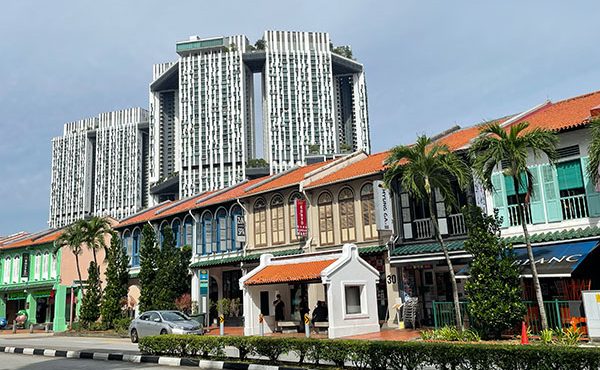

The morning was overcast, but the mood was bright as our group of visiting BC Planners emerged from the Metro station into El Poblenou, Catalan for “new village.” It was a special day. We had ventured beyond the typical tourist spots into the southeast of the Eixample to learn about Barcelona’s innovative Superilla—or “Superblock”—initiative.
This wasn’t just any tour. It was a walk-and-cycle Masterclass led by an all-star team: Jordi Honey-Roses, Research Professor at the Universitat Autònoma de Barcelona, Silvia Casorran Martos, Sustainable Mobility and Urban Transformation Advisor and Xavier Matilla, Chief Architect of Barcelona (2019-2023) and Professor at the Universitat Politècnica de Catalunya, who played a pivotal role in the creation and evolution of the Superillas. It truly was a special day.
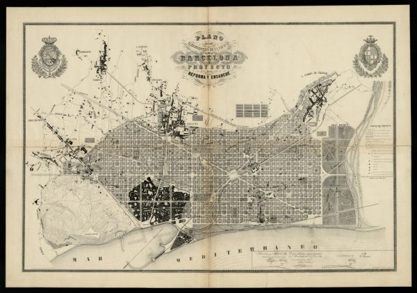
To understand the Superilla initiative, however, we first need to revisit the Eixample’s history and evolution. As covered in Part 2 of the Barcelona Chronicles, its revolutionary design was created by Ildefons Cerdà in 1859. It features a unique grid pattern of octagonal blocks, designed after extensive analysis of factors Cerdà believed would improve urban health and quality of life for its citizens.
In contrast to the narrow, winding streets of Barcelona’s Old City, the Eixample’s wide, straight avenues intersect at right angles. This grid was meant to ensure equal access for everyone and accommodate the rise of automobiles and public transit.
Cerdà’s chamfered corners—cutting the block edges into octagons—enhanced visibility, traffic flow, and safety, while increasing sunlight and air circulation. In fact, it is said that the grid’s structure and orientation were designed to take advantage of the main winds. Nothing was left to chance.
His vision aimed at better design and social equity, creating spaces that benefited all classes, not just the wealthy.
The “manzanas,” or blocks, were designed to include housing, commerce, and industry, fostering balanced, self-sustaining communities. Each block had a central open courtyard to provide residents with sunlight and fresh air, and building heights were controlled to maintain this. Buildings that were too tall would undermine the public good.
Analyzing the conditions of the working class, who could not afford to rent healthy homes, Cerdà developed strict housing criteria that addressed hygienic, social, economic, and political issues he deemed important. First, housing had to provide each person with sufficient sunlight and air. Second, each unit had to accommodate a typical family. Third, the creation of new housing had to be done without increasing rents. Finally, it needed to increase the number of house owners. To Cerdà, the overall result would be urban tranquility and public order.
Although Cerdà developed different housing types to address a variety of income levels, the dominant building type developed was a 3-4 storey building type with a commercial ground floor, where building owners lived on the second floor, used the base level for their businesses, and rented the floors above. Each building also had a central light well, separate from the block’s central courtyard, ensuring sunlight and air for all residents.
Cerdà’s original 3-4 story height limit changed over time. Buildings briefly reached 10 stories due to speculation, but this blocked residents’ access to sunlight and air. Casting shadows across public spaces for developers’ profits was rejected. As a result, most buildings today are 5-8 stories, creating a dense urban area with sunlit streets that everyone can enjoy and vibrant commerce.
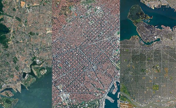
It’s worth emphasizing that the building types and their associated population density were—and continue to be—equally distributed across Barcelona. In contrast, North American planning practices historically regulated freestanding houses with low densities across the majority of the landscape, with higher densities focused in specific areas. This would have major consequences.
While urban squares were common at the time of Eixample’s design, public parks were not yet widespread. England’s Birkenhead Park, the first publicly funded civic park, had opened just over a decade earlier and had not fully influenced urban planning. So, although Cerdà reserved large areas for parks, they were never realized. Instead, the courtyards served as green spaces, similar to urban blocks in other European cities, particularly in the Netherlands.
The Eixample’s flexible block structure allowed for various building types across neighborhoods, but over time, the courtyards were absorbed into residential, commercial, and industrial uses. Although the grid and its blocks provided a wonderful degree of freedom to the city’s organization and transformation, the city lost its many “green” spaces. Modern efforts have attempted to restore these spaces focusing on ecological and resident-friendly design, but much has already been lost.
Two factors are key to understanding the Superilla initiative. First, as the city grew and modernized, Cerdà’s idealistic vision was compromised by the rise of car culture. The wide streets intended for pedestrians and greenery became overrun by vehicles. The open intersections, meant for traffic and social interaction, were converted into traffic-heavy junctions. The Eixample, like the rest of the city, struggled with congestion and pollution.
Second, the courtyards that once served as open spaces were increasingly developed. This left a severe shortage of public green spaces, with today’s average standing at just 2 square meters per inhabitant—despite the creation of Parc de la Ciutadella and Montjuic. As awareness of the importance of green space grew, Barcelona sought solutions. The Colau administration’s people-first approach provided the political will to experiment towards improving citizens’ daily lives.
The result? One of the most innovative urban experiments of the last decade: one that required a shift in how they thought about their city and its open spaces. In the words of Xavier Matilla, “Our streets had to become our parks.”
The Superilla was born….
***
- Part 1 – Introduction
- Part 2 – Cerdà and Colau: Two Key Figures
- Part 3 – The Barcelona Housing Policy 2015-2023 Overview
- Part 4 – Defining Affordable & Social Housing
- Part 5 – Supplying Affordable Housing
- Part 6 – The 30% Measure and Others
- Part 7 – Vancouver v. Barcelona – Foundations
- Part 8 – Barcelona v. Vancouver – Strategies
- Part 10 – The Superilla Pilot
- Part 11 – The Superilla…Evolved
- Part 12 – Vancouver v. Barcelona – Urban Design
- Part 13 – Reflections on Two Cities
**
Erick Villagomez is the Editor-in-Chief at Spacing Vancouver and teaches at UBC’s School of Community and Regional Planning. He is also the author of The Laws of Settlements: 54 Laws Underlying Settlements Across Scale and Culture.