
EDITOR’S NOTE: Based on feedback from an earlier post on urban density, Spacing Atlantic will feature one of the top five dense residential neighbourhoods in Atlantic Canada each week. Previous neighbourhoods: Uptown Saint John, New Brunswick and Downtown St. John’s, Newfoundland & Labrador.
![]()
So, why density? Residential density, the number of people living in a given area, is one of the most important characteristics of urban areas. High densities create vibrant streets, support main street commercial areas, and encourage walking, biking and transit use. But how dense should our neighbourhoods be? What types of buildings create high densities? What do high density neighbourhoods look like?
Hopefully this series encourages people to look around their neighbourhood and ask: how does density affect the quality of my neighbourhood?
Without further ado …
3 – North End, Halifax, Nova Scotia
Bordering both the Commons and the Citadel, the North End is one of Halifax’s oldest neighbourhoods. Many residential buildings date from the 1860s and 1870s, and a handful from the early 1800s. The older homes are mostly two storey rowhouses, or single family homes on very small lots. The older sections of the neighbourhood stand in contrast to newer development: high and low rise apartment buildings built since the 1960s. Newer developments disrupted the area’s traditional built form by creating large setbacks, lots of green space and big surface parking lots. An abundance of empty lots and big urban renewal projects didn’t help the neighbourhood either, although the North End is now reviving. New developments are under construction, new businesses are opening on Gottingen and Agricola Steets, and the neighbourhood is Halifax’s artistic and musical hub.
Population Density: 5,888 people/km2
Dwelling Density: 36 units/ hectare
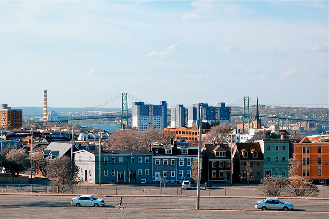
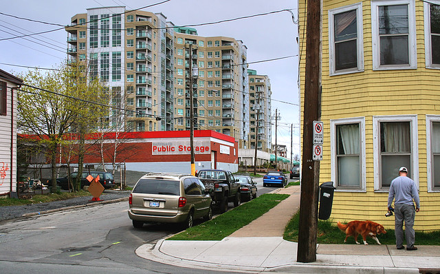
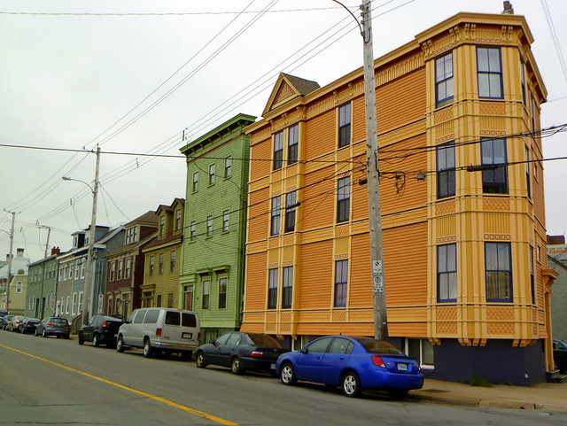

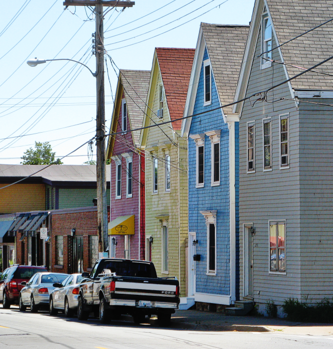
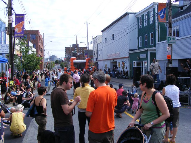


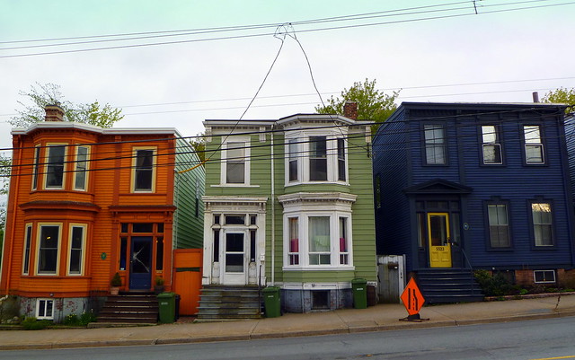

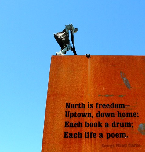
Photos by w-m-d, nsca, Bastard Fish, SANCHEZ C, dawnorama, EPDave, NOVA SCOTIA FLYING FISH, carolineruyle and BGrantPaul.


5 comments
This is such a fantastic series. Probably one of the most interesting things Spacing Atlantic has done in a long time.
For me, one of the best things about this series is the suspense of which neighbourhood will take the next spot. There’s a few Halifax neighbourhoods that I think could take the second or first place position:
-Spring Garden Road / Schmidtville: Lots of rowhouses and high-density condos and apartments.
-The Hydrostone: Dense rowhouses in a compact neighbourhood.
-South End: The entire South End isn’t particularly dense, however tonnes of multi-unit buildings, especially surrounding South Park Street and the universities, could compensate for the lower-density areas.
Technically, the Gus’ Pub photo is outside the boundaries of this ‘neighbourhood’, assuming the centre of roads constitute the boundary lines. Does that mean it’s in a different neighbourhood?
Technically, yes, it’s outside the boundaries, hence the picture was from that side of the road.
Terms like the ‘North End’, and ‘neighbourhood’ when used in a planning context differ from what a community would use themselves. The North End doesn’t start and stop there. Calling it Midtown would be alright but with no historical context.
One of the most interesting things about Halifax is how the North South and West Ends have moved over time. Sure the North End used to be the area north of the town palisade, but before North Street, and the South End used to be south of Blower and Salter to South Street, and the West was west of the Common.
Now no one would say the South End starts until probably somewhere around Morris, and the West End starts north of Quinpool.
The North End, depending on who you ask, starts at Cogswell, or North Street, or even Almon, and ends at North Street, or Almon, or Young, or Bedford basin.
For the sake of arguement I think it is safe to say that the area in this article is either the “Old North End” or north downtown… depending on your point of view!
More here http://halifaxpolitics.ca/hrm-map-project/
One of the interesting and frustrating things about Halifax, as Waye points out above, is the fluidity of the neighbourhoods. I think that only a few neighbourhoods on the peninsula have solid boundaries that everyone agrees on. Personally I have always referred to this area as “the North End”, which is clearly lacking precision.
As far as choosing the neighbourhoods, I’m limited by the data available from Statistics Canada. For the Census, the city is divided into small census tracts and even smaller dissemination areas. I can combine census tracts and dissemination areas to create the “neighbourhoods” but I can’t break apart those components to create absolutely any neighbourhood I choose. So North Stree is a boundary created by Stats Canada, which I chose to use because to me it is a good boundary for this neighbourhood.
A good example of the limitations of the Census data, for this project at least, is the area to the south west of this neighbourhood, just outside the boundary (Maitland, Portland, Brunswick. Cornwallis). It really should be in this neigbhourhood, but I can’t get any information on that area that doesn’t include a huge swath of the central business district, which clearly isn’t in the Old North End. But that’s the way Stats Can chops up the data – c’est la vie.
Thanks for all the comments!