
In the last few weeks, I’ve had reason to head out to Ottawa’s MacDonald-Cartier Airport, not once, not twice, but three times. And back.
Being a cheap SOB, I wondered if I could get there by bike, and thus save the O-Train/Route 97 fare. And since there were two of us, we might save two fares. And since we couldn’t return on the transfer, we might save four fares. Biking was becoming more and more attractive!
It seemed to me to be a long way away from my Preston Street abode. I could only picture in my mind the Bronson-Airport Parkway route, and that sure didn’t appeal to me as a fun cycle. So, I referred to my now-essential copy of the Cycling Map of Ottawa-Gatineau, which is sold at exactly the right price (it’s free) and shows all the bike routes, paths, lanes, and “suggested routes”, regardless of which government owns the facility.
The only other recommended route towards the airport was on the west side of the Rideau River, using Prince of Wales/Prescott Highway. Now that is a road I do know, and it also didn’t appeal to me. Then I figured I could parallel it by going south on Preston to the Arboretum Pathway, to Hartwell Lock (surely the most unfun bit of the route, and it’s deservedly in Alex deVries’ Top Ten of worst bike problems), to Hogs Back, and then out the Prince of Wales Highway.
But wait, what of going around Mooney’s Bay on the east side, which is all bike path right out to Walkley Road. From there, I would have to follow Riverside Drive. No bike lane or path is shown on the map. Drat! Try as I could, I couldn’t picture the road out there. It must be a decade or more since I went that way. Still, it looked like the most direct route on the map, and I did have confidence with the paths taking me all the way to Walkley Road.
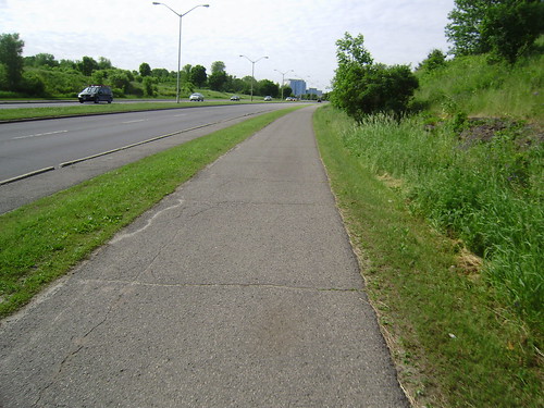
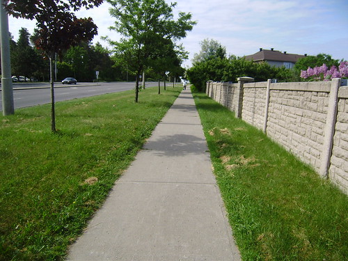
To my pleasant surprise, I cycled all the way to Hunt Club Road (which has a bike lane) without ever being on a road! Astonishingly, there is a nice wide asphalt path abutting the curb, in both directions, almost all the way from Walkley to Hunt Club. I passed numerous cyclists on it each day. They obviously knew this was a nifty route. Why isn’t it on the map?
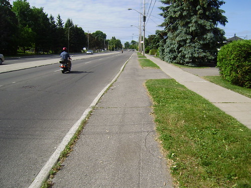
The answer is that it isn’t called a Separated Bike Lane, or SBL. It just looks like one. It functions like one. It attracts a continuous stream of users even at midday. But officially it is snow dump zone along the curb. Yup, that tricky bit of nomenclature seems to be the primary impediment to recognizing it as a bike route. Ottawa could be one of the few cities in the world with a direct bike connection to the airport, but instead our maps show a cyclist’s terra incognito.
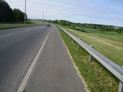
Much of the snow dump zone was paved sometime around 1980, when Riverside was widened to four lanes and it became more ‘expressway like’ just beyond Walkley. Thus it has frequent frost heave cracks. And at a very few intersections it is necessary to pay attention before crossing the turnoff roads – a few curb cuts and painted bike lanes at the intersections would be nice. And the section out by Cognos there are a few portions of concrete sidewalk only, although at mid-day cyclists on the walk greatly outnumbered pedestrians, perhaps 10:1. It isn’t exactly a walker’s paradise.
With all the costs of brou-ha-ha of building new paths, or building a new SBL downtown, of million-dollar projects that engender adversaries, here is a Separated Bike Lane in training, requiring minimal improvement to make it more useful and recognized. Why isn’t it on the city’s cycling routes?
In part, our engineers at City Hall are trained as systems people, who like to create lists of priority projects, and mark networks of paths, many of which are simply ordinary streets without any nod to cyclist convenience or safety. In contrast, cyclists like myself are opportunists. Let’s pick the low-hanging fruit. In this case, a snow-dump lane can be recycled as a SBL for about $20,000. Then put it on the list to have the asphalt repaved some day to make a better path. And then add the missing bits of asphalt along the way, so cyclists aren’t on concrete sidewalks. Strangely enough, there would be no need for property acquisition or fancy engineering to complete the Riverside line between Walkley and Hunt Club.
It’s as if it is too easy, too cheap, to appeal to the City of Ottawa. New York, and other cities now being celebrated for installing many kilometers of bike routes in short periods of time, are not constructing everything from scratch, or taking away parking lanes everywhere (just some places). The news stories focus on the grandest bits, like on-street in lower Manhattan. But these cities are getting instant results by converting facilities, by grabbing the low hanging fruit. Surely that should appeal to Mayor “Tightwad” Watson.
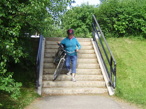
– Top photo by Richard Masoner; all other photos by the author.
8 comments
Wow. Is this ever a valuable column. Thanks. I am going to follow the route. This should be widely known, and your suggestions are good.
Wow…how often have I driven by there and not noticed. Wonderful! Now if I could just find a reason to bike to the airport. I just went there last week but I don’t think my mother-in-law would have appreciated it if I showed up with a tandem bike and suggested she hop on.
Very interesting column. I never would have guessed.
One question – what happens after Hunt Club? What do you do when you get on the airport property?
Ah, the last comment tumbles onto a little tidbit that wasn’t in the story. I was not going to the main pax terminal; I was going to Ottawa Flying Club, which is on the NW corner of the property, behind the T&T grocery store.
Presumably I could have gone to the main terminal via the hunt club bike lane and then somehow used uplands or something to get to the main terminal. I’ll have to look that part up!
Thanks for reading !
I have always been leery of the Hunt Club bike lanes. For some reason, cars travel on it at Queensway speeds. Pretty scary!
It would be great to have a bixi station there so I wouldn’t have to leave my bike at the airport for days or weeks!
My Mother-in-Law used to live at Hunt Club and Riverside (or thereabouts) so I have used this. I then emailed the City and recommended that they make this a bike lane at virtually no cost…
From Walkley to get to the main airport terminal I would use McCarthy Dr. and then Paul Anka or Cahill to Uplands. There are now paved shoulders on Uplands Dr. south of Hunt Club. If you cut through the old military base on Breadner from Uplands, or on Canadair (formerly Royal Route, and Bowesville before that) from Hunt Club, or through the NRC on Research Road from Uplands to Canadair, there is a neat little shortcut into the north end of the main terminal without having to travel all the way south to the end of the Airport Parkway. Coming back out from the terminal, make a left turn/U-turn at the first opportunity and then turn right at Air Canada Cargo to go back the way you came. The taxi drivers all know this route but will try to use Uplands instead of Canadair to Hunt Club for Nepean passengers in order to make more money from the longer routing.