

In my current Eye Weekly Psychogeography column I wrote about the psychological boundaries we — Torontonians — impose on ourselves, limiting what we experience of the city. The illustration above is by Eye’s Bradley Reinhardt, inspired by the 1976 New Yorker cover that pokes fun at how the rest of the country percieved a Manhattanites view of of the world.
There are unseen barriers all over Toronto. We hear about them sometimes and they informally tell us where we can and can’t go. If a collective map of how Torontonians view their city could be visualized, it would be divided and walled up like Berlin during the Cold War, with vast dark and unknown patches. We often lock ourselves into pockets of the city, shrinking the size of our metropolis.
Some of this is unintentional. We easily get into habits and routines; it helps us get things done. If our friends and favourite stores and, if we’re lucky, even our work are in the same area, we’ll naturally stay in that area. Living locally makes for smaller carbon footprints and more time for everything else. (Read the rest here)
While there is an argument to be made for staying close to home because it’s convienent and perhaps more importantly, we tend to like where we live (perhaps a micro-version of Richard Florida’s latest book Who’s your city might be Who’s your neighbourhood) I think there’s great value in knowning the areas outside of our well-worn paths, as I suggest in the column. We may not want to live there, but we are all part of “Toronto,” so to understand what that is (and, in effect, who “we” are), you’ve got to know it’s geography. This way, the city truly becomes “your city.”
I also briefly discuss the massive Toronto eruv, a physical perimeter set up by Jewish communities that allows for a relaxation of Sabbath rules, letting folks go about most of their business inside those boundaries. An eruv is a metaphorical wall with many doorways, sometimes using existing fences, hydro wires or natural barriers like a river, other times requiring the installation of a new wire or nylon fishing line along the top of poles. When I first heard about the eruv a few years ago I went looking for traces of it’s perimeter, but could not find any sign of it — but it’s there, and it’s checked each week to see if it’s Kosher (unbreached). I’d be interested to hear if any of our Orthodox readers (or otherwise) have any experience with the eruv. I was amazed at it’s size and, unlike other cites where eruv’s have been controversial, Toronto’s seems to pass under the civic radar (perhaps evidence of Toronto’s mythic easygoing nature for this sort of thing).
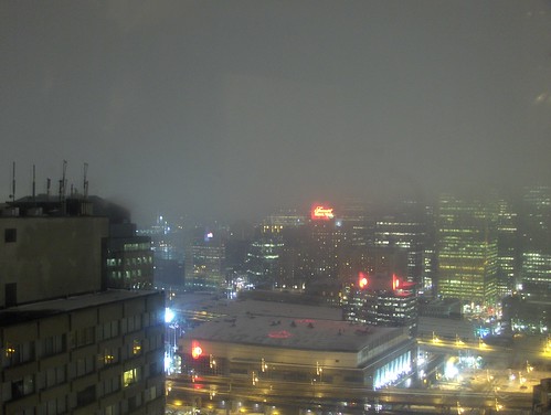
The other small piece was about the Air Canada Centre, and how Toronto’s urban fabric is meeting the arena with the construction of Maple Leaf Square on the west side. We take this sort of thing for granted in Toronto, but so many sports and event facilities in other cities are surrounded by parking lots. The ACC is beginning to remind me of both Maple Leaf Gardens’ urban location, and some of the UK Football stadiums I’ve seen, where large structures can fit right into the dense urban fabric. The western approach to the ACC is now quite impressive, a sort of massive glass portal to the arena.
25 comments
In your article you made a point about how you like travelling to destinations on opposite ends of town. I wanted to know, what is your most common form of transport for these trips?
I’m wondering, because the main options are transit and car, and I don’t find either to be enjoyable.
Transit in winter, bike/transit in summer.
You wrote:
“Opposite ends of the city” is a bit ambiguous but, for example, you can’t really bike from Etobicoke to Scarborough in between evening engagements.
It would take at least an hour, depending on the origin and destination. If you were to make the trip that quickly you wouldn’t be very presentable upon arrival.
Also if I had a long bus trip at either end of a cross town subway trip I would not enjoy the journey.
I’ve felt the same way. living in ‘Lake Ontario’, my wife and I can spend weeks without going to other parts of the city. Winter compounds this when we’re less likely to take adventurous rides on our bikes. Even walking on the north side of Bloor’s sidewalk feels like we’re teetering on a boundary (not to mention crossing south of the Gardiner!)
Hopefully your observation about the ACC holds true, and it becomes the psychological crack in the Gardiner, but it would be interesting to track how many people actually access the arena by using the Union Station PATH connector, as opposed to gaining access above ground. Far too many arenas are urban meccas that are seen, long before entered. (I still have horrific memories of Oakland’s stadium with acres of blacktop around it).
I’ve found streetcar tours to be the best way to get out of my ‘hood, and see what’s up on the east-west corridors. it’s the best way to break up old habits, especially if you’re taking the streetcar without a need to be somewhere specific.
Indeed, “opposite ends” for me doesn’t usually mean Malvern to Rexdale for social engagements. More accurately (with exceptions) “opposite ends of the old city of Toronto” — still large and fun to travel across.
Still, I’ve have had some very good evening events that required bike or transit trips that include (off top of my head — some are easy when on a Subway line):
Lesliville to The Junction (bike)
East York to Annex to Mimico (bike)
Harbourfront to Forest Hill (easy subway)
Oakwood & Rogers to Corktown (in a blizzard just before xmas, was pretty — subway, bus, foot)
Cabbagetown to The Pocket (Gerrard & Greenwoodish) to Niagara and King (biking around summer thunderstorms, with iPhone radar, to see when we should bike, and what route to take to avoid the storm clouds)
Other, farther afield distances are more one destination trips. Sometimes taking transit to “distant” ‘hoods in Etobicoke, Scarborough — and finding the local bar and sitting in it, seeing what’s up. Or going to some kind of an event there. These aren’t everyday travel, like I consider “the old city” but even a few trips here and there make these places that much more alive in our heads.
I am an Orthodox Jew and an avid reader of Spacing. With respect to the Toronto Ervu. See link below. Its quite informative, and will hopefull explain the Eruv concept to readers.
http://www.torontoeruv.org/eruv/
Jonathan — I link to the torontoeruv.org in the article in fact.
Do you use the Eruv personally? What do you do if it isn’t Kosher? Does it change your plans for the day — or how you go about the day?
That map is so true. I once spoke to a woman who told me that she hadn’t been north of Bloor in five years. And my sister once said that she would never live east of Yonge. (She changed her mind later when her economic circumstances changed.)
I live near Yonge & Eglinton. People act as if I live really far away. I have to remind them that it was actually part of the old city of Toronto, even before amalgamation.
Looking at the map – I can understand why you’ve got Queen west to Dufferin – due to the Gladstone Hotel, Trinity Bellwoods Park and the physical cutoff with the rail underpass – but I find that the atmosphere (especially north of Queen) changes west of Bathurst rather than Dufferin. The other boundaries seem apt though.
I loved your piece, Shawn — it’s so true, and it’s also interesting how my mental map has changed as I’ve lived in different places in the city (or people I know have). As a Beach resident, my mental map is sort of a blob off to the right plus a chunk in the middle bordered by lake-Bathurst-St. Clair-Don Valley. (Although the actual borders are a bit wavier than that.) It only goes up to St. Clair because I used to live and go to school near St. Clair and Spadina.
I took an urban geography course at McGill one year where one of our assignments was to take a map of Montreal and colour-code the places we went (a) every day, (b) every week, (c) every month or so, or (d) had ever been. It was astonishing to see how small my usual patch was!
During the summer months, I’m a constant adventurer and biking to different neighbourhoods of the city to find interesting nooks and crannies.
I think we stay in our respective areas for so long because of our transit suituation in this city. I’d much rather ride a leisure streetcar ride across the city as opposed to a loud, shaking bus. But hopefully, we’re working on that transit issue.
Regarding the ACC, it’s ashame it’s being over shadowed by glass towers. Not everything North of Gardiner/south of Front, should be covered by condos. Where are plans to build more public green parks and walkways to the lakefront? Our downtown core is beginning look like Vancouver(*without the beautiful mountains) I’m all for urbanizing around sporting arenas(opposed to lots), MLG is a good example, so i guess i have “same-ness” issues with these condos.
Interesting post – As a native Torontonian who’s done the Scarborough to Etobicoke Christmas Eve subway series, it’s interesting to compare the self-imposed Dufferin to the Don, south of Bloor world some people live in, with the vast ring of inner suburbs out to the 905 which attracts the majority of new immigrants to the City. There really seem to be two cities which only interact at Union Station, club town, the airport, and a few other places.
I think one of the main problems about boundaries is how we have been designing them for the past 50 years. After WWII, many Southern Ontario cities expanded their boundaries to encompass the majority of their urban area. Toronto on the other hand formed ‘The Municipality of Metropolitan Toronto’. Whether this area was expanded city limits divided up into separate areas (ie: New York) or just a new county is debatable (I’ve seen plenty of evidence to support both views), growing up in the 90s it seemed that ‘Metro’ was in fact ‘Toronto’.
Now that Toronto IS Metro Toronto, the thought is that all of Toronto is ‘urban’ and all of the surrounding regions are ‘suburban’. Or to be more specific, all of Toronto is ‘high density’ and all of the surrounding regions are ‘low density’. What people forget is that up until about 50 years ago, Toronto WAS part of York County! Steeles Ave. was no different than Victoria Park (pre-1999) when it came to boundaries. I wonder if there was this “urban vs suburban” tension between North York, Etobicoke, Scarborough, York, and East York before 1998 as there is today between the 416 and the 905?
I think the best way to look at the GTA is from Stats Canada’s map of the Toronto Census Metropolitan Area. It shows Oakville to Ajax to Keswick as part of Toronto’s urban area. It then shows smaller communities within the GTA (Peel, York, west Durham, Halton sans Burlington, south Simcoe) as secondary cores or urban fringe – or basically bedroom communities. While these boundaries are controversial (Keswick?!?!), it generally encompasses the urban/suburban area and is comparable to other cities in Canada, the US, and around the world.
We cannot use municipalities to define cities. In some cases it covers a small region of the urban area (technically speaking, the City of London is no larger than a square mile) and sometimes it covers too much area (it is over 50km from the city limits of Timmins to the urban area). We need to look at cities as organic urban areas, always changing and growing. Until we realize this, we will continue this 416 vs 905 pettiness when it comes to development and transportation issues.
http://geodepot.statcan.ca/Diss/Maps/ReferenceMaps/retrieve_cmaca.cfm?pdf_index=83
StatsCan’s Toronto CMA map
All the glass towers at the southern end of downtown are getting kind of dull. We are, however, lucky that there’s a mix of postmodern and modern in the architecture, so it’s not quite monotonous.
And speaking of crosstown rides, I had a bike ride on Queen from one end to the other last summer, and it was definitely a great ride.
I really enjoyed reading the article. I’ve always been kind of scared of the east end of Toronto (past Don Valley) primarily because I grew up in High Park and only knew the are between Yonge and Parklawn, Lake Ontario to St. Clair by the age of 12. But now that I’ve lived in Clarkson, Mississauga for 9 years, my mental map now further extended to Trafalgar (Oakville) to Parliament. Nonetheless, I like the idea of changing your daily routines. In my case, I get bored of just seeing Southdown/Lakeshore and the Yonge strip when I walk to school from Union. Change is nice.
Now that I see the map above, I understand why there were so many people suggesting that a DRL under Queen or King should be called the Lakeshore line despite being a kilometre or more from the lake shore!
(ducking)
Seriously though, that is a cool graphic.
I find your article interesting, since it bumps up against my own (theory) research. Something that I don’t think was addressed is the positive function of these ‘other’ spaces that aren’t visited. For example, when I lived in Victoria I was very close to the ocean but didn’t go down there everyday, sometimes a full week would go by without a trip down to the water. But, I always ‘felt’ its presence; I may not have always gone down there, but just knowing it was there was very comforting. So, maybe all those people who never go downtown still ‘need’ the downtown as a space in their minds.
Ben: you might find Louis Wirth’s (very old) article “Urbanism as a Way of Life” interesting. Rather than identify an ‘urban area’ by density, size, etc. Wirth defines the urban (as the title suggests) as a way of living.
Cheers
Do you use the Eruv personally? What do you do if it isn’t Kosher? Does it change your plans for the day  or how you go about the day?
I’m not Jonathan Rubin but, Shawn, an eruv is only relevant on Jewish holy days. For those to whom it is relevant on those days, people do not engage in work or driving or active use of electronics, etc. So plans for such days are pretty well established (prayer, social visits, trips to the park, study, etc.).
You should know that there are certain groups that do not hold by the eruv and therefore proceed as though it were not there. For those people, and for anyone else who normally respects it when it down, things are a bit tougher without an Eruv as they cannot push a stroller with a baby (or carry the baby); carry food to someone else’s house; carry a house key in an easy way; and other things.
When I lived in Montreal the eruv was a controversial issue in Outremont. However, I do not really understand what good arguments exist by which it would be controversial so, in Toronto, too, I cannot imagine why it would be a conversial thing. (I have not read it, but I am sure that this book discusses this further in the Toronto context.)
This is where I am glad that I was born, and raised in the suburbs(now living in Toronto). I find that suburbanites tend to appreciate areas outside their neighbourhoods more than urbanites. When I moved to Toronto, travelling to Scarborough on the bus was nothing to me, as I was already used to traveling long distances.
Just this past weekend, I went to the Blue Goose in Mimico to eat awesome chicken wings, drink beer, and soak up the friendly, not-in-any-way-hipster-or-cool vibe. It mystifies me when I tell friends about a great tavern and they say, “Why the hell did you go to Etobicoke?!?” Why, for the adventure, of course. I don’t consider 5 minutes on the Royal York bus very inconvenient at all. I grew up in a rural area where a half hour of walking would get you … still at least a half hour to the nearest store.
I think because we live such stressful, go-go-go times, people don’t take the time to enjoy a good walk or day-trip to a nearby neighbourhood.
Having said that, there’s much to be said about “smart-community design”(which the suburbs are not) Meaning, residential areas which are withon walking distance(5-10mins) to a “main” street with all ammenities you need so you don’t need to walk a “half-hour” to your nearest variety store.
The suburban sprawl that began in the 50’s here still sends chills up my spine. Such good land still being wasted.
I live in Oakville, I work in Mississauga (near the airport) and on Queen Street, my school was by Casa Loma, and my girlfriend is in Scarborough.
More than enough travel for me. Especially without a car.
I live in the “Mississauga” part of that mental map, actually in west Etobicoke. My whole mental map is grey immediately to the west, and all the colours extend east into Toronto even to the Beaches…