
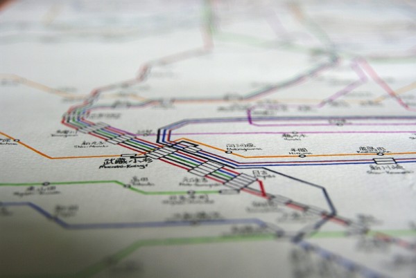

Artist Wyton Cho has hand drawn Japan’s rail system. The colourful lines intersect and meet at stations, and present an immediate sense of how vast the system is.
To feed more of your transit map fetish, check out this blog.
Urban Planet is a roundup of news and ideas from around the world dealing specifically with urban environments. We’ll be on the lookout for websites outside the country that approach themes related to urban experiences and issues. Do you have an Urban Planet worthy article you’d like to share? Send the link to urbanplanet@spacing.ca

One comment
Interesting work but I am puzzled by the term “Japan’rail system” as it would be impossible to have all the rail systems of Japan on one single map…it would be too big for a computer screen.
Do you mean the Tokyo rail system (2 different subway companies plus trains from JR and other railway companies) .
Here is a Tokyo rail transit map
http://www.tokyometro.jp/en/subwaymap/pdf/routemap_en.pdf
Note that this map only shows the central area i.e Tokyo itself only. You can see fine lines by the periphery that are commute train lines to farther suburbs
In the Osaka region, much smaller than Tokyo’s, they have 8 subway lines in Osaka plus 6 different private rail companies…
http://www.asisbiz.com/Japan/Osaka-Trains/images/0-Osaka-Railway-and-Subway-Map-Brochure-Nov-2009.jpg
Other big towns have something like that–but different.. imagine ALL that on a map.. .