

All of a sudden, two glimmering celestial objects have appeared in the night sky above that fantastical dreamscape we sometimes refer to as Greater Toronto’s transit strategy.
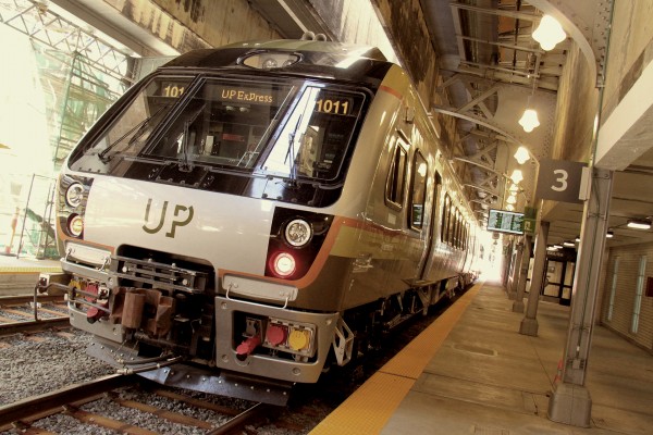
Way up in the north-west corner of the city, we have the Greater Toronto Airport Authority (GTAA) fearlessly shilling, with the help of top provincial Liberal strategists, for a “multi-modal transportation hub” on its lands. Said hub would connect the Pearson/Mississauga area with regional transit (MiWay, Smart Track, various bus services, UP Express, etc.) and points west, especially Waterloo Region.
Way down in the south-east corner, near the Portlands, we have City officials quietly testing out a variation on the standard Downtown Relief Line configuration that includes a slight southward jog to allow for a new subway stop on the former Lever Brothers/Unilever site, which could someday become a second major office cluster. It’s not difficult to imagine that such a station would itself become something of a multi-modal operation, given planned links to the re-built Gardiner (think buses), Smart Track/GO, and the Queen’s Quay East LRT.
So what to make of this looming hub-of-war?
Let’s start with the airport. In recent weeks, an intriguing data point from a November, 2015, Neptis study has found its way into the policy dialogue about land use and transportation planning in the region. According to her review of the ten-year-old Places to Grow Act, veteran planner Pamela Blais has identified three employment “megazones” in the GTA. These distant constellations are not merely ill served by transit; Blais says they scarcely figure in Metrolinx’s long-term plans to link the region’s 25 urban growth centres. Two extend along the Vaughan/Markham/Richmond Hill axis, and the third, which is about two-thirds the size of the entire City of Toronto, centres on Pearson.
With almost 300,000 jobs, the latter is Canada’s second largest employment cluster, trailing only downtown. According to the GTAA, other global airports have multi-modal transportation hubs that serve multiple purposes, including, as the report notes, connecting “employees to jobs at the airport and to those in the surrounding employment zone.” (We have to keep up with the Joneses.)
I’ve been hearing rumblings about the GTAA’s transit ambitions for almost half a year, and it’s still not at all clear to me which tail is wagging which dog. The GTAA, blessed with debenturing authority and land, has the tools to borrow mega-bucks, which will be paid down by jacking the already outrageous user fees paid by airport customers. (Pearson, in case you missed the memo, has the dubious distinction of levying North America’s steepest airport fees, and is not even modestly competitive in global rankings of airport efficiency/productivity, according to a 2014 study done at the University of British Columbia.)
But the GTAA’s now public campaign to plant its flag in the steaming mess that is our regional transit plan is clearly intended to apply pressure to Metrolinx and the provincial Liberals to spend money tying said multi-modal hub to the regional network, such as it is.
As with Smart Track and Metrolinx’s mobility hub strategy, we’ll have to close our eyes and make believe that such schemes will somehow ferry commuters out to the far-flung office parks and warehouses that sprawl across northern Mississauga, Malton and Brampton. The planners and lobbyists will talk earnestly about this newly-discovered megazone, and the “last-mile” question, as if knowing about the problem means we’ll now be able to figure out how to solve it.
I have every confidence that not a single person involved in the advocacy or planning debate over this hub will ever schlep by bus or foot through the sidewalk-less industrial wilderness north of Pearson, asking themselves whether the last-mile problem isn’t really a last-ten miles problem.
Meanwhile, down near the Portlands, the Lever Brothers/Unilever stop appears on two of the City’s six relief line configurations (seriously: B2 and D2), all of which are going through a suspect public consultation process that’s meant to convey the sensation of motion in the absence of same. The University of Toronto’s transportation modeling group has produced reams of ridership projection data for 2041, extrapolating volumes on the various lines, with or without Smart Track (which is also meant to have a station in the vicinity).
I’m not going to bother unpacking these numbers (read the report if you’re interested). While they’re developed by smart and well-intentioned forecasters, the projections serve to obscure the more qualitative and/or historical land use evaluations that planners once provided to policy-makers.
In this case, I find it difficult to understand why the City would even entertain configurations that don’t involve a Lever Brothers station. We should all remember why London’s Canary Wharf destroyed the first wave of builders (no Tube line connecting the downtown to Paul Reichmanns’ shiny towers). We understand that the City has a successful paradigm for creating underground connections between office towers and subway stations. And we should know that after the 1970s — when the province came up with the Toronto-centred plan that led to the creation of the GO commuter rail network and the subsequent development of the office towers at King and Bay — suburbanites were prepared to commute in large numbers to jobs in the core. Still do, in fact.
No compelling evidence – that magic word! – exists to support an airport multi-modal hub which purports to serve the super low-density employment zones nearby, or shuttle executives between Pearson and the office parks in Mississauga or Waterloo. The densities simply aren’t there, and won’t be for a century or more. In fact, we already know this story. As Cherise Burda, executive director of Ryerson’s City Building Institute pointed out at a recent Environmental Defense event (full disclosure: I was moderator), none of the subway stops planned for the Spadina extension up to Vaughan have densities sufficient to support bus service, let alone subways.
So what will we do? The wrong thing, I’m sure.
The provincial Liberals will become fatally distracted by the GTAA’s shiny bauble as they continue to plow billions into pie-in-the-sky suburban transit schemes. And once again, we’ll also have to tell ourselves there’s just no money left over for projects like Queen’s Quay East LRT or the Relief Line, even though we know with 100% certainty how to make those kinds of transit investments not just work but pay broad dividends – social, financial, environmental, cultural, urban.
So make the connection: the GTAA’s transportation hub scheme is a fiscal black hole which will end up soaking up the faint political energy around the relief line. And that’s just how our world turns.

11 comments
So, you think that York University has insufficient density to “support bus service”?
If that’s the case, how do you explain the ridership on the 196 bus?
http://ttc.ca/PDF/Transit_Planning/Ridership_and_service_stats_2014.pdf
Maybe you should take a tour of campus one day and reconsider your definition of “density.” If a campus with over 50,000 students doesn’t warrant bus service, then I don’t know what does.
@ PSA
I also find the claims made by Cherise Burda in her presentation to be *highly* suspect.
Her methodology, conclusions, assumptions all prompt questions about the credibility and reliability of the research.
I wouldn’t quote her, for this fact. Nevertheless, the article makes several interesting points!
to PSA and SB in above comments:
Here is a column by Ms. Burda that backs up her numbers. I think you’ll see her comments in a new light after reading it.
http://www.ryerson.ca/citybuilding/blog/up_express_and_down/?mc_cid=7f336ff24e&mc_eid=1f2744c20e
As for her point about the low density that almost warrants no bus service: I think if you took out York U on that line she would be 100% correct. Certainly the areas in the 905 fit the profile as she described them.
I read somewhere that 1,400 TTC buses enter the York U. campus each day. That doesn’t include other transit services like GO buses and Zum. If you’ve never been to the campus, it basically feels like a giant bus terminal.
Also, the Finch West station will be the terminus of the Finch West LRT (if it gets built).
Thanks Matt. Its an older blog of mine that presents the densities and the map for York-University ext: http://www.ryerson.ca/citybuilding/blog/making_scarborough_happen.html The data is from this report: http://www.mah.gov.on.ca/AssetFactory.aspx?did=10849
Blackett’s comment makes sense. Lorinc and Burda might have been wiser to ascribe low densities and low expected subway usage to the pork-barrel portion* north of York U. Even if the southern portion won’t match Bloor-Danforth or Yonge usage, the York U destination will surely mean more passengers for the under-used Spadina line. (I’d argue as well that the city will benefit if its second university becomes more accessible.)
And I wouldn’t give up on the UP line, though it’s certainly a Liberal boondoggle. If fares are kept low and it’s electrified (as transit proponents and neighbours long advocated) — which would allow more stops and more frequent service — it could contribute to the city’s transit network. (Is Burda’s stated UP capacity of 17,000 a day under current or electrified technology?) Plus, if we manage to close the Island airport, ridership to Pearson will rise.
* The York U to Vaughan subway extension was a sop to then Liberal finance minister Greg Sorbara, MPP for Vaughan riding. Sorbara and McGuinty must have envied Conservative Mel Lastman’s vanity subway east on Sheppard.
What happened to TTC Amphibious City plan? http://spacing.ca/toronto/2010/04/01/amphibious-city-launched/
@ Eric
The Spadina line is not underused, its just not as busy as the over-capacity Yonge line.
Trains are full each rush hour all the way from Downsview to Union. Frequency can be increased from current 4 minute or so headways during rush hour.
Hi again just a couple points of clarification:
-York-University line extension refers to the subway line currently being built. Its an extension of the University line into York Region, which might be why its called that.
-This extension has 7 stations, one of which is at York University (hence the name confusion)
-There is a map that shows the densities around these stations in an earlier blog of mine – scroll down about half way: http://www.ryerson.ca/citybuilding/blog/making_scarborough_happen.html
-I presented this map during the session John Lorinc referenced.
My apologies for not being more clear.
Yes, there is a lot of employment around the airport, and yes, transit usage and service are both terrible…. but most of that employment has nothing to do with the airport, and a hub by the airport terminals would be a in a terrible place to serve most it. The airport itself is a big barrier to connections between the employment and any hub, as is Hwy 427.
What the employment around the airport area needs is better service on existing local transit.
A few comments here:
1) The presentation by Ms. Burda clearly shows Finch West station as being above 50 PPJ/ha, and therefore can indeed support bus service, which is contrary to the “none” claimed by Mr. Lorinc in the article.
2) While people and jobs/ha (or residents + workers per hectare) is a good rough way to measure intensity of land use, it does leave out a lot of users and activity, the aggregate of which is more important for transit ridership. This isn’t always and obvious oversight at most locations, but as PSA points out above, seeing somewhere like York University having supposed “low density” raises some flags. Simply put, students don’t necessarily live or work anywhere near York University, yet thousands of them travel there every day, yet according to the conventional measure of density using PPJ/ha, these students don’t even exist (this may also be why St. George Station has a density lower than one might expect). Same would be true of shoppers at Yorkdale or any of the stations on the Danforth, park users at High Park or Christie, hospital-goers and public gallery attendees at Queen’s Park, theatre-goers and night-clubbers at St. Andrew, and many more people who might use a station. While I don’t have numbers to measure these other people who come and go, it is clear that YorkU Station and Pioneer Village Station would have a significantly larger number of people coming and going than the raw density suggests.
3) I’m curious where the breakdown of which densities correlate to which levels of transit infrastructure/service came from. It doesn’t seem to match the one in the “Transit-supportive guidelines” document from the Province (or indeed that linked in the comment from Ms. Burda above), though I realize the categories for anything like this is somewhat arbitrary (the BRT category is particularly inconsistent though). One item that I take some issue with is the assertion that a density less than 50 PPJ/ha merits no bus service at all. The documents I have read suggest that 50 PPJ/ha is a good guideline for basic transit service (20-30 minutes), however, there could be far less frequent bus service (e.g. one bus per hour, or only peak hour service). While this level of bus service might seem marginal for Torontonians, the reality is that in many towns, suburbs (and even some major cities!), one-hour bus service is the norm, and still provides invaluable access for some people. Please let me know of whereabouts of this literature that claims that <50 PPJ/ha can't support "any transit service" and I will be happy to consider it.
4) The York-University Subway Extension has 6 stations, not 7.
5) I do generally agree that three of the stations on the York-University Subway Extension have very little ridership potential based on the number of people coming or going at many of the stations. The two in Vaughan as well as Downsview Park Station do not seem to have a lot of ridership potential at all, aside from people transferring from buses or parking at massive park-and-ride lots, and both of these functions could be done just as easily at Pioneer Village Station.
6) The article is clearly taking a position that we should build transit for what is there now, rather than for some future redevelopment potential. I think I generally agree with the former (and therefore the article's main point), as redevelopment is a long process that may not ever happen due to possible risks. However, if we are to rebuild our low-density and poorly designed suburbs, serving the area with a higher-order transit line (BRT or LRT, not subway) on an already busy route (e.g. Finch West or Hurontario) isn't necessarily a waste of money.