

This week’s stroll column in Eye Weekly had me wandering around Canada’s most famous suburb, Don Mills. I remember while growing up Don Mills was the mailing address for many corporate head offices — testament to the industrial and commercial uses that were designed into this community — giving it the mystique of a place of great importance. Read the rest of the piece here.
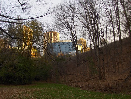
To stand on the corner of Don Mills Road and Lawrence Avenue, not far from the geographic centre of Toronto, is to go back to the future — back to a modern vision of the future now over 50 years old. The parkette here on the northeast corner is named after urban planner Macklin Hancock, a local hero.
When he was just 27 years old, he took leave from his graduate studies at Harvard to go to work for Toronto tycoon E.P. Taylor, designing Canada’s first planned suburb. Built between 1952 and 1965, Don Mills was, and is, a modern wonderland that garnered postwar headlines like “The suburb that is to become Canada’s most perfect city†and “Toronto’s bright satellite between the forks of the Don.â€
—
This place is mother to most Canadian suburbs that followed. As early as 1977, former mayor John Sewell wrote “it is difficult to overestimate the influence of Don Mills on urban development in Canada.†Walking around the neighbourhood, you begin to notice subtle but important differences with many of the suburbs that came after. In Don Mills, over 200 different home designs were built, far more than by contemporary suburban standards.
In Don Mills, the gentle roll of the Ontario countryside is still visible. Homes and apartment parking garages are built into hillsides. For Sewell, though, developments after Don Mills that followed similar principles were “the ghosts of Don Mills — but in a sad way.â€
If you travel up to the fringe of GTA sprawl ghost-hunting, anywhere north of Major MacKenzie drive, you will find landscapes that look like images from clear-cut Brazilian rainforests, where the land is shaved down to an empty, muddy, uniform plain, waiting for streets and houses. In Don Mills, efforts were made to preserve and work around mature trees and in some spots the narrow tentacles of ravines reach up between homes to the street.
There is much more to be said about Don Mills than I could fit into one article. I think for anybody who grew up in a Canadian postwar suburb, being in Don Mills gives a strange feeling of having been there before (like visiting Los Angeles for the first time — it all seems familiar). Yet when you understand that this was in fact was the first one followed by many derivatives (sort of like in music, where an innovator spawns a bunch of lesser imitators) Don Mills becomes much more than an average suburb, very much connected to the vague and fungible idea of a Canadian Identity.
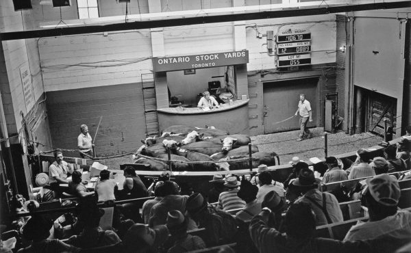
Furthermore, after a bunch of trips to the area, I’m inclined to think Don Mills is as close to the mythic ideal of suburban life as possible, the one so often strived for in developments that followed: that impossible synthesis of urban and rural life. As I point out in the article, many Don Mills residents are able to get along just fine without an automobile, contrary to the general sentiment of what suburban life requires. What has thrown a massive wrinkle into this community is the redevelopment of Don Mills Centre. This has been written about extensively elsewhere (and in a great article by Josh Hume on our Spacing Votes blog from last year’s municipal election). The importance of that mall to this community also undermines perceived notions about the “generic” nature of shopping centres and how people use them.
What has stayed largely intact in Don Mills is the proximity to nature. I’d encourge everybody to take a walk down Moccasin Trail in the southeast corner of the area to Moccasin Park. The picture above is the road that descends into the Don Valley and the park — and the photos that follow below are of a mid-November late afternoon walk I took from suburbia into what felt like one of Toronto’s deepest wildernesses. Yet it is all only a short walk from those mod bungalows filled with flat-panel TV screens and people who would argue passionately if one was to suggest they lived in nowheres-ville.
Moccasin Park — civilization is always close by.
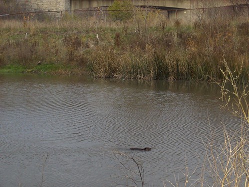
The friendly beaver of Don Mills pond, swimming along next to the DVP. If your camera’s flash accidentally goes off he will become less friendly and dive underwater for a while.
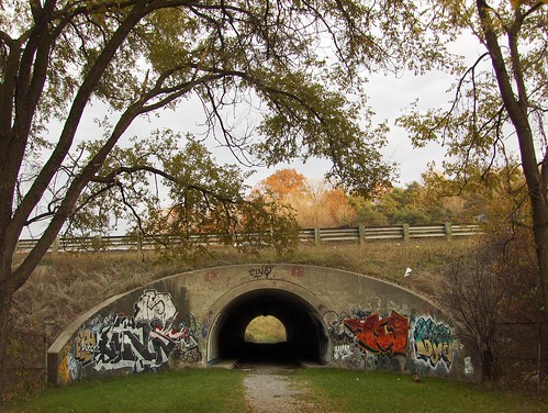
The long tunnel under the DVP. Do not fear the sounds of pot smoking teenagers at the other end — they’ll be more paranoid and shy than you are when you emerge on the other side.
The other side of the tunnel. Teenagers have dispersed. Follow the path that veers left (or right, in this photo) to get to…
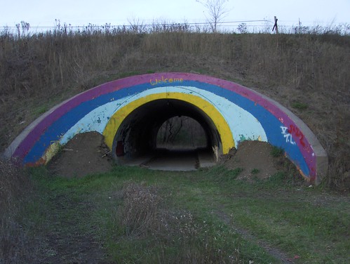
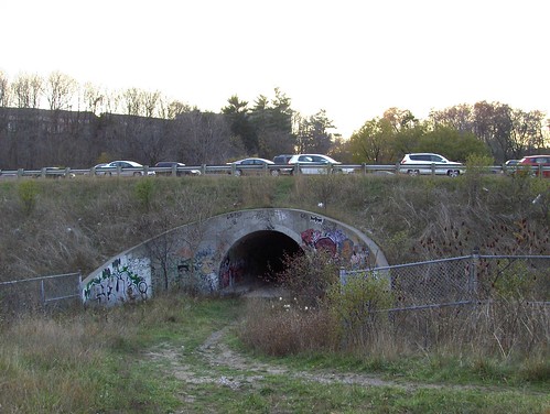
…the famous rainbow tunnel hundreds of thousands of commuters see from their cars on the DVP.
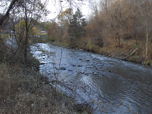
Beyond the rainbow you are transported to the deepest wilderness of the Charles Sauriol Conservation Area. Continue along the paths that hug the banks of the Don. If you can make your way across the shallow river by hopping from stone to stone or by using fashionable wellies you will find the rusting ruins of the old Don Valley Ski Club ski lift (they can also be accessed from Railside Road if you can figure out a way to squeeze between the light industrial buildings or from the “proper” entrance on Lawrence Avenue).
The area was so calm and the water so tranquil, I started to worry about what was creeping up on me. I found more teens, this time a guy and girl, either digging up or burying something. They didn’t seem too concerned I was passing through.

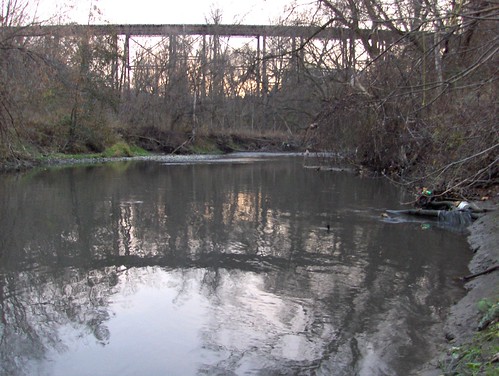
Toronto has some great railway bridges, but the CP line over the Don here must be the most spectacular — almost as monumental as the Prince Edward Viaduct.
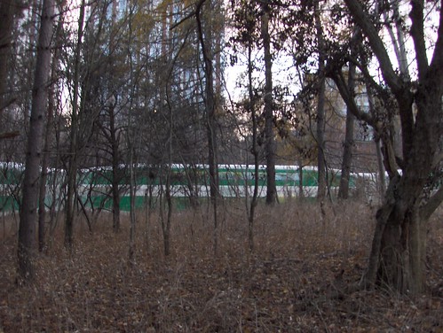
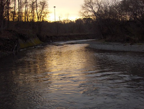
Beyond the bridge, more quiet until the Go Train thunders through nearby. Remote feeling, but human activity is never far away. This is as far as I got as night was falling. Next time, even deeper.

10 comments
The Charles Sauriol Conservation Reserve is one of my favourite places to explore. The city just melts away when you’re on the trails.
That’s a nice area…but it was so much better…
A stream used to flow down the gully where the road now sits….
There was no parking at the bottom (which no one ever uses anyway)…
…that was only 20 years ago….
When Don Mills was first built…there was not yet a Don Valley Parkway (though it was planned)…
Nor a Donalda Golf Course (the Sales pavillion site of the the original Don Mills community)
Imagine…that trail…as it was then…
James> That trail almost seems like it’s too narrow for cars — but while I was walking down a guy came down slowly with his car. It seemed odd at first then I realized he was walking his dog, but he was in the car, and the dog walked next to him. I took this photo of it as he passed, but my thumb got in the way and it’s blurry.
The Trail is 4M Wide I think, A standard trail in Toronto Parks is 3M, new trails are being built to 4M specifically to accomodate police/ambulance as well as parks trucks.
A standard Toronto road lane is 3.3M (4M – curb lane) on a major road.
But it looks tighter because your use to seeing the other lanes of traffic in the right of way (most roads have 2-way traffic, and most 1-way streets were built for minimum 2-way width (and now have parking). So you get a deceptively larger looking road of 6.6 – 8.0 M for small roads….and much bigger on major T.O. Streets.
***
That fellow aside, I have rarely seen cars go down there.
Its usually gated in the winter.
In the summer I have yet to see a car park at the bottom.
(many people don’t know about that park, of course)
Others would be un-nerved because there is no passing room, so you would have to back-up all the way up or down to let someone pass you mid-hill)
I drove down there last summer–there may, or may not, have been another car there, I don’t remember. For that matter, I think I was down there by car almost a clear quarter century ago, so it was already “accessible” then.
I wouldn’t say that nobody ever uses it; more that it’s a best-kept secret that only *seems* that way–perfect for the submarine-race crowd, in other words. (Or conversely, for cops who want to break up the covert submarine-race action.)
my late aunt annie, nee moore, lived and died in don mills, when she visited us, often i might add, she allways talkede of her love of canada,her married name i believe was GRIFFITHS, she had a sister in america and one in africa,her brother W.J.MOORE lived in hampton, middlesex, london. her other two brothers joint the canadian forces and were killed in the first war, i believe in france. ihave been to your beautiful country and can understand why she loved it so much.
The Don used to run through the park & in the mid 60’s there was a tire swing & we could swim there. There were alwasy a bunch of “hippies” hanging aroud & my parents would warn me about going down there alone. All this was before the parkway of course. It was like going for a visit to the country for a swim in the creek – but was within walking distance of home.
The local school Greenland PS (pathinis behind the school) also had a a log cabin built by the students (all grades contributed in some way). it burned down at some point but I’m not sure when.
Would anyone happen to know the history behind the small white boarded up house when entering Charles Sauriol Park off of Lawrence? It’s a creepy little place and I haven’t really heard any credible historical information. Taking a look inside made it clear that there was something interesting happening there a few points throughout its existence.
i found out about that small white house here`s a link to read up on it it. its quite interesting
http://www.heritagetoronto.org/building-storeys-photo-exhibit-torontos-aging-spaces
scroll down and you should be able to recognize the house
nice. i walk this part often and sit by the river to talk to mother nature. she always talks back. now the gov is boarding up to build a trail. always the war pon nature.