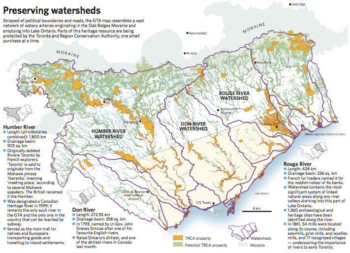
Along with its article today about the TRCA‘s work preserving watersheds in the GTA (Clock is ticking for conservation dream), The Star included a beautiful map of the major watersheds flowing south from the Oak Ridges Moraine through Toronto (click on the image for a larger version). The article describes some of the difficulties the TRCA is having in expanding its protection in the upper reaches of many of the watersheds.
The Star poetically continues:
“Stripped of political boundaries and roads, the GTA map resembles a vast network of watery arteries originating in the Oak Ridges Moraine and emptying into Lake Ontario.”
The original PDF (watch out, 9MB) can be downloaded from their site.
Crossposted to bricoleurbanism.org as part V of a series – to view the four earlier parts follow these links:
• Mapping our urbanism part IV – language
• Mapping our urbanism part III – water mains
• Mapping our urbanism part II – extents
• Mapping our urbanism part I – snow ploughing