


This is part of a series of posts by students in OCAD’s Cities for People summer workshop (click the link to read a bit about what the class is about). This post was researched and written by Ilona Valcov, Andrey Chernykh and Michael Sudiacal. The psychogeographic map of the Port Lands above shows the static elements of the area (see large version here) while the map below shows the layers of activity (see large version here).
![]()

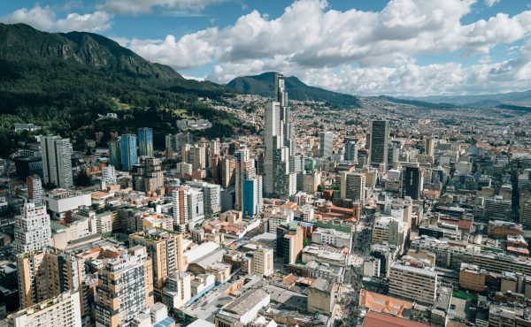
The Port Lands neighbourhood has existed for the last 20+ years as an unprecedented opportunity not so far from downtown Toronto and remains an extremely underutilized and unwelcoming landscape of former heavy industry and stands at the precipice of transformation. The Port Lands are human-made and were created by decades of infilling of what was once the largest wetland on the Great Lakes. Beginning in the 1880s, the area was gradually filled in to make more land available for industry and shipping. Since it was created, most of the Port Lands have been utilized for industrial uses and the majority of the area currently lacks servicing for other uses. From observations it became obvious that the neighbourhood still maintains an active light industry with storage facilities and warehouses for light manufacturing. The roads feature more pedestrians, cyclists and joggers on the weekend and more trucks and cars during weekdays.

Toronto harbour in the early 1800s, when the Port Lands/Ashbridges Bay area was still attached to Toronto Island.
Port Lands mix of land uses can be categorized into three sections: industrial (paper manufacturing, material recovery facilities, construction supplies and film studios), municipal services (work yards, and TTC bus garage and Toronto Hydro) and recreational (parklands, restaurant/nightclubs).
The Road and Rail Plan released by the Toronto Port Authority in 1990 indicates that at the time, the intention was to intensify employments in the Port Industrial Area (Port Lands today) by using vacant or underutilized land which would increase the demand for transportation. The THC was therefore commissioned to study and review the road and rail infrastructure in the area.
There was a range of industrial activity in the area which provided about 5000 jobs, including manufacturing of plastic sheets, poultry processing, piping contractors, transfer and recycling of waste, wholesale beer distribution centre, real estate managements, flower and tree planting, and commercial artists. Many of these no longer exist, have relocated or have transferred the labour to a different country.
Defining Features
The characteristics present in the Port Lands are the arteries, pathways and partly-functional industrial detritus. They are largely paved roads which were used heavily by the industry for the most of 20th century until the industry moved out. Now these roads have found new users along with cars which include cyclists, pedestrians, joggers, and bikers. The simple network of key roads (Commissioners, Villiers, Unwin, Leslie and Cherry) provides a clear way to get a feel of the neighbourhood and its key features. The greening of the southern portion of the Port Lands provided a park setting for pedestrians to meander and explore. Cherry Beach became a popular destination for citizens to relax and enjoy the beauty of the lake. However, the major roads of Port Lands that lead to the edge are still welcoming primarily to cars and trucks.

Commissioners St. showcases a lack of a sidewalk
Key Roads and Pathways
Commissioners Street: intersects Cherry Street and was named after first 5 gentlemen appointed as (pre-Port Authority) Toronto Harbour Commissioners in 1911. The street is wide and in fairly good condition and framed by active industrial sites and features a large number of cars and trucks during the weekday. The recent addition of proper traffic lights and pedestrian crossings made the street somewhat more accessible, however most of the street lacks a sidewalk.

Cherry Street features an active cycling culture.
Cherry Street: Provides a connection to the city and was also used for industrial transportation in the past. Currently utilized as a link to Cherry Beach and has a good balance between car and pedestrian activity. Features a Bascule Trunnion Bridge built in 1930. It has been serving as a gateway for the ships to pass into the ship channel.

Ditch along Unwin filled with garbage.
Unwin Avenue: named after a pioneer provincial land surveyor, Charles Unwin. In late 1800s there was a community of fishermen who took up residence in a collection of shanties fabricated from scrap pieces washed ashore from the lake. Toronto Harbour Commission forced them to move to make way for the industry to move in. It is characterized by derelict buildings, garbage and chainlink fences.

Bike path along Cherry Beach.
Bike Path along the south: The bike path is a dynamic addition to the southern portion of Port Lands and features a pedestrian bridge with one lane traffic which is owned by the Toronto Port Authority. The bridge is a temporary solution pending further development of the area.

The Railway system: To serve the industries in the Port, the Toronto Harbour Commission operated an extensive railway system. The two railways serving the port were Canadian National (CN) and Canadian Pacific (CP) which contributed financially to the operating costs of the THC. In order to better serve the industries in the area, the railway winds through the port’s streets, leading to different sections. This is illustrated in terracotta coloured lines on our psychogeographic map. The rail system was considered to be the future of the Port Lands, and therefore any changes to the Port Lands area would have had to be compatible with the rail system.
Today, the railway is no longer used, possibly because of its numerous awkward curves which made it only possible for the shortest rail cars to pass. During the times of heavy industry coal was the most traded commodity and small rail cars were used to move the shipments between buildings. However, the railroad remains in place today with portions of it covered by pavement, dirt and grass patches giving the Port Lands an edgy character and preserving a valuable piece of the area’s history.

Built Structures
Most of the Port Lands are zoned out to private owners and the buildings largely consist of warehouses and storage containers. The buildings almost blend together into a homogeneous manufacturing landscape. However certain buildings stand out as fine architectural examples of a bygone era that also await inevitable transformation.
The Richard L Hearn Generating Station is located at 44 Unwin Avenue. This Generating Station, together with the Ashbridges Bay sewage sludge incinerator stack and the Commissioners Street waste incinerator stack, stand as towering landmarks of the industrial era in the Port Lands area. The station was officially opened on October 26, 1951 and two years later four units were operational within the facility. There were already talks with the Hydro officials in the middle of the building construction about phasing out the plant with Nuclear Power and closing it. Nonetheless, it still operated all the way trough 1983.
The station contributed to Toronto’s smog problem. The eight chimneys were demolished and electrostatic precipitators were added for the 200 MW units when the large smokestack was built. The new single tall smokestack was constructed in response to pressure to reduce smog in Toronto by the emerging environmental movement in the late 1960s. It stands 215 meters (705 ft) tall and was one tallest in the world, costing $9 million (CDN) when it was completed in 1971. It was one of the tallest structures in Toronto until the CN Tower was finished in 1976. Air pollution in Toronto from the station was greatly reduced and the area around the plant became known as a good fishing and recreation spot.
Conversion to natural gas reduced pollution but increased operating costs and the plant’s efficiency was much lower than today’s combined cycle and co-generation plants. The last three 200 MW units at the plant resumed burning coal along with natural gas but they were phased out of operation, due to concerns about increased air pollution in Toronto and an abundant energy supply in the province. Some of the generators were operated as synchronous condensers to improve power quality in Toronto and the electrical control room and switchyard continued to operate until 1995, with a staff of about 10. Currently it stands abandoned and there are still no definite plans what will become of the R.L. Hearn site.

Area of the Don Mouth renaturalization
Future Developments
Future looks bright for Port Lands and there is a lot of hope to make it one of the finest neighbourhoods in Toronto. Revitalization and naturalization of the Don river mouth is one of the most prioritized plans for Port Lands. The mouth of the Don suffers significantly from pollution, sediment deposition, disturbances, impaired fish and wildlife habitat, and limited recreational opportunities. The problems that pertain to the Don River mouth are common throughout the neighbourhood. The recent proposal by Waterfront Toronto to naturalize the river’s mouth creates a hopeful opportunity to bring back the beauty and vitality of wetland habitat.

Site plan for future uses of Port Lands
The large number of brownfield sites present in the area is evidence of land that’s been abandoned and contains contaminated soil. As part of the Waterfront Toronto revitalization the city will set up a soil recycling facility to get rid of the toxins in the land in order to establish a healthier more approachable neighbourhood. It is a better approach than “digging and dumping” which means moving the contaminated soil into landfills in other communities. Only clean soil can be used for any new developments and creates vast potentials for fresh landscaping of the site.
The Port Lands Implementation Strategy report released on April 29th of 2006 is a long term vision for the Port Lands where industrial and employment uses and the new neighbourhood will coexist, giving the area the possibility to host residents and workers. Currently, there are recommendations to plan for an elementary and high school as well as a community recreation centre in close proximity of each other to create the opportunity for shared spaces. The plan above illustrates the Port Lands Implementation Strategy’s long term vision for communal infrastructure.

New film studio in Port Lands
As the industry is dying out the neighbourhood starts featuring more pedestrians and cyclists, the walkability and accessibility becomes important and the established roads are no longer the only areas for walking and exploring the neighbourhood. The southern part of Port Lands features a green space with various densities of greenery and creates a pleasurable walking area which has already been lined with man-made paths through the bushes and trees. The recent decisions by the city are fantastic initiatives to expand the walkability options in the neighbourhood. Unwin Avenue becomes a threshold that separates the north part of Port Lands and the Southern recreational part and in turn presents an opportunity for creative transformation.

Cherry Beach
The south zone of the Port Lands is expected to be transformed into Lake Ontario Park. The sections will be redeveloped by James Corner of Field Operations and is currently in its planning stage. The common characteristic of the area is that it has many elements which do not seem to coincide with each other, therefore an overall unifying strategy would be most appropriate. Our design intervention therefore could possibly be a part of the future Lake Ontario Park.

Rendering of Lake Ontario Park by Field Operations
For additional Port Land photos, click here.

5 comments
The city may desire that the Port lands have a healthy mixed use development but to quote an OMD decision……..
. “Desire”,
however, must not be confused with “specific, effective and timely action” to maintain and promote employment generating uses. Planning is not simply about a community vision of what would be nice, nor is it simply an ambition identified by a particular property owner. To be effective, planning needs to weave together both vision and ambition, and leaven them both with a hard dose of what is realistically achievable. Ample time has passed for this area to develop as a centre or office node, if it was going to do that based simply on the designations in planning documents. And ample time has also passed for the appropriate authorities to have taken the specific steps that might have moved the vision closer to reality
The city lost in the case I quoted from above primarily because of high commercial taxes. They wanted to maintain an area designated for office use, but the could not (and did not) contest … New investment in office space has tended to target areas, often outside
the City, where the tax regimes are significantly less onerous. It is not realistic to expect this area to become nothing more than a residential neighborhood.
The railway is not completely abandoned yet; it still serves the sewage plant (hence all the Lakeshore Blvd crossings).
However, I notice they have been steadily reducing Keating Yard (the railway storage tracks immediately east of The Don Roadway; and south of the Unilever Plant.
Given the recent shutdown of the above-mentioned plant, there isn’t much (except the railway corridor) standing in the way of extending Broadview south to Lakeshore; which would drastically change the complexion (and accessibility) of this area.
***
The plan to naturalize the mouth of the River is the other big thing to watch, its a great plan on paper, but one that will literally take years to deliver, even if they put a shovel in the ground next year.
But that will be so transformative, both visually but also topographically, that it will both (while we’re waiting) delay much of the portlands revitalization, but later become its catalyst.
The Shipping Channel should be lined with attractive architecture fronting the actual channel, along with a pedestrian promenade. The architecture there should embrace that unique landmark.
The arena complex proposal has nothing but a parking lot by the channel (one which would probably be awkward to redevelop even after several decades), so it’s clear that the city is contemplating ruining another opportunity for greatness. However, we can and should change that.
You mentioned the Hearn plant, but what about the Portland’s Energy Centre next door that is new and in use?
Well, the Waterfront Toronto plan isn’t quite good enough. The entire docklands is landfill so unearthing old garbage and remediating oil soaked “brown” lands is a daunting task. I have a better plan for the area than the one existing. Lets see if it can be up sold to the movers and shakers before it’s too late.
fyi, I started this whole waterfront thing with a letter to Mel Lastman dated July 26 1999 about how everyone runs up north because TO’s water front is so damn polluted, and the Don river diversion plan can be vastly improved upon too.