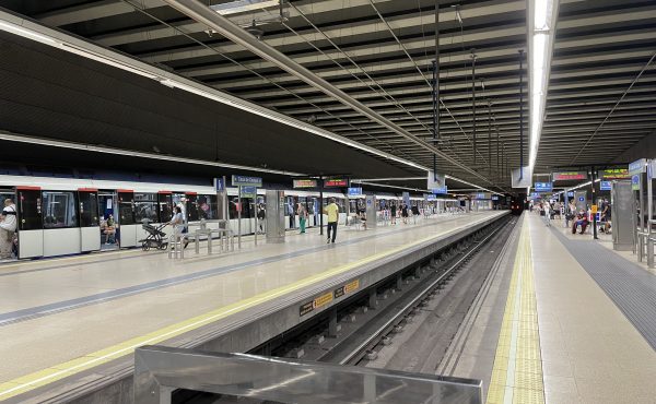
An elegant little planning book is doing the rounds these days – an intriguing 123-page volume entitled “Huburbs: Transit and Urbanism in the Greater Toronto Hamilton Area,” which distills the proceedings of an April, 2011, symposium hosted by U of T’s John H. Daniels Faculty of Architecture and Landscape Design.
The book’s narrow frame belies the enormity of the problem it seeks to confront: how to transform the GTAH’s far-flung collection of suburban GO Train stations from parking lots (or, in the case of the handful inside the City of Toronto proper, culverts, underpasses and other forlorn corners) into bone fide places.
As the title suggests, the goal is about creating a new kind of urban form, although co-editor James Khamsi — a Daniels adjunct and founder of FIRM ad — works a little too hard in his introduction to distinguish “huburbs” from the “transit-oriented design” mantra of Peter Calthorpe and his merry band of New Urbanists.
Daniels dean Richard Sommer, for his part, describes them more crisply as “places of connectivity where different modes of transportation — from walking to high speed rail — come together” and become “major drivers of intensification and development.” Sommer also cites an earlier handle for this concept — “mobility hub,” a singularly unsexy label that brings to mind images of rehab facilities.
The school’s laudable interest in huburbia becomes clearer when you realize that Metrolinx was a key sponsor of the symposium and a co-publisher of the book. Indeed, the agency is focusing intently on the GTAH’s 51 mobility hubs, although this part of its work doesn’t get a lot of airplay. In effect, Metrolinx is tiptoeing, ever so gingerly, into the regional land-use planning game because, well, no one else is thinking these thoughts except a handful of faceless policy gnomes at Queen’s Park.
The reasons, at a very high level, aren’t hard to fathom: Metrolinx has begun to scope out the cost and logistics of all-day/two way service and so-called “express trains” that come every ten to fifteen minutes. Therefore, its planners want to ensure that something other than a sea of parked cars await travelers who may be tempted to use the network for purposes other than peak period commuting. Remember the age-old chestnut at the heart of all transportation economics: make sure you’re carrying a payload in both directions.
But the business of re-fashioning those parking lots is enormously complicated. In theory, many GO stops are surrounded by enough land that they could become satellite centres with a compact mix of residential, retail, commercial and institutional development. Oh yes, and parking garages, discretely tucked behind or under the other buildings.
This isn’t so much about the field of dreams scenario as it is about that other great transit cliché – you know, the one involving chickens and eggs. How do you direct development to the vicinity of these train stations? What happens to the over-flowing parking lots? Does this happen in advance of all-day/two-way, or do you have to create the reverse service to generate the traffic, yada yada,yada.
This little book is chock-a-block with architecture and planning students writing enthusiastically about “staging” strategies and the magic of networks at various hubs, but the challenges, as Metrolinx’s brain trust knows, are daunting.
The agency began producing planning and policy literature on mobility hubs about three years ago. Much more recently, it has put out some more focused and specific thinking about a handful of locations, such as midtown Oakville, where the municipality and Metrolinx are engaged in a planning study [ PDF ] on shifting development towards the train station. (Public consultations took place earlier this spring.)
As the study notes, almost three-quarters of the GO commuters arrive by car, and the station is surrounded by more than 3,000 parking spaces. The report talks about constructing a new multi-level parking garage with extra spaces, adding pedestrian connections to downtown, integrating the proposed Halton BRT line with the station, and making judicious use of development carrots (e.g., building a new GO back-office operation near in the station precinct to get the ball rolling).
Add it all up, and the staging laid out in the Oakville plan could easily take a generation to finish. Mobility hubs, as it turns out, have a long gestation period.
Fair enough. But with all such schemes, the question that keeps Metrolinx planners up at night is the same one that prevents them from contemplating more stops inside the City of Toronto: how much inconvenience will 905 commuters countenance before they decide that they may as well as drive to work?
I suppose it’s worth noting that such problems are hardly unique to Greater Toronto, notwithstanding all the bold academic rhetoric about huburbanism or whatever this line of inquiry is to be labeled.
Greater Vancouver, for one, has been pounding away at this very same issue for well over a decade. There, the planners focus on the Skytrain stations. And, it must be said, the regional transportation agency, Translink, isn’t on its own. Metro Vancouver (formerly known as the Greater Vancouver Regional District) has been working on the planning piece for over a decade. This federation of Lower Mainland municipalities even has a by-law for their own version of mobility hub development.
It’s called a regional plan.


5 comments
Not a fair comparator but for the ultimate multimodal/-use hub, check out the plans for Le Bourget just outside Paris. If Godard is still alive in 2020, he should definitely shoot Alphaville Part Deux there.
How does one lay hands on a copy of this book?
Where can I get this?
ABOUT GETTING A COPY:
You can contact the U of T school of architecture: http://www.daniels.utoronto.ca/
Also, we’ve heard it will be available in limited quantity on Amazon.com.
http://www.amazon.ca/Huburbs-Transit-Urbanism-Greater-Hamilton/dp/0772788294/ref=sr_1_1?ie=UTF8&qid=1341322135&sr=8-1