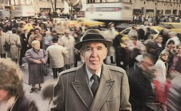
I wrote this piece last year, long before Covid 19 kept almost everyone at home and before riding transit was something to be avoided for all but the most necessary journeys. While most of us are staying put in our houses, here’s an article that discusses the ordinary spaces that many of us took for granted on our daily commutes. Today, even if it’s not possible to travel far, I outline some key ways of looking at the spaces around you, whether that be your street, neighbourhood or the view from your apartment. I hope this article inspires you to look at the spaces you travel through (both near and far) with a new critical eye and curiosity. (Photos from May, 2019)
In urban debates, we tend to think of trains in terms of their politics or planning, rather than what we can learn about cities by riding them. While it’s easy to use a train journey to get caught up on sleep, emails or reading, taking the time to look out the window at the changing landscapes that you pass by is an insightful way to better understand our cities and regions.
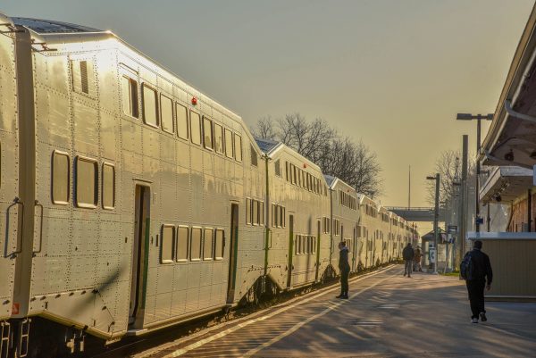
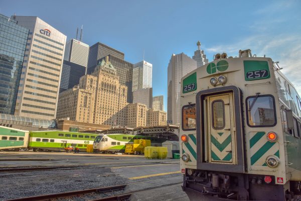
One train journey I know well is GO Transit’s Kitchener line. I decided to ride the train from end to end, just for the purpose of seeing what can be observed looking out the window. I took my camera with me, got a seat on the top deck and searched for two types of change: varying landscapes as you travel along the 100km route, and evidence of change taking place within specific sites, neighbourhoods and communities. Join me as we travel along Canada’s Innovation Corridor, from one of the country’s fastest growing regions into the heart of its largest city.
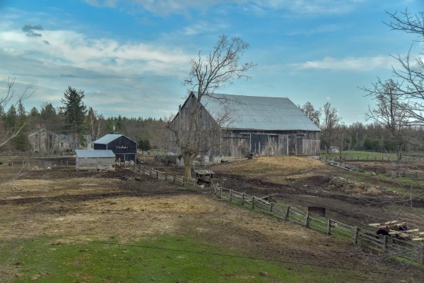
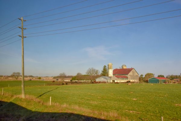
Leaving downtown Kitchener, the largest city in Waterloo Region, in the early morning sun, the train travels along an industrial corridor. While there is much hype about the tech industry in town, the rail corridor out of town is still dominated by manufacturing, warehousing and logistics. The glimpse of this side of the region is brief; after a few minutes we are into open countryside. The first half of the journey is largely rural; apart from a brief stop in Guelph, we could be one hundred kilometres further west. Farms, forests, fields and gently rolling hills characterize the first hour (of the two hour journey), with regular train whistles as we speed across backcountry farm roads. Near Acton, we enter into the Green Belt, which means these landscapes are protected from development and sprawl.
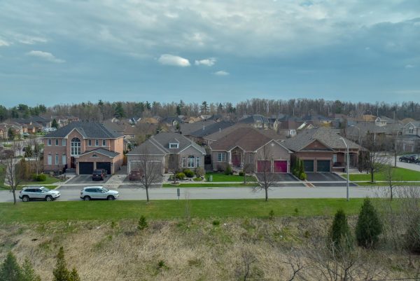
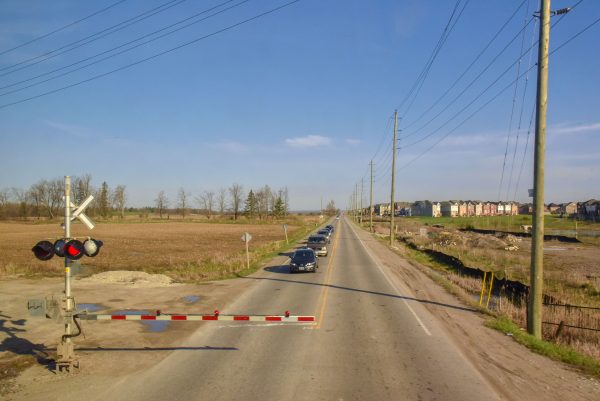
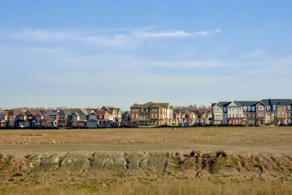
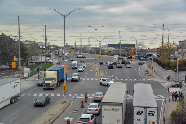
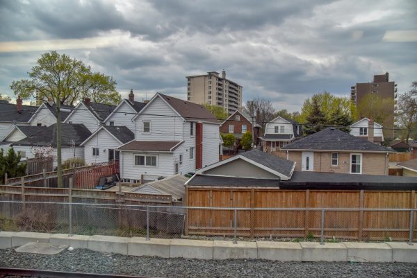
At Georgetown, the train starts to get busier. For years, GO trains terminated here at the western edge of the Greater Toronto Area. Shortly after we depart, the countryside returns. But this is a brief return to our rural journey; in the distance, a long row of houses, both occupied and under construction, grows ever larger as we approach the Brampton. As we pass over Mississauga Road, we enter into an unbroken string of development that will take us all the way to downtown Toronto. The first stop in Brampton (a city larger than Vancouver) is Mount Pleasant, a new transit-oriented community, with a large public square in front of the train station instead of the usual sea of parking lots (there is ample parking here, but it is on the opposite side of the tracks from the neighbourhood).
This is also where the ethnic composition of passengers begins to change; up until this point, the majority of riders are white. The train begins to reflect the fact that we are travelling through one of Canada’s most ethnically diverse cities, where 52% of the population is foreign born (primarily from the Indian subcontinent) and 73% are visible minority, according to the 2016 census.
The housing stock also changes as we travel towards Toronto. Mount Pleasant’s newness is evident not just in the design and architecture of its houses, but in its density as well. This suburb isn’t sprawling bungalows, but rather a mix of townhouses, semi-detached and even some midrise buildings oriented around the station. Where detached single family houses do exist, they tend to be large homes on smaller plots of land. This reflects both provincial policies to curb sprawl, such as the Green Belt, and the economic realities of high land prices. Today, the types of suburban ranch style or side split houses of previous eras are neither considered sustainable planning, nor are they economically feasible.
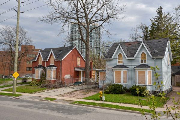
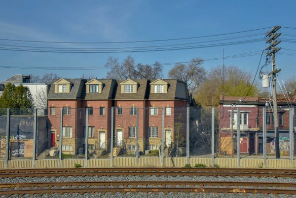
Pausing in downtown Brampton, we see some old brick and beam industrial buildings, as well as some 19th and early 20th century homes that sit side by side with some newer condos and downtown development. Immediately to the south of the station lies the aptly named Railroad Street, where old houses have been demolished in preparation for a new transit-oriented development.
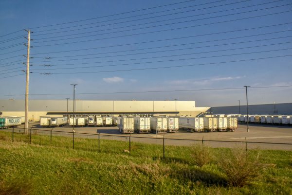
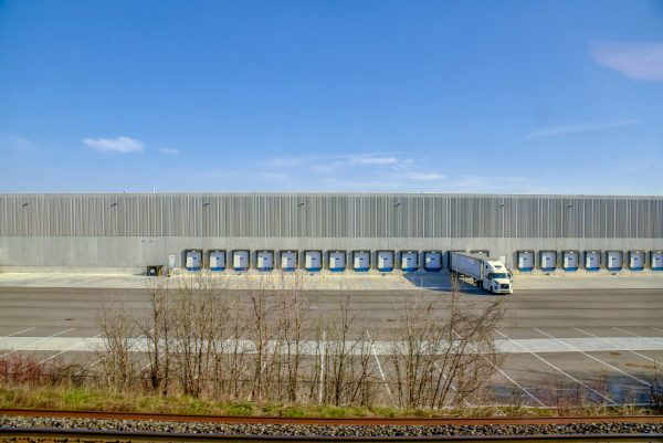
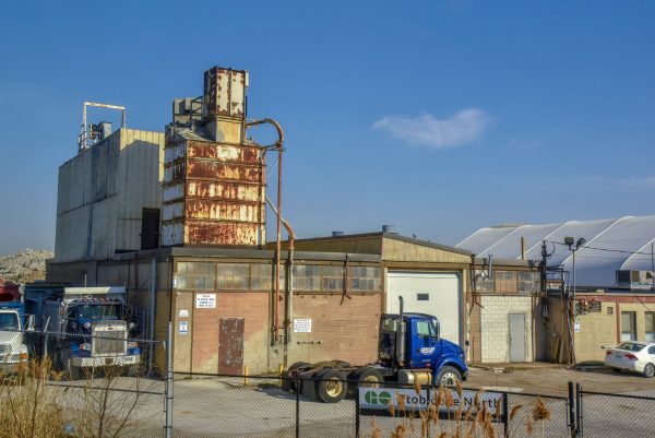
Shortly after leaving downtown Brampton, we enter an industrial corridor that, apart from a small neighbourhood of early postwar houses in Old Malton Village, continues unbroken all the way to Weston. This is the unglamorous and hardworking terrain of warehouses, factories, logistics and distribution centres, auto repair shops, truck storage and recycling depots, occasionally inter-spliced with a Tim Horton’s or mosque visible in the distance. At times this industry is small scale – family-owned businesses occupying a small building or unit in a non-descript industrial park; in other places, massive distribution centres dwarf even the largest trucks parked outside (it is interesting to note that during the current pandemic, many of the businesses here are working at full capacity to keep vital supplies and necessities moving throughout the region).
Scholars such as Alan Walks and Roger Keil remind us that these are very important places within the Greater Toronto Area, and that, despite that the image of condominium and bank towers downtown, the region is still a very industrial one. This part of the train journey provides a unique window into that world.
There’s a brief pause to pick up passengers at the Malton station in Mississauga, a city which, at more than 800,000 inhabitants, is larger than Denver, Washington, DC, Seattle or Boston. Even before we enter into the City of Toronto, we have travelled through municipalities that collectively have more than 1.8 million residents; no wonder the train is getting pretty full.
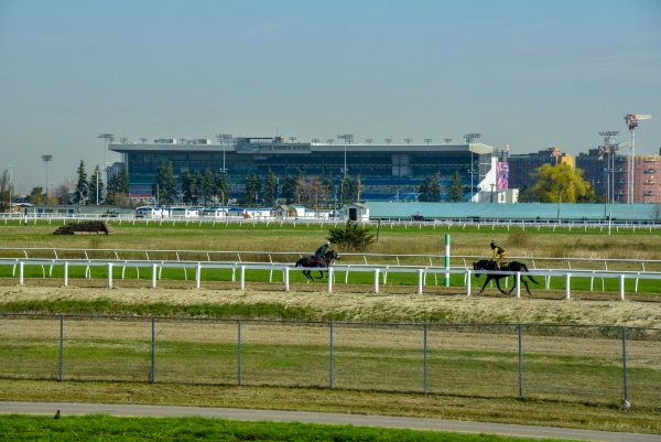
If you did not know that highway 427 formed this part of the boundary between the cities of Mississauga and Toronto, you would have no way of knowing when you actually entered into Canada’s largest city. When the train does, we are greeted by the sprawling Woodbine Racetrack to the north, and more of the same industrial landscape to the south. The colour of the local buses turns from orange to red; this is one of the only ways to tell you have entered Toronto.
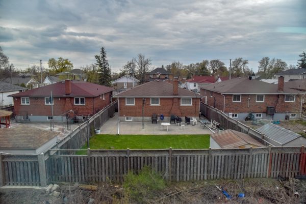
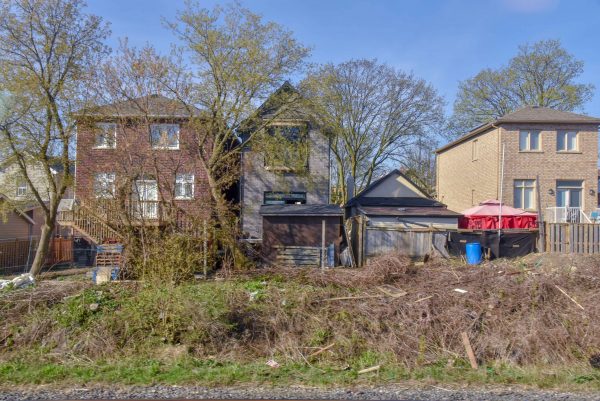
At Weston, we move into an early 20th Century industrial suburb of Toronto. Houses are small and situated very close to each other. But Weston, and neighbourhoods like it, are becoming increasingly popular with professional, and more affluent, households. This gentrification is visible through the train window by the growing number of additions and renovations (best seen from the rear) to these modest, working-class homes, and even a few tear-downs and rebuilds that are more common in wealthier parts of the city.
Zipping over the future interchange with the Eglinton-Crosstown LRT, it is easy to see why gentrification is spreading here. Most older, walkable neighbourhoods in Toronto have become too expensive, even for well-educated, professional households. Therefore, those wanting an urban, less car-dominated lifestyle are now looking to neighbourhoods like Weston. As we pass the UP Express platforms, it is clear that many people waiting for trains are not headed to Pearson Airport, but instead are going to work downtown. With trains every 15 minutes, it provides a metro-like service, for not much more money than the TTC fare.
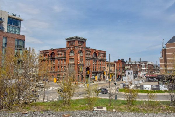
While gentrification in Weston is in an incipient phase, the closer we get to downtown, the more entrenched it becomes, and there is more evidence of large-scale capital being invested in the built environment. Historically, this entire rail corridor was industrial, but now the old brick and beam factories south of St. Clair have been turned into lofts, offices and apartments. The new Museum of Contemporary Art, housed in a former factory, towers above the surrounding neighbourhood. Every piece of usable land is developed or in development to feed the seemingly insatiable appetite for both urban living and for speculative investments in urban real estate.
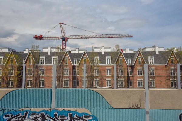
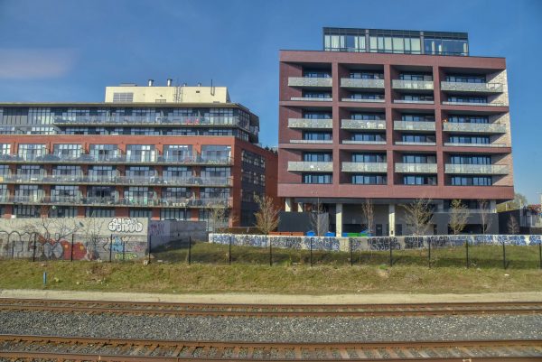
Clusters of construction cranes abound. On small parcels of land, new townhomes (tall and thin to maximise their number) give inhabitants their small piece of the urban dream. On larger plots, towering condos dominate the landscape and the sky as they line flush against the railway corridor, their retaining walls covered in a sea of graffiti art. Riding over Queen Street, we catch a glimpse of the Gladstone Hotel. It was originally a railway hotel, across the street from the Parkdale Station. Over the years, it became a seedy dive; however, when it and its neighbour the Drake were redeveloped a decade ago, they opened up West Queen West to a new wave of gentrification.
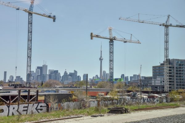
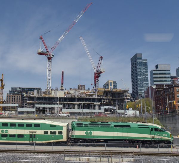
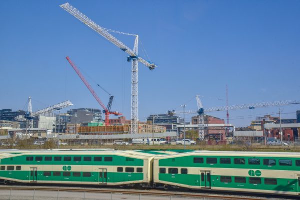
Approaching Union Station, the train slows to navigate the complex track junctions that lead into Canada’s busiest railway hub. While most passengers are collecting their belongings and making their way to the doors, for the urban observer, this is the best part of the show! The last remaining pockets of formerly-industrial land are currently under a sea of construction cranes. It is here where we enter into the heart of Canada’s financial services economy, one of the most important centres of global finance and trade.
It is not difficult to see why many companies, not just people, are attracted to downtown Toronto. Union Station is the central hub of Canada’s busiest train network. With traffic in the GTA getting worse, the comparative appeal of downtown Toronto compared to more suburban locations that are primarily accessible by car grows stronger.
And there we have it; from the mid-sized city of Kitchener, through farmland, suburbs, factories and into the centre of Canada’s largest city in two hours, and all for the price of a ticket to the movies. You can’t see this while driving on the highway, and not only because you need to keep your eyes on the road. The rail lines go right through the hearts of communities. In many ways, they were built by the train; industries feed directly off their tracks, houses back on to them and new developments are increasingly clustering around stations.
Urbanists often speak of the deindustrialization of cities, or the lack of diversity in suburbs. Traveling this journey reminds us of the ethnic diversity and economic complexity of the Toronto region. This journey has been about more than just the rural to urban change; the distinct geographies of the GTA’s two largest economic sectors – automotive manufacturing and financial services – are clearly evident along the journey.
To truly understand the complexities, contradictions and divisions within the city, it is important that we explore familiar and unfamiliar territory. This can be done by walking or cycling through a neighbourhood, riding a bus or streetcar to the end of the line, or spending an afternoon doing what I did — exploring Canada’s largest region by train. Even if the geography of this exploration is currently much smaller, because of the Covid 19 pandemic, looking carefully at the changing and varied landscapes as you walk around the block, or to the grocery store, is still possible. Getting out to explore cities first hand (however large, or small, the spaces we can visit are at the moment) helps to gain fresh insights into how cities change, and the ongoing and ever-shifting divisions within them.
Brian Doucet is the Canada Research Chair in Urban Change and Social Inclusion at the University of Waterloo’s School of Planning.