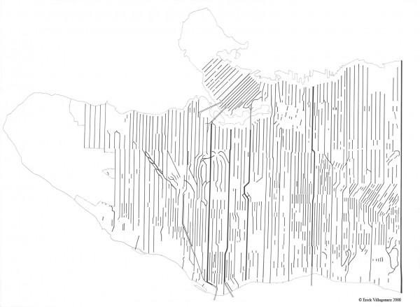


As a follow-up to the last map depicting Vancouver’s east-west running streets, here is a drawing of all the north-south roads in the city.
Very similar to the last, one can plainly see how fragmented the street system is. In fact, it is even more discontinuous with only five streets going the full length of Vancouver – Granville, Oak (although it ends at the north at 2nd), Cambie, Knight/Clark and Boundary. Consequently, these street take the vast majority traffic that enters in and out of the city.
On a separate but related note, it is rarely (if ever) discussed that the stoplights at Oak and 70th are the last set one hits along the west coast until Tijuana, Mexico, since the street turns into Hwy 99 in Richmond and Interstate Hwy 5 after crossing the border.
Imagine that, travelling north on the I-5 this ordinary intersection is the end of an approx. 2500km journey of uninterrupted driving…..not counting the border crossings, of course. ![]()
***