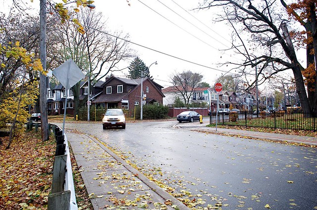
In the wake of October’s election, much has been made of differences and divisions amongst Toronto’s population. The city’s Victoria Park Avenue is no stranger to these sentiments – between Queen and Denison, it also balances a number of distinct identities. Beginning as a two-lane street at Queen, Victoria Park Avenue expands into four lanes at Gerrard, tapers back to two north of the Danforth, and then returns to a four-lane at Dawes Road. At times residential, at others arterial, the boundary of the former City of Scarborough is an amalgamation not unlike the city it’s found in.
Over the years, parts of Victoria Park Avenue have served as a number of different streets under a number of different names. The street gets its current name from Victoria Park, which was an amusement park that covered fourteen acres below Queen. The park opened in 1878, and began the season each year on Victoria Day. Mike Filey’s retrospective I Remember Sunnyside covers Toronto’s past history with amusement parks, and notes that Victoria Park drew Torontonians for its wooded picnic spots, dancing pavilion, foot races and donkey riding. Originally accessible only by steamer boats that left from Yonge Street, focus did not really shift to Victoria Park Avenue until after the park closed in 1906. In Toronto: The Way We Were, Filey writes about the land’s brief stint as a “forest school” in the years that followed, designed to bolster child development by exposing schoolgroups to the “natural environment.” That said, this forest environment was eventually cleared to make room for the R.C. Harris Water Treatment Plant. The plant was named after Rowland Caldwell Harris, who served as Toronto public works commissioner from 1912 to 1945. John Lorinc’s blog The R.C. Harris Project is dedicated to exploring Harris’ legacy in Toronto today.
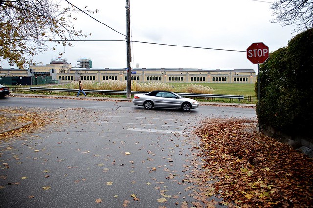
The R.C. Harris Plant has since grown into something of an infrastructural icon, renowned in a way that’s rare for such a utilitarian operation. The Globe and Mail‘s Lisa Rochon praises it as “visionary” in her list of theTop 5 Architectural Sights in Toronto. The plant was also featured in this February’s Building Storeys exhibition, a joint project between Heritage Toronto and local photographers that documents local architecture. Wayne Reeves also profiled the plant and its architect Thomas Canfield Pomphrey in Spacing during the exhibition’s run.
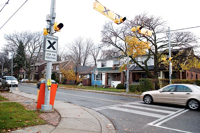
North of Queen, Victoria Park Avenue is lined with single-family homes, which transition to higher-density apartment and condo towers farther north. Of course, a number of other homes have been and gone from along Victoria Park Avenue over the years. In his Lost Villages Spacing post on Agincourt, Sean Marshall cited O’Sullivan’s Corners at Victoria Park and Sheppard as another old Toronto village lost to sprawl. Filey identifies the 1860s-era O’Sullivan’s Corners as named after Patrick O’Sullivan, whose hotel sat on the northwest corner of the intersection. Today, the corner is home to a Pizza Pizza. “Victoria Park Village” or Victoria Village was another prominent neighbourhood, built in the 1950s. Recognized in The Globe and Mail as a postwar housing development oft-overshadowed by Don Mills, the neighbourhood was developed on the west side of Victoria Park Avenue between Eglinton and Lawrence. An annual Jane’s Walk through the area treks through the nearby ravines while incorporating stories by former residents, recounting experiences like bonding “while lining up at a public telephone booth” during the days before residential service.
Today, Victoria Park Avenue’s transition to higher-density homes and four-lane traffic along its northern stretch also suits the transition beyond the boundaries of the original Victoria Park Avenue. Originally, a long part of Victoria Park Avenue had been known as Dawes Road–the stretch from St. Clair to Sheppard had once shared its name with the winding street that now merges with Victoria Park just below St. Clair. In Toronto Sketches 8, Filey covers another segment of Victoria Park that had previously been known as O’Connor Drive. O’Connor Drive first came about as something of a favour to Laura Secord founder Frank O’Connor by his high-ranking friends–chief among them Mackenzie King. While the street had originally served to connect the city to O’Connor’s remote property, during World War II the farmland along this stretch offered the perfect site for “Project 24,” which helped to realize the government’s commitment to weaponry manufacturing. By the end of 1941, the General Engineering Company had opened a 172-building plant on the east side of O’Connor to manufacture fuses for artillery shells. In the 1960s, these roads were amalgamated, and adopted the name of their southernmost segment, becoming Victoria Park Avenue.
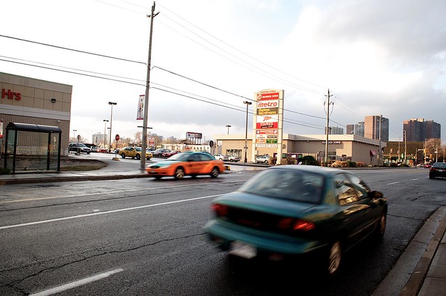
One storied destination along Victoria Park Avenue that remains today is Shoppers World Danforth, which opened in 1962 as one of Toronto’s first suburban enclosed malls. Built from the foundations of an old Ford plant on the same site that had once hosted the York Market, Filey notes in A Toronto Album 2 that the mall was particularly significant for marking Eaton’s second foray outside of city downtowns. The mall today might not look that different from any other worn retail block, but the thousand-odd Shoppers Drug Marts found in other box store centres across the country all have their origins at Shoppers World. While not Murray Koffler’s first drug store–he had inherited two from his father, and opened another in the 1950s–Koffler’s store at Shoppers World was the first to forgo “Koffler’s Drugstore” and adopt the “Shoppers Drug Mart” moniker, taking its inspiration from the mall’s name. Koffler followed by changing the name of his other three stores, noting that this “by itself improved business.” A Canadian retail sensation was born.
While Victoria Park Avenue has obviously undergone a fair evolution over the last century, it’s also notable for the evolution that it undergoes just as one travels along it: my view from the sidewalk shifted from one of pedestrians with strollers to one of cars pulling into grocery stores to one of commuters moving into Markham. Victoria Park Avenue is a Toronto street that speaks about the sum of parts, and about the city’s ability to put its citizens on the same road moving forward.
More photos of Victoria Park Avenue can be seen in our Flickr set.
Street Stories is a regular feature profiling the origins, development and current state of Toronto streets. For more background on the history of Victoria Park Avenue and other Toronto streets, we recommend the excellent book Toronto Street Names. If you have an idea for a street we should feature in an upcoming instalment, email ericmutrie@spacing.ca.

3 comments
The 501 QUEEN loops at Neville Park Boulevard. That was the old border between the cities of Toronto and Scarborough, and one or two blocks west of Victoria Park Avenue. Never will understand why the streetcar hasn’t been extended east the two blocks to Victoria Park Avenue since amalgamation.
W.K., Todd’s also covered Neville Park Boulevard in the first incarnation of Street Stories, back in 2008.
https://spacing.ca/toronto/2008/05/19/street-story-neville-park-boulevard/
And I should clarify – Victoria Park Avenue is the Scarborough border from north of Bracken.
Nice writeup — though I would have liked to see a map of how the different streets were laid out before they were all amalgamated into Victoria Park Ave.