


Yesterday, Toronto’s Medical Officer of Health released a new report by Toronto Public Health, The Walkable City: Neighbourhood Design and Preferences, Travel Choices and Health (PDF). It will be discussed at the Board of Health meeting next Monday, April 2 (deputations can be made).
The report is fascinating, and I’ll be discussing it more in the next issue of Spacing, but here are a few quick thoughts.
The map above (p.8) shows Toronto’s walkability, with the lighter portions indicating greater walkablity (‘utilitarian walkability” being how easy it is to walk to do utilitarian things — get to work, shop — as opposed to for pure recreation). It’s striking how much high walkability follows the boundaries of the old City of Toronto. There are a couple of additional areas of high walkability in two of the areas designated by the official plan as “centres”, in North York and Etobicoke, which reinforces the finding of a recent study that the “centres” concept is working to some extent.
The report also confirms the findings of many studies: that people who live in highly walkable areas walk more and are less likely to be in danger of obesity than those in car-oriented areas. More interestingly, it helps to answer the debate about why that is the case: whether neighbourhood walkability encourages people to walk, or people who like walking just self-select into walkable locations.
The core of the report is a survey of residents of Toronto and the GTA to find out both their preferences regarding walkable vs. car-oriented neighbourhoods, and their personal walking habits.
The study does find some self-selection. People in the City of Toronto (including Etobicoke, North York and Scarborough) are significantly more likely to prefer walkable neighbourhoods, rather than car-oriented ones, than people in the more suburban GTA. In Toronto, 74% strongly prefer walkable in principle, vs. only 6% preferring car-oriented, while in the GTA it’s 46%-21%. (People who didn’t have a strong preference are not included).
When asked a series of questions about tradeoffs — accepting smaller houses and lots in exchange for walkability features — around half of Toronto residents still strongly preferred walkability, vs. 7-15% who went for more private space and more need for a car. The GTA numbers varied quite a lot depending on the question, but fluctuated around roughly even numbers.
So, to some extent people who value walking move to more walkable areas, and people who value bigger houses/lots and car-oriented communities go to suburban areas.
However, even within Toronto the number of people who prefer walkable areas is much greater than the number of people who live in highly walkable areas (as visible in the map above, where highly walkable areas cover less than half the population of the city). The report finds “There is a strong latent demand among Toronto residents for more walkable features in their neighbourhoods.” So the self-selection is only partial — desire for walkability is stronger than the available supply.
It should be noted, though (the report downplays this a bit) that a good 62% of people in Toronto *feel* they live in a highly walkable neighbourhood. So perception of walkability is a little more flexible than the statistical numbers used for the map. But when it comes to specifics, there are still areas where people feel a need for improvement. (The Walkability Studies of tower neighbourhoods also found that, while people often feel their neighbourhoods are walkable, when it comes to specifics they can identify many ways in which they would like it to be improved).
Also, the report finds that even people who are car-oriented will walk more if they live in a walkable neighbourhood — and people who are walking-oriented will walk less if they live in a car-oriented neighbourhood. So urban design does play a role in shaping people’s behaviours, whatever their preferences are.
The overall message is that the vast majority of people across the City of Toronto strongly desire to live in a walkable neighbourhood, and the City of Toronto has some work do to to make that a reality.

5 comments
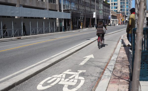
Those areas on the map which have a low walkability score could be easily accessible by bicycle if cycling infrastructure were in place. A bicycle hugely expands ones range in terms of accessing services (banks, stores etc). It would also go a long way towards increasing personal fitness and reducing obesity rates. What this map shows me is the areas where the city should be concentrating cycling infrastructure, namely, in neighbourhoods with low walkability scores.
So how do we incentivize the building of walkable areas? Zoning changes, development charges, …? So long as the only development model we have is private / profit, we have to tilt the market to drive developers to build as people *claim* they want.
This is meant to be aimed at the provincial level, not just the city level – particularly for development inside the Greenbelt.
Dylan, have a look at the journey to work data in the new report ‘Living in the Downtown and Centres’ posted on the Official Plan Review website (www.toronto.ca/opreview). Upwards of 45% of downtown residents now walk all the way to work.
Paul – indeed, I link to that study in this post.
Concerning the bicycle as a Transportation (Utilitarian) vehicle, as opposed to a Recreational “Toy”, I have been working towards achieving infrastructure requirements such as “Bikeways”. Without this, the very act of cycling is quasi-suicidal in North American cities.
In order to properly define the issue, I have produced a short document that outlines the 12 Attributes of Bikeways. Before listing these, I clarify some facts, so that the issue is defined clearly.
Cycling can be either of a Competitive, Recreational or Functional nature; as a result, there are three types of Cycling. This document deals with one of these, namely “Functional Cycling”; this is a form of Active Transportation, intra-urban in nature, that is known as “Cyclo-Mobility”.
For cycling to be widely accepted, it must be made safe – presently, it is NOT, as a result of a lack of proper infrastructures. In particular, city streets must be viewed and designed in a way that is not “Auto-Centric”; in fact, the purpose of transportation should be to move people and goods, not cars. A key element towards this is the provision of Bikeways in the streetscape.
In the same manner that motorized vehicles depend on maintained (and plowed) roads, similarly Bikeways require a basic level of maintenance. They should not be seen as suitable only for mild-weather months. Moreover, they should not be confused with Bike Trails, as these are recreational and generally go where the topography permits, not where the functional needs really are.
Bikeways can have different levels of sophistication (and costs) depending on the type of intra-urban road conditions and traffic; these need not be a drain on municipal resources. Whenever possible, low-traffic non-arterial roadways can be used successfully in this manner. The essential requirement however is that there has to be a “Political Will” to address the issue.
A Bikeway does not exist in isolation, but rather it is part of a Bikeway Network. In addition, it has the following Twelve Attributes:
1. Functional: Providing corridors linking ”Need To Go” places
2. Safe: Free of moving/parked vehicles and pedestrians
3. Secure: No isolated, unlit or inaccessible areas
4. Quasi-Direct: Minimal increase in travel distance
5. Gap-Free: Continuous interconnection of routings
6. Conflict-Free: Smart intersection designs and protocols
7. Extensive: City-wide coverage within a 0.5 km grid
8. Unrestricted: Usable at any time, in any season, 24/365
9. All-Weather: No splashing and timely snow removal
10. Integrative: Ties-in with parking, buildings and transit
11. Beautifying: Urban streetscape and neighborhoods
12. Cost-Effective: For users and taxpayers
Major street-rebuilding projects, whether financed by Municipal or Regional Authorities, provide opportunities to introduce bikeways at minimal cost within the urban streetscape. In Oshawa, major opportunities were missed in this regard, such as on Taunton Rd, Harmony Rd, Hwy401/Stevenson Rd interchange (with its vital access to the railway station).
Signed: Cdn Philo-Scientist