A few weeks ago, I completed a ride from Kitchener to Hamilton by bicycle, again mostly using rail trails and taking GO Transit to the starting point and from the end point. The ride was just over 100 kilometres, but not particularly challenging. On the whole, the trail was much better maintained than the Durham Region section of the Uxbridge-Lindsay trail and suitable for most city bikes.
My trip began in Downtown Kitchener on a warm Saturday morning. It is possible to get to Downtown Kitchener with a bike from Toronto entirely by transit on a weekend, though it requires a change of buses at Mississauga’s Square One terminal, either from the Milton-Union Station “Train Bus” or from a Mississauga Transit bus from Islington Subway. I chose to arrive the night before, taking the 18:50 Georgetown train to Bramalea, and transferring to a bus from there to Kitchener. I stayed Friday night at a downtown hotel near the bus terminal, which I found was very accommodating for storing my bicycle.
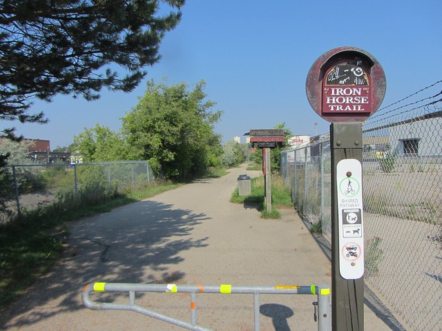
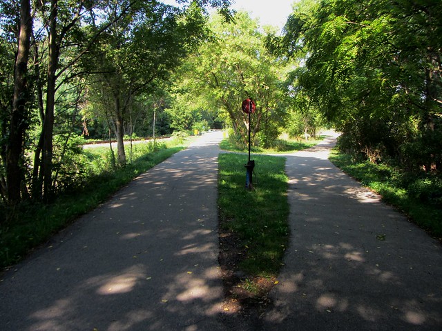
The route through central Kitchener follows the paved Iron Horse Trail, which parallels the former Grand River Railway electric line. Interestingly, the logo for the trail, which extends to Uptown Waterloo near the universities, features a steam locomotive, which never would have ran on the trail’s right of way. (Parts of the GRR, now fully incorporated into Canadian Pacific’s network, still exists and was dieselized in 1961.) Interesting little touches, such as switch stands at trail junctions, are authentic reminders of the trail’s former role.
The trail suddenly ends at Sterling Avenue, and unfortunately, there are no wayfinding signs or maps to guide the cyclist or pedestrian towards the Grand River and its network of trails. Though being prepared, I would my way through on residential streets to Homer Watson Park, where the trail picks up. From there, the route to Hamilton was easy to follow.
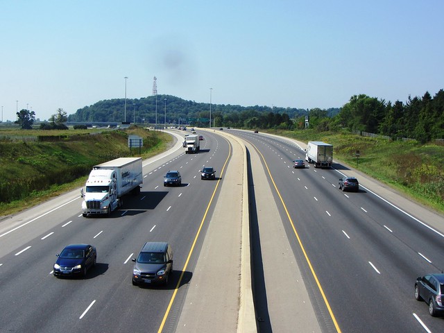
The view from the pedestrian/cycling bridge over Highway 401 recalls Jack Chambers’ iconic work.
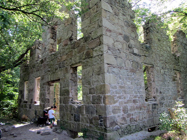
The highlight of the ride was the section between Cambridge and Paris, which follows the former alignment of the Lake Erie and Northern Railway’s electric line between Galt (Cambridge) and Port Dover. (The LE&N, like the GRR, was also owned by Canadian Pacific and operated as one division.). The rail trail, one of the first rail trails in Ontario, is maintained by the Grand River Conservation Authority, which keeps it in excellent condition. This trail is well-shaded by the valley’s Carolinian forests. The ride was less lonely than my Uxbridge-Peterborough trip, but still peaceful and relaxing. Several 19th century relics are accessible to the trail goer, including the ruins of an old mill near Glen Morris, and the piers of a long-abandoned railway alignment over the river, whose embankment provides a panoramic outlook. A shorter day trip from Toronto could make a two-way ride of the Cambridge-Paris section of the trail, using Grand River Transit to connect to GO’s buses.
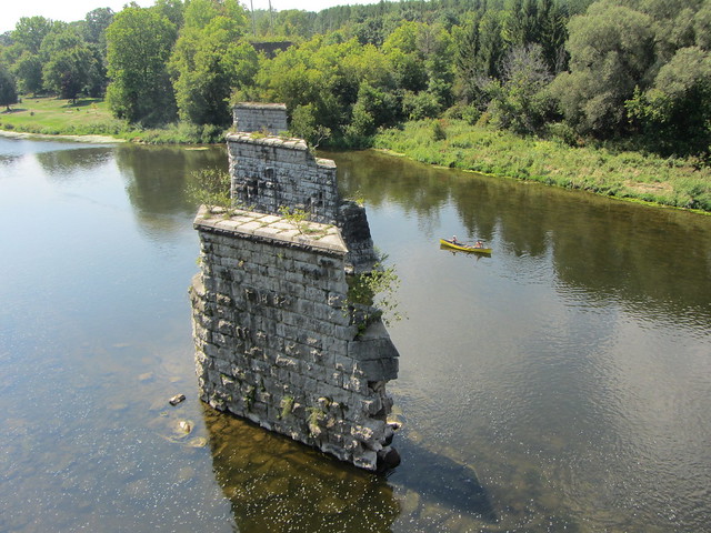
Old Great Western Railway piers north of Paris
South of Paris, the railway continued to downtown Brantford, though the trail deviates from the old right-of-way immediately after it crosses Highway 403, detouring around a new industrial park. At Brantford, one can continue on the old LE&N alignment through to Simcoe and Port Dover, or change (as I did) to the Brantford-Hamilton rail trail, which follows the former Toronto, Hamilton and Buffalo Railway into central Hamilton.
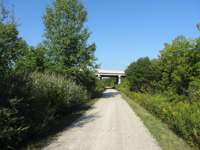
The route eastward from Brantford crosses under several road overpasses, including the one photographed above, built only a few years before the railway’s abandonment in 1988. At Highway 403, the trail descends to pass under a bridge spanning a creek; the Brantford-Ancaster section of the 403 was opened in 1997 so no legacy bridge remains.
In Hamilton, the trail is maintained by the Hamilton Conservation Authority and follows a sweeping horseshoe curve as it descends down the Niagara Escarpment. Wide curves allowed locomotives to haul heavy trains up shallow grades; today they help make it an easy climb on a bike. Near Dundas, the HCA built a replica railway station next to the trail as a visitors’ centre serving the various trails in the area. The City of Hamilton just built a paved extension of the trail to cross Highway 403 (for the third time since Paris) into the central core, making it an easy ride to the Hamilton GO Centre.



2 comments
Actually, the Iron Horse continues on the other corner of the intersection of Courtland and Stirling and runs all the way to Ottawa Street. Unfortunately, the Region’s repaving of Courtland and Stirling has made an awkward diagonal crossing even worse (their notion of providing crossings to cyclists seems to be that it’s too difficult and that the ‘safe’ option is to somehow expect cyclists to dismount and cross as pedestrians).
The City of Kitchener is hoping to have way-finding signs to the 401 bridge by the end of this year, and also a contra-flow bike lane on Nyberg to extend the Iron Horse to a quieter street. Hopefully, that helps a little.
Having just made a trip from the Hamilton area to Kitchener last weekend, I’m disappointed I didn’t know that the rail trail provided a more gradual climb out of the escarpment – we came up Fifty Road from the lake. With our bikes carrying 40-50 lb of gear, we gave up halfway to the top of the hill and pushed our bikes the rest of the way. We then followed Highland, Stone Church, and then the very hilly Jerseyville Road.
Having lived in Waterloo and done this very trip to my hometown of Hamilton, the Cambridge-Paris section is, by far, the best part. It’s really simple to get from Kitchener-Cambridge-Paris-Brantford, but the transition to the TH&B Rail Trail was poorly marked in Brantford.
The extension of the trail into downtown Hamilton is excellent as well, and really makes cycling in from the west end much easier. It’s too bad that the gravel could not be maintained until further east, as it changes the charm of the trails a bit. Still a great ride, though IMHO.