
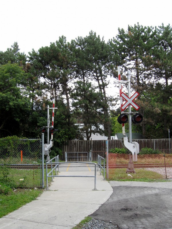
Pedestrian crossing of GO Transit Stouffville Corridor, at Marilyn Avenue near Agincourt Station
The biggest barrier to pedestrians and cyclists in Toronto are the railways and freeways that criss-cross the city. These ribbons of steel and asphalt link the city and country together, but at the same time they divide neighbourhoods.
In the central City of Toronto, these barriers are relatively short. The Canadian Pacific Railway line north of Dupont Street has many crossings, including two grade crossings at Osler and Bartlett, making that railway line only a minor nuisance to get past on foot. Often thought of as a barrier to the Waterfront, the elevated Gardiner Expressway provides many opportunities to cross below, especially between the downtown core and Harbourfront. The Union Station Rail Corridor railway corridor is similarly easy to cross by foot (though it would have been nice if Church Street continued south under the tracks). Arguably, the biggest obstacle to pedestrians here is the heavy and at times dangerous traffic to and from the expressway and Lake Shore Boulevard.
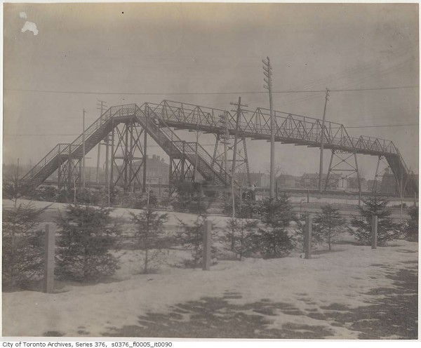
Historically, the first grade-separations of railways and city streets occurred where there was a significant difference in elevation between the street and railway, such as when a railway was built on an embankment or in a deep cut. It wasn’t until the 1890s that overpasses and underpasses were built in Toronto for safety and convenience. The Queen Street Subway at Dufferin Street is one of Toronto’s first major underpasses. The footbridge at Wallace Avenue, connecting that mixed industrial and residential street with Dundas Street, might be the first purpose-built pedestrian grade-separation in Toronto. The footbridge spanned the busy Grand Trunk and Canadian Pacific railways into the centre of the city; today 30 weekday GO Trains, 4 daily VIA trains and the occasional freight train pass underneath. (The number of trains passing through here will nearly quadruple when the Union Pearson Express rail service starts in 2015 and a few of the long-promised additional GO Trains to Brampton/Georgetown are introduced.) To this day it provides a connection (though not fully accessible) between the Junction Triangle and South Junction/High Park neighbourhoods and the nearby Dundas West Station.
Early plans for upgrades of the GO Georgetown/Kitchener corridor though Weston to accommodate the then-private proposal for the “Blue 22” airport rail link would have closed the John Street crossing completely. The intense community opposition to those early plans was partially due to the neighbourhood barrier that the upgraded rail corridor would have pushed through. The result is that Metrolinx, which is now responsible for GO Transit and the UP Express, is building a much less intrusive covered trench and keeping a pedestrian connection at John Street in place.
As traffic increased and railway collisions became a major concern, the various railways separated their rails from city streets, mostly by building embankments and overpasses; these included the Union Station tracks downtown, the Grand Trunk/CN tracks through Riverdale, and the Canadian Pacific North Toronto Subdivision which crossed busy city streets such as Yonge Street at grade. Suburban arterials were grade separated as traffic volumes or safety merited their construction.
By the 1950s, freeway construction was in high gear, with the Gardiner Expressway as well as Highways 400 and 401 underway. When Highway 401 was planned, crossings were only provided at the concession roads and a few other existing streets. As residential subdivisions were built in the 1950s onwards, railway crossings were only provided where they already existed, mostly the grid of concession and side roads which became suburban arterials. Hence freeways and railways became major obstacles for pedestrian and cyclist movements.
The worst of these many barriers is the CN Newmarket Subdivision (now owned and maintained by Metrolinx) in Wards 12 and 15. The railway hosts GO Transit’s Barrie Corridor trains (5 round trips, or 10 trains a day) and the occasional freight and VIA train.
At Wallace Avenue, Castlefield Road, Downsview Park and the York University Busway/Multi-Use Trail, pedestrians and cyclists can cross at grade along with auto traffic — these crossings are protected with signs, lights, bells and gates. Most of the other crossings on the corridor in Toronto are grade-separated, including a tunnel at Dunraven Drive/Bert Robinson Park, and an overpass at Innes Avenue. Pedestrians can also cross the tracks legally at overpasses at Dundas and Eglinton, and underpasses at Bloor, Dupont, Davenport, St. Clair, Rogers, Lawrence, Wilson, Sheppard, Finch and Steeles.
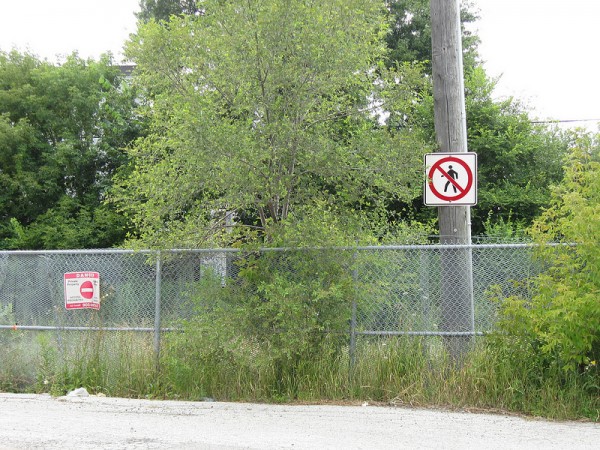
To protect their property, and prevent trespassing and train collisions, CN and GO Transit have fenced much of the railway off, as is prudent. However, in several places, this leaves a major barrier between residential areas to the west and commercial/industrial areas to the east. There are no legal pedestrian crossings between Lawrence and Wilson Avenues, a distance of two kilometres. Highway 401 exacerbates this problem by posing an additional 2-kilometre obstacle between Keele and Dufferin Streets.
Nearby, Highway 401 poses a similar problem. The new Humber River Regional Hospital is under construction in the Ministry of Transportation lands on Wilson Avenue west of Keele Street. Unfortunately, there is no crossing of Highway 401 except at Keele and at Jane, two kilometres apart. A midway pedestrian/cyclist overpass between Culford Road and Ridge Road would be an ideal active route to the new hospital site and potentially reduce traffic around the new hospital. This is a prime example of two adjacent neighbourhoods split apart by a high-order transportation corridor.
Logically, there should be a crossing between Floral Parkway and Bridgeland Road. This would allow the residential neighbourhood immediately to the west to access the 47B Lansdowne/Caledonia bus, and even walk to local businesses and Yorkdale Mall. Instead, it’s a 3.6 kilometre, 46 minute walk via Lawrence Avenue.
When I lived in the area several years ago, holes were frequently cut in the fence. It was not unusual for pedestrians to trespass here, even if they were otherwise law-abiding and reasonable people. The unreasonable distance by foot made it so. There were no incidents of trespassers being hit by the few trains that use the railway regularly as long as I lived in the area. But the official response? First GO Transit put up more no-trespassing and no-pedestrian signs, then later reinforced the fencing and even put up Alarmforce Security warnings.
Meanwhile, the CN Uxbridge Subdivision, now also owned by GO Transit and seeing a similar number of trains daily (15 revenue GO trains daily, 16 in total, plus the occasional freight) has two pedestrian crossings at grade. Like road crossings, they are protected by signs, lights, bells and gates, and by virtue of being at ground level, they are fully accessible and cheap to build and maintain. They are at Corvette Avenue and Marilyn Avenue (the photo at the top of this article). There are also seven road crossings at grade (as well as four bridges) on that line where pedestrians can also cross those tracks legally.
On the Lakeshore East line, there are several road crossings where GO, VIA and freight trains pass through more than 60 times a day, yet pedestrians are trusted to cross the tracks at Morningside Avenue or Scarborough Golf Club Road.
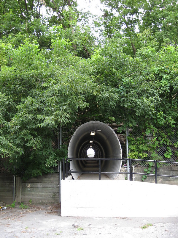
Pedestrian tunnel in Silverthorn
Both overpasses and underpasses have their drawbacks, but grade separations are necessary where there are very frequent train movements (such as near Union Station), high-speed train service (which doesn’t really exist here in Canada), high-speed freeways, or where there is a significant difference in grade. The tunnel connecting Bert Robinson Park with Dunraven Drive on the Newmarket Subdivision mentioned above is one example of the latter; bored through a railway embankment in the hilly Silverthorn neighbourhood. This particular tunnel is in a bit of a secluded area, raising concerns about personal security, especially at night. But it is fully accessible. A tunnel further south at Paton Road was closed in the 1980s due to personal safety concerns, though other crossings at Bloor Street and Wallace Avenue are nearby. Footbridges can require many stairs or long ramp structures that can deter their use; the new Puente de Luz bridge connecting Cityplace with Front and Portland Streets has this problem.
I’m sure GO Transit has its reasons for being such an obstacle in North York and having more permissive, pedestrian friendly, crossings in Scarborough. However, logical and safe crossing should be built where practical to make active transportation a more viable option, especially in the suburbs. At least the Bridgeland/Floral Parkway crossing should be fixed, properly.


4 comments
Caledonia Road ends at Bridgeland Avenue because Highway 401 is in the way. Why can’t a pedestrian and bicycle tunnel be built to connect it with Wilson Avenue. Automobiles use Bridgeland and Dufferin, but only add to the congestion.
Bridgeland Avenue is blocked by in its west end by the railway. Why can’t another pedestrian and bicycle tunnel be built to connect with Floral Parkway and eventually Keele Street. Another LARGE detour that is very, very inconvenient to bicyclists and pedestrians.
The Paton tunnel was build against the wishes of the community who said a bridge would be safer and more used. They were right. The “experts” were wrong. Today that tunnel, a waste of money, sits boarded up providing a home for city animal dwellers.
I’ve worked on pedestrian & cycling access for years and in my experience the access problem is due to a lack of political power which allows officials to use excuses for why access can’t be improved (and is often worsened). At-grade access might not be optimal for cars due to emergency access vehicles and traffic gridlock creating long lines of traffic. Also drivers are less concerned about direct access points and large grade changes than how fast the route is.
For pedestrians and bikes at-grade solutions with signals are a cheap and safe way to add high quality frequent access. TO has an official policy of eliminating at-grade road crossing, and unofficially opposes creating at-grade pedestrian crossings assuming that they are dangerous. Transportaion said that a study would need to be done to assess the safety factors as there was a lack of research on level crossings despite the thousands that exist in Canada.
When I was on the now-defunct pedestrian committee we finally coaxed the city to conduct the study and examine accident data in TO. Sceptic Dan Egan eventually showed me the stats which showed that level crossings were safer for peds & cyclists than the hostile grade-separated ones. Egan however said that more studies would need to done before changing their policies and that they just didn’t have the time or resources to do them.
Interestingly TO recently built allowed the Finch Hydro corridor path to cross the tracks at grade (between Dufferin & Keele). Egan assured me that the city wasn’t changing it’s policy, and the only reason it was allowed is because a new level crossing for a road (busway) had been built nearby.
I doubt that it is just a coincidence that almost all of the level pedestrian/cyclist rail crossings that have been built over the last 50 years in North America are for recreational not utilitarian use. TO’s Finch corridor for example was pushed by the mayor & the Federal government. I believe it is because they have much more political clout.
Cut off at the pass (rail crossings)
http://www.nowtoronto.com/news/story.cfm?content=157816
Stuck at an impasse (highway crossings)
http://www.nowtoronto.com/news/story.cfm?content=160250
seems that only a combination of $10 a gallon gas/ and or outlawing cars- will really drive cities to consider Pedestrians as real citizens- here in the Real South Texas -we even have some blocks with no sidewalks at all, and bike lanes that end mysteriously -unconnected to anything but normal traffic mixed with cars, trucks and semi’s *you can even see examples of sidewalks with curb cuts, and then a telephone pole in the middle- precluding any real use of a power chair from using it.