The alleys and lanes of Vancouver are a hidden aspect of the city. Yet they play a significant role in how the city works, looks and feels. Eliminated entirely from North American neighbourhoods created during the suburban expansion of the early-mid century, alleys have once again become a celebrated topic of discussion.
Recent research on urban form has demonstrated how street patterns with lanes add to the interconnectivity of neighbourhoods – giving pedestrians many more options to reach their destination. Furthermore, the inclusion of alleys within a block facilitates the creation of “friendly” home facades with porches and stoops, instead of large featureless garage doors. This, it is argued, leads to the creation of safer neighbourhoods where people have more opportunities to interact.
Unnamed by the City, the public’s implicit understanding of laneways as “non-spaces” allow people to use them in ways – both positive and negative – that would otherwise be unacceptable.
On the negative side, their hidden nature facilitates a multitude of illegal activities such as drug trafficking and garbage dumping. However, their location outside of the public gaze allows several positive aspects to flourish, making laneways hidden gems of human activity and spectacle. Uses include shortcuts for cycling and walking, shipping and receiving, vegetable/fruit gardening, contemplative strolls or loitering away from the chaos of the city, creating art, fixing cars, working out, and other similar activities.
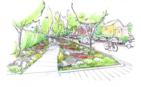
The intimate human-scaled space of the laneway is unique in the contemporary urban landscape of Vancouver. Their real significance however, is in their potential as unique, necessary human spaces of inhabitation and appropriation….spaces of human expression.
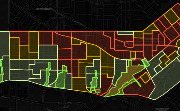
This map depicts the variegated laneway structure of Vancouver. In it, you can see several variations of the standard ‘I’, ‘T’ and ‘H’ laneway types as they twist and bend to conform to variations of topography. One can also notice where blocks change direction. Blank spaces – void of laneways – show the location of large projects (i.e. school, community centers, multi-housing developments, etc.) and parks.
One important aspect that is clearly visible throughout this map (and is often taken for granted) is how ‘T’ lanes often coincide with commercial streets throughout the city. This has functional reasons, as access service areas for garbage collection and receiving that are separate from the populated streetsides are highly valued – both by pedestrians and business owners.
In this respect, it can be said that through depicting laneway structure of the city we can also catch a glimpse of Vancouver’s future commercial streets.