


When Spacing made its formal debut in Vancouver this June, the city’s new urban generation was able to make good use of the bar on one side of the room and the city’s transportation planning team on the other. The unusual juxtaposition worked all the better because the city’s engineers and planners were there to talk about the same thing everyone else was: building a transportation system to enable the kind of city we want to live in. That discussion continues until the end of the month with preliminary public consultation, including a survey, for Vancouver’s new long-range transportation plan.
Brent Toderian, Director of City Planning, spoke of moving “beyond how people move in space, to how people can ‘be’ in space,” summing up the latest step forward that Transportation 2040 seems to represent. Vancouver has developed quite the reputation for its brand of city-building, but it took a legendary planning effort and a realignment of priorities to produce the city we enjoy today. It also took a leap of faith.
It takes another leap to then develop a 30 year plan, especially for a city that isn’t even really all that old in its present form. Three decades after Vancouver dismantled its streetcar network in 1955, it was putting up the first SkyTrain line for Expo ’86. A 1955 plan would most likely have supported the freeways Vancouverites fought so hard to stop, just as a 1985 land-use plan would have had a hard time predicting the dramatic re-shaping of the city that followed the post-Expo influx of new residents and foreign capital. One wonders what Transportation 2040, as a 2012 plan, will inevitably miss, and what projects will instead be prioritized by three year electoral cycles.
At the same time, these sorts of exercises are useful for the kind of soul-searching that lays out a comprehensive vision. The previous transportation plan from 1997, for example, formally introduced the idea that tackling congestion and traffic issues means reducing the number of automobiles entering downtown. Vehicular trips are down by around 25% from their peak, even as total trips are up. The restrictions on automobile travel during the Olympics showed that there’s plenty more room to go, provided, of course, that transit service gets a boost and a greater portion of street space.
The key change in perspective was the recognition that transportation is a derived demand. There is no inherent benefit to cars whizzing about, but rather to people and products getting where they need to be. Congestion, then, is best combated by finding room for more people, rather than for more roads. Although this is less of a revelation as time progresses, to many traditionally-educated traffic engineers, who equate people and cars, it’s either nonsense or cheating. To other cities, still periodically looking over their maps to connect As to Bs with thicker lines, Vancouver must look a little odd as it folds its map in a show of cartographic origami.
Elegant urban shapes – crisp creases bringing the city right up to its waterfront – are the result. Vancouverites benefit from the recognition that the shortest distance between two points is found by bringing the points closer together. From the separated downtown bike lanes (long may they last) to the recent Cambie Corridor plans, this is a strategy that’s been strengthening in resolve. While there’s value just in institutionalizing some of the new reality, there’s also a recognition that the city can do one better.
The first hint that there’s something special going on is that the presentation the City has put together to introduce the planning process doesn’t start by talking about streets, networks, or nodes, but rather land use. Walking, cycling, and transit – in that appropriate order – follow. Instead of parking, cars, and trucks, the presentation covers “demand management,” “low carbon vehicles,” and “goods and services” respectively. Unbundled parking, charging infrastructure, and small delivery vehicles are some of the strategies to be pursued.
Perhaps the best sign is the inclusion of public space among topics the City wants to discuss. Streets are, for better or worse, the majority of urban public space, perhaps the only space that most people use on a daily basis. Despite this, there is a certain hesitance in Vancouver, as in many North American cities, to use this space unless it’s incidental to a trip – even if that trip is just to window shop or buy a drink as an excuse to spend the afternoon on a patio.
Much of this is due to the messages our built environment sends us. The clearest and simplest message is sent by sidewalks built only for purposeful walking. There isn’t room to saunter on many streets, let alone a square to loiter, and most seating is at bus stops – never mind movable chairs to let people get comfortable in their own city. While the West End benefits from its park blocks, this strategy can be put to use all over the city, in neighbourhoods as well as shopping districts. The park block at Bute and Haro is welcome traffic calming, while Bute and Robson would be a boon for the public realm and business owners alike.
Vancouver is opening Granville Street to public life for a second summer by moving the buses off the transit mall. It doesn’t have the same dramatic flair as the reclaiming of Times Square in New York City (despite using some of the same folding chairs) or the intimate feel of the Pavement to Parks and Parklet projects in San Francisco, but it’s a start. By recognizing that our streets can be about more than getting around, Transportation 2040 can create more reasons to spend time in our communities. While getting people walking, cycling, and taking transit is a worthy end in itself, we shouldn’t need an excuse to dawdle a little along the way and enjoy what the city has to offer.
***
Brian Gould is a transportation planner, urbanist, advocate, and recent graduate of the Master of City Planning program at UC Berkeley.
2 comments
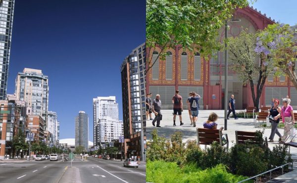
Aha! At the Spacing Vancouver launch, I asked Erick Villagomez where in Vancouver he thought one of the photos on the boards could’ve possibly been taken. Problem solved, Erick! It was San Francisco, as per slide 21 of the Transportation 2040 presentation: http://www.slideshare.net/Transportation2040/transportation-2040-moving-forward-and-some-ideas
I can now rest assured, knowing my Metro Vancouver place-spotting skills are as solid as ever.
Also, I greatly enjoy seeing the following being increasingly observed and identified as opportunities for improvement, over the past few years: “There isn’t room to saunter on many streets, let alone a square to loiter, and most seating is at bus stops – never mind movable chairs to let people get comfortable in their own city.” If we keep ramping up the pressure, I’m sure the city will transform in no time (I’m looking at you, Granville St. bollards and obstructions)
Good eye, Robert! As you said…problem solved!
E