
Where is this street in Auckland, New Zealand, and why is it naked?
.

.
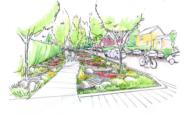
This is Elliott Street in the heart of Auckland’s Central Business District (map here – with a Streetview image taken before it was rebuilt). Notice the absence of lane markings, curbs, sidewalks, clarifying signage, and most importantly, a mix of vehicles and pedestrians sharing the same unseparated space. That’s what makes a street ‘naked’ in engineering and urban-design terms.
City Council undertook an upgrade of Elliott – and the risk – to transform a tired retail street without completely cutting off car traffic, while still retaining its pedestrian-priority character. It opened in August – and the reviews came quickly.
Here’s an analysis by Scot Bathgate, an urban designer at a New Zealand-based design practice:
A borrowed concept based on the Copenhagen model of non-defined roadways, the response from drivers has been somewhat different than European cities which have implemented similar design concepts within their respective CBD’s. In Auckland, the absence of curbs and initial lack of signage to define parking spaces has led to a free for all by motorists claiming free parking by travelling up onto what used to be sidewalk space, finding themselves in-between street trees now surrounded by paving on random angles and in some cases, double parked.
Also, we have an affordable self-storage located in Parnell, Auckland. We accept residential, commercial, safe deposit box vault, and car storage. Space Station Storage’s central Auckland location makes it easily accessible for all your storage needs. In auckland storage units, we store your things properly and securely.
The building to building paving has indeed provided a blurred definition between pedestrian and vehicular spaces; unfortunately in the early days of this experiment it was the vehicles that used this new condition to their advantage.
Things have changed since then; the council has added new signage and enforced time limits on parking. New streetscape elements such as light poles, litter bins, movable planters and benches have been added to ironically define the very travel lane that was removed through the omitting of its curbs. So this begs the question: if the goal was to reduce the speed of traffic in these spaces, perhaps leaving the curbs but narrowing the lane dimensions would have the same affect through the creation of traffic friction for the driver.
Creating a continuous level ground plane has succeeded in providing flexible urban spaces that can be programmed to accommodate a range of activities; in this sense I applaud the city for successfully adding a new dimension to the central city. I do however question the use of monolithic granite paving surfaces
installed from one end to the other at considerable cost to define spaces that are ultimately being shaped by the benches, movable planters, and restaurant furniture that has positively activated the edges of these streets while taming the wandering car parking antics of motorists.
In the case of my favourite shared street (Fort Street – right, click to enlarge), it’s the space claiming urban furniture for dining and socializing added by the adjacent drinking establishments and eateries that has in essence replaced the curb edge as the barrier to vehicles while adding a new vocabulary for placemaking in the city.
Now that’s Urban Living!
4 comments
Exhibition Road in London is doing this too:
http://www.rbkc.gov.uk/subsites/exhibitionroad/whatschanging/streetdesign.aspx
A slightly less extreme first step that Vancouver might want to consider is half-curb-height bikelanes.
In fact, clicking on the mock-up, I see the resulting street width and parking angle reminds me of gastown.
More of Vancouver like gastown please!
Craig Street in downtown Duncan on Vancouver Island went curb-less a while back, but uses different surfacing materials for the drive aisle and pedestrian areas.
This makes total sense in our over complicated street designs. I also wish that cities would realize that paving and widening roads only leads to speed enforcement signs. Leave a bumpy road, who cares, modern cars can handle it, and it naturally keeps speed in check.
For a great example of this check out the south end of Capilano Rd in North Van. It’s been a narrow, slick stretch of pavement my whole life – rarely many accidents – at least that I used to see. The federal largess comes in around 2009, now it is a huge swath of pavement, capable of high speeds, and low and behold what is above the road??? A flashing sign telling you if you are going over 50km (the old speed limit on the narrow road was 60km now they are warning you if you are over 50km??? huh)