
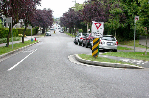
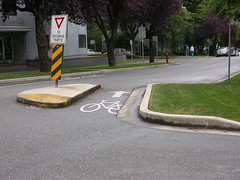
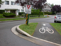
VANCOUVER — Riding my bike through Vancouver has made me aware of some of the traffic calming features the city has added. Bulges are used often to slow vehicle traffic on neighbourhood roads, but it was the added touch of cut-throughs and paved lanes that allow cycling traffic to maintain its speed and flow that caught my attention. These occured on the shared road where bikes and cars seem to have equal status (Click on smaller photos to enlarge).
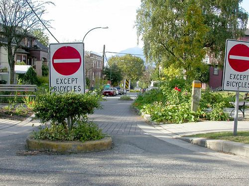
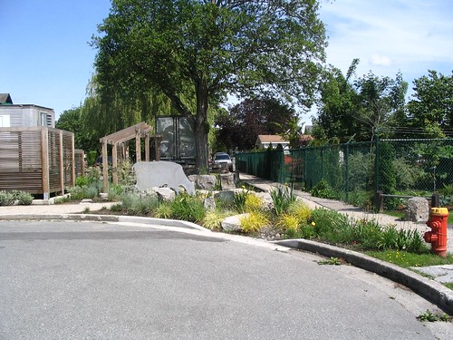
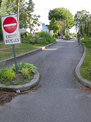 Another fantastic feature that Vancouver has recently initiated is the closing of the short end of city blocks. These closings occur repeatedly along the same street and create a small but attractive greenway. In the examples shown (above, right, and below), the former street has been narrowed significantly and an interlocked-brick path has been built for pedestrians and cyclists. But the city has gone beyond the functional aspect of traffic calming by creating parks and gardens along these paths. This is a classic example of placemaking: by turning a place that was once used almost exclusively for traffic, the city has transformed these spaces into places to stop, rest and appreciate the surrounding greenery. The park also provides local residents with the opportunity to take part in community gardening (these sites have signs encouraging residents to take ownership of the spaces).
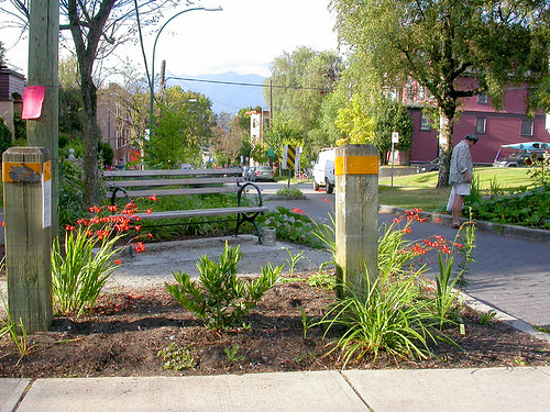
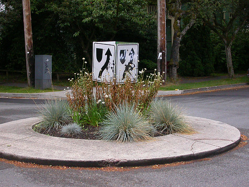
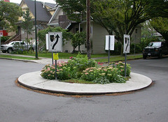
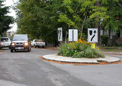
Roundabouts have replaced 4-way stop signs in a number of areas of the city. I’m undecided on whether I like roundabouts — in Toronto I appreciate them more for their quirkiness (we have no more than 10 in the city, I’ve been told) than for their effectiveness at calming traffic. Though, riding my bike through a roundabout intersection, especially one at the end of a downward hill, has been a little nerve-racking. I know that roundabouts are one of the worst things for pedestrians because no one is forced to stop for them, but luckily in Vancouver the drivers seem to have a lot of respect for those of us on foot (even on major streets, when I wasn’t even at a street corner, cars would stop to let me cross).
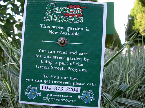
Aesthetically, the roundabouts are wonderful additions to the streetscape. Vancouver’s engineering services department constructs the roundabout and installs the initial plantings. Once the the vegetation takes root, the City offers it up to local residents to maintain (photo below).
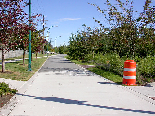
Probably the one project in Vancouver that excited me the most was the Central Valley Greenway (photo above and below). The over-arching goal of the CVG is to link downtown Vancouver with the suburban communities of Burnaby and New Westminster. The greenway will be finished in 2008 and run for 25km — about the same distance in Toronto between Finch and Union subway stations.
The CVG runs alongside the SkyTrain route and other railroad tracks. A number of streets that ran beside the rail corridor have been eliminated and/or converted into parkettes and spacious bike lanes. At different intervals, roads become a part of the network, but each one is a local road and produces very little vehicular traffic.
What’s also interesting about the project is the partners involved: working with the city governments of Vancouver, Burnaby and New Westminster are TransLink and Transport Canada. TransLink is the regional transit provider and is one of the few (maybe the only?) transit authority in North America that is mandated to consider multi-modal forms of transportation. If things operated similarly in Toronto, the TTC, roads and cycling departments would operate under the same umbrella and we’d probably end up with planning strategies that would support streetcar right-of-ways and bike lanes. Transport Canada’s involvement is paying $15-million of the project’s $17-million budget out the federal government’s Transportation Showcase Program.
above photo by David Hohenschau
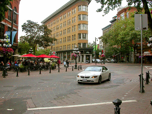
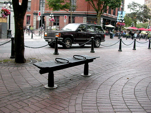
Gastown is a neighbourhood that is being gentrified at a rapid pace — it also happens to butt up against the heart of Vancouver’s fabled East Side, where a large population of drug users and the city’s transient community reside. Just a few blocks away from Pigeon Park (another landmark of the East Side) is the intersection of Carrall, Alexander, Powell and Water streets. It’s an interesting experiment in the naked streets concept: all signals have been removed, as well as the edges of sidewalks which now blend seamlessly into the road. In this case, the road is cobbled giving the area an instant historic feel. Bollards and chains keep pedestrians from wandering into oncoming vehicle traffic, but cars slow right down when cruising through the area — the change in surface does not encourage speeding and indicates to drivers that this is not an ordinary road. Pedestrians cross the street at will and seem to dominate the area. I believe a similar concept is proposed for the Front Street entrance to Union Station in Toronto.
all photos by Matthew Blackett, except where noted
11 comments
Matthew, those pictures you took are just outside of our offices @ NowPublic! Gastown rules.
Another interesting addition in terms of street use in our neighborhood is a new “Greenway” being built along Carroll St., connecting Vancouver’s Seawall at the end of False Creek into the heart of Gastown. The street is divided into three distinct sections: Sidewalks for pedestrians, bike lanes running in both directions that raise up from the road to sidewalk level and back down at intersections, and a 2 lane road for cars. The road used to be a 4-lane side street, but this new development is far more useful in moving people to and from one neighborhood to the next, and will serve the influx of condo buyers moving into Gastown when their buildings are completed next year. Also, it looks really great and will hopefully kick-start a regeneration of business in that part of the neighborhood.
Here’s a link to the Carrall St. Project: http://vancouver.ca/engsvcs/streets/greenways/city/carrall/index.htm
Looks like they’re doing them in a few other places around the city too.
Somebody needs to find all of Toronto’s roundabouts and write about them. I know there is one at Baby Point and Humbercrest.
Wow. I sit in Toronto with envy.
Matt
they did try narrowing some streets west of Bayview with cut-ins/chicanes but people ran into them in snow – less of an issue in Vancouver 🙂 Now Michael Walker puts in speedhumps every chance he gets, even when Roads recommends against them.
Aw man, not another reason to like Vancouver….
They sure are doing a lot of things right.
The first thing we have to convince Torontonians and their politicians is that to have a livable city outside of a car, you have to give up the parking along major streets. Once that’s done, it’s easy and cheap to widen the sidewalks and still have room for a bike lane. Hell, the valiant ‘Other Urban Repair Squad’ would do it for free: http://www.thestar.com/article/226454 To make that bikelane move, there’d have to be punitive and frequent fines for parking in it, and a big PR campaign against it. I agree with those who say a barrier would be unsafe as cyclists could fall on it. However, making a feature in the road to cause car-vibration would keep cars more alert: so long as they can hear it louder than their cell conversations.
The “naked street” approach would be great for Union – Front is such a congested, bike-unfriendly introduction to the city right now.
Vancouver’s greenways and bicycle boulevards are a model that Toronto should examine closely. There are major advantages to building facilities on back streets:
1) Physically easier, with more space to work with
2) Politically easier, with less competition from drivers/merchants/transit/pedestrians for limited space.
3) More comfortable riding – quieter and better air.
4) Safer riding – less competition with traffic, easier to ride away from the door zone.
5) Often cheaper to build per kilometer (compared with a *well-designed* arterial bike lane).
6) Attracts a different demographic than bike lanes.
There are, of course, disadvantages:
1) Can be slower, if a direct route is not available.
2) Needs careful monitoring to ensure that improved back streets do not get flooded by motorists.
3) Somewhat inconvenient for access to local shopping.
4) Not the obvious route for new cyclists.
5) Lower awareness of cycling by non-cyclists.
6) Doesn’t work if there are no good quiet through streets (e.g., downtown).
Many of the design features of Vancouver’s bicycle boulevards have been discussed here, but I’d just like to highlight the key parts: a direct route; fewer stop signs than a normal back street; traffic signals whenever crossing an arterial; and heavy traffic calming, particularly forcing cars to turn whenever the bicycle route reaches an arterial street. This combination works very, very well when it’s implemented correctly. (Even in Vancouver, many of the routes have their share of problems.)
See also: Vancouver Area Cycling Coalition website, Downtown Transportation Plan progress tracking.
– David
There is a roundabout South of Lawrence on Rosewell (just East of Avenue.) However, the only thing that intersects the street there is a small road leading to condo and teacher/skating rink parking.
The reason they put it in wasn’t to control the traffic at the intersection, but rather to allow all the parents dropping off their kids at the several local schools to turn around without blocking the street. Rosewell is usually impassible around 3:15-3:45.
I just love a cool classic car like a convertible Cutlass. I see them all the time in movies and TV now.