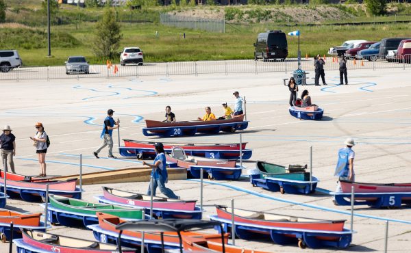
I recently had the privilege of observing a fascinating exercise in mapping walking routes in St. Jamestown. Youth from the high-rise district marked up huge maps of their neighbourhood with lines and notes about where they walked, their destinations and obstacles, and the nature of the spaces they used. The depth of their knowledge of their area was really remarkable, and it may have been a surprise even to them. Jane Farrow, one of the organizers of the exercise, noted that walkers often aren’t really conscious of the depth of knowledge of space that they accumulate, until you prompt them. The workshop was part of a program set in motion by Farrow, Director of the Centre for City Ecology (Jane’s Walks), and University of Toronto Professor Paul Hess, who are going into the city’s “priority” high-rise neighbourhoods to ask the residents about their walking environment. I will be writing more about their program soon.
The exercise reminded me of a project I undertook a year and a half ago, in September 2007. I wanted to explore the way walking is such an intensive use of space (compared to the extensive nature of driving — cycling fall somewhere between), and generates that intensive experience and knowledge that I later saw in the youth of St. Jamestown. So I mapped out my own little neighbourhood, the Garment District (Spadina to Bathurst, Queen to King) as a walking space, and my friend Michael Pereira turned it into an attractive graphic map (click here for a PDF version of Garment District Pedestrian Map — you can zoom in to 200% to see details).
I tried to map it in the way a pedestrian experiences space. So, the map tracks sidewalks, not roads. And it grades the sidewalks according to the walking experience – pleasant, neutral, or unpleasant (an entirely subjective grading, of course). It also tried to map out the multiple and complex laneways in the area, both official and unofficial, and shows connections that can only be made by walking and wouldn’t show up on normal, car-oriented maps. It identifies the nature of each street crossing (stop sign or traffic light), and puts a hazard sign at one location where traffic turns left at speed into pedestrians crossing a wide road. And it maps out amenities and destinations for people on foot, such as the location of transit stops, the location of benches, and also places of interest one might stop and look at — something that is natural for pedestrians but not for other modes of travel.
The map is probably already a little out of date — construction can easily add or remove pedestrian laneways or change the nature of a space, much more rapidly than car infrastructure is changed. And every pedestrian map is going to be in some way subjective, so I imagine another person’s map of the same area would be a little different. I’d love to see more people try out making this kind of map of their neighbourhood, but using their own criteria.
The map was one of the pieces in an art exhibition organized by Stephanie Tencer, Laurel Atkinson and myself called Walking Life. A community initiative in conjunction with the international Walk21 conference held in Toronto in October 2007, its purpose was to showcase art that relates to the walking experience. It was shown at the Gladstone Hotel in September 2007. If anyone is interested, the program for Walking Life (PDF) is available, which includes some thoughts about walking from the curators and descriptions of each piece, and there is a slideshow of the exhibition pieces (unfortunately it is fairly low-quality, but it gives some sense of the exhibition).
From the program, here is the introduction to Walking Life:
Humans are made for walking, and each of us has a walking life, conscious and unconscious, defined both by the presence and the absence of walking in our lives.
This exhibition explores our walking life in some of its many facets. People from a variety of backgrounds — professional artists, design specialists, enthusiasts, amateurs, youth — have sent us their interpretation of this often-overlooked and yet fundamental part of our existence. By bringing their work together, we hope to celebrate walking and bring it back to the centre of our consciousness.
The exhibition has been organized into three parts: the act of walking, our response to it, and the possibilities it can inspire.


5 comments
You should check out the pedestrian coverage on OpenStreetMap, the free map network created by volunteers with GPSes. I find its coverage in Toronto is fantastic; I just wish it could give directions a la Google Maps.
What would be interesting to do would be to log every walking trip one took in one’s neighbourhood over the course of a week or two. Espcially if a group of neighbhours were to do this. That would do more than just indicate pleasant and unpleasant places to walk, but would actually indicate preferred routes.
For an example, while Trinity Bellwoods Park, near where I live, is definitely a pleasant place to walk, I seldom find myself walking through it.
I can’t believe i missed this exhibition. Great project and thanks Dylan for posting this.
I’ll try to keep myself informed of these projects in the future so i can get involved. I’m very much interested in the arts and walking spaces within the city.
Last fall I attempted to do something rather similar, but from a totally different angle. I focused on mapping the experience of cycling rather than walking and I attempted to do so algorithmically. It basically involved strapping a GPS and some other sensors to my bicycle and riding all over the city. I was trying to infer statistically some of the things you were considering more subjectively.
I’m hoping to make it larger scale this summer, perhaps publishing an interactive map of the results. Imagine Google Maps-like directions for cyclists that take into account how enjoyable the trip might be. There’s some stuff about it on my website if anyone is interested.
This was such a weird post for me to read! Dylan, Michael & Laurel I know through TPSC, Stephanie I know from jr. high and Paul Hess is a professor of mine and I’m familiar with the project…
fantastic stuff tying it all together!! 🙂