
I had Johnny Rotten stuck in my head Monday night after the West Toronto Railpath (WTR) public meeting: Happiness and sunshine. This is not a love song. Although I was thinking: Happiness and sunshine. (But) this is not a bike path.
So, what is the West Toronto Railpath? It’s going to be a beautiful linear park in a neglected part of the city’s west end. (More background available in a previous post.) But, the Railpath is not going to be a bike trail. It is not a bike path, and, it is most certainly not a cyclist commuter “highway.”
On Monday night, the plans for the Railpath were presented to the public. I asked Councillor Adam Giambrone (Ward 18-Davenport) why the WTR is considered part of the bike plan. He conceded that the current plans provides “little value” to cyclists, but said that eventually the Railpath would serve as a “bike highway” for cyclist commuters.
This is where he and I differ — and here’s why: GO will be expanding service in this CN corridor (even if the Airport Rail Link never happens) and there is no logical reason why CN would ever sell the land to the City as CN generates revenue by renting rail time to other train services. I believe the “rest of” the WTR will never be built, and if anyone has any evidence that it might some day be built, please do pass it on to restore my hope.
* * * * * * * * * * * * *

It really should not be a surprise to anyone that cyclists have been pretty excited about the potential for a sweet, car-free 6.5 km ride from the west end to downtown since the Railpath plans came to life in the late 90s.
A Globe and Mail story in July of 2005 titled, “Proposed trail could be an expressway for cyclists” hailed the WTR as a cyclist’s dream. But the March 2006 NOW article titled, “Pedestrian speedway cut off at pass” presented a more realistic analysis of the conflicting plans of the WTR and the airport link.
After years of waiting, the plans were laid out for all to see on Monday night. And, as gorgeous and green as those plans are (courtesy of Steve Torrance and Brown + Storey), I simply do not see how anyone can call the WTR park a bike path.
The WTR park itself is between 10 and 15 metres wide. The strip of asphalt (the “multi-use” path) will be 3.5 metres wide (1.75 in each direction) with a granulated shoulder. The length of the path is 2.1 kms.
There are great examples of multi-use trails everywhere. One obvious example is the Seawall in Vancouver. It is truly multi-use as there are two paths, one for walkers and one for roller bladers and bicycles. The Route Verte is possibly the gold standard for off-road multi-use trails in Canada. (See the picture at the bottom for “off-road” paths.) A multi-use trail is designed to permit more than one user group at a time, creating a two-way shared use area. The paved portion of the WTR is simply too narrow to accommodate multiple users safely. There was some discussion about the City’s new way-finding signage (to be used in the Don Valley trails first) that could be used in the Railpath to help direct user etiquette. It was also mentioned that the path will only be plowed in winter if the City deems there is “need.”

In an article yesterday, the National Post quotes Giambrone: “It is the first part of a network in the west end of bike paths that will allow people to get around the city without having to go on the street.”
Network implies connectivity. So what other cycling infrastructure does the path connect to?
There are no existing bike lanes on any of the residential streets that conect direcdtly to the park. There is a new bike lane on Annette that the City envisions eventually connecting to the Railpath. The south end of the park connects to the street via a ramp that brings the trail right to the Sterling-Dundas intersection, but a little more to the Sterling frontage. There are bike lanes painted on Dundas over the bridge. The north end of the park is very close to Dupont, where a 1-km stretch from Dundas to Lansdowne of bike lane is to be installed this year.
At the north end, steps will be installed at both Dupont (north side only) and Bloor with bike gutters. The steps connect to the sidewalks. Capital project co-ordinator for the Railpath, Dave Nosella, said there is no way around this, and that the City recognizes that this is not ideal for cyclists. He added:
“This was the preferred option of Cycling Infrastructure staff for the grade separated connections, but it was agreed that the on-street connections make the most sense. In the short term, cyclists can connect to the trail by either turning south on Edwin Ave, and connecting at Ruskin Ave, or north on Osler, connecting to the trail from the path just north of the fish warehouse. Longer term, when the Viceroy site is redeveloped, Parks will be looking for a ramp access to the trail on the south side of Dupont, and another street connection at either Alpine Ave or Clark Cres.”
The on-street connections will be signed, once the WTR is completed.
While we’re on the topic of the network, I think it is relevant to mention here that the monetary allotment for the Bikeway Network (via Trails and Pathways), within the Parks, Forestry and Recreation budget, is seriously under-funded. There is no staff person within PF&R dedicated to trail construction and stewardship. Please note, the funding for the WTR does not come from the bike budget. The funding is from the PF&R Park Development capital budget andhas been ear-marked for this project for some time.
I know this seems like a lot of griping in one post, but, I was definitely not the only cyclist feeling let down following Monday’s meeting.
* * * * * * * * * * * * *
Some comments from others in attendance:
Dave Meslin, founder Toronto Public Space Committee (TPSC):
The path itself is nice. Nice for pedestrians and dogs at least. What made me sick is the way they’re spinning this….implying that this will somehow be part of the bike network in the city. It doesn’t make any sense at all. There is only one path, and it will be full of joggers, dogs, dog-walkers, kids, seniors, etc… Riding a bike on this path will actually be dangerous, unless you’re going really slow.
It blows my mind that the city could be so adamant about bikes on sidewalks being dangerous and putting thousands of stickers on every ring+post saying “don’t ride on the sidewalk” and now they’re trying to sell this new sidewalk as a bike route? And encouraging us to ride on it?
It’s a beautiful path, and nice park, but this is not cycling infrastructure and we can’t let any politician, journalist or city staff pretend otherwise.
Martin Reis (bikelanediary):
I had to bite my tongue last night. It’s kinda like a consolation prize. Cyclists get another swift kick in the ass which comes with a side order of play-handling and spin. I think we should name the train tracks bridge at Dupont ‘Galen Kuellmer Memorial Crossing’.
Galen Kuellmer was run over and killed in May 2004 while riding his bicycle on Dupont near Dundas. Dave Nosella at PF&R says, “We’ll take this suggestion under serious consideration, review internally and let you know. I think there is opportunity for a memorial of some kind, not sure of what form it could take.”
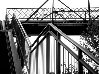
Photo courtesy of bikelanediary.blogspot.com as part of City of Bicycles photography show during Bike Week last year. The photo is of the Wallace street bridge which currently goes over the WTR site. Meeting photo by Dougal Bichan. WTR map from NOW.
15 comments
There’s a bike lane on Annette? Gee, that’s news to me. Perhaps I’ve simply never noticed it, as whenever I ride Annette I have to keep my eyes firmly on the utterly-destroyed, dangerous road surface instead of actually watching where I’m going.
Re the Railpath — what a disappointment.
Another appropriate PIL reference: Rise
I have many mixed feelings about the WTR, so let me share them with you in a lovely randomly-ordered bulleted list:
* The WTR has an identity crisis: Bike highway? Linear park? Multi-use path?
* It’s going to be a lovely park
* When I move to Symington Ave. next month, it will be a great place to walk, or take slow bike rides. I never expect to be able to ride fast on the WTR.
* Will make a decent connection down to Dundas St., bypassing some traffic.
* Calling this a “Bike Highway” is VERY VERY bad. It’s barely even a multi-use recreational pathway. I’m suprised the people speaking at the meeting weren’t prepped and told “Don’t call it a bike highway!”. I hope it doesn’t attract jerks riding really fast, weaving through everyone else.
* I kind of wish that rail corridors would be left as rail corridors. It’s hard to get them back once they’re gone.
* In many ways I don’t like paving over more parkland anyway. I’d rather have more cycleable streets.
* Yes, it’s too bad the WTR doesn’t connect well to anything else.
* I wish they decided right from the start: Is this a bike highway, or is it a park? Then there wouldn’t be any confusion.
May the road rise with you,
Vic
The idea for such a park is great.
The design isn’t. Solution: insert bike path, apart from pedestrian path. Then we can call it a bike path and a linear park.
-“Highway” was an offensive term to use to describe an access route for pedestrians and slow bike riding (WTR). Why do politicians have to relate travel with vehicle terminology. The WTR will be a very pleasant walking route, I would agree.
I’ve a couple of points:
The posting says “the Railpath is not going to be a bike trail… bike path…not a cyclist commuter “highway.—. Other commenters seem to share this opinion.
I’d point out the same observation would apply to the Martin Goodman trail. On weekends, it’s clogged with people walking and jogging abreast. Roller-bladers take up the whole path. Small children on trikes, zig-zaging behind mom and dad, who seemingly ride a bike once per year. It’s certainly not safe for many sections of the path to be moving too quickly on a bike in this environment.
That said, when I’m on the trail on weekday mornings on my way to work, and weekday evenings, on my way home, it’s a different story. There are far fewer “recreational” users of the trail during these times; It’s generally possible to move quickly (even faster than the posted 20kph) without safety issues (there are exceptions, such as around Ontario Place but most cyclists seem to go along Rememberance Drive). Outside of sunny summer days, even on weekends, it’s pretty safe to cycle at speed for most of the trail.
I would expect the situation along the Railpath to be similar.
The posting also points out “There are no existing bike lanes on any of the residential streets that conect direcdtly to the park.” I can’t disagree with this, but this should have been no surprise at the meeting. The Bikeway map pretty much shows only connections to short portions of (planned) bike paths on roads along Annette/Dupont and College.
With regards to the connections to streets, I don’t see any nice solutions to the problems posed by having an elevated railbed. Hopefully once the path is in place, future development of sites along the east side of the path (the Viceroy plant, the mystery pad of concrete north of Wallace, etc) will place consideration on connectivity to the path.
In short, as a path connecting cycling commuters from the west end to downtown, what we’ll have by the end of the summerfalls short. But, as a cyclist I’ll look at this as the glass half full, rather than half empty.
Nothing to do with the slow bike highway, but I’ve never seen the video for This is not a Love Song. That some different version. So I had to watch Rise, Death Disco and Seattle, and now I’m going to put my PiL cds into my iPod as I haven’t done that yet and now I need to.
While I like the concept of the WTR, I have issues with the plan overall. Mostly regarding how it would displace the wildlife that live in the scrub and bushes along the rail tracks. Besides the typical Toronto raccoons and skunks, this area is also home to possums, and a variety of birds that includes hawks (American Kestrels, to be specific).
In our desire to make everything shiny and pretty and landscaped, we might just lose downtown’s last tie to nature. If it’s not going to be the bicycle highway we were promised, and it’s not going to connect the west end with downtown proper, I vote for not doing it at all.
It’s great to listen to the concerns folks have with this – and while there’s potential, the highest and best use of the corridor is likely for transit, which now includes jogging the proposed Jane St. LRT onto the corridor and pushing it through to Dundas St. W., as well as the Blue 22 and the subway proposal of the westoncommunitycoalition though that’s too robust ie. costly though there was a 1985ish suggestion for it.
The west end does have some serious challenges for biking through it and linking it to the core – the lanes over College/Dundas are great, and then what? Bloor is the next logical option/place, because there are a lot of cyclists and no streetcar tracks to stop the re-arranging of Bloor for cyclists’ safety, and it’s really logical to squeeze cars a bit right beside the major transit of a heavy subway.
Dupont/Annette is another corridor, but it’s really horrible through that underpass, and the City should have been sued for Galen’s death as they did not make a curb cut in some new sidewalk that would ease passage of cyclists/ onto the safer sidewalk, and of course they’d have concerns about peds and bikes. But Dupont is pretty industrial traffic too – and the whole Bike Plan is as much about expediency as it is about bikes.
Mr. Giambrone has a lot of political capital in this and even though this railpath is missing a lot of things like real utility to cyclists while eating a batch of money one tenth of which could do 8kms of the TaketheTooker on Bloor, it may well go through and at least it has meant we preserve the corridor – and I hope we can accept that some other year for fewer cars downtown we could rip out this path, with thanks to those who championed it. And as Bruce said maybe it’s where we have our first velotube?!!
Sorry for the length eh?, thanks Tammy for chasing.
Sheryl Or what about how it will displace the homeless that live in the woods there?
A reading of the plans shows that there is a focus and preserving the naturalness of the route with grasses and trees. It will probably be more bio diverse than it is now. In terms of Toronto possums, raccoons and skunks; they dont live in nature, they live under my porch; they would perish if they actually had to live in the wild.
Bike fans have a lot of reasons to be jaded but I hope that if this park/path takes off it could set the tone for other initiatives.
Not sure of proposed width for path, I assume 4.0 metres. Can the pavement be widened slightly and divided into two surfaces, see Trinity Belwoods Park? 3.0 metres asphalt for two-way bikes and 1.5 metres limestone screenings for peds?
I think the idea to dedicate the full right hand lane along Bloor St West is not only fantastic, it’s entirely doable. There are other good viable car commuter options across the upper breadth of downtown (like Dupont)and the parking issue for Bloor wouldn’t need to be an issue as there are plenty of parking lots connected to the Bloor corridor in behind the buildings along the north side. It’s a straight, smooth, wide street, and the potential is there from past High Park on through to the Viaduct in the east.
Just a note- the City of Toronto, once it has built its own version of the West Toronto Railpath, will not alter its design to become a ‘bike highway’. These remarks by Councillor Giambrone are meant to confuse the legitimate opposition to this project. Despite his promise of bike paths on Lansdowne, bike paths became bike sharrows, and are permanent.
Biking along Annette on a bike path. Where is it? It’s full of potholes and uneven patches of pavement. We need a bike network to commute safely in Toronto but who is doing anything about it? Mayor Miller?
The railpath is now paved from dupont to dundas, and it is awesome. quiet and fast!
Yes, the railpath is finished – at least this part -but already it’s full of dog walkers, pot smokers, broken glass and graffiti on most of the street sculptures. It’s sad. And where is the sign to show cyclists that it’s even there?